


Photo Credits (5)
Difficulty
Moderate
Trail Length
2.4 miles
Trail Type
Out And Back
Elevation Gain
350 ft
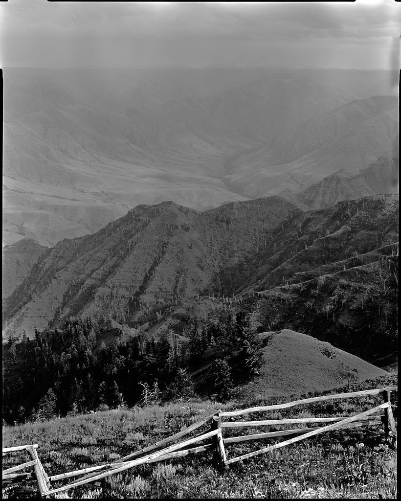
About Imnaha Falls
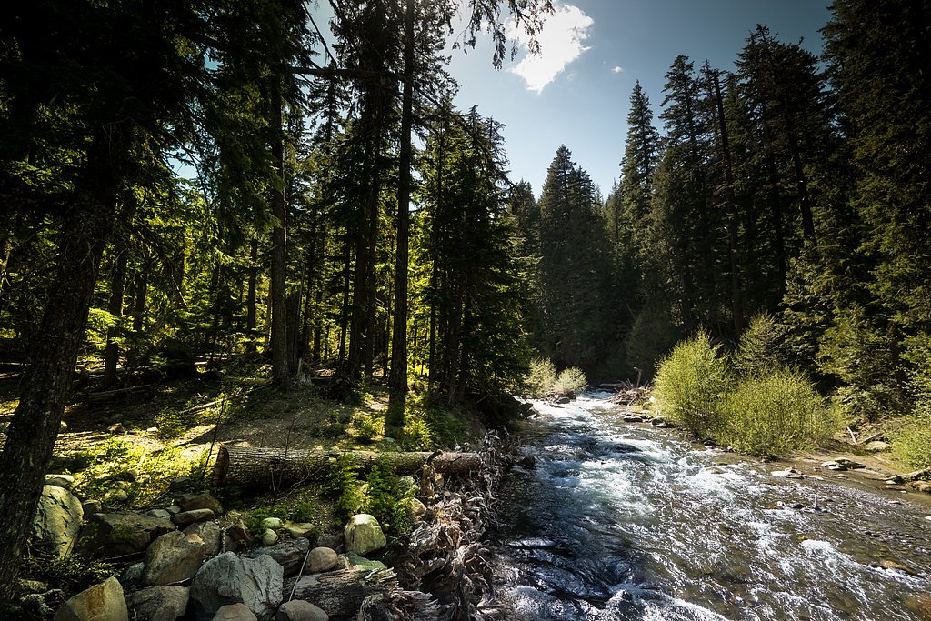
Imnaha Falls tumbles along the Imnaha River in northeastern Oregon, set within the Eagle Cap Wilderness and managed by the U.S. Forest Service as part of the Whitman National Forest. The cascade sits amid rugged canyon walls and dense forest, offering a picturesque and secluded spot for photographers and day hikers who appreciate wild, less-traveled reaches of the forest. The setting feels remote yet approachable, with the falls framed by mossy rock and stands of conifer. The approach rewards visitors with classic Wallowa country scenery—deep river-cut canyons, mixed timber, and the steady sound of rushing water. Managed by the USFS, the area is best enjoyed with leave-no-trace practices; the trail is a moderate outing that suits hikers looking for a relatively short but scenic adventure into the national forest.
The Setting
Imnaha Falls sits at 5,220 feet within Whitman National Forest, fed by the East Fork Wallowa River, in the high mountains of Oregon.
Trail & Hike Details
The Approach
The moderate 2.4-mile out-and-back trail gains 350 feet of elevation on the way to the falls.
Trail Description
USFS-trail data lists the route to Imnaha Falls as a 2.4-mile out-and-back with roughly 350 feet of elevation gain, rated moderate in difficulty. The trail follows river corridor terrain through dense forest and includes some moderate elevation changes and rocky, uneven sections; hikers will pass smaller cascades and scenic river views en route. Surface, grade, and technical class are not specified in the available USFS data, so expect a natural tread with occasional rock and root obstacles and plan footwear and pacing accordingly.
What to Expect
Dogs are welcome.
Accessibility
The trail is not wheelchair accessible. Uneven terrain and elevation changes require steady footing.
Frequently Asked Questions
🐶 Are Dogs Allowed at Imnaha Falls?
✅ Dogs are allowed
Are There Any Fees or Permits Required?
🤑 Fee: $5.00
Permit required
A Northwest Forest Pass or equivalent is required for parking at the trailhead.
🏊 Is There Swimming at Imnaha Falls?
❌ Swimming is not allowed
When to Visit
Spring and early summer are ideal times to visit, as the waterfall is typically at its fullest due to snowmelt. Fall offers beautiful foliage, while summer provides warmer weather for hiking.
Seasonal Access
The best time to visit is Spring, Summer, and Fall. Access roads and trails may close during winter due to snow. Check with Whitman National Forest for seasonal road closures.
Safety Information
Be prepared for changing weather conditions and carry the 10 essentials for hiking. Watch for slippery rocks near the falls and be cautious of wildlife encounters.
Current Water Conditions
27 ft³/s
Current discharge — how much water is flowing
Lower than usual for this time of year
Based on 52 years of record
5.00 ft
Water depth at gauge
55°F
ColdBracing — limit time in water
7-Day Discharge Trend
What does this mean for your visit?
Flow is lower than usual for this time of year. Water temperature is a bracing 55 degrees F, limit your time in the water.
About This Gauge
This gauge is on a nearby waterway and may not reflect exact conditions at the falls.
7-Day Flow Outlook
Based on the USGS gauge EAST FORK WALLOWA RIVER NEAR JOSEPH, OR (20 km away).
Today
Roaring
31 cfs
6/10Tomorrow
Roaring
31 cfs
6/10Sun
Roaring
29 cfs
6/10Mon
Roaring
30 cfs
6/10Tue
Roaring
30 cfs
6/10Wed
Roaring
27 cfs
9/10Thu
Roaring
27 cfs
9/10Best window: Wed — roaring flow, sunny (trip score 9/10).
Best time of year: this gauge typically runs highest from early May to early August, peaking in June.
How we calculate this
This is a transparent outlook, not a precise forecast. We take the waterfall's current flow strength (how it ranks against its historical normal for today, from the nearest USGS stream gauge), carry that ranking forward along the gauge's seasonal curve, and nudge it for forecast rain. Confidence is highest for the next day or two and falls further out. Always check official conditions and your own judgment before visiting — high flows can be dangerous.
Know when to go.
Get a free email alert when waterfalls near Halfway hit peak flow. We only send when conditions are worth the trip — no weekly newsletters, no spam.
Weather Forecast
Location & Access
Getting There
Imnaha Falls is located in the Eagle Cap Wilderness, accessible via the Wallowa Lake Trailhead near Joseph, Oregon. The trail to the falls is part of the East Fork Wallowa River Trail.
Get Directions on Google MapsParking
Parking is available at the Wallowa Lake Trailhead, which serves as the starting point for the hike to Imnaha Falls. The parking area may fill up during peak seasons, so arriving early is recommended.
Elevation
5,220 feet above sea level
Coordinates
45.107102° N, -117.107389° W
Land Management
Managed by USFS
Visitor Tips & Gear
Wear sturdy hiking shoes and bring plenty of water. Check trail conditions before heading out, especially in spring when snowmelt can make the trail muddy or slippery. Cell service is limited, so plan accordingly.
As an Amazon Associate, we earn from qualifying purchases.
With 2.4 miles and 350 ft of elevation gain, sturdy boots and trekking poles will help on this moderate trail. Sun exposure on the trail makes good sun protection a must in summer.

Polarized Sunglasses (Knockaround)
Cuts glare off the water so you actually see the falls — and your photos turn out better too.

Columbia Watertight II Rain Jacket
Packs into its own pocket, seam-sealed, and keeps you dry from spray and surprise rain.

Earth Pak Waterproof Dry Bag
Keeps your phone and gear dry when waterfall mist soaks everything else.

Waterproof Phone Pouch (AiRunTech)
Cheap insurance — take photos right next to the falls without killing your phone.

Timberland Euro Sprint Mid Waterproof
Trusted waterproof boot with premium leather and grippy rubber sole — reliable on rocky, wet trails.

TrailBuddy Trekking Poles
Lightweight aluminum, cork grips, and flip-locks that actually hold — a best-seller for good reason.
Where to Stay

Eagle Cap Chalets

Prairie Creek Condo

Serendipity Cottage

Backcountry Bungalow
Browse vacation cabins and private rentals nearby
Unique outdoor stays — tents, yurts, and treehouses
Rent a campervan or RV for your waterfall road trip
Some links are affiliate links. We may earn a commission at no extra cost to you.
Nearby Campground
Hells Canyon - Oregon/Wallowa Valley
13.3 miles away · 0 sites
The Hells Canyon National Recreation Area (HCNRA) straddles both sides of the Snake River in both Oregon and Idaho. The recreation sites and trails in this section are all found away from the Wild and Scenic Snake River in the Oregon uplands, and in other forest lands near the Wallowa Valley. All other upland sites and all trails in the Hells Canyon NRA - Snake River, or Hells Canyon NRA - Idaho are found in those recreation area sections.Popular recreation areas include the Hells Canyon Wilderne
Book on Recreation.govNearby Hot Springs
Hot springs near Halfway, Oregon
Medical Hot Springs
Medical Hot Springs emerges at 140°F in Union County's forested mountains, requiring a 289-meter walk from Medical Springs High...
Stinky Warm Spring
Stinky Warm Spring earns its name from hydrogen sulfide gas that gives the 88-degree water a distinct rotten-egg smell, a commo...
Kropp Hot Spring
Kropp Hot Spring emerges at 109°F, flowing 61 degrees above ambient at 3,227 feet elevation in Union County's Blue Mountains. T...
Zims Resort Hot Springs
Zims Resort Hot Springs delivers 144°F water virtually at roadside, sitting just 17 feet from Zims Road in Valley County, Idaho...

Boulder Creek Spring
Boulder Creek Spring delivers 82-degree Fahrenheit water just 52 feet from Boulder Creek Road near McCall, with an exceptionall...

Warm Spring
Warm Spring flows at 85°F at 2,953 feet in Union County near the town of Union, creating a 36.7-degree differential above ambie...
Looking for a soak after your hike? Explore more hot springs near Halfway, Oregon on SoakingSprings.
Explore Oregon springsAdditional Information
Nearby Attractions
Wallowa Lake, Eagle Cap Wilderness, and the town of Joseph, Oregon.
Wildlife
The area is home to deer, elk, black bears, and a variety of bird species. Be cautious and follow wildlife safety guidelines.
Cities near Imnaha Falls
Nearby Waterfalls
Writing about Imnaha Falls? Embed this waterfall on your site for free.