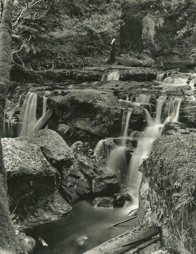
East Fork Falls
By Armen Suny · Last verified Mar 2026
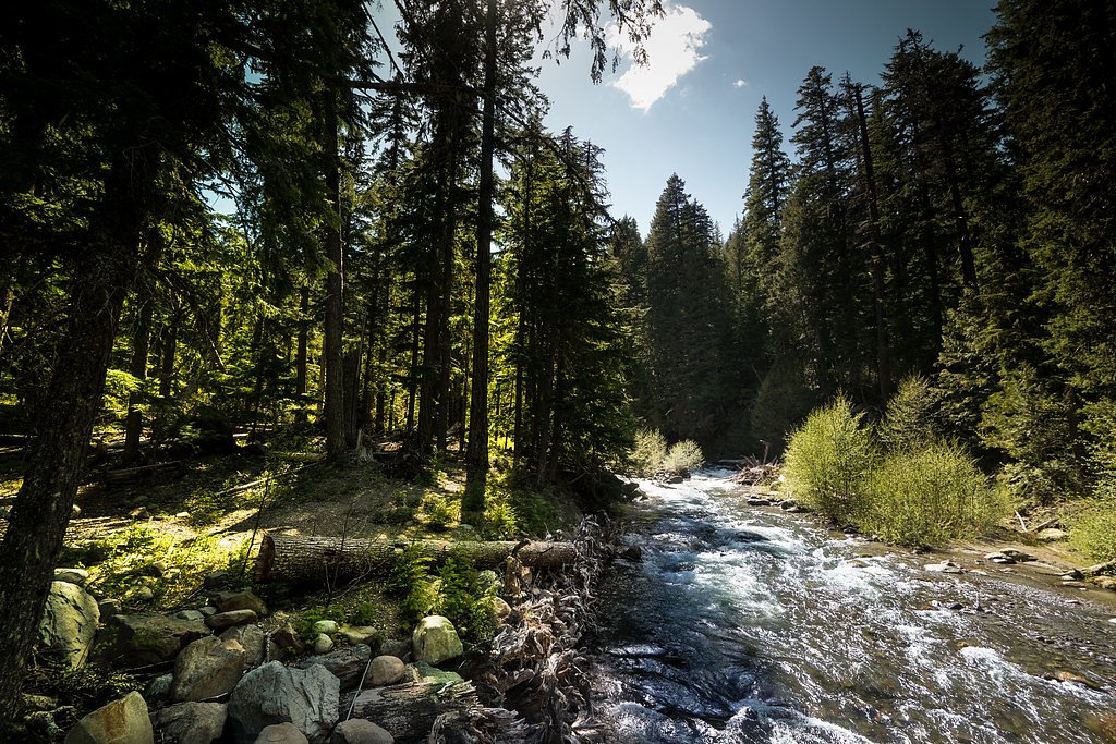
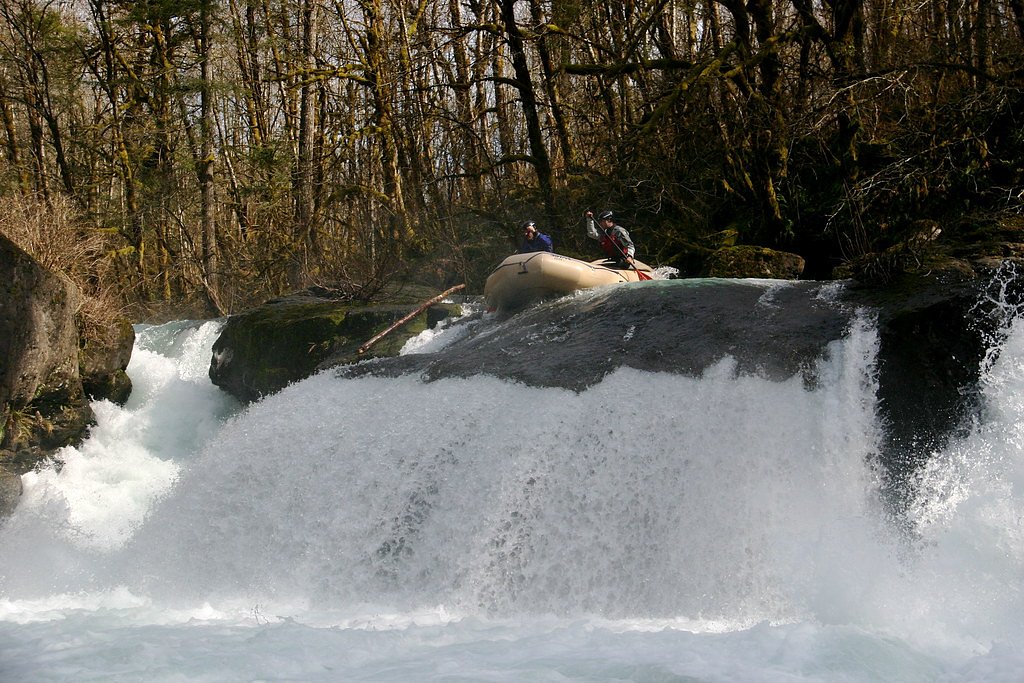
Photo Credits (5)
Difficulty
Moderate
Trail Length
2.4 miles
Trail Type
Out And Back
Elevation Gain
350 ft
About East Fork Falls
East Fork Falls is a small, picturesque cascade on the East Fork of the Coquille River tucked into the forested hills of Whitman National Forest. Managed by the U.S. Forest Service, the waterfall is a quieter, lesser-known spot that rewards hikers seeking solitude and a peaceful riverside setting. The falls’ intimate scale and surrounding old-growth canopy make it a great short outing for nature lovers and photographers who prefer trails with fewer crowds. Access is straightforward but rustic: the approach threads through shaded woods and finishes at a scenic, sheltered plunge. There is no campground within 10 km; the nearest developed site in the provided data is Two Color Guard Station, about 20.4 km away, so plan day trips accordingly and pack out what you pack in.
The Setting
East Fork Falls sits at 6,066 feet within Whitman National Forest, fed by the East Fork Wallowa River, in the high mountains of Oregon.
Trail & Hike Details
The Approach
The moderate 2.4-mile out-and-back trail gains 350 feet of elevation on the way to the falls.
Trail Description
Trail: out-and-back, 2.4 miles round trip with ~350 feet of elevation gain (moderate difficulty). The ascent averages roughly a 2.8% grade overall, making for a steady but not strenuous climb. The path follows natural forest tread and winds through shaded, uneven stretches—expect some narrow sections and exposed roots. Sturdy footwear is recommended; the route is suitable for most hikers comfortable with moderate, non-technical trails. (Managed by the U.S. Forest Service within Whitman National Forest; no USFS trail number provided in the supplied data.)
What to Expect
Dogs are welcome.
Accessibility
The trail is not wheelchair accessible. Uneven terrain and elevation changes require steady footing.
Frequently Asked Questions
🐶 Are Dogs Allowed at East Fork Falls?
✅ Dogs are allowed
Are There Any Fees or Permits Required?
🆖 No fees required
🏊 Is There Swimming at East Fork Falls?
❌ Swimming is not allowed
When to Visit
Spring and early summer are ideal for visiting East Fork Falls, as the water flow is typically strongest during this time.
Seasonal Access
The best time to visit is Spring, Summer, and Fall. Access roads and trails may close during winter due to snow. Check with Whitman National Forest for seasonal road closures.
Safety Information
Be cautious on forest roads and trails, as they may be slippery or muddy. Watch for falling branches or debris, especially after storms. Cell phone reception may be limited in the area.
Current Water Conditions
Based on a USGS gauge 15.9 miles away
24 ft³/s
Current discharge — how much water is flowing
Lower than usual for this time of year
Based on 52 years of record
4.95 ft
Water depth at gauge
55°F
ColdBracing — limit time in water
7-Day Discharge Trend
What does this mean for your visit?
Flow is lower than usual for this time of year. Water temperature is a bracing 55 degrees F, limit your time in the water.
About This Gauge
This gauge is on a regional waterway. Conditions at the falls may differ, especially after local rain.
7-Day Flow Outlook
Based on the USGS gauge EAST FORK WALLOWA RIVER NEAR JOSEPH, OR (26 km away).
Today
Moderate
27 cfs
6/10Tomorrow
Moderate
28 cfs
6/10Sat
Moderate
28 cfs
6/10Sun
Moderate
26 cfs
6/10Mon
Moderate
26 cfs
5/10Tue
Moderate
24 cfs
8/10Wed
Moderate
23 cfs
8/10Best window: Tue — moderate flow, sunny (trip score 8/10).
Best time of year: this gauge typically runs highest from early May to early August, peaking in June.
How we calculate this
This is a transparent outlook, not a precise forecast. We take the waterfall's current flow strength (how it ranks against its historical normal for today, from the nearest USGS stream gauge), carry that ranking forward along the gauge's seasonal curve, and nudge it for forecast rain. Confidence is highest for the next day or two and falls further out. Always check official conditions and your own judgment before visiting — high flows can be dangerous.
Know when to go.
Get a free email alert when waterfalls near Halfway hit peak flow. We only send when conditions are worth the trip — no weekly newsletters, no spam.
Weather Forecast
Location & Access
Getting There
East Fork Falls is located in a remote area of Oregon. Access typically involves driving on forest roads, which may be unpaved and require a high-clearance vehicle. Directions can vary, so it is recommended to consult a reliable map or GPS before visiting.
Get Directions on Google MapsParking
Parking is limited and may be informal, typically along the side of the road near the trailhead or access point.
Elevation
6,066 feet above sea level
Coordinates
45.042890° N, -117.176091° W
Land Management
Managed by USFS
Visitor Tips & Gear
Visit during spring or early summer for the best water flow. Bring insect repellent during warmer months, as mosquitoes may be present. Be cautious on forest roads, especially after rain, as they can become muddy or slippery.
This trail sits at 6,066 ft above sea level
Elevated TrailUV radiation is roughly 24% stronger at this elevation than at sea level, and the dry air accelerates dehydration. Extra sun protection and fluids go a long way.
As an Amazon Associate, we earn from qualifying purchases.

Coppertone Sport SPF 50 Sunscreen
UV intensity jumps ~4% per 1,000 ft — at this elevation you can burn in half the time.

Sun Bum SPF 30 Lip Balm (3-Pack)
Lips have almost no natural UV protection and burn fast in thin, dry mountain air.

Liquid I.V. Electrolyte Packets
You lose moisture ~2x faster at elevation — electrolytes help you absorb water efficiently.

ROCKNIGHT Polarized UV400 Sunglasses
High-altitude glare off rock and water is intense — UV400 lenses block 99%+ of UVA/UVB.
As an Amazon Associate, we earn from qualifying purchases.
With 2.4 miles and 350 ft of elevation gain, sturdy boots and trekking poles will help on this moderate trail. Sun exposure on the trail makes good sun protection a must in summer.

Polarized Sunglasses (Knockaround)
Cuts glare off the water so you actually see the falls — and your photos turn out better too.

Columbia Watertight II Rain Jacket
Packs into its own pocket, seam-sealed, and keeps you dry from spray and surprise rain.

Earth Pak Waterproof Dry Bag
Keeps your phone and gear dry when waterfall mist soaks everything else.

Waterproof Phone Pouch (AiRunTech)
Cheap insurance — take photos right next to the falls without killing your phone.

Timberland Euro Sprint Mid Waterproof
Trusted waterproof boot with premium leather and grippy rubber sole — reliable on rocky, wet trails.

TrailBuddy Trekking Poles
Lightweight aluminum, cork grips, and flip-locks that actually hold — a best-seller for good reason.
Where to Stay

Eagle Cap Chalets

Serendipity Cottage

Prairie Creek Condo

Knotty Pine Cabin
Browse vacation cabins and private rentals nearby
Unique outdoor stays — tents, yurts, and treehouses
Rent a campervan or RV for your waterfall road trip
Some links are affiliate links. We may earn a commission at no extra cost to you.
Nearby Campground
TWO COLOR GUARD STATION
12.7 miles away · 1 sites
Overview The Civilian Conservation Corps originally constructed the Two Color Guard Station in the 1930s for use as crew quarters and bunkhouse. The original building was removed in 1976. The current guard station was built in 1959. Two Color Guard Station is open June through October. Guests can drive to it except after significant snowfall, when it's only accessible by snowmobile. Guests staying in the later part of the season are encouraged to bring extra supplies to ensure a comfortable and e
Book on Recreation.govNearby Hot Springs
Hot springs near Halfway, Oregon
Medical Hot Springs
Medical Hot Springs emerges at 140°F in Union County's forested mountains, requiring a 289-meter walk from Medical Springs High...
Kropp Hot Spring
Kropp Hot Spring emerges at 109°F, flowing 61 degrees above ambient at 3,227 feet elevation in Union County's Blue Mountains. T...
Nelson Spring
Nelson Spring flows at 80°F in Baker County, emerging at 2,685 feet elevation and running 28 degrees above ambient air temperat...
Spring (Hot)
This unnamed hot spring in Baker County emerges at 3,397 feet elevation along Sunnyslope Road near Baker City. The spring flows...
Zims Resort Hot Springs
Zims Resort Hot Springs delivers 144°F water virtually at roadside, sitting just 17 feet from Zims Road in Valley County, Idaho...
Radium Hot Springs
Radium Hot Springs emerges at 135°F in Baker County, Oregon, making it one of the hotter accessible thermal features in the Blu...
Looking for a soak after your hike? Explore more hot springs near Halfway, Oregon on SoakingSprings.
Explore Oregon springsAdditional Information
Nearby Attractions
Nearby attractions may include other waterfalls or hiking trails in the surrounding forest. Check local maps for additional points of interest.
Wildlife
The area is home to a variety of wildlife, including birds, deer, and small mammals. Be respectful of the natural habitat.
Cities near East Fork Falls
Nearby Waterfalls

Other waterfalls named East Fork Falls
1 other waterfall shares this name across the U.S.
Writing about East Fork Falls? Embed this waterfall on your site for free.