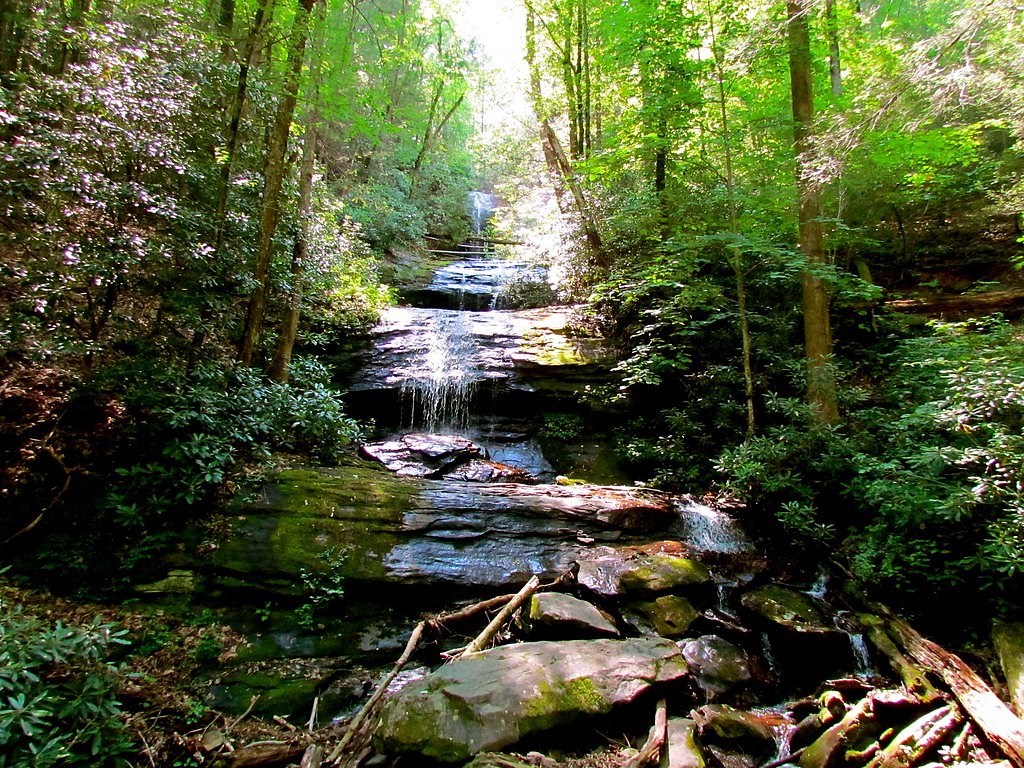
High Water Falls
By Armen Suny · Last verified May 2026
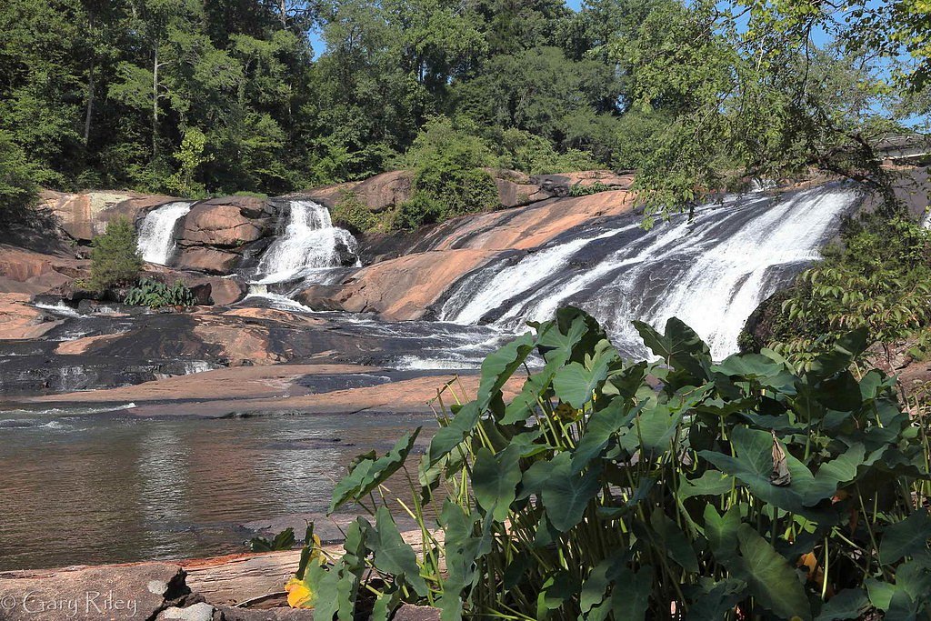
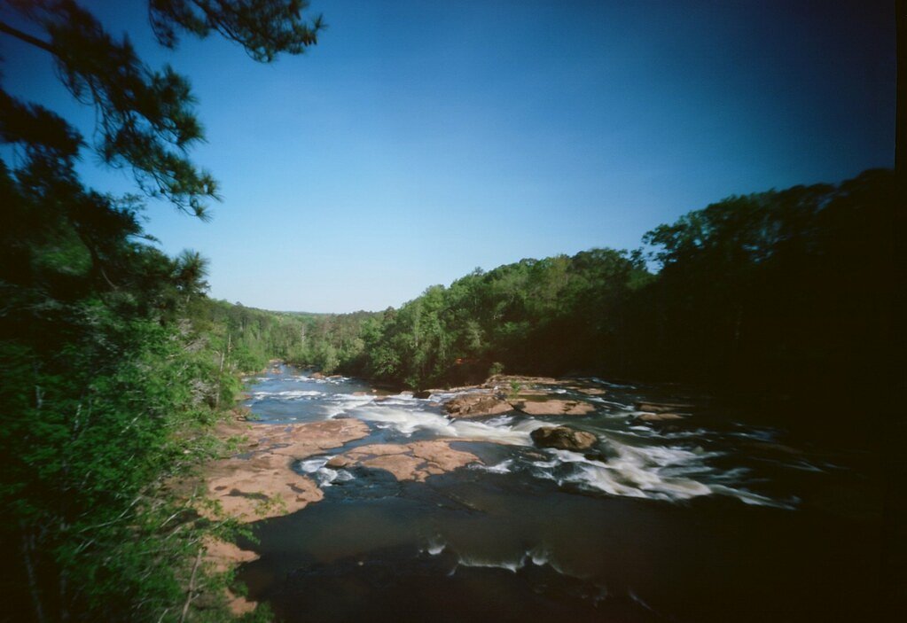

Photo Credits (4)
Difficulty
Moderate
Trail Length
2.4 miles
Trail Type
Out And Back
Elevation Gain
350 ft
About High Water Falls
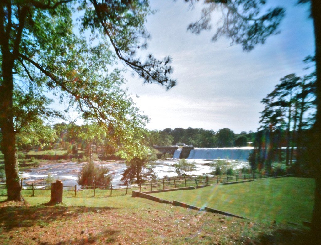
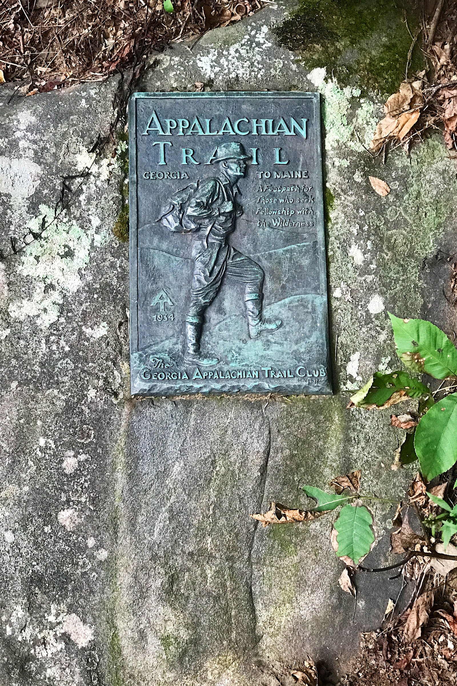
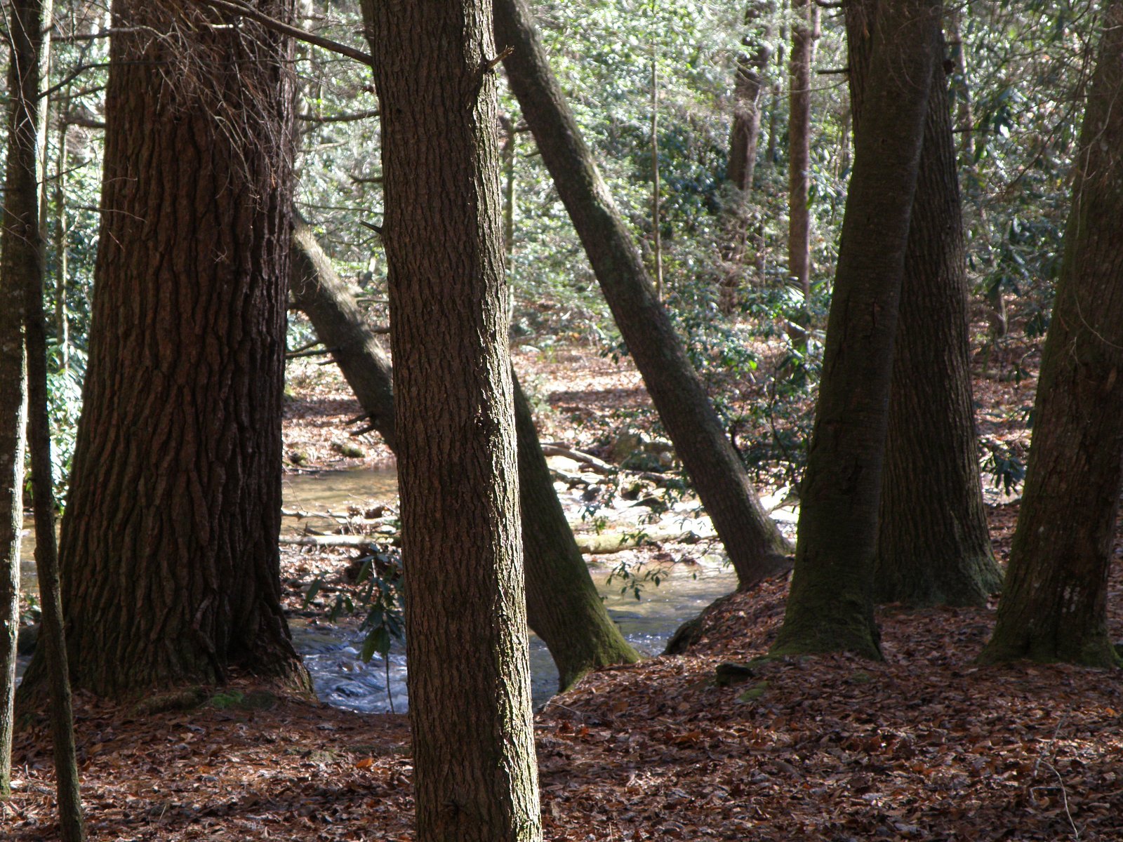
High Water Falls sits within the Chattahoochee National Forest and is managed by the U.S. Forest Service, offering a peaceful cascade framed by mature hardwoods. The waterfall is accessed via the USFS Byron Herbert Reece Trail (Trail #112), and the route to the falls is a pleasant moderate outing—about 2.4 miles round trip with roughly 350 feet of elevation gain—making it a rewarding choice for day hikers looking for a relatively short but scenic forest hike. The Byron Herbert Reece Trail is maintained by the USFS and is recorded in USFS GIS as 0.68 miles for the managed trail segment; the full hiking route is typically done as an out-and-back. If you plan to camp nearby, the DeSoto Falls Recreation Area is just over 2 km (2.01 km) away, providing convenient access to overnight options before or after your hike. The tone of the trail is inviting yet natural—expect native tread and moderate grades as you approach the falls.
The Setting
High Water Falls sits at 2,680 feet within Chattahoochee National Forest, fed by the Nottely River, in the hills of Georgia.
Nearby Falls Worth Visiting
Dukes Creek Falls (150 ft) lies 7.5 miles to the east. Also nearby: DeSoto Falls (120 ft, 0.4 mi) and Helton Creek Falls (100 ft, 2.5 mi).
Trail & Hike Details
The Approach
The moderate hike follows Byron Herbert Reece (#112), a 2.4-mile out-and-back trail over natural surface. Expect 350 feet of elevation gain with grades of 12-20%. The trail is developed (Class 3).
USFS Trail
BYRON HERBERT REECE #112
Trail Class
Developed
Surface
Avg Grade
USFS Segment
0.68 miTrail Description
Trail: Byron Herbert Reece (USFS Trail #112). Trail type: out-and-back; total route distance commonly reported as 2.4 miles with approximately 350 ft of elevation gain and rated moderate. USFS GIS lists the managed trail segment at 0.68 miles. Surface: NAT (native material). Typical grade: 12–20%. USFS class: 3. Hikers should be prepared for natural, uneven tread and sustained uphill sections on the approach; appropriate footwear and basic trail navigation are recommended.
What to Expect
Expect a peaceful natural setting with the potential for scenic views of the waterfall. Trail conditions and accessibility may vary.
Accessibility
The trail is not wheelchair accessible. Uneven terrain and elevation changes require steady footing.
Frequently Asked Questions
🐶 Are Dogs Allowed at High Water Falls?
❌ Dogs are not allowed
Are There Any Fees or Permits Required?
🆖 No fees required
🏊 Is There Swimming at High Water Falls?
❌ Swimming is not allowed
When to Visit
Spring and fall are typically the best times to visit, as the weather is mild and the waterfall may have a stronger flow.
Seasonal Access
The best time to visit is Spring, Summer, and Fall. Winter access may be limited. Check with Chattahoochee National Forest for seasonal road closures.
Safety Information
Trail conditions may be uneven or slippery, especially after rain. Visitors should exercise caution and stay on marked paths. Cell service may be limited in the area.
Current Water Conditions
58 ft³/s
Current discharge — how much water is flowing
Much lower than usual for this time of year
Based on 58 years of record
1.61 ft
Water depth at gauge
7-Day Discharge Trend
What does this mean for your visit?
Flow is well below normal for this time of year, so the waterfall may be a trickle.
About This Gauge
This gauge is on a nearby waterway and may not reflect exact conditions at the falls.
7-Day Flow Outlook
Based on the USGS gauge NOTTELY RIVER NEAR BLAIRSVILLE, GA (13 km away).
Today
Low
66 cfs
3/10Tomorrow
Low
70 cfs
3/10Wed
Low
74 cfs
3/10Thu
Low
75 cfs
3/10Fri
Low
75 cfs
3/10Sat
Low
70 cfs
3/10Sun
Low
68 cfs
3/10Best window: Today — low flow, mostly sunny then chance showers and thunderstorms (trip score 3/10).
Best time of year: this gauge typically runs highest from early March to late April, peaking in April.
How we calculate this
This is a transparent outlook, not a precise forecast. We take the waterfall's current flow strength (how it ranks against its historical normal for today, from the nearest USGS stream gauge), carry that ranking forward along the gauge's seasonal curve, and nudge it for forecast rain. Confidence is highest for the next day or two and falls further out. Always check official conditions and your own judgment before visiting — high flows can be dangerous.
Know when to go.
Get a free email alert when waterfalls near Blairsville hit peak flow. We only send when conditions are worth the trip — no weekly newsletters, no spam.
Weather Forecast
Location & Access
Getting There
The exact location of High Water Falls is not well-documented. Visitors are advised to consult local maps or guides for directions.
Get Directions on Google MapsParking
Parking availability is unclear. It is recommended to check with local resources or visitor centers for parking options.
Elevation
2,680 feet above sea level
Coordinates
34.723297° N, -83.920195° W
Land Management
Managed by USFS
Visitor Tips & Gear
Wear sturdy footwear and bring plenty of water. Check weather conditions before visiting and be prepared for uneven terrain.
As an Amazon Associate, we earn from qualifying purchases.
With 2.4 miles and 350 ft of elevation gain, sturdy boots and trekking poles will help on this moderate trail. Sun exposure on the trail makes good sun protection a must in summer.

Polarized Sunglasses (Knockaround)
Cuts glare off the water so you actually see the falls — and your photos turn out better too.

Columbia Watertight II Rain Jacket
Packs into its own pocket, seam-sealed, and keeps you dry from spray and surprise rain.

Earth Pak Waterproof Dry Bag
Keeps your phone and gear dry when waterfall mist soaks everything else.

Waterproof Phone Pouch (AiRunTech)
Cheap insurance — take photos right next to the falls without killing your phone.

Timberland Euro Sprint Mid Waterproof
Trusted waterproof boot with premium leather and grippy rubber sole — reliable on rocky, wet trails.

TrailBuddy Trekking Poles
Lightweight aluminum, cork grips, and flip-locks that actually hold — a best-seller for good reason.
Where to Stay

Dahlonega Resort and Vineyard

Holiday Inn Express & Suites Helen by IHG

Ferny Creek Cottage

Quality Inn Dahlonega Near University
Browse vacation cabins and private rentals nearby
Unique outdoor stays — tents, yurts, and treehouses
Rent a campervan or RV for your waterfall road trip
Some links are affiliate links. We may earn a commission at no extra cost to you.
Nearby Campground
Desoto Falls Recreation Area
1.2 miles away · 23 sites
Overview Desoto Falls Recreation Area is a U.S. Forest Service Campground located approximately 2 hours North of Atlanta in the North Georgia mountains of the Chattahoochee National Forest. Desoto Falls offers visitors year-round recreation opportunities including camping, fishing, picnicking, and beautiful hikes to our nearby waterfalls. The campground is situated along Frogtown Creek with at an elevation of 2,080 feet above sea level, under a dense forest of deciduous and evergreen trees. 23
Book on Recreation.govAdditional Information
Nearby Attractions
Nearby attractions are not well-documented. Visitors may explore other natural areas or parks in Georgia.
Wildlife
The area may feature typical Georgia wildlife such as birds, deer, and small mammals. Visitors should be cautious of snakes and other potentially hazardous animals.
Cities near High Water Falls
Nearby Waterfalls
Writing about High Water Falls? Embed this waterfall on your site for free.