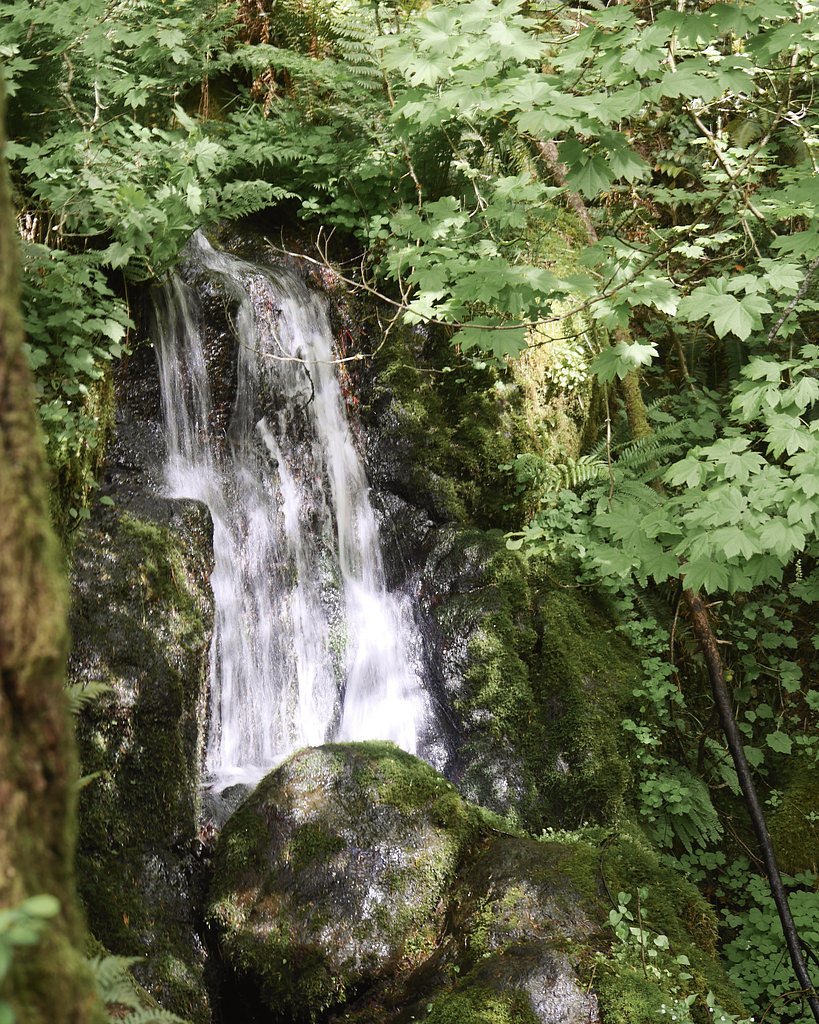
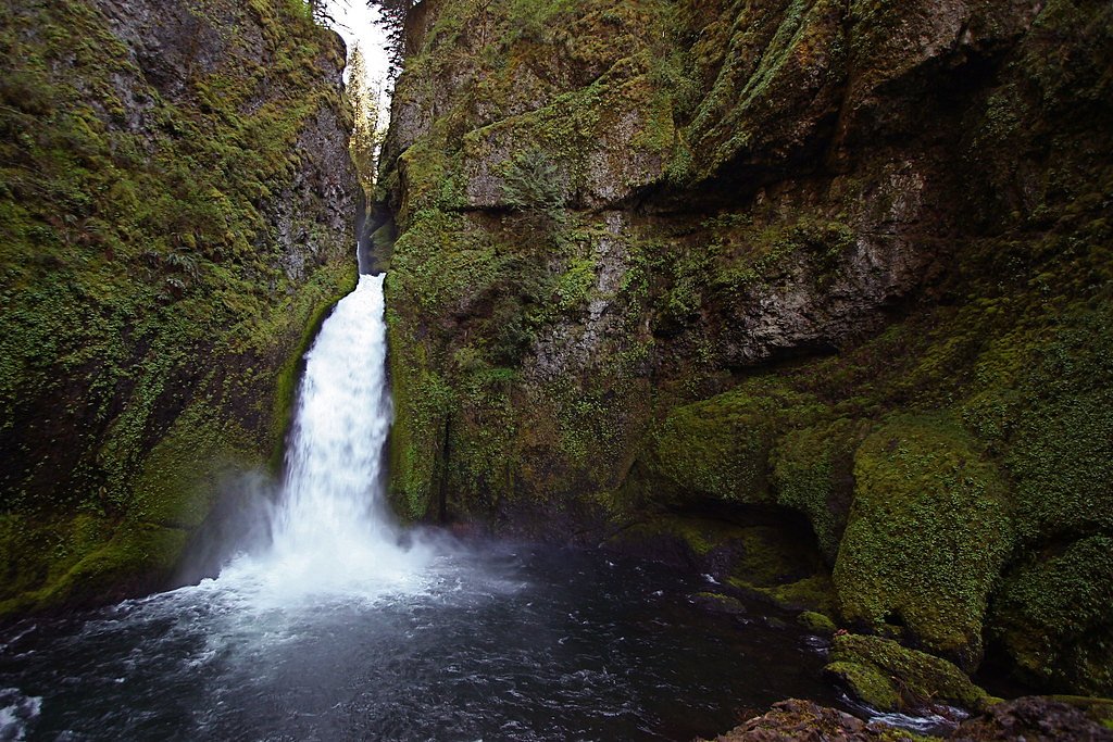
Hardy Falls
By Armen Suny · Last verified Mar 2026
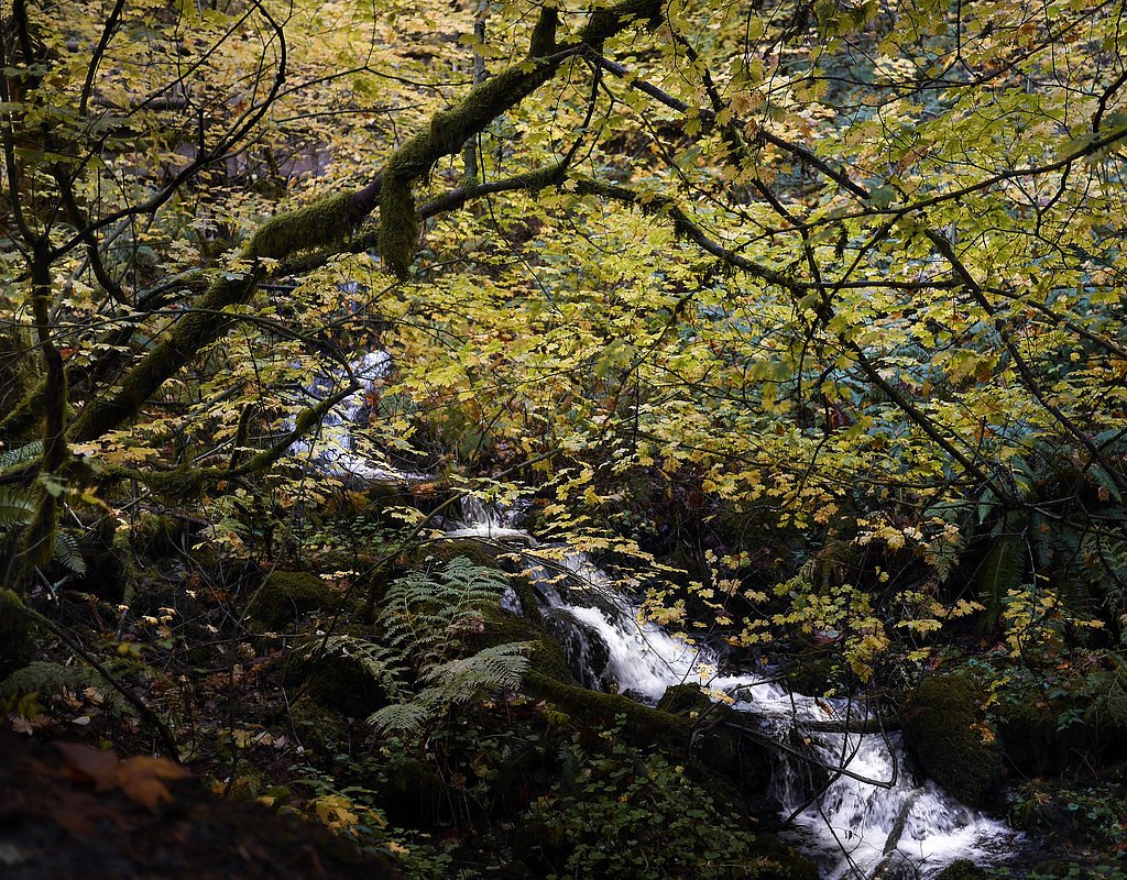
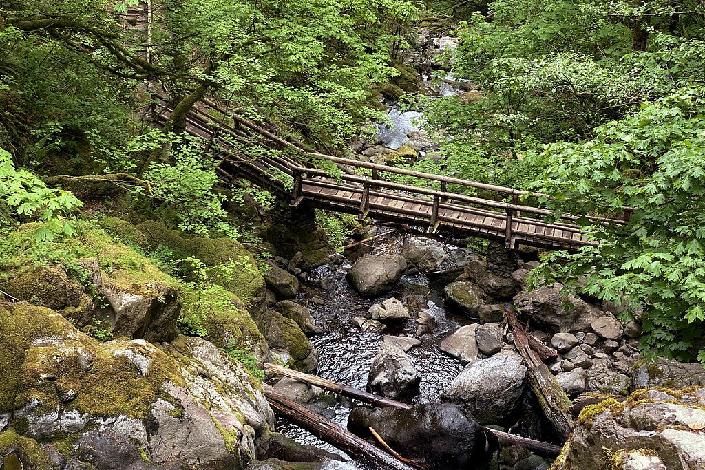
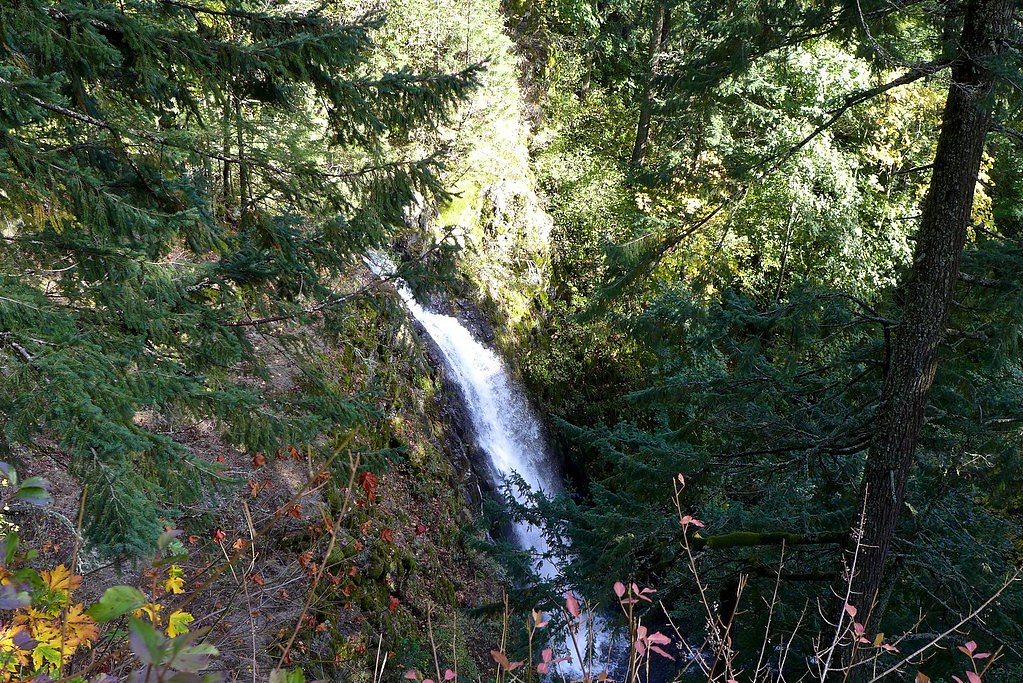
Photo Credits (5)
Difficulty
Hard
Trail Length
7.5 miles
Trail Type
Out And Back
Elevation Gain
2,000 ft
About Hardy Falls
Hardy Falls is a scenic waterfall located in Beacon Rock State Park in Washington. It is part of the Hardy Creek drainage and is known for its lush surroundings and serene atmosphere. The waterfall is often visited in conjunction with Rodney Falls, which is nearby.
The Setting
Hardy Falls sits at 863 feet within Beacon Rock, fed by the Wind River, in the foothills of Washington.
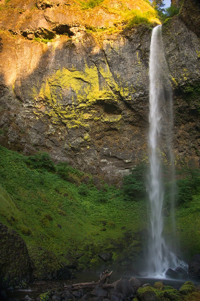
Nearby Falls Worth Visiting
Elowah Falls (213 ft) lies 2.3 miles to the southeast. Also nearby: Wahclella Falls (65 ft, 3.5 mi).
Trail & Hike Details
The Approach
The hard 7.5-mile out-and-back trail gains 2,000 feet of elevation on the way to the falls.
Trail Description
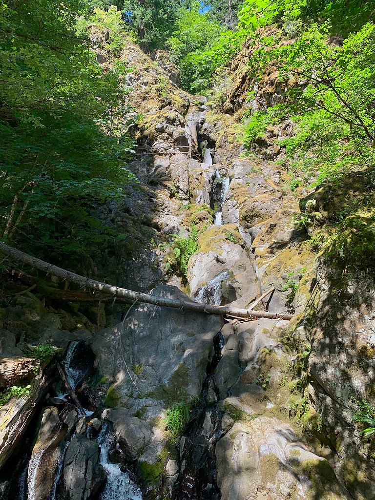
The trail to Hardy Falls is part of the Hamilton Mountain Trail, which is a challenging hike with significant elevation gain. The trail passes through dense forest, offering views of Hardy Falls and Rodney Falls along the way. The path can be steep and rocky in sections, so proper footwear is recommended.
What to Expect
Dogs are welcome.
Accessibility
The trail involves steep, uneven terrain with significant elevation change and is not accessible to mobility devices.
Frequently Asked Questions
🐶 Are Dogs Allowed at Hardy Falls?
✅ Dogs are allowed
Are There Any Fees or Permits Required?
🤑 Fee: $10.00
Permit required
A Discover Pass is required for parking at Beacon Rock State Park.
🏊 Is There Swimming at Hardy Falls?
❌ Swimming is not allowed
When to Visit
Spring and early summer are the best times to visit Hardy Falls, as the water flow is typically strongest during these seasons.
Seasonal Access
The best time to visit is Spring, Summer, and Fall. Winter access may be limited.
Safety Information
The trail can be slippery after rain, and there are steep drop-offs in some areas. Use caution and stay on the marked trail. Carry enough water and be prepared for changing weather conditions.
Current Water Conditions
255 ft³/s
Current discharge — how much water is flowing
Much lower than usual for this time of year
Based on 1 years of record
2.49 ft
Water depth at gauge
58°F
ColdBracing — limit time in water
7-Day Discharge Trend
What does this mean for your visit?
Flow is well below normal for this time of year, so the waterfall may be a trickle. Water temperature is a bracing 58 degrees F, limit your time in the water. Expect crystal clear visibility.
Water Quality
Water Clarity
Crystal clearExcellent visibility
About This Gauge
This gauge is on a nearby waterway and may not reflect exact conditions at the falls.
7-Day Flow Outlook
Based on the USGS gauge WIND RIVER NEAR CARSON, WA (20 km away).
Today
Barely Flowing
255 cfs
4/10Tomorrow
Low
286 cfs
3/10Sat
Low
301 cfs
3/10Sun
Low
283 cfs
4/10Mon
Low
271 cfs
4/10Tue
Low
265 cfs
4/10Wed
Barely Flowing
243 cfs
5/10Best window: Wed — barely flowing flow, partly sunny (trip score 5/10).
Best time of year: this gauge typically runs highest from mid March to mid April, peaking in February.
How we calculate this
This is a transparent outlook, not a precise forecast. We take the waterfall's current flow strength (how it ranks against its historical normal for today, from the nearest USGS stream gauge), carry that ranking forward along the gauge's seasonal curve, and nudge it for forecast rain. Confidence is highest for the next day or two and falls further out. Always check official conditions and your own judgment before visiting — high flows can be dangerous.
Know when to go.
Get a free email alert when waterfalls near North Bonneville hit peak flow. We only send when conditions are worth the trip — no weekly newsletters, no spam.
Weather Forecast
Location & Access
Getting There
Hardy Falls is located within Beacon Rock State Park, which is accessible via State Route 14 in the Columbia River Gorge. The trailhead for Hardy Falls is near the parking area for the Hamilton Mountain Trail.
Get Directions on Google MapsParking
Parking is available at the Beacon Rock State Park trailhead. A Discover Pass is required to park here.
Elevation
863 feet above sea level
Coordinates
45.642339° N, -122.015639° W
Land Management
Managed by SPR
Visitor Tips & Gear
Start early to avoid crowds, especially on weekends. Bring plenty of water and snacks, as the hike can be physically demanding. Check the weather forecast and dress in layers, as conditions can change quickly in the Columbia River Gorge.
As an Amazon Associate, we earn from qualifying purchases.
This challenging 7.5 miles trail gains 2,000 ft in elevation — come prepared with proper hiking boots and trekking poles. Sun exposure on the trail makes good sun protection a must in summer.

Sawyer Squeeze Water Filter
The backcountry standard — filters 99.9% of bacteria and weighs just 3 oz.

Polarized Sunglasses (Knockaround)
Cuts glare off the water so you actually see the falls — and your photos turn out better too.

Columbia Watertight II Rain Jacket
Packs into its own pocket, seam-sealed, and keeps you dry from spray and surprise rain.

Earth Pak Waterproof Dry Bag
Keeps your phone and gear dry when waterfall mist soaks everything else.

Waterproof Phone Pouch (AiRunTech)
Cheap insurance — take photos right next to the falls without killing your phone.

Timberland Euro Sprint Mid Waterproof
Trusted waterproof boot with premium leather and grippy rubber sole — reliable on rocky, wet trails.
Where to Stay

Bonneville Hot Springs Resort & Spa

Skamania Lodge

Mount Hood Village

Mt Air Motel
Browse vacation cabins and private rentals nearby
Unique outdoor stays — tents, yurts, and treehouses
Rent a campervan or RV for your waterfall road trip
Some links are affiliate links. We may earn a commission at no extra cost to you.
Nearby Campground
EAGLE CREEK OVERLOOK GRP SITE
4.1 miles away · 1 sites
Overview Eagle Creek Overlook Group Site is set on a forested bluff above the Columbia River, providing an ideal setting for family gatherings and group events. Developed by the Civilian Conservation Corps (CCC) in the 1930s as a place to view construction of the Bonneville Dam, this site features CCC masonry and offers expansive views of the Columbia River and mountains rising from the gorge.Recreation The Eagle Recreation Area, just a short walk or bike ride away, provides visitors with opportu
Book on Recreation.govNearby Hot Springs
Hot springs near North Bonneville, Washington
Moffetts (Bonneville) Hot Springs
Moffetts Hot Springs, also called Bonneville Hot Springs, flows at 97 degrees in the Gifford Pinchot National Forest at just 75...
Rock Creek Hot Springs
Rock Creek Hot Springs emerges in the Columbia River Gorge in Skamania County, Washington, with water documented as 'hot' witho...
St Martins Hot Springs
St. Martins Hot Springs flows at 120 degrees Fahrenheit at just 432 feet elevation in the Columbia River Gorge near Carson in S...

Collins Hot Springs
Collins Hot Springs emerges at 122 degrees just 127 feet above sea level in the Columbia River Gorge, producing water 68.4 degr...

Mount Hood Fumaroles
Mount Hood Fumaroles vent at 194°F from the flanks of Oregon's highest peak, among the state's most extreme geothermal features...

Swim Warm Springs
Swim Warm Springs emerges at 79°F within Mount Hood National Forest at 4,063 feet elevation, flowing just 6.9 meters from White...
Looking for a soak after your hike? Explore more hot springs near North Bonneville, Washington on SoakingSprings.
Explore Washington springsAdditional Information
Nearby Attractions
Rodney Falls, Hamilton Mountain, Beacon Rock, Columbia River Gorge Scenic Area
Wildlife
The area is home to deer, birds, and small mammals. Keep an eye out for wildlife along the trail.
Cities near Hardy Falls
Nearby Waterfalls
Writing about Hardy Falls? Embed this waterfall on your site for free.