
Grand Falls
Maine • 40 ft
By Armen Suny · Last verified Mar 2026
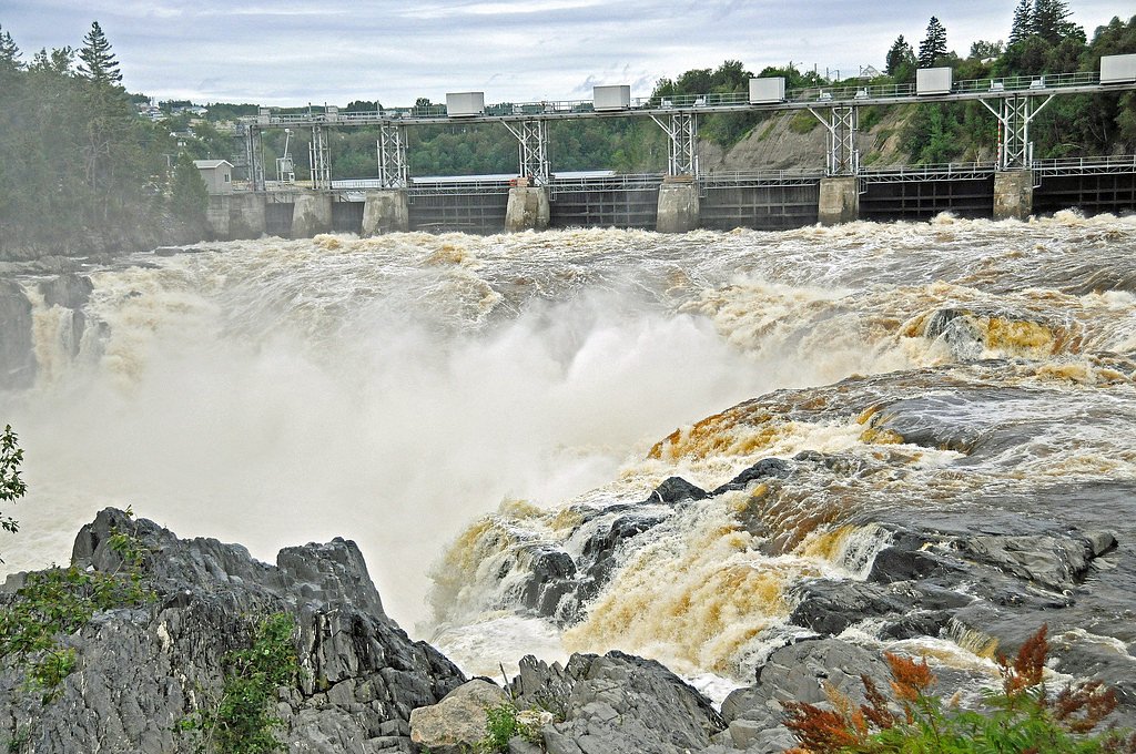
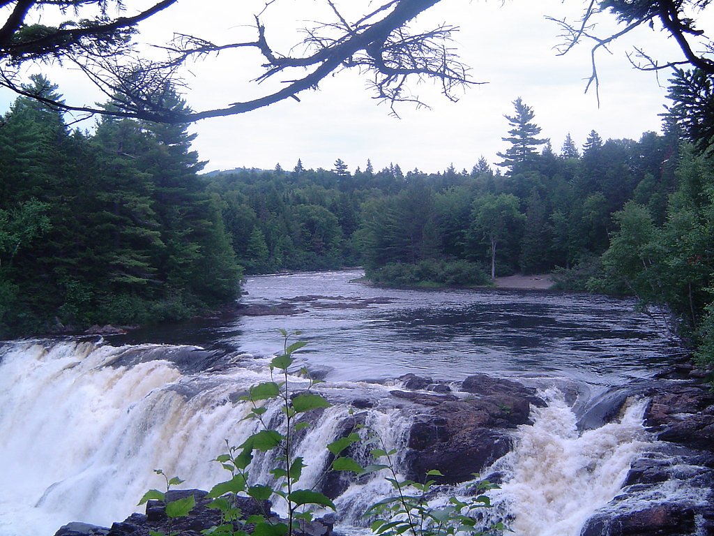
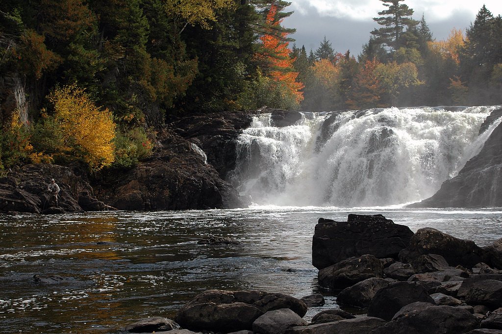
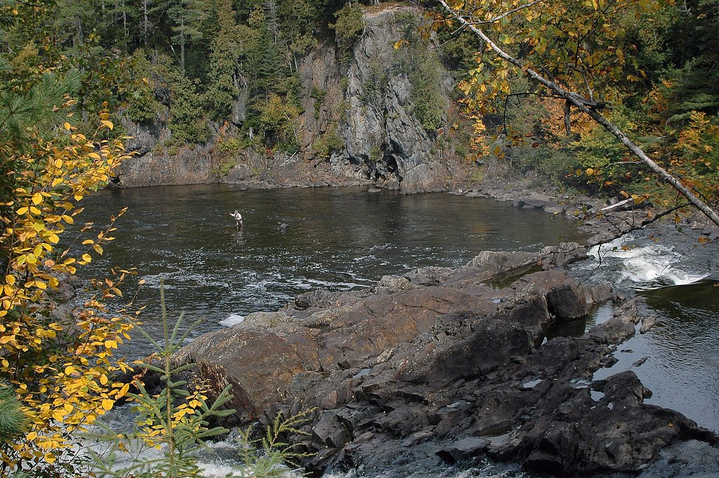
Photo Credits (5)
Difficulty
Moderate
Trail Length
2.4 miles
Trail Type
Out And Back
Elevation Gain
350 ft
About Grand Falls
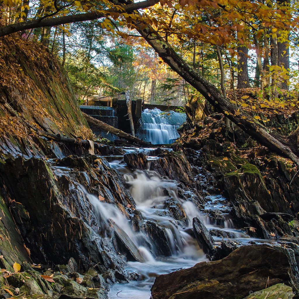
Grand Falls is a stunning waterfall located on the Dead River in Maine. It features a wide cascade with a drop of approximately 40 feet, creating a dramatic and picturesque scene. The waterfall is surrounded by dense forest, offering a serene and remote experience for visitors.
The Setting
Grand Falls sits at 988 feet along the Spencer Stream, in the foothills of Maine. The falls drop 40 feet.
Height: 40 feet
Trail & Hike Details
The Approach
The moderate 2.4-mile out-and-back trail gains 350 feet of elevation on the way to the falls.
Trail Description
The trail to Grand Falls is a short and relatively flat hike through a forested area. It is well-marked and suitable for most visitors, including families. The trail leads directly to the base of the falls, offering excellent views and photo opportunities.
What to Expect
The falls drop 40 feet. Dogs are welcome.
Accessibility
The trail is not wheelchair accessible. Uneven terrain and elevation changes require steady footing.
Frequently Asked Questions
🐶 Are Dogs Allowed at Grand Falls?
✅ Dogs are allowed
Are There Any Fees or Permits Required?
🆖 No fees required
🏊 Is There Swimming at Grand Falls?
❌ Swimming is not allowed
When to Visit
Spring and early summer are the best times to visit, as the water flow is typically strongest due to snowmelt and rainfall. Fall offers beautiful foliage, while summer provides warmer weather for hiking.
Seasonal Access
The best time to visit is Spring, Summer, and Fall. Winter access may be limited.
Safety Information
Visitors should exercise caution near the falls, as the rocks can be slippery and the currents are strong. Cell phone service may be limited in the area, so plan accordingly.
Current Water Conditions
361 ft³/s
Current discharge — how much water is flowing
Higher than usual for this time of year
Based on 26 years of record
3.48 ft
Water depth at gauge
7-Day Discharge Trend
What does this mean for your visit?
The water is flowing higher than usual for this time of year.
About This Gauge
7-Day Flow Outlook
Based on the USGS gauge Spencer Stream near Grand Falls, Maine (2 km away).
Today
Low
390 cfs
4/10Tomorrow
Moderate
355 cfs
5/10Sun
Moderate
437 cfs
4/10Mon
Low
589 cfs
6/10Tue
Low
481 cfs
4/10Wed
Moderate
547 cfs
5/10Thu
Moderate
481 cfs
5/10Best window: Mon — low flow, mostly sunny (trip score 6/10).
Best time of year: this gauge typically runs highest from late March to mid June, peaking in April.
How we calculate this
This is a transparent outlook, not a precise forecast. We take the waterfall's current flow strength (how it ranks against its historical normal for today, from the nearest USGS stream gauge), carry that ranking forward along the gauge's seasonal curve, and nudge it for forecast rain. Confidence is highest for the next day or two and falls further out. Always check official conditions and your own judgment before visiting — high flows can be dangerous.
Know when to go.
Get a free email alert when waterfalls near Kingfield hit peak flow. We only send when conditions are worth the trip — no weekly newsletters, no spam.
Weather Forecast
Location & Access
Getting There
Grand Falls is located in western Maine, near the town of West Forks. Access is typically via logging roads, and a high-clearance vehicle is recommended. Directions can vary, so it is advised to consult a detailed map or GPS before visiting.
Get Directions on Google MapsParking
There is a small parking area near the trailhead, but space may be limited. Visitors should be prepared for unpaved and potentially rough road conditions.
Elevation
988 feet above sea level
Coordinates
45.297553° N, -70.222289° W
Visitor Tips & Gear
Bring bug spray during the summer months, as mosquitoes and black flies can be prevalent. Wear sturdy shoes, as the trail may be muddy or uneven in places. Check road conditions before heading out, as the access roads can be rough.
As an Amazon Associate, we earn from qualifying purchases.
With 2.4 miles and 350 ft of elevation gain, sturdy boots and trekking poles will help on this moderate trail. Sun exposure on the trail makes good sun protection a must in summer.

Polarized Sunglasses (Knockaround)
Cuts glare off the water so you actually see the falls — and your photos turn out better too.

Columbia Watertight II Rain Jacket
Packs into its own pocket, seam-sealed, and keeps you dry from spray and surprise rain.

Earth Pak Waterproof Dry Bag
Keeps your phone and gear dry when waterfall mist soaks everything else.

Waterproof Phone Pouch (AiRunTech)
Cheap insurance — take photos right next to the falls without killing your phone.

Timberland Euro Sprint Mid Waterproof
Trusted waterproof boot with premium leather and grippy rubber sole — reliable on rocky, wet trails.

TrailBuddy Trekking Poles
Lightweight aluminum, cork grips, and flip-locks that actually hold — a best-seller for good reason.
Where to Stay

Charming Bingham Home Near Outdoor Adventure, Pet Friendly!

The Sterling Inn

All-Season Sanctuary: Steps to Moosehead Lake

Sugarloaf Inn
Browse vacation cabins and private rentals nearby
Unique outdoor stays — tents, yurts, and treehouses
Rent a campervan or RV for your waterfall road trip
Some links are affiliate links. We may earn a commission at no extra cost to you.
Additional Information
Nearby Attractions
The Forks area offers other outdoor activities such as whitewater rafting on the Kennebec River and hiking on nearby trails.
Wildlife
The area is home to a variety of wildlife, including deer, moose, and birds. Visitors should be cautious and respectful of the natural habitat.
Cities near Grand Falls
Nearby Waterfalls
Other waterfalls named Grand Falls
5 other waterfalls share this name across the U.S.
Writing about Grand Falls? Embed this waterfall on your site for free.