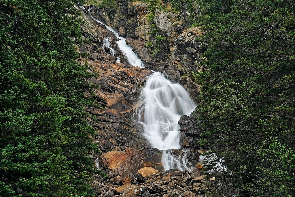
Glacier Falls
Wyoming • Grand Teton National Park
By Armen Suny · Last verified Mar 2026
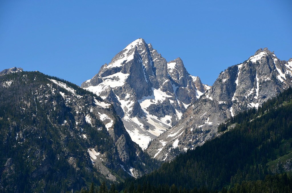
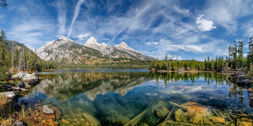
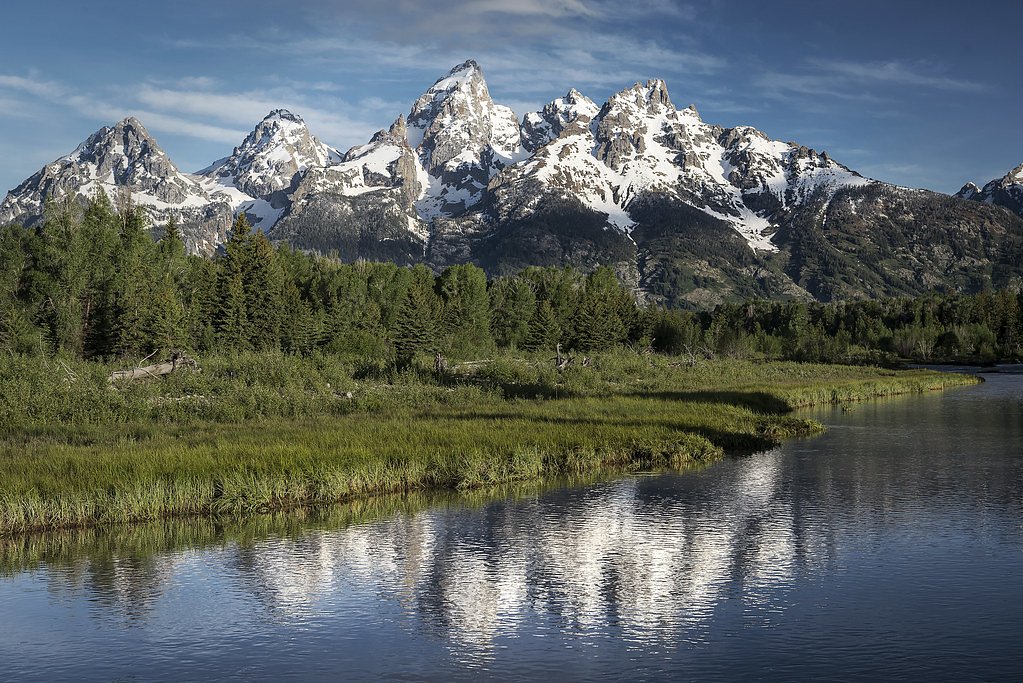

Photo Credits (5)
Difficulty
Moderate
Trail Length
4.0 miles
Trail Type
Out And Back
Elevation Gain
800 ft
About Glacier Falls
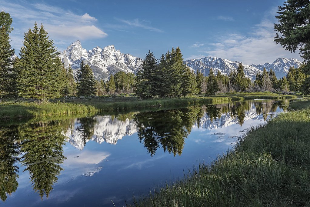
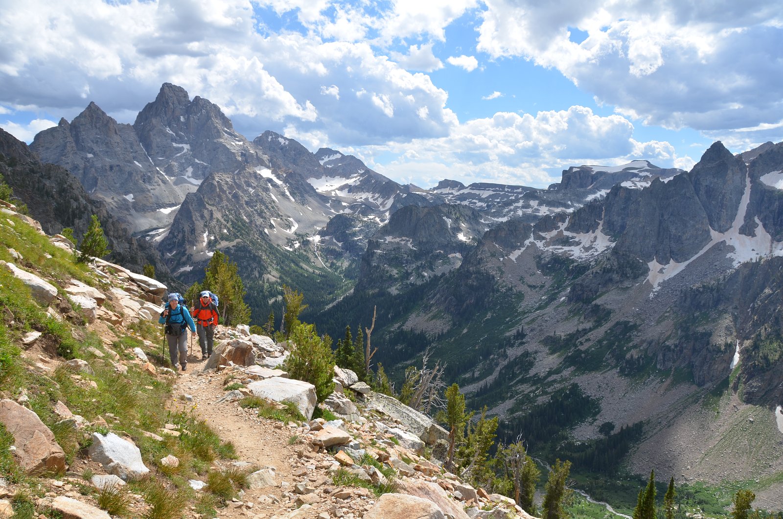
Glacier Falls is a scenic waterfall tucked into Wyoming’s Grand Teton National Park and managed by the National Park Service. The falls make a rewarding destination for hikers who want a taste of the park’s rugged beauty without committing to a multi-day trek — the setting feels wild and park-managed, with the protections and visitor expectations that come with an NPS unit. The most common approach to Glacier Falls is an out-and-back route of about 4.0 miles with roughly 800 feet of elevation gain, rated moderate. That manageable length and gain make it a popular day-hike option for visitors to Grand Teton National Park looking to experience a striking cascade within the park’s boundaries.
The Setting
Glacier Falls sits at 7,667 feet within Grand Teton National Park, fed by the Snake River, in the high mountains of Wyoming.
Trail & Hike Details
The Approach
The moderate 4.0-mile out-and-back trail gains 800 feet of elevation on the way to the falls.
Trail Description
Trail statistics: 4.0 miles (out-and-back), approximately 800 feet elevation gain, difficulty: moderate. The route is listed as an out-and-back hike within Grand Teton National Park and is managed by the National Park Service. Official park trail information does not specify a detailed surface type, percent grade, or technical class for this route, so hikers should be prepared for typical park-trail conditions and a steady climb. The trail’s moderate rating indicates sustained uphill sections but no specialized technical gear is generally required for fit day hikers.
What to Expect
Visitors can expect a moderately challenging hike with rewarding views of the waterfall and surrounding wilderness. Wildlife sightings are possible, and the area is known for its tranquility and natural beauty.
Accessibility
The trail is not wheelchair accessible. Uneven terrain and elevation changes require steady footing.
Frequently Asked Questions
🐶 Are Dogs Allowed at Glacier Falls?
❌ Dogs are not allowed
Are There Any Fees or Permits Required?
🆖 No fees required
🏊 Is There Swimming at Glacier Falls?
❌ Swimming is not allowed
When to Visit
The best time to visit Glacier Falls is during late spring through early fall when the trail is typically clear of snow and the waterfall flow is at its peak.
Seasonal Access
The best time to visit is Spring, Summer, and Fall. Access roads and trails may close during winter due to snow. Check with Grand Teton National Park for current conditions.
Safety Information
Be cautious of slippery rocks near the waterfall and changing weather conditions. Carry bear spray and be aware of wildlife in the area. Always let someone know your hiking plans.
Current Water Conditions
8,100 ft³/s
Current discharge — how much water is flowing
About average for this time of year
Based on 31 years of record
12.07 ft
Water depth at gauge
58°F
ColdBracing — limit time in water
7-Day Discharge Trend
What does this mean for your visit?
Flow is about average for this time of year. Water temperature is a bracing 58 degrees F, limit your time in the water. Expect excellent dissolved oxygen levels. PH is normal at 8.1 and mineral content is typical.
Water Quality
Dissolved Oxygen
ExcellentSupports aquatic life
pH
NormalWithin healthy range (6.5-8.5)
Conductance
Dissolved minerals in the water
About This Gauge
This gauge is on a nearby waterway and may not reflect exact conditions at the falls.
7-Day Flow Outlook
Based on the USGS gauge SNAKE RIVER AT MOOSE, WY (9 km away).
Today
Strong
8100 cfs
10/10Tomorrow
Strong
7748 cfs
10/10Tue
Strong
8152 cfs
10/10Wed
Strong
7983 cfs
10/10Thu
Strong
7983 cfs
10/10Fri
Roaring
9011 cfs
6/10Sat
Roaring
9315 cfs
6/10Best window: Today — strong flow, sunny (trip score 10/10).
Best time of year: this gauge typically runs highest from early May to early August, peaking in June.
How we calculate this
This is a transparent outlook, not a precise forecast. We take the waterfall's current flow strength (how it ranks against its historical normal for today, from the nearest USGS stream gauge), carry that ranking forward along the gauge's seasonal curve, and nudge it for forecast rain. Confidence is highest for the next day or two and falls further out. Always check official conditions and your own judgment before visiting — high flows can be dangerous.
Know when to go.
Get a free email alert when waterfalls near Teton Village hit peak flow. We only send when conditions are worth the trip — no weekly newsletters, no spam.
Weather Forecast
Location & Access
Getting There
Glacier Falls can be accessed via a trailhead in the Bridger-Teton National Forest. The exact trailhead and directions may vary depending on the route chosen, so consulting a detailed map or guide is recommended.
Get Directions on Google MapsParking
Parking is typically available at the trailhead, but spaces may be limited during peak seasons. Arrive early to secure a spot.
Elevation
7,667 feet above sea level
Coordinates
43.729108° N, -110.759298° W
Land Management
Managed by NPS
Visitor Tips & Gear
Wear sturdy hiking shoes and bring plenty of water. Start early in the day to avoid crowds and ensure you have enough daylight for the hike. Be prepared for changing weather conditions, especially in the mountains.
This trail sits at 7,667 ft above sea level
Elevated TrailUV radiation is roughly 31% stronger at this elevation than at sea level, and the dry air accelerates dehydration. Extra sun protection and fluids go a long way.
As an Amazon Associate, we earn from qualifying purchases.

Coppertone Sport SPF 50 Sunscreen
UV intensity jumps ~4% per 1,000 ft — at this elevation you can burn in half the time.

Sun Bum SPF 30 Lip Balm (3-Pack)
Lips have almost no natural UV protection and burn fast in thin, dry mountain air.

Liquid I.V. Electrolyte Packets
You lose moisture ~2x faster at elevation — electrolytes help you absorb water efficiently.

ROCKNIGHT Polarized UV400 Sunglasses
High-altitude glare off rock and water is intense — UV400 lenses block 99%+ of UVA/UVB.
As an Amazon Associate, we earn from qualifying purchases.
With 4.0 miles and 800 ft of elevation gain, sturdy boots and trekking poles will help on this moderate trail. Sun exposure on the trail makes good sun protection a must in summer.
America the Beautiful Annual Pass
Covers entrance fees at 2,000+ federal recreation sites — required at most National Parks.

Polarized Sunglasses (Knockaround)
Cuts glare off the water so you actually see the falls — and your photos turn out better too.

Columbia Watertight II Rain Jacket
Packs into its own pocket, seam-sealed, and keeps you dry from spray and surprise rain.

Earth Pak Waterproof Dry Bag
Keeps your phone and gear dry when waterfall mist soaks everything else.

Waterproof Phone Pouch (AiRunTech)
Cheap insurance — take photos right next to the falls without killing your phone.

Timberland Euro Sprint Mid Waterproof
Trusted waterproof boot with premium leather and grippy rubber sole — reliable on rocky, wet trails.

TrailBuddy Trekking Poles
Lightweight aluminum, cork grips, and flip-locks that actually hold — a best-seller for good reason.
Where to Stay

Elk Country Inn

Jackson Hole Hideout

Antler Inn

Faraway Jackson Hole
Browse vacation cabins and private rentals nearby
Unique outdoor stays — tents, yurts, and treehouses
Rent a campervan or RV for your waterfall road trip
Some links are affiliate links. We may earn a commission at no extra cost to you.
Nearby Campground
TETON CANYON
8.2 miles away · 27 sites
Overview Teton Canyon Campground is located in beautiful Teton Canyon at an elevation of approximately 6,500 feet. Driggs, Idaho is just 11 miles away. Hiking, backpacking and horseback riding are popular activities in this scenic region.Recreation The towering Teton Range and Jedediah Smith Wilderness are adjacent to the canyon. Excellent hiking, backpacking and horseback riding opportunities abound, with trails leaving from the campground. A horse staging area is located at the trailhead parkin
Book on Recreation.govNearby Hot Springs
Hot springs near Teton Village, Wyoming

Abercrombie Warm Springs
Abercrombie Warm Springs flows at 81°F within Grand Teton National Park, requiring a 104-meter walk from Warm Springs Road. The...

Kelly Warm Spring
Kelly Warm Spring flows at 81 degrees Fahrenheit just 108 meters from Gros Ventre Road at 6,684 feet elevation in Grand Teton N...
Jackson Lake Hot Springs
Jackson Lake Hot Springs emerges at 162 degrees Fahrenheit along Jackson Lake's northwestern shore in Grand Teton National Park...
Boyles Hill Springs
Boyles Hill Springs emerges at 86°F near Wilson in Teton County's valley floor, flowing 45.8 degrees above ambient temperature ...

Astoria Mineral Hot Springs
Astoria Mineral Hot Springs flows at 99°F from a roadside location 75.9 meters from West Johnny Counts Road in Teton County, Wy...
Taylor Springs
Taylor Springs surfaces at 68 degrees Fahrenheit near Victor in Teton County, running 26.7 degrees above ambient air at 6,092 f...
Looking for a soak after your hike? Explore more hot springs near Teton Village, Wyoming on SoakingSprings.
Explore Wyoming springsAdditional Information
Nearby Attractions
Nearby attractions include other trails in the Bridger-Teton National Forest, Grand Teton National Park, and Jackson Hole.
Wildlife
The area is home to a variety of wildlife, including deer, elk, and possibly bears. Carry bear spray and follow wildlife safety guidelines.
Cities near Glacier Falls
Nearby Waterfalls


Other waterfalls named Glacier Falls
1 other waterfall shares this name across the U.S.
Writing about Glacier Falls? Embed this waterfall on your site for free.