
Photo Credits (5)
Difficulty
Hard
Trail Length
10.0 miles
Trail Type
Out And Back
Elevation Gain
2 ft
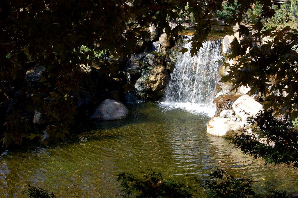
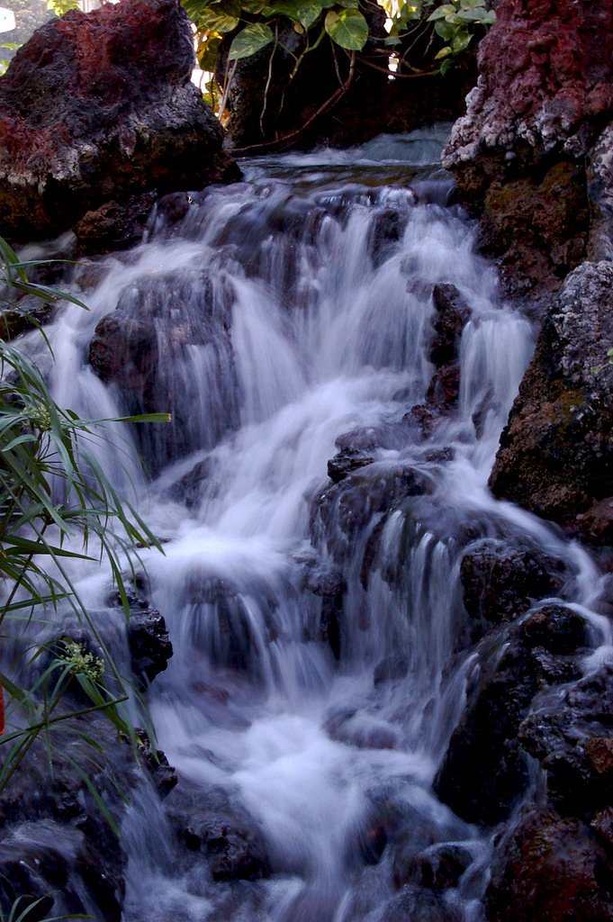
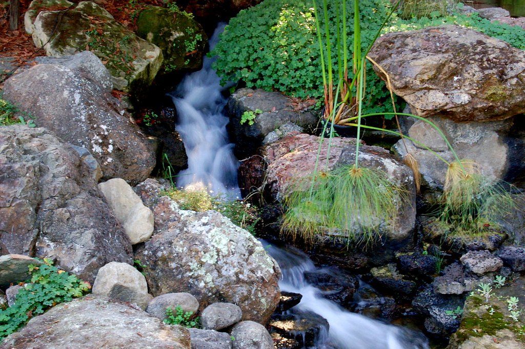
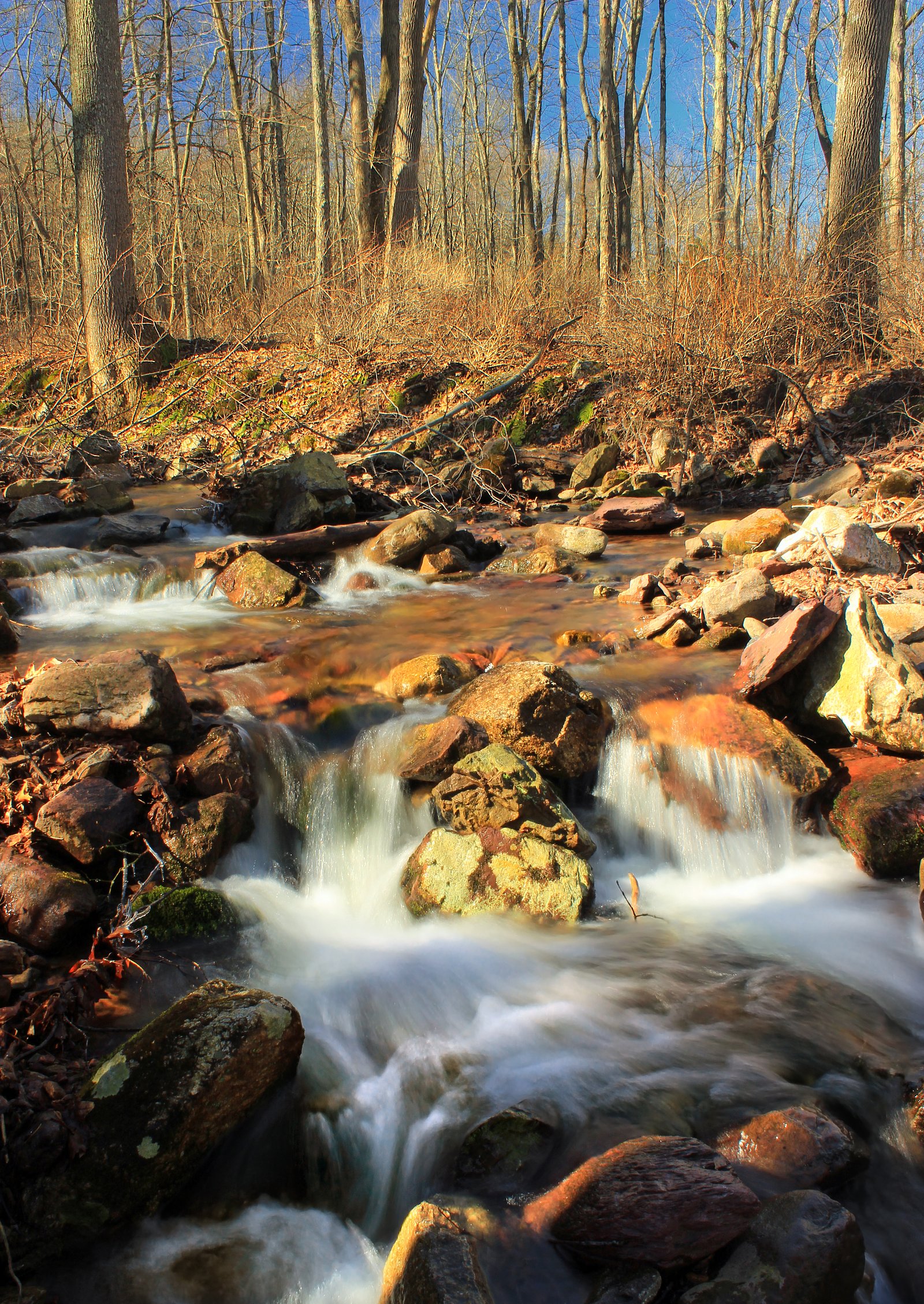
About Garlic Falls
Garlic Falls is a remote and lesser-known waterfall located in the Sierra National Forest in California. It is situated along the Kings River and offers a secluded experience for adventurous hikers. The waterfall is surrounded by rugged terrain and dense forest, making it a hidden gem for those seeking solitude and natural beauty.
The Setting
Garlic Falls sits at 1,896 feet within Sierra National Forest, in the hills of California.
Trail & Hike Details
The Approach
The hard hike follows Kings River Nrt (#27E40), a 10.0-mile out-and-back trail over natural surface. Expect 2 feet of elevation gain with grades of 10-12%. The trail is developed (Class 3).
USFS Trail
KINGS RIVER NRT #27E40
Trail Class
Developed
Surface
Avg Grade
USFS Segment
2.99 miTrail Description
The trail to Garlic Falls is a challenging hike that follows the Kings River and traverses rugged terrain. Hikers will encounter steep sections, loose rocks, and potentially overgrown areas. The trail offers stunning views of the river and surrounding forest, culminating in the secluded Garlic Falls.
What to Expect
Expect a strenuous hike with significant elevation gain and remote conditions. The waterfall itself is a peaceful and scenic reward for those who make the trek. Wildlife sightings are possible, and the area is known for its natural beauty and tranquility.
Accessibility
The trail involves steep, uneven terrain with significant elevation change and is not accessible to mobility devices.
Frequently Asked Questions
🐶 Are Dogs Allowed at Garlic Falls?
❌ Dogs are not allowed
Are There Any Fees or Permits Required?
🆖 No fees required
🏊 Is There Swimming at Garlic Falls?
❌ Swimming is not allowed
When to Visit
Spring and early summer are the best times to visit Garlic Falls, as the waterfall is typically at its fullest due to snowmelt. Fall can also be a good time, with cooler temperatures and fewer visitors.
Seasonal Access
The best time to visit is Spring, Summer, and Fall. Winter access may be limited. Check with Sierra National Forest for seasonal road closures.
Safety Information
Hikers should be prepared for remote conditions and carry adequate supplies. Cell phone service may be limited or unavailable. Watch for loose rocks and steep drop-offs along the trail. Check weather conditions before starting your hike, and avoid the trail during storms or high water levels.
Know when to go.
Get a free email alert when waterfalls near Wilsonia hit peak flow. We only send when conditions are worth the trip — no weekly newsletters, no spam.
Weather Forecast
Location & Access
Getting There
Garlic Falls is accessed via a trailhead near the Kings River in the Sierra National Forest. The trailhead is typically reached by driving along Forest Service roads, which may require a high-clearance vehicle depending on conditions. It is recommended to check with the Sierra National Forest office for the latest road and trail conditions.
Get Directions on Google MapsParking
Parking is available near the trailhead, but spaces may be limited. Visitors should ensure their vehicle is parked in designated areas to avoid fines or towing.
Elevation
1,896 feet above sea level
Coordinates
36.861304° N, -118.952076° W
Land Management
Managed by USFS
Visitor Tips & Gear
Start early to allow plenty of time for the hike and return. Bring plenty of water, as the trail can be hot and exposed in some sections. Wear sturdy hiking boots and consider trekking poles for stability on steep or uneven terrain.
As an Amazon Associate, we earn from qualifying purchases.
This challenging 10.0 miles trail gains 2 ft in elevation — come prepared with proper hiking boots and trekking poles. Sun exposure on the trail makes good sun protection a must in summer.

Sawyer Squeeze Water Filter
The backcountry standard — filters 99.9% of bacteria and weighs just 3 oz.

Polarized Sunglasses (Knockaround)
Cuts glare off the water so you actually see the falls — and your photos turn out better too.

Columbia Watertight II Rain Jacket
Packs into its own pocket, seam-sealed, and keeps you dry from spray and surprise rain.

Earth Pak Waterproof Dry Bag
Keeps your phone and gear dry when waterfall mist soaks everything else.

Waterproof Phone Pouch (AiRunTech)
Cheap insurance — take photos right next to the falls without killing your phone.

Timberland Euro Sprint Mid Waterproof
Trusted waterproof boot with premium leather and grippy rubber sole — reliable on rocky, wet trails.
Where to Stay

Cozy Cottage

Sequoia Resort

Fivespot Cabin

Willow Nest - Sequoia And Kings Canyon Villa - Luxury In Nature
Browse vacation cabins and private rentals nearby
Unique outdoor stays — tents, yurts, and treehouses
Rent a campervan or RV for your waterfall road trip
Some links are affiliate links. We may earn a commission at no extra cost to you.
Nearby Campground
Convict Flat Campground
7.2 miles away · 0 sites
Located in Kings Canyon, 19 miles NE of Grant Grove via Hwy 180. Family campground (5 units), vault tiolet and suitable for small - midsize trailers. Elevation 3,000 feet.
Book on Recreation.govNearby Hot Springs
Hot springs near Wilsonia, California

Blaney Meadows Hot Springs
Blaney Meadows Hot Springs emerges at 109 degrees Fahrenheit from the Sierra National Forest at 7,676 feet elevation, deliverin...

Mono Hot Springs
Mono Hot Springs emerges at 109°F in the High Sierra's alpine terrain, set at 6,561 feet where thermal water feeds a series of ...
Unnamed Spring Mono County 1
High in the Sierra National Forest near Mammoth Lakes, this 95-degree thermal spring flows at 5,585 feet elevation, creating 46...
Fish Creek Hot Springs
Fish Creek Hot Springs, also called Iva Bell Hot Springs, emerges at 110°F deep in Sierra National Forest's backcountry at 7,24...
Kern Hot Spring
Kern Hot Spring emerges at 109°F in Sequoia National Park at 6,908 feet elevation, accessible only via backcountry hiking. Prot...
Keough Hot Springs
Keough Hot Springs emerges at 124°F in the Owens Valley near Bishop, situated just seven miles south along US Highway 395. The ...
Looking for a soak after your hike? Explore more hot springs near Wilsonia, California on SoakingSprings.
Explore California springsAdditional Information
Nearby Attractions
Nearby attractions include the Kings River, other hiking trails in the Sierra National Forest, and Kings Canyon National Park.
Wildlife
The area is home to a variety of wildlife, including deer, black bears, and numerous bird species. Be prepared for potential wildlife encounters and store food securely.
Cities near Garlic Falls
Nearby Waterfalls
Writing about Garlic Falls? Embed this waterfall on your site for free.