Foster Falls
Tennessee • 60 ft
By Armen Suny · Last verified Mar 2026
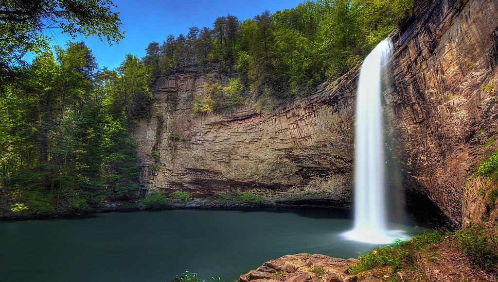
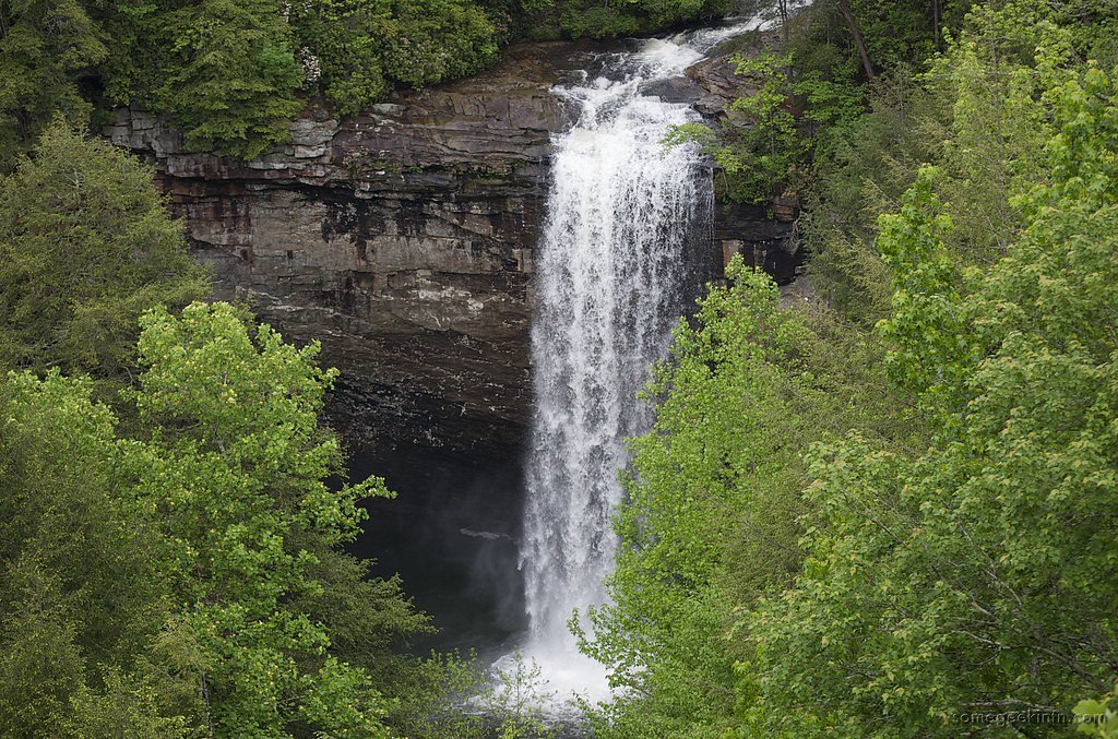
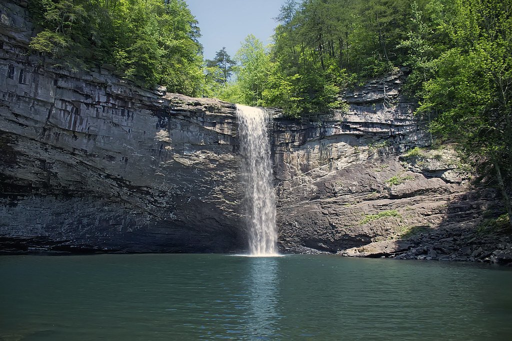

Photo Credits (5)
Difficulty
Moderate
Trail Length
1.6 miles
Trail Type
Out And Back
Elevation Gain
200 ft
About Foster Falls
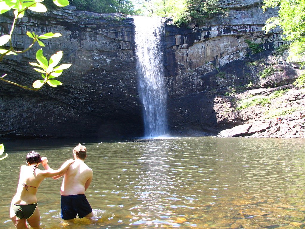
Foster Falls is a striking 60-foot plunge tucked into South Cumberland State Park in Marion County, Tennessee. Managed as part of South Cumberland State Park, the falls are a popular destination for hikers, climbers and anyone seeking scenic bluffs and a cool plunge pool. There’s a convenient overlook by the parking area and a well-loved viewpoint at the base where you can take in the full drop. Foster Falls also serves as the southern terminus of the famed Fiery Gizzard Trail, which runs from Tracy City to Foster Falls and is renowned for its beauty and ecological diversity. Backpacker magazine has cited the Fiery Gizzard as one of the top 25 hiking trails in the United States; the full 12.5-mile route features waterfalls, dramatic rock formations and hemlock trees more than 200 years old. The Fiery Gizzard follows Fiery Gizzard Creek for stretches and, for those who continue beyond Foster Falls, climbs roughly 500 feet to Raven Point for a spectacular overlook.
The Setting
Foster Falls sits at 1,591 feet along the Sequatchie River, in the hills of Tennessee. The falls drop 60 feet.
Height: 60 feet
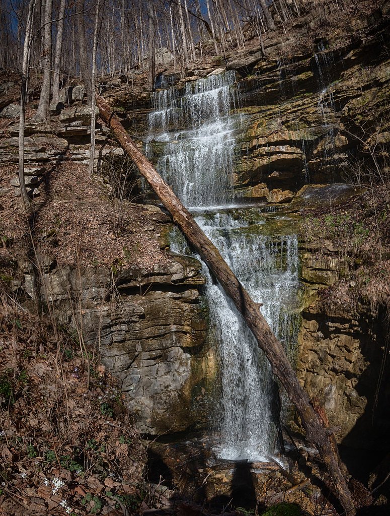
Nearby Falls Worth Visiting
Deer Lick Falls (15 ft) lies 9.1 miles to the northwest.
Trail & Hike Details
The Approach
The moderate 1.6-mile out-and-back trail gains 200 feet of elevation on the way to the falls.
Trail Description
Trail length: 1.6 miles (out-and-back). Elevation gain: ~200 feet. Difficulty: Moderate. Waterfall height: 60 feet. The approach to Foster Falls begins with a descent to the base and includes rocky, uneven natural terrain that requires steady footing. The route is an out-and-back with short steep sections on the way down and back up; visitors can enjoy views of the falls from both the base and the overlook near the parking area. The Foster Falls access also connects directly with the Fiery Gizzard Trail for those looking to extend their hike toward Tracy City or ascend the roughly 500-foot climb to Raven Point.
What to Expect
The falls drop 60 feet. Swimming is permitted. Dogs are welcome.
Accessibility
The trail is not wheelchair accessible. Uneven terrain and elevation changes require steady footing.
Frequently Asked Questions
🐶 Are Dogs Allowed at Foster Falls?
✅ Dogs are allowed
Are There Any Fees or Permits Required?
🆖 No fees required
🏊 Is There Swimming at Foster Falls?
✅ Swimming is allowed
When to Visit
Spring and fall are ideal for visiting Foster Falls due to pleasant weather and vibrant foliage. Summer is also popular, but the trail can be more crowded.
Seasonal Access
The best time to visit is Spring, Summer, Fall, and Winter.
Safety Information
The trail can be slippery, especially after rain. Exercise caution near the edge of the falls and on rocky sections. Swimming is at your own risk, as there are no lifeguards.
Current Water Conditions
133 ft³/s
Current discharge — how much water is flowing
About average for this time of year
Based on 97 years of record
1.22 ft
Water depth at gauge
7-Day Discharge Trend
What does this mean for your visit?
Flow is about average for this time of year.
About This Gauge
This gauge is on a nearby waterway and may not reflect exact conditions at the falls.
7-Day Flow Outlook
Based on the USGS gauge SEQUATCHIE RIVER NEAR WHITWELL, TN (16 km away).
Today
Low
152 cfs
3/10Tomorrow
Moderate
164 cfs
4/10Tue
Moderate
175 cfs
4/10Wed
Moderate
186 cfs
4/10Thu
Moderate
174 cfs
4/10Fri
Moderate
167 cfs
4/10Sat
Moderate
176 cfs
4/10Best window: Tomorrow — moderate flow, slight chance showers and thunderstorms (trip score 4/10).
Best time of year: this gauge typically runs highest from early February to mid April, peaking in March.
How we calculate this
This is a transparent outlook, not a precise forecast. We take the waterfall's current flow strength (how it ranks against its historical normal for today, from the nearest USGS stream gauge), carry that ranking forward along the gauge's seasonal curve, and nudge it for forecast rain. Confidence is highest for the next day or two and falls further out. Always check official conditions and your own judgment before visiting — high flows can be dangerous.
Know when to go.
Get a free email alert when waterfalls near Kimball hit peak flow. We only send when conditions are worth the trip — no weekly newsletters, no spam.
Weather Forecast
Location & Access
Getting There
Foster Falls is located near Tracy City, Tennessee, within South Cumberland State Park. It is accessible via US-41 and is well-marked with signs leading to the parking area.
Get Directions on Google MapsParking
There is a designated parking lot at the Foster Falls Recreation Area, which provides easy access to the trailhead. Parking is free, but it can fill up quickly during peak seasons.
Elevation
1,591 feet above sea level
Coordinates
35.181745° N, -85.675803° W
Visitor Tips & Gear
Arrive early to secure parking, especially on weekends. Wear sturdy shoes as the trail can be rocky and slippery. Bring water and snacks, and be prepared for a short but steep climb back to the parking area.
As an Amazon Associate, we earn from qualifying purchases.
With 1.6 miles and 200 ft of elevation gain, sturdy boots and trekking poles will help on this moderate trail. Icy conditions are common in winter — traction cleats are a smart addition.

Columbia Watertight II Rain Jacket
Packs into its own pocket, seam-sealed, and keeps you dry from spray and surprise rain.

Polarized Sunglasses (Knockaround)
Cuts glare off the water so you actually see the falls — and your photos turn out better too.

Earth Pak Waterproof Dry Bag
Keeps your phone and gear dry when waterfall mist soaks everything else.

Waterproof Phone Pouch (AiRunTech)
Cheap insurance — take photos right next to the falls without killing your phone.

Timberland Euro Sprint Mid Waterproof
Trusted waterproof boot with premium leather and grippy rubber sole — reliable on rocky, wet trails.

TrailBuddy Trekking Poles
Lightweight aluminum, cork grips, and flip-locks that actually hold — a best-seller for good reason.
Where to Stay

Spark by Hilton Kimball

Quality Inn Monteagle

Hampton Inn Kimball

Quality Inn & Suites Jasper - Kimball
Browse vacation cabins and private rentals nearby
Unique outdoor stays — tents, yurts, and treehouses
Rent a campervan or RV for your waterfall road trip
Some links are affiliate links. We may earn a commission at no extra cost to you.
Additional Information
Nearby Attractions
The Fiery Gizzard Trail, Grundy Forest, and other waterfalls within South Cumberland State Park.
Wildlife
The area is home to a variety of wildlife, including birds, deer, and small mammals. Visitors may also encounter snakes, so caution is advised.
Cities near Foster Falls
Nearby Waterfalls
Writing about Foster Falls? Embed this waterfall on your site for free.