Fish River Falls
By Armen Suny · Last verified Mar 2026
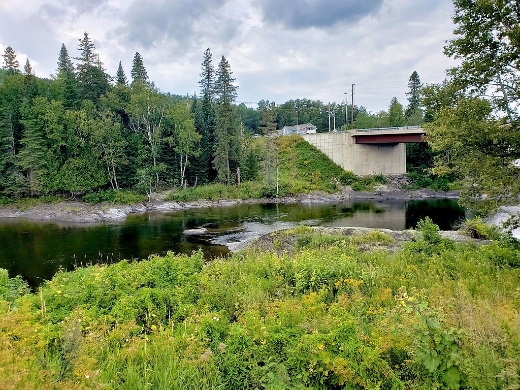
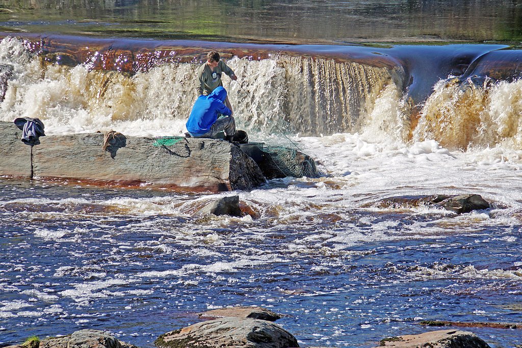
Photo Credits (5)
Difficulty
Moderate
Trail Length
2.4 miles
Trail Type
Out And Back
Elevation Gain
350 ft
About Fish River Falls
Fish River Falls is a scenic waterfall located in northern Maine, known for its rugged beauty and remote setting. The falls are part of the Fish River, which flows through the dense forests of Aroostook County. The area is popular among outdoor enthusiasts for its natural charm and tranquility.
The Setting
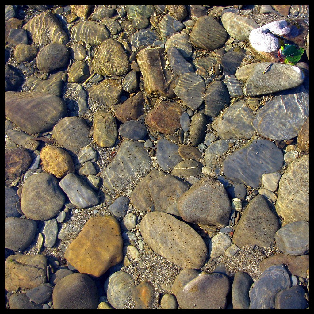
Fish River Falls sits at 538 feet along the Fish River, in the foothills of Maine.
Trail & Hike Details
The Approach
The moderate 2.4-mile out-and-back trail gains 350 feet of elevation on the way to the falls.
Trail Description
The trail to Fish River Falls is a short and relatively flat path through a forested area. It is well-marked and suitable for most visitors, including families. The trail leads directly to the falls, offering scenic views of the surrounding wilderness along the way.
What to Expect
Dogs are welcome.
Accessibility
The trail is not wheelchair accessible. Uneven terrain and elevation changes require steady footing.
Frequently Asked Questions
🐶 Are Dogs Allowed at Fish River Falls?
✅ Dogs are allowed
Are There Any Fees or Permits Required?
🆖 No fees required
🏊 Is There Swimming at Fish River Falls?
❌ Swimming is not allowed
When to Visit
The best time to visit Fish River Falls is during the spring and early summer when water flow is typically at its peak. Fall is also a great time to visit, as the surrounding foliage provides a stunning backdrop.
Seasonal Access
The best time to visit is Spring, Summer, and Fall. Winter access may be limited.
Safety Information
Exercise caution near the falls, as the rocks can be slippery and the water currents strong. Be prepared for changing weather conditions, and let someone know your plans if hiking alone.
Current Water Conditions
2,180 ft³/s
Current discharge — how much water is flowing
Much higher than usual for this time of year
Based on 96 years of record
5.17 ft
Water depth at gauge
7-Day Discharge Trend
What does this mean for your visit?
The water is flowing much higher than usual, expect an impressive display.
About This Gauge
7-Day Flow Outlook
Based on the USGS gauge Fish River near Fort Kent, Maine (4 km away).
Today
Moderate
2485 cfs
4/10Tomorrow
Moderate
2593 cfs
4/10Mon
Moderate
2233 cfs
8/10Tue
Moderate
2294 cfs
4/10Wed
Moderate
2228 cfs
5/10Thu
Moderate
2243 cfs
4/10Fri
Moderate
2277 cfs
4/10Best window: Mon — moderate flow, sunny (trip score 8/10).
Best time of year: this gauge typically runs highest from early April to late June, peaking in May.
How we calculate this
This is a transparent outlook, not a precise forecast. We take the waterfall's current flow strength (how it ranks against its historical normal for today, from the nearest USGS stream gauge), carry that ranking forward along the gauge's seasonal curve, and nudge it for forecast rain. Confidence is highest for the next day or two and falls further out. Always check official conditions and your own judgment before visiting — high flows can be dangerous.
Know when to go.
Get a free email alert when waterfalls near Grand Isle hit peak flow. We only send when conditions are worth the trip — no weekly newsletters, no spam.
Weather Forecast
Location & Access
Getting There
Fish River Falls is located approximately 23.2 miles from Grand Isle, 41.7 miles from Caribou, and 50.6 miles from Presque Isle. The falls can be accessed via a trail off Fish River Falls Road, which is a gravel road leading into the forest. Visitors should use GPS coordinates 47.2049, -68.5858 for navigation.
Get Directions on Google MapsParking
There is a small parking area near the trailhead on Fish River Falls Road. Parking availability may be limited, especially during peak seasons.
Elevation
538 feet above sea level
Coordinates
47.204876° N, -68.585830° W
Visitor Tips & Gear
Wear sturdy footwear, as the trail may be muddy or uneven in places. Bring insect repellent during the warmer months to protect against mosquitoes and other insects. Check weather conditions before visiting, as the trail may be slippery after rain.
As an Amazon Associate, we earn from qualifying purchases.
With 2.4 miles and 350 ft of elevation gain, sturdy boots and trekking poles will help on this moderate trail. Sun exposure on the trail makes good sun protection a must in summer.

Polarized Sunglasses (Knockaround)
Cuts glare off the water so you actually see the falls — and your photos turn out better too.

Columbia Watertight II Rain Jacket
Packs into its own pocket, seam-sealed, and keeps you dry from spray and surprise rain.

Earth Pak Waterproof Dry Bag
Keeps your phone and gear dry when waterfall mist soaks everything else.

Waterproof Phone Pouch (AiRunTech)
Cheap insurance — take photos right next to the falls without killing your phone.

Timberland Euro Sprint Mid Waterproof
Trusted waterproof boot with premium leather and grippy rubber sole — reliable on rocky, wet trails.

TrailBuddy Trekking Poles
Lightweight aluminum, cork grips, and flip-locks that actually hold — a best-seller for good reason.
Where to Stay

Quality Hotel & Conference Centre

Best Western Plus Edmundston

Comfort Inn

Morel Executive Suites
Browse vacation cabins and private rentals nearby
Unique outdoor stays — tents, yurts, and treehouses
Rent a campervan or RV for your waterfall road trip
Some links are affiliate links. We may earn a commission at no extra cost to you.
Additional Information
Nearby Attractions
Nearby attractions include the town of Fort Kent, the northern terminus of U.S. Route 1, and the Aroostook National Wildlife Refuge.
Wildlife
The area is home to a variety of wildlife, including deer, moose, and various bird species. Visitors should remain cautious and respectful of the natural habitat.
Cities near Fish River Falls
Other waterfalls named Fish River Falls
1 other waterfall shares this name across the U.S.
Writing about Fish River Falls? Embed this waterfall on your site for free.