
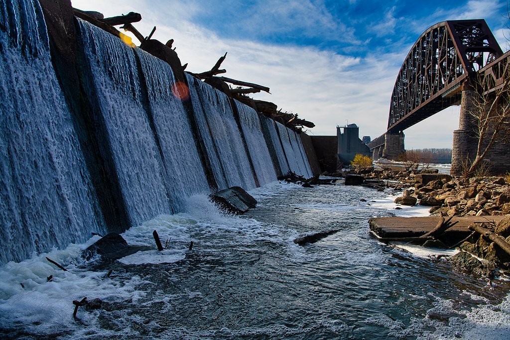
Falls of the Ohio
By Armen Suny · Last verified May 2026

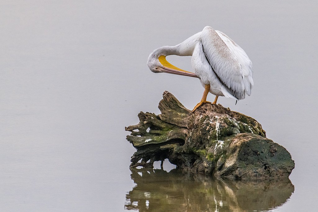
Photo Credits (3)
Difficulty
Easy
Trail Length
1.2 miles
Trail Type
Out And Back
Elevation Gain
50 ft
About Falls of the Ohio
The Falls of the Ohio is a unique geological and historical site located on the Indiana side of the Ohio River, near Clarksville. It features exposed fossil beds that date back over 390 million years, making it a popular destination for geology enthusiasts and history buffs. The area is part of the Falls of the Ohio State Park and offers scenic views of the river and Louisville skyline.
The Setting
Falls of the Ohio sits at 446 feet along the Silver Creek, in the coastal lowlands of Indiana.
Trail & Hike Details
The Approach
The easy 1.2-mile out and back trail gains 50 feet of elevation on the way to the falls.
Trail Description
The Falls of the Ohio features several short walking paths and areas to explore the fossil beds along the river. Trails are generally flat and easy to navigate, making them suitable for visitors of all ages. Some areas may be rocky or uneven, especially near the fossil beds.
What to Expect
Dogs are welcome.
Accessibility
The trail is not wheelchair accessible. Uneven terrain and elevation changes require steady footing.
Frequently Asked Questions
🐶 Are Dogs Allowed at Falls of the Ohio?
✅ Dogs are allowed
Are There Any Fees or Permits Required?
🤑 Fee: $0.00
🏊 Is There Swimming at Falls of the Ohio?
❌ Swimming is not allowed
When to Visit
Spring and fall are ideal for comfortable weather and fewer crowds, but the site is accessible year-round.
Seasonal Access
The best time to visit is Spring, Summer, Fall, and Winter.
Safety Information
Exercise caution when exploring the fossil beds, as the rocks can be slippery, especially after rain. Be aware of rising water levels in the river, which can occur suddenly.
Current Water Conditions
241 ft³/s
Current discharge — how much water is flowing
Higher than usual for this time of year
Based on 71 years of record
5.65 ft
Water depth at gauge
7-Day Discharge Trend
What does this mean for your visit?
The water is flowing higher than usual for this time of year.
About This Gauge
This gauge is on a nearby waterway and may not reflect exact conditions at the falls.
7-Day Flow Outlook
Based on the USGS gauge SILVER CREEK NEAR SELLERSBURG, IN (11 km away).
Today
Moderate
283 cfs
6/10Tomorrow
Moderate
300 cfs
6/10Sat
Moderate
300 cfs
6/10Sun
Moderate
300 cfs
6/10Mon
Moderate
265 cfs
8/10Tue
Moderate
248 cfs
8/10Wed
Moderate
248 cfs
8/10Best window: Mon — moderate flow, sunny (trip score 8/10).
How we calculate this
This is a transparent outlook, not a precise forecast. We take the waterfall's current flow strength (how it ranks against its historical normal for today, from the nearest USGS stream gauge), carry that ranking forward along the gauge's seasonal curve, and nudge it for forecast rain. Confidence is highest for the next day or two and falls further out. Always check official conditions and your own judgment before visiting — high flows can be dangerous.
Know when to go.
Get a free email alert when waterfalls near Clarksville hit peak flow. We only send when conditions are worth the trip — no weekly newsletters, no spam.
Weather Forecast
Location & Access
Getting There
The Falls of the Ohio State Park is located at 201 W. Riverside Drive, Clarksville, Indiana. It is easily accessible by car and is approximately 10 minutes from downtown Louisville, Kentucky.
Get Directions on Google MapsParking
Ample parking is available at the state park's visitor center. Parking is free, but there may be fees for accessing certain areas or exhibits.
Hours
Elevation
446 feet above sea level
Coordinates
38.272015° N, -85.752185° W
Visitor Tips & Gear
Wear sturdy shoes if you plan to explore the fossil beds, as the terrain can be uneven and rocky. Bring water and sunscreen, especially during warmer months. Check the visitor center for guided tours or educational programs.
As an Amazon Associate, we earn from qualifying purchases.
This easy 1.2 miles hike is straightforward — comfortable trail shoes and plenty of water should do. Icy conditions are common in winter — traction cleats are a smart addition.

Columbia Watertight II Rain Jacket
Packs into its own pocket, seam-sealed, and keeps you dry from spray and surprise rain.

Polarized Sunglasses (Knockaround)
Cuts glare off the water so you actually see the falls — and your photos turn out better too.

Earth Pak Waterproof Dry Bag
Keeps your phone and gear dry when waterfall mist soaks everything else.

Waterproof Phone Pouch (AiRunTech)
Cheap insurance — take photos right next to the falls without killing your phone.

Kahtoola MICROspikes
Cult-favorite traction cleats that grip ice and wet rock — essential for winter waterfall hikes.

JOBY GorillaPod Starter Kit
Wraps around railings and rocks for long-exposure waterfall shots — no flat surface needed.
Where to Stay

Holiday Inn Express - New Albany

Radisson Hotel Louisville North

Hampton Inn New Albany Louisville West

Comfort Inn & Suites Clarksville - Louisville North
Browse vacation cabins and private rentals nearby
Unique outdoor stays — tents, yurts, and treehouses
Rent a campervan or RV for your waterfall road trip
Some links are affiliate links. We may earn a commission at no extra cost to you.
Additional Information
Nearby Attractions
Nearby attractions include the Louisville Waterfront Park, Big Four Bridge, and the historic downtown area of Jeffersonville, Indiana.
Wildlife
The area is home to various bird species, including herons and egrets, as well as fish and other aquatic life in the Ohio River.
Cities near Falls of the Ohio
Nearby Waterfalls
Other waterfalls named Falls of the Ohio
1 other waterfall shares this name across the U.S.
Writing about Falls of the Ohio? Embed this waterfall on your site for free.