Falls of Lana
By Armen Suny · Last verified Mar 2026
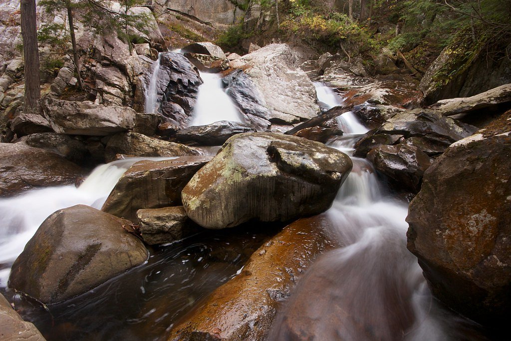
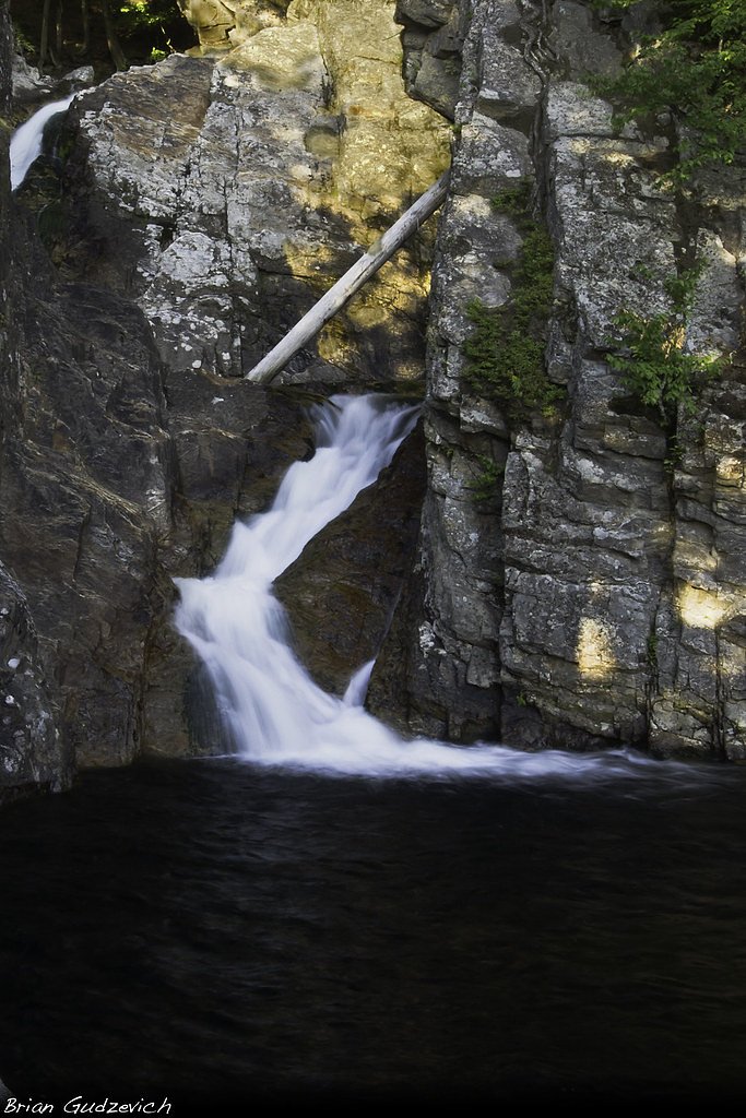
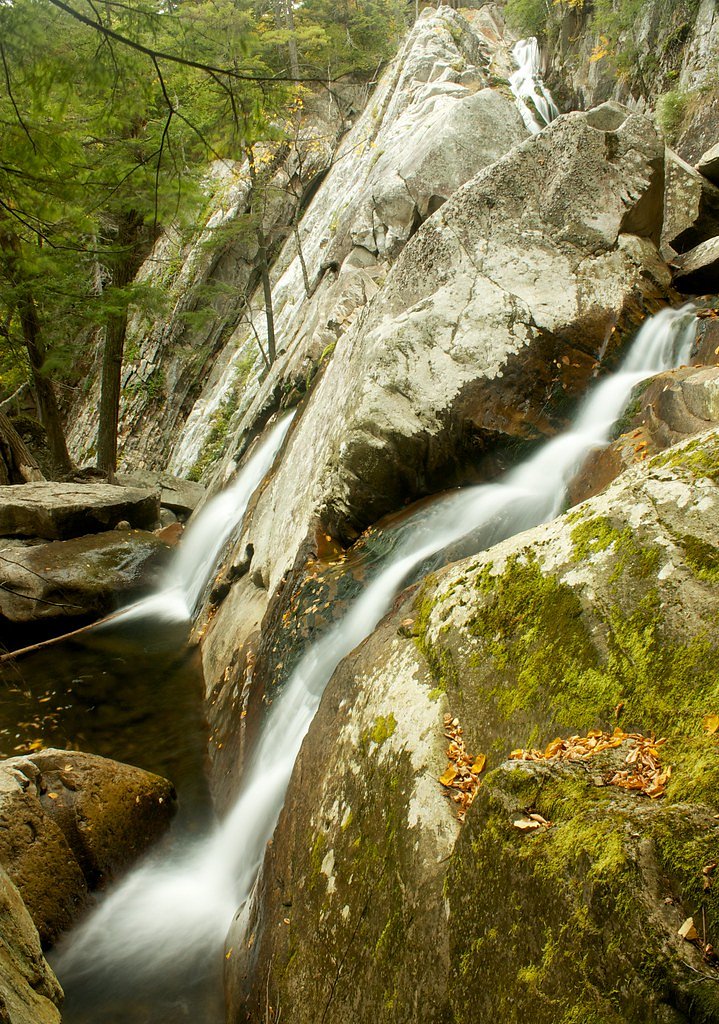

Photo Credits (5)
Difficulty
Moderate
Trail Length
1.4 miles
Trail Type
Out And Back
Elevation Gain
300 ft
About Falls of Lana
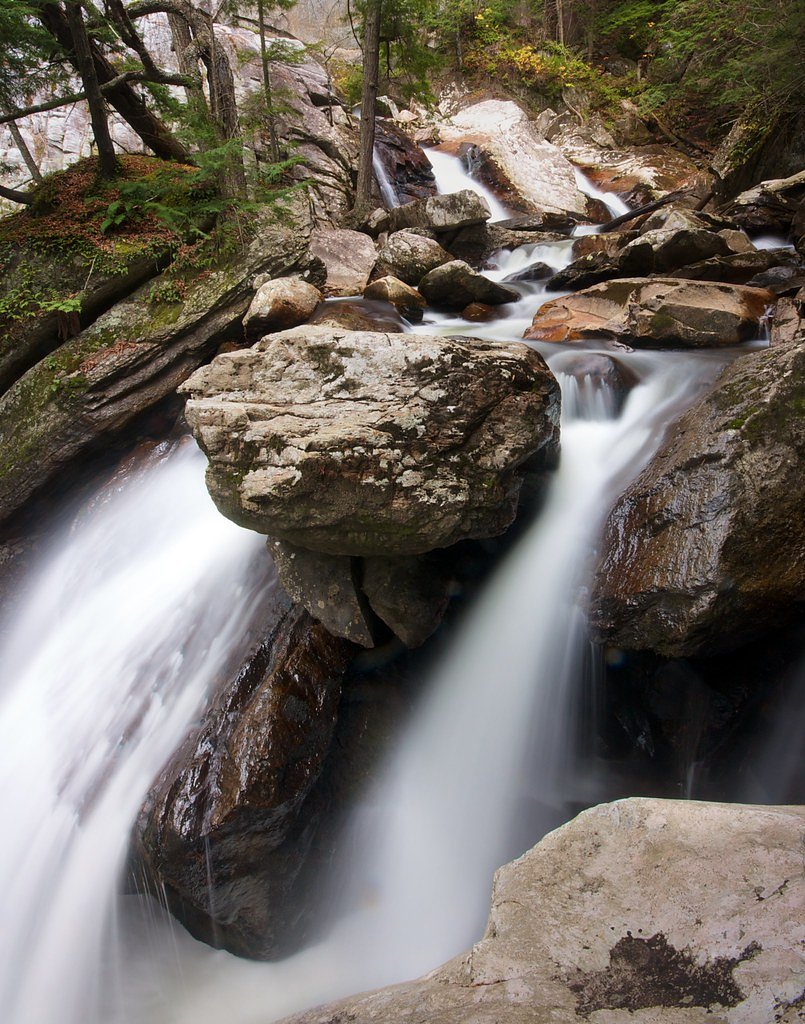
Falls of Lana is a picturesque waterfall located in the Green Mountain National Forest near Salisbury, Vermont. It features a series of cascades and pools surrounded by lush forest, making it a popular destination for hikers and nature enthusiasts.
The Setting
Falls of Lana sits at 751 feet within Green Mountain National Forest, fed by the Otter Creek, in the foothills of Vermont.
Trail & Hike Details
The Approach
The moderate hike follows Silver Lake (#SNO-127), a 1.4-mile out-and-back trail over snow. Expect 300 feet of elevation gain with grades of 8-10%. The trail is highly developed (Class 4).
USFS Trail
SILVER LAKE #SNO-127
Trail Class
Highly Developed
Surface
Avg Grade
USFS Segment
0.02 miTrail Description
The trail to Falls of Lana is a moderately challenging hike through a forested area with some rocky and uneven terrain. The path follows a stream and offers scenic views of the cascading falls. The trail can be slippery, especially after rain, so proper footwear is recommended.
What to Expect
Dogs are welcome.
Accessibility
The trail is not wheelchair accessible. Uneven terrain and elevation changes require steady footing.
Frequently Asked Questions
🐶 Are Dogs Allowed at Falls of Lana?
✅ Dogs are allowed
Are There Any Fees or Permits Required?
🤑 Fee: $5.00
🏊 Is There Swimming at Falls of Lana?
❌ Swimming is not allowed
When to Visit
Spring and early summer are ideal for visiting, as the falls are typically at their fullest due to snowmelt and rainfall. Fall offers stunning foliage views, while summer provides a lush green backdrop.
Seasonal Access
The best time to visit is Spring, Summer, and Fall. Winter access may be limited. Check with Green Mountain National Forest for seasonal road closures.
Safety Information
The trail can be slippery, especially after rain. Stay on marked paths and avoid climbing on wet rocks near the falls. Cell service may be limited in the area.
Current Water Conditions
1,780 ft³/s
Current discharge — how much water is flowing
Much higher than usual for this time of year
Based on 110 years of record
3.55 ft
Water depth at gauge
7-Day Discharge Trend
What does this mean for your visit?
The water is flowing much higher than usual, expect an impressive display.
About This Gauge
This gauge is on a nearby waterway and may not reflect exact conditions at the falls.
7-Day Flow Outlook
Based on the USGS gauge OTTER CREEK AT MIDDLEBURY, VT (15 km away).
Today
Barely Flowing
1780 cfs
5/10Tomorrow
Low
1878 cfs
3/10Wed
Low
2040 cfs
3/10Thu
Low
1899 cfs
3/10Fri
Low
1782 cfs
3/10Sat
Low
1801 cfs
3/10Sun
Low
1664 cfs
4/10Best window: Today — barely flowing flow, sunny (trip score 5/10).
Best time of year: this gauge typically runs highest from early March to late May, peaking in April.
How we calculate this
This is a transparent outlook, not a precise forecast. We take the waterfall's current flow strength (how it ranks against its historical normal for today, from the nearest USGS stream gauge), carry that ranking forward along the gauge's seasonal curve, and nudge it for forecast rain. Confidence is highest for the next day or two and falls further out. Always check official conditions and your own judgment before visiting — high flows can be dangerous.
Know when to go.
Get a free email alert when waterfalls near East Middlebury hit peak flow. We only send when conditions are worth the trip — no weekly newsletters, no spam.
Weather Forecast
Location & Access
Getting There
Falls of Lana is accessible via Route 53 near Lake Dunmore. The trailhead is located at the Branbury State Park area, and visitors can follow signs to the Falls of Lana Trail.
Get Directions on Google MapsParking
Parking is available at the Branbury State Park parking lot. During peak seasons, parking may be limited, so arriving early is recommended.
Elevation
751 feet above sea level
Coordinates
43.904229° N, -73.062614° W
Land Management
Managed by USFS
Visitor Tips & Gear
Wear sturdy hiking shoes as the trail can be rocky and slippery. Bring bug spray during the summer months. Arrive early to secure parking, especially during weekends. Check weather conditions before visiting, as the trail may be more challenging after rain.
As an Amazon Associate, we earn from qualifying purchases.
With 1.4 miles and 300 ft of elevation gain, sturdy boots and trekking poles will help on this moderate trail. Sun exposure on the trail makes good sun protection a must in summer.

Polarized Sunglasses (Knockaround)
Cuts glare off the water so you actually see the falls — and your photos turn out better too.

Columbia Watertight II Rain Jacket
Packs into its own pocket, seam-sealed, and keeps you dry from spray and surprise rain.

Earth Pak Waterproof Dry Bag
Keeps your phone and gear dry when waterfall mist soaks everything else.

Waterproof Phone Pouch (AiRunTech)
Cheap insurance — take photos right next to the falls without killing your phone.

Timberland Euro Sprint Mid Waterproof
Trusted waterproof boot with premium leather and grippy rubber sole — reliable on rocky, wet trails.

TrailBuddy Trekking Poles
Lightweight aluminum, cork grips, and flip-locks that actually hold — a best-seller for good reason.
Where to Stay

Chic Brandon Cabin w/ Pool, Hot Tub + Sauna!

Cedarbrook Queen Studio 110

Cedarbrook Queen Studio 207

Ski in/out Spruce Glen Townhomes on Great Eastern Trail
Browse vacation cabins and private rentals nearby
Unique outdoor stays — tents, yurts, and treehouses
Rent a campervan or RV for your waterfall road trip
Some links are affiliate links. We may earn a commission at no extra cost to you.
Nearby Campground
Silver Lake Campground
0.8 miles away · 16 sites
Overview Silver Lake Campground is a small, primitive hike or bike-in only campground located on Silver Lake in Leicester, VT. There are 15 campsites, seven of which are available for advanced reservations along with eight first-come, first-served sites. It is a 0.6 mile hike in or a 1.5 mile bike ride in to access the campground. Please note: This Silver Lake Campground is located in Vermont. Recreation The Moosalamoo National Recreation Area consists of 16,000 acres abounding with recreation o
Book on Recreation.govAdditional Information
Nearby Attractions
Lake Dunmore, Branbury State Park, Silver Lake Trail
Wildlife
The area is home to a variety of wildlife, including birds, deer, and small mammals. Be cautious of ticks during warmer months.
Cities near Falls of Lana
Nearby Waterfalls
Writing about Falls of Lana? Embed this waterfall on your site for free.