
Photo Credits (5)
Difficulty
Easy
Trail Length
2.2 miles
Trail Type
Out And Back
Elevation Gain
240 ft
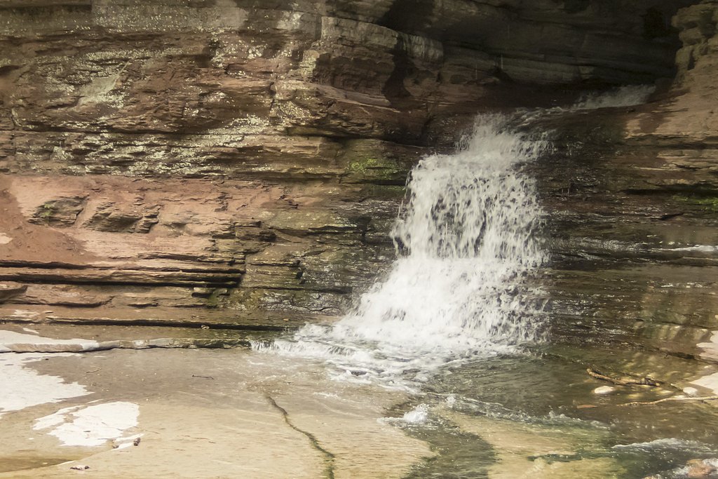
About Eden Falls
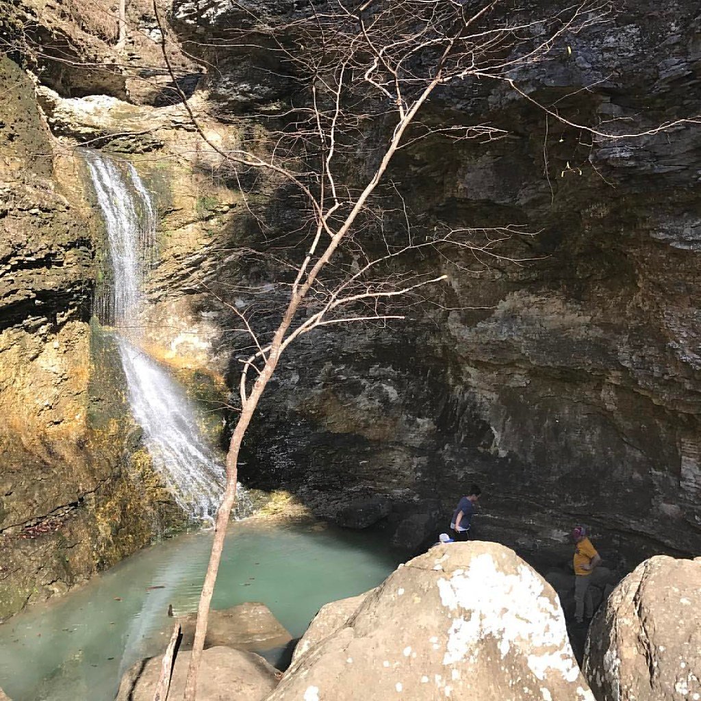
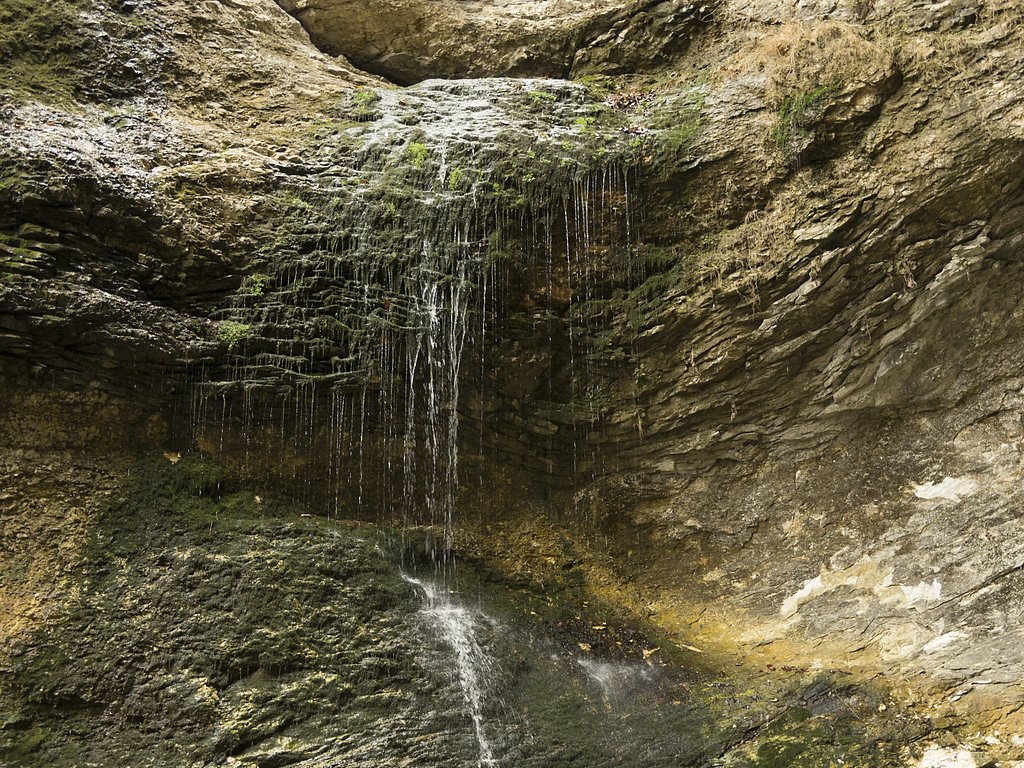
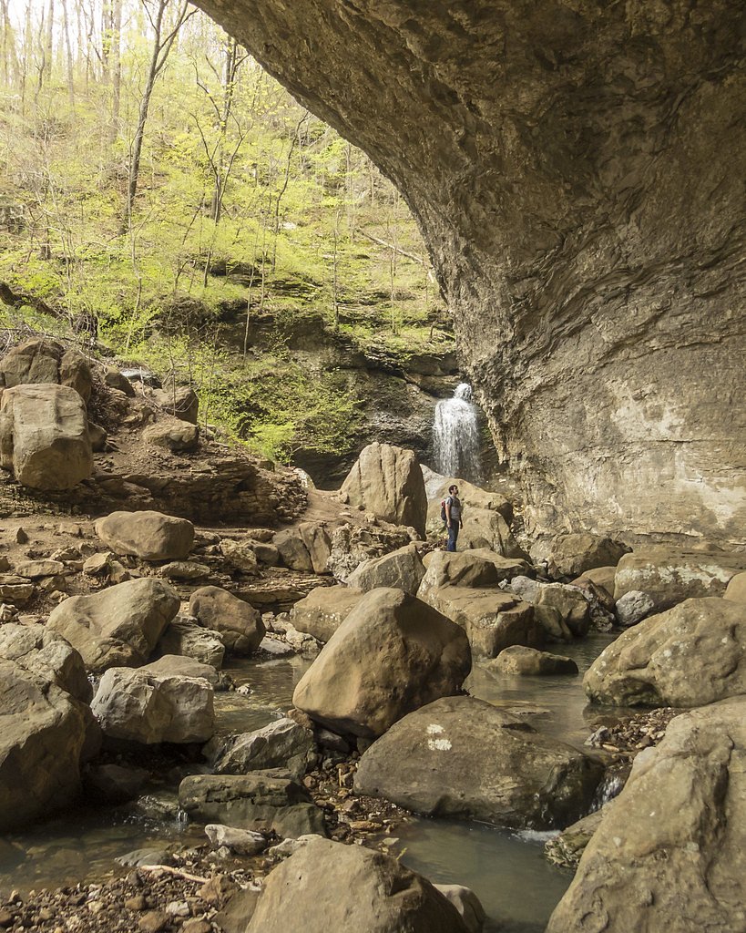
Eden Falls is a picturesque waterfall located within the Lost Valley Trail in the Buffalo National River area of Arkansas. It features a cascading drop and is surrounded by lush greenery, making it a popular destination for hikers and nature enthusiasts.
The Setting
Eden Falls sits at 1,329 feet within Buffalo National River, in the foothills of Arkansas.
Trail & Hike Details
The Approach
The easy 2.2-mile out-and-back trail gains 240 feet of elevation on the way to the falls.
Trail Description
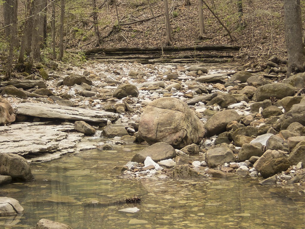
The Lost Valley Trail is a well-maintained and relatively short trail that leads to Eden Falls. The trail passes through a scenic valley, featuring a natural bridge, caves, and smaller waterfalls before reaching Eden Falls. The final section of the trail involves a slight incline but is manageable for most visitors.
What to Expect
Dogs are welcome.
Accessibility
The trail is not wheelchair accessible. Uneven terrain and elevation changes require steady footing.
Frequently Asked Questions
🐶 Are Dogs Allowed at Eden Falls?
✅ Dogs are allowed
Are There Any Fees or Permits Required?
🆖 No fees required
🏊 Is There Swimming at Eden Falls?
❌ Swimming is not allowed
When to Visit
Spring is the best time to visit Eden Falls, as the waterfall is typically at its fullest due to seasonal rainfall. Fall is also a great time to enjoy the colorful foliage.
Seasonal Access
The best time to visit is Spring, Summer, and Fall. Winter access may be limited. Check the National Park Service website for current conditions.
Safety Information
Be cautious of slippery rocks near the waterfall, especially after rain. Watch for uneven terrain and tree roots along the trail. Carry a flashlight if exploring caves, and avoid entering during heavy rainfall due to the risk of flooding.
Know when to go.
Get a free email alert when waterfalls near Ponca hit peak flow. We only send when conditions are worth the trip — no weekly newsletters, no spam.
Weather Forecast
Location & Access
Getting There
Eden Falls is located near Ponca, Arkansas, within the Buffalo National River area. The trailhead for the Lost Valley Trail, which leads to the waterfall, is accessible via Highway 43. Look for signs directing you to the Lost Valley Trailhead parking area.
Get Directions on Google MapsParking
There is a designated parking area at the Lost Valley Trailhead. Parking is generally free, but it can fill up quickly during peak seasons.
Elevation
1,329 feet above sea level
Coordinates
36.017577° N, -93.387405° W
Land Management
Managed by NPS
Visitor Tips & Gear
Arrive early to secure parking, especially during weekends and peak seasons. Wear sturdy shoes, as the trail can be muddy or slippery after rain. Bring water and snacks, and consider a flashlight if you plan to explore the nearby caves.
As an Amazon Associate, we earn from qualifying purchases.
This easy 2.2 miles hike is straightforward — comfortable trail shoes and plenty of water should do. Sun exposure on the trail makes good sun protection a must in summer.
America the Beautiful Annual Pass
Covers entrance fees at 2,000+ federal recreation sites — required at most National Parks.

Polarized Sunglasses (Knockaround)
Cuts glare off the water so you actually see the falls — and your photos turn out better too.

Columbia Watertight II Rain Jacket
Packs into its own pocket, seam-sealed, and keeps you dry from spray and surprise rain.

Earth Pak Waterproof Dry Bag
Keeps your phone and gear dry when waterfall mist soaks everything else.

Waterproof Phone Pouch (AiRunTech)
Cheap insurance — take photos right next to the falls without killing your phone.

JOBY GorillaPod Starter Kit
Wraps around railings and rocks for long-exposure waterfall shots — no flat surface needed.

Osprey Daylite Daypack
Light, organized, and just the right size for a day hike — fits water, snacks, and layers.
Where to Stay

Butterfly Ridge Cabin - At the Top of the Canyon

Buffalo River Misty Creek Lodge

BRB - Cozy Bungalow at the Top of the Canyon

Sunrise Mountain Retreat-Summer Getaway in Jasper with a Hot Tub
Browse vacation cabins and private rentals nearby
Unique outdoor stays — tents, yurts, and treehouses
Rent a campervan or RV for your waterfall road trip
Some links are affiliate links. We may earn a commission at no extra cost to you.
Nearby Campground
Steel Creek Campground
2.7 miles away · 40 sites
Overview Steel Creek Campground is situated along the Buffalo River under the towering and picturesque Roark Bluff. One section of the campground offers 26 walk-in tent sites and another section of the campground offers 14 sites for those camping with horses. Half of the sites in the campground are available for reservations. Steel Creek is located about 3 miles (5 km) east of Ponca, just off Highway 74. Recreation Paddling conditions in the upper (westernmost) district of Buffalo National River
Book on Recreation.govAdditional Information
Nearby Attractions
The Buffalo National River offers numerous hiking trails, canoeing opportunities, and scenic overlooks. Nearby attractions include the Ponca Elk Education Center and the Hemmed-In Hollow Falls.
Wildlife
The area is home to a variety of wildlife, including deer, elk, and numerous bird species. Visitors may also encounter smaller animals like squirrels and lizards.
Cities near Eden Falls
Writing about Eden Falls? Embed this waterfall on your site for free.