Difficulty
Moderate
Trail Length
2.4 miles
Trail Type
Out And Back
Elevation Gain
350 ft
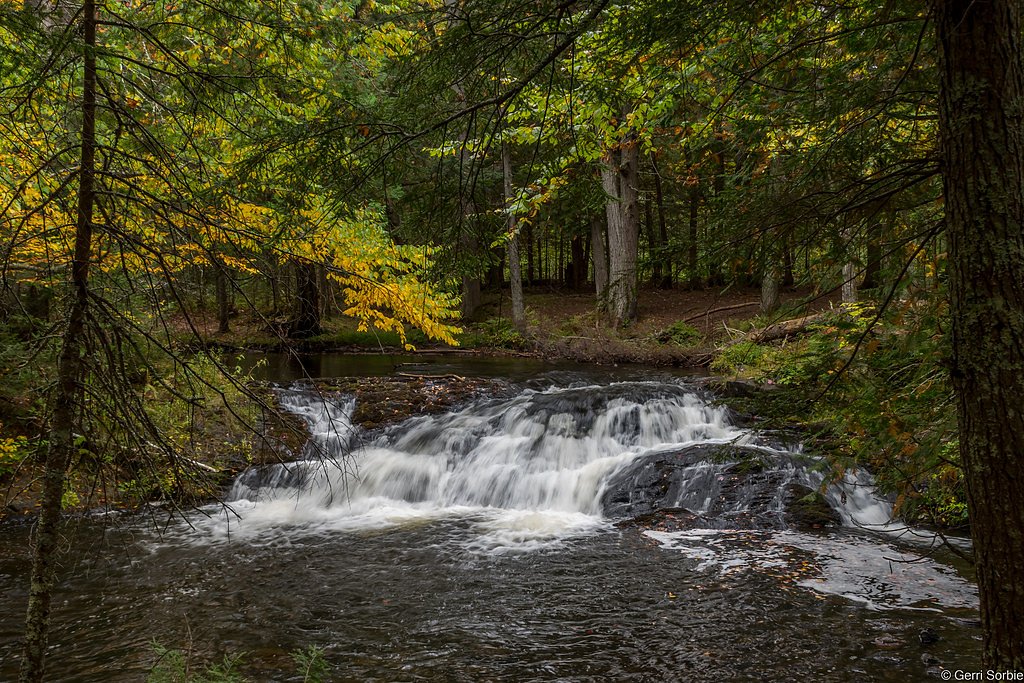
About Dumpy Falls
Dumpy Falls is a small, tucked-away cascade set amid the quiet woods of the Ottawa National Forest, managed by the U.S. Forest Service. The falls are a charming, intimate spot that rewards a short hike with a peaceful forest-and-water scene rather than a towering drop. Access is via the USFS trail NFST-3610-Y (Trail #T3610-Y), and many visitors follow a commonly used 2.4-mile out-and-back route that climbs about 350 feet and is generally rated moderate in difficulty. The hike and immediate trail are on native tread and are classified by the Forest Service as a Class 3 route with a typical grade of 0–5%; USFS mapping also shows a short 0.13-mile GIS segment at the falls. Because the surface is natural soil and leaf litter, the trail can be soft or muddy after rain, so come prepared with good footwear. If you’re planning to stay overnight, the Kenton Ranger District campground is nearby—about 7.88 km from the trailhead—making Dumpy Falls a nice stop on a longer backcountry or car-camping itinerary.
The Setting
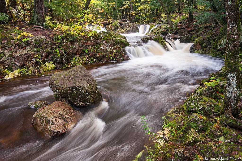
Dumpy Falls sits at 1,519 feet within Ottawa National Forest, fed by the Middle Branch Ontonagon River, in the hills of Michigan.
Trail & Hike Details
The Approach
The moderate hike follows Nfst 3610 Y (#T3610-Y), a 2.4-mile out-and-back trail over natural surface. Expect 350 feet of elevation gain with grades of 0-5%. The trail is developed (Class 3).
USFS Trail
NFST-3610-Y #T3610-Y
Trail Class
Developed
Surface
Avg Grade
USFS Segment
0.13 miTrail Description
Follow USFS NFST-3610-Y (Trail #T3610-Y) in the Ottawa National Forest for the standard 2.4-mile out-and-back to Dumpy Falls; the route gains approximately 350 feet and is rated moderate. The trail is listed by the Forest Service as Class 3 with a native material surface and a typical grade of 0–5%. USFS GIS data show a mapped 0.13-mile segment at the falls. Expect narrow, natural tread that can be uneven or muddy after rain—suitable for hikers comfortable on native-surface trails. Nearest camping: Kenton Ranger District campground, about 7.88 km away.
What to Expect
Dogs are welcome.
Accessibility
The trail is not wheelchair accessible. Uneven terrain and elevation changes require steady footing.
Frequently Asked Questions
🐶 Are Dogs Allowed at Dumpy Falls?
✅ Dogs are allowed
Are There Any Fees or Permits Required?
🆖 No fees required
🏊 Is There Swimming at Dumpy Falls?
❌ Swimming is not allowed
When to Visit
Spring and early summer are the best times to visit, as the water flow is typically stronger due to snowmelt and rainfall.
Seasonal Access
The best time to visit is Spring, Summer, and Fall. Winter access may be limited. Check with Ottawa National Forest for seasonal road closures.
Safety Information
Be cautious of slippery rocks near the waterfall. Avoid visiting during heavy rain or icy conditions, as the trail may become hazardous.
Current Water Conditions
209 ft³/s
Current discharge — how much water is flowing
Higher than usual for this time of year
Based on 78 years of record
4.88 ft
Water depth at gauge
7-Day Discharge Trend
What does this mean for your visit?
The water is flowing higher than usual for this time of year.
About This Gauge
This gauge is on a nearby waterway and may not reflect exact conditions at the falls.
7-Day Flow Outlook
Based on the USGS gauge MIDDLE BRANCH ONTONAGON RIVER NEAR PAULDING, MI (14 km away).
Today
Roaring
238 cfs
6/10Tomorrow
Roaring
242 cfs
6/10Fri
Roaring
239 cfs
6/10Sat
Roaring
228 cfs
6/10Sun
Roaring
222 cfs
6/10Mon
Roaring
198 cfs
9/10Tue
Roaring
218 cfs
6/10Best window: Mon — roaring flow, mostly sunny (trip score 9/10).
Best time of year: this gauge typically runs highest from late March to mid June, peaking in April.
How we calculate this
This is a transparent outlook, not a precise forecast. We take the waterfall's current flow strength (how it ranks against its historical normal for today, from the nearest USGS stream gauge), carry that ranking forward along the gauge's seasonal curve, and nudge it for forecast rain. Confidence is highest for the next day or two and falls further out. Always check official conditions and your own judgment before visiting — high flows can be dangerous.
Know when to go.
Get a free email alert when waterfalls near Bruce Crossing hit peak flow. We only send when conditions are worth the trip — no weekly newsletters, no spam.
Weather Forecast
Location & Access
Getting There
Dumpy Falls is located in Michigan's Upper Peninsula, near the town of Munising. Access may require driving on unpaved roads, so a vehicle with good clearance is recommended.
Get Directions on Google MapsParking
There is limited parking available near the trailhead. Visitors should plan to park in designated areas to avoid blocking access.
Elevation
1,519 feet above sea level
Coordinates
46.416890° N, -88.913750° W
Land Management
Managed by USFS
Visitor Tips & Gear
Wear sturdy shoes as the trail may be muddy. Bring insect repellent during warmer months, as mosquitoes can be present. Consider visiting after rainfall for a more impressive water flow.
As an Amazon Associate, we earn from qualifying purchases.
With 2.4 miles and 350 ft of elevation gain, sturdy boots and trekking poles will help on this moderate trail. Sun exposure on the trail makes good sun protection a must in summer.

Columbia Watertight II Rain Jacket
Packs into its own pocket, seam-sealed, and keeps you dry from spray and surprise rain.

Earth Pak Waterproof Dry Bag
Keeps your phone and gear dry when waterfall mist soaks everything else.

Waterproof Phone Pouch (AiRunTech)
Cheap insurance — take photos right next to the falls without killing your phone.

Timberland Euro Sprint Mid Waterproof
Trusted waterproof boot with premium leather and grippy rubber sole — reliable on rocky, wet trails.

TrailBuddy Trekking Poles
Lightweight aluminum, cork grips, and flip-locks that actually hold — a best-seller for good reason.

Polarized Sunglasses (Knockaround)
Cuts glare off the water so you actually see the falls — and your photos turn out better too.
Where to Stay

Two Rivers Motel and Cabins of Kenton, MI

AmericInn by Wyndham Iron River

Phelps Cabin on 26 Acres with Fire Pit!

Lakeshore Motel Ice Lake
Browse vacation cabins and private rentals nearby
Unique outdoor stays — tents, yurts, and treehouses
Rent a campervan or RV for your waterfall road trip
Some links are affiliate links. We may earn a commission at no extra cost to you.
Nearby Campground
Kenton Ranger District
4.9 miles away · 0 sites
The Kenton Ranger District is the largest and oldest district on the Ottawa, dating back to 1931, when the forest had only one district. The recreation program includes a wide variety of dispersed activities including hunting, fishing, remote camping and hiking including two wildernesses, snowmobiling on numerous maintained trails, recreational driving with a variety of potential destinations including lakes, waterfalls and other scenic attractions. Developed recreation includes 7 campgrounds (3
Book on Recreation.govAdditional Information
Nearby Attractions
Nearby attractions include Munising Falls, Pictured Rocks National Lakeshore, and other waterfalls in the area such as Wagner Falls and Alger Falls.
Wildlife
The area is home to various wildlife, including birds, deer, and small mammals. Visitors should be cautious of ticks during warmer months.
Cities near Dumpy Falls
Nearby Waterfalls
Writing about Dumpy Falls? Embed this waterfall on your site for free.