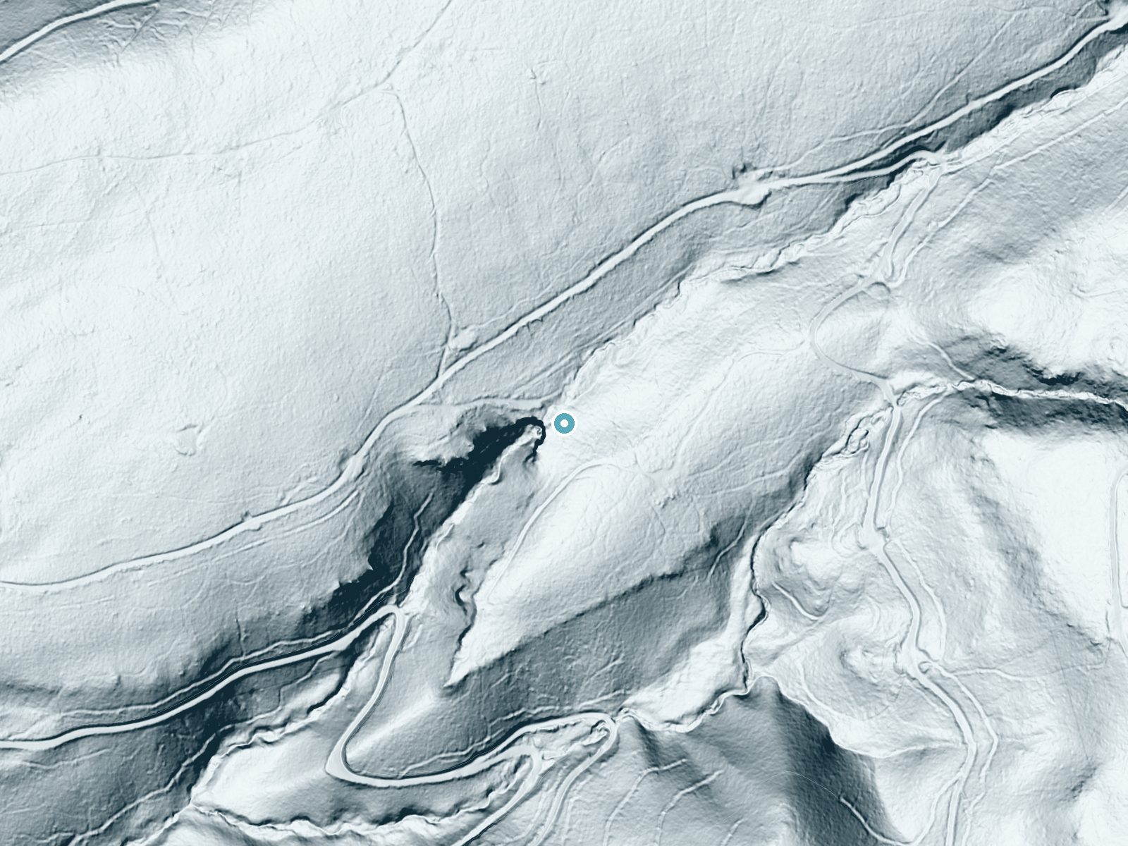
 LiDAR terrain view · USGS 3DEP
Before you go
Deadhorse Falls appears to be on private land, and no public trail or legal access route is documented. Do not enter without the landowner's permission.
About Deadhorse Falls
Deadhorse Falls is a named waterfall in eastern Tehama County, southwest of Mineral. It sits on land that Forest Service ownership maps show as non-federal, inside the Lassen National Forest boundary. We found no published trail, route or access information for it.
Trail & Hike Details
Frequently Asked Questions
🐶 Are Dogs Allowed at Deadhorse Falls?
❌ Dogs are not allowed
Are There Any Fees or Permits Required?
🤑 Fees are required
Permit required
An Adventure Pass is required for parking in the Cleveland National Forest. Passes can be purchased online or at local vendors.
🏊 Is There Swimming at Deadhorse Falls?
❌ Swimming is not allowed
When to Visit
Seasonal Access
The best time to visit is Spring, Summer, and Fall. Winter access may be limited.
Know when to go.
Get a free email alert when waterfalls near Mineral hit peak flow. We only send when conditions are worth the trip — no weekly newsletters, no spam.
Is Deadhorse Falls Frozen?
Updated about 11 hours agoNot frozen highs above freezing lately
Deadhorse Falls is not frozen right now; highs have been above freezing. Yesterday ran 47°F to 38°F.
- Days below freezing
- 0 of the last 14
- Current cold streak
- 0 days
- Freezing days ahead
- 0 of the next 7
- Flow
- no gauge
Winter safety. Frozen falls are the one waterfall trip with a documented injury pattern: falling ice, and ice-glazed rock and trail. Wear microspikes, keep well back from the base and from overhangs, and never walk out on ice over moving water.
Estimate from Open-Meteo daily temperatures at the falls, the LiDAR-measured facing direction, and the nearest stream gauge. It is a likelihood, not a report from the trail.
Weather Forecast
The Terrain, Seen by LiDAR
Aircraft-mounted lasers measured this ground to within inches. Trees and buildings are digitally stripped away, leaving the bare shape of the land the water has carved.
Here the descent is spread out: 1-meter lidar measures about 181 feet of drop through Deadhorse Falls, stretched along the creek rather than stacked in one wall. The brink sits at about 4,140 feet above sea level.
The ground changes about 88 feet in the 500 feet above the falls and 43 feet in the 500 feet below. Facing west, the falls glow in afternoon and evening light.
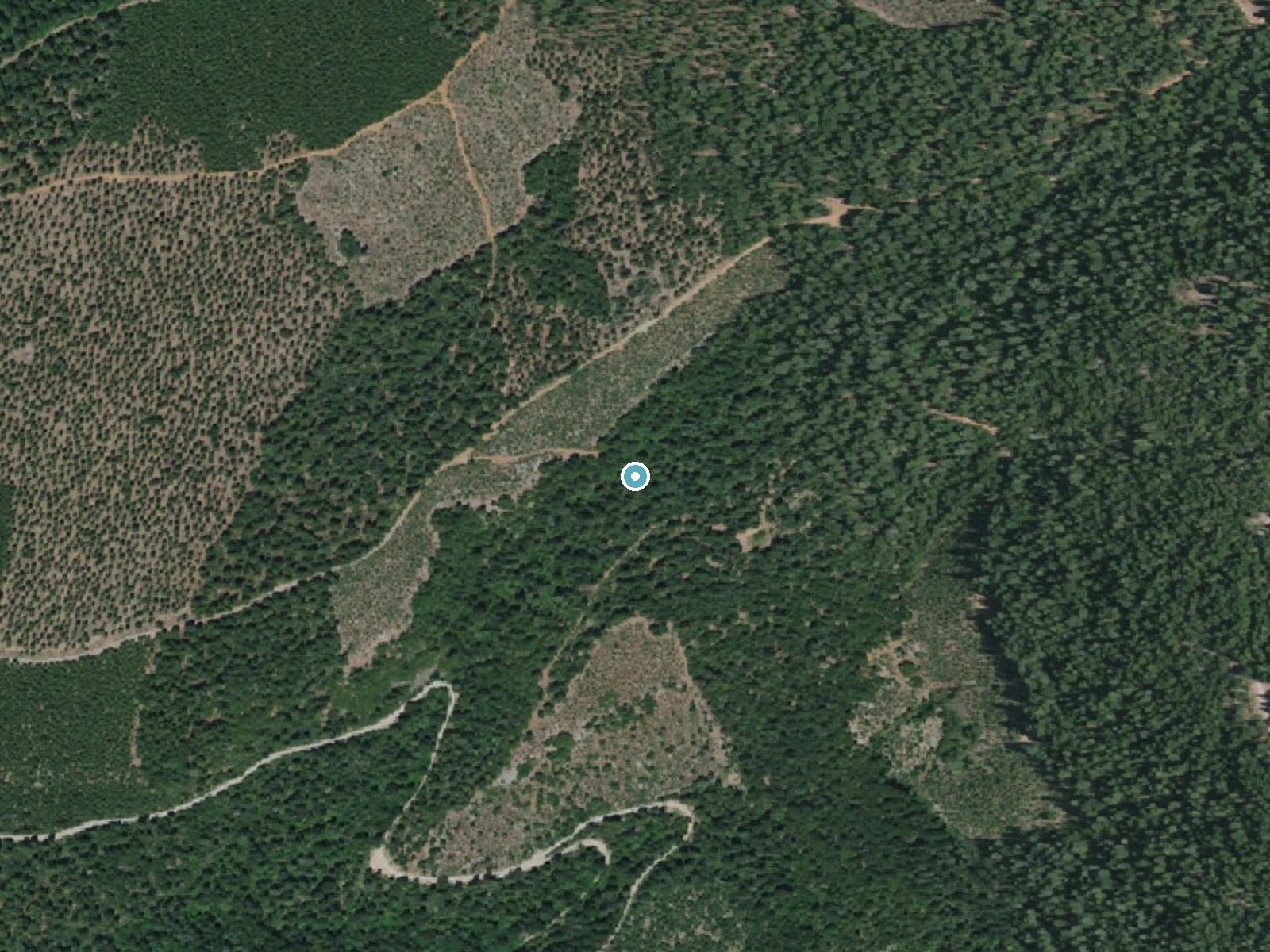
Drag to compare. The dot marks the waterfall. The frame is about a mile across.
- Ground elevation
- 4,140 feet
- Measured by 1-meter lidar
- Drop at the falls
- About 181 feet
- Change in ground height within ~250 feet of the falls
- Faces
- West
- Glows in afternoon and evening light.
A slice through the lidar ground surface, from above the falls to downstream (heading west).
Elevation data: USGS 3D Elevation Program. Aerial imagery: USGS The National Map. Public domain.
Location & Access
Elevation
4,140 feet above sea level
Coordinates
40.293193° N, -121.703067° W
Visitor Tips & Gear
Where to Stay

Gaia Hotel & Spa Redding, an Ascend Collection Hotel

Village at Childs Meadow

Comfort Suites Red Bluff near I-5

Baymont by Wyndham Anderson
Browse vacation cabins and private rentals nearby
Unique outdoor stays — tents, yurts, and treehouses
Rent a campervan or RV for your waterfall road trip
Some links are affiliate links. We may earn a commission at no extra cost to you.
Nearby Campground
Battle Creek Campground
5.5 miles away · 0 sites
Battle Creek Campground is a developed campground with 50 designated sites and a maximum of 8 people per site. Grills and tables are provided. Battle Creek Campground is close to Lassen Volcanic National Park which offers many diverse hiking trails and other outdoor amenities. Battle Creek Campground is located on Highway 36 approximately 2 miles west of Mineral, CA, and 38 miles east of Red Bluff, CA.
Book on Recreation.govNearby Hot Springs
Hot springs near Chico, California
Morgan Hot Spring
Morgan Hot Spring erupts at an extreme 205°F in the northern Sierra Nevada, far too hot for human immersion but visually dramat...

Growler Hot Spring
Growler Hot Spring discharges at a spectacular 203 degrees Fahrenheit, the highest temperature in this survey and reflecting ex...

Sulphur Works, Tophet Hot Springs
Sulphur Works and Tophet Hot Springs emerge at a dramatic 199°F at 6,932 feet elevation within Lassen Volcanic National Park, o...

Mill Creek Springs
Mill Creek Springs flows at a spectacular 150°F within Lassen Volcanic National Park, making it one of California's hottest spr...

Bumpass Hell
Bumpass Hell reaches a boiling 199°F at Lassen Volcanic National Park's 8,017-foot summit zone, creating the park's largest and...

Devils Kitchen
Devils Kitchen erupts at 203°F within Lassen Volcanic National Park, requiring a challenging 1.6-mile hike to reach one of the ...
Looking for a soak after your hike? Explore more hot springs near Chico, California on SoakingSprings.
Explore California springsAdditional Information
Nearby Attractions
Battle Creek Campground in Lassen National Forest is about 5.5 miles away.
Cities near Deadhorse Falls
Nearby Waterfalls
Writing about Deadhorse Falls? Embed this waterfall on your site for free.