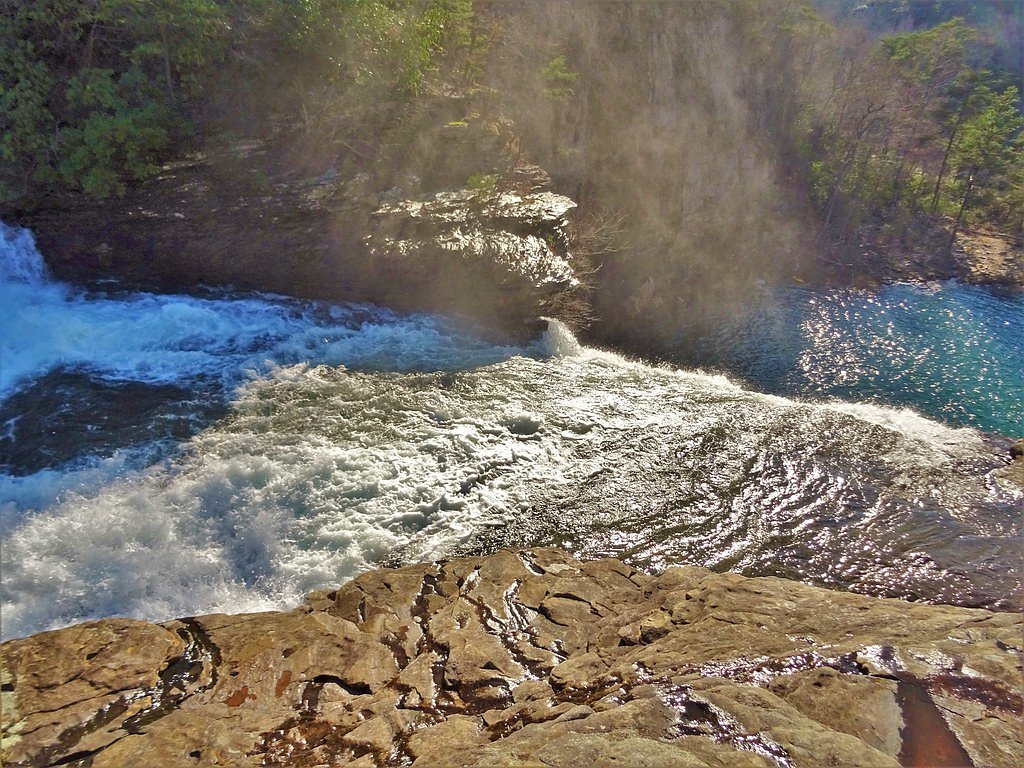
De Soto Falls
Alabama • 104 ft
By Armen Suny · Last verified Mar 2026

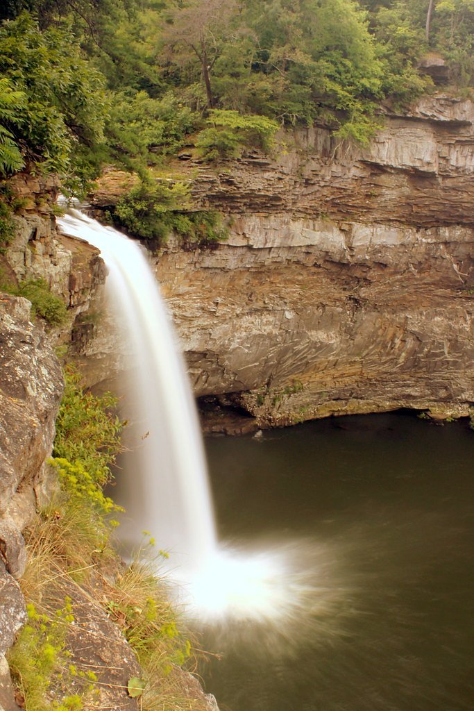
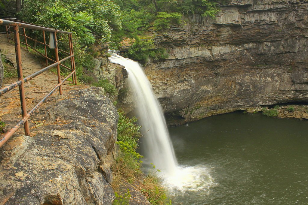
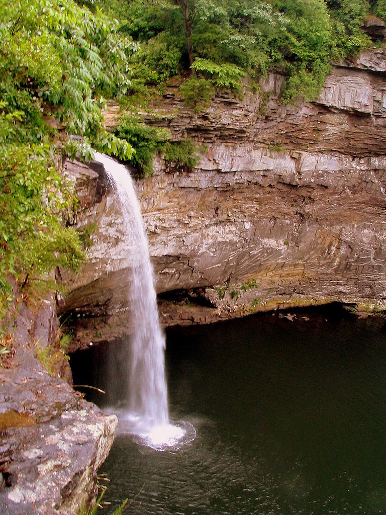
Photo Credits (5)
Difficulty
Moderate
Trail Length
2.4 miles
Trail Type
Out And Back
Elevation Gain
350 ft
About De Soto Falls
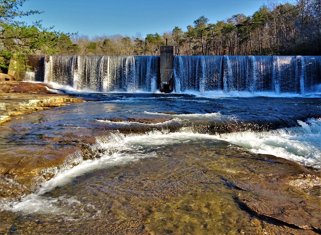
DeSoto Falls drops an impressive 104 feet along the West Fork of the Little River near Mentone, Alabama, inside DeSoto State Park. The cascade has carved a compact canyon over time, creating dramatic rock walls and a photogenic plunge that draws hikers and photographers alike. The falls are named for Spanish explorer Hernando de Soto, and their vertical drop has even attracted adventurous kayakers who run the falls under extreme conditions. Set within DeSoto State Park, the site feels wild yet accessible — a classic Southern Appalachians waterfall framed by forested ridges. Whether you’re stopping in for the landmark views or planning a longer loop in the park, the falls make a memorable destination with a strong sense of place and history.
The Setting
De Soto Falls sits at 1,604 feet along the Big Wills Creek, in the hills of Alabama. At 104 feet, it is among the taller waterfalls in Alabama.
Height: 104 feet
Trail & Hike Details
The Approach
The moderate 2.4-mile out-and-back trail gains 350 feet of elevation on the way to the falls.
Trail Description
The hike to DeSoto Falls is an out-and-back route of about 2.4 miles with roughly 350 feet of elevation gain and is rated moderate. The trail leads through forested terrain down toward the small canyon carved by the West Fork of the Little River and delivers viewpoints of the 104-foot plunge. Managed as part of DeSoto State Park (not a USFS route), the trail’s moderate grade and length make it a satisfying half-day outing for most hikers; expect typical footpath conditions rather than a paved promenade.
What to Expect
The falls cascade 104 feet. Dogs are welcome.
Accessibility
The trail is not wheelchair accessible. Uneven terrain and elevation changes require steady footing.
Frequently Asked Questions
🐶 Are Dogs Allowed at De Soto Falls?
✅ Dogs are allowed
Are There Any Fees or Permits Required?
🤑 Fee: $4.00
🏊 Is There Swimming at De Soto Falls?
❌ Swimming is not allowed
When to Visit
Spring and fall are particularly beautiful due to the lush greenery and vibrant foliage, but the falls are impressive year-round. After heavy rains, the waterfall flow is especially strong.
Seasonal Access
The best time to visit is Spring, Summer, Fall, and Winter.
Safety Information
Stay on designated paths and avoid getting too close to the edge of the gorge. The rocks can be slippery, especially after rain. Supervise children closely.
Current Water Conditions
9 ft³/s
Current discharge — how much water is flowing
Much lower than usual for this time of year
Based on 23 years of record
3.89 ft
Water depth at gauge
7-Day Discharge Trend
What does this mean for your visit?
Flow is well below normal for this time of year, so the waterfall may be a trickle.
About This Gauge
This gauge is on a nearby waterway and may not reflect exact conditions at the falls.
7-Day Flow Outlook
Based on the USGS gauge BIG WILLS CREEK AT STATE HWY 35 NR FORT PAYNE, AL (20 km away).
Today
Barely Flowing
9 cfs
5/10Tomorrow
Low
11 cfs
3/10Thu
Low
11 cfs
3/10Fri
Low
11 cfs
3/10Sat
Low
11 cfs
3/10Sun
Low
12 cfs
3/10Mon
Low
13 cfs
3/10Best window: Today — barely flowing flow, sunny (trip score 5/10).
Best time of year: this gauge typically runs highest from early February to early April, peaking in March.
How we calculate this
This is a transparent outlook, not a precise forecast. We take the waterfall's current flow strength (how it ranks against its historical normal for today, from the nearest USGS stream gauge), carry that ranking forward along the gauge's seasonal curve, and nudge it for forecast rain. Confidence is highest for the next day or two and falls further out. Always check official conditions and your own judgment before visiting — high flows can be dangerous.
Know when to go.
Get a free email alert when waterfalls near Mentone hit peak flow. We only send when conditions are worth the trip — no weekly newsletters, no spam.
Weather Forecast
Location & Access
Getting There
De Soto Falls is located approximately 6 miles from DeSoto State Park's main area. Visitors can access the falls via DeSoto Falls Picnic Area, which is easily reachable by car. The falls are located near Lookout Mountain Parkway.
Get Directions on Google MapsParking
There is a designated parking area at the DeSoto Falls Picnic Area, which provides easy access to the falls.
Elevation
1,604 feet above sea level
Coordinates
34.548973° N, -85.590520° W
Visitor Tips & Gear
Arrive early during peak seasons to secure parking. Bring a camera to capture the stunning views. The area can be slippery after rain, so wear appropriate footwear if exploring beyond the overlook.
As an Amazon Associate, we earn from qualifying purchases.
With 2.4 miles and 350 ft of elevation gain, sturdy boots and trekking poles will help on this moderate trail. Icy conditions are common in winter — traction cleats are a smart addition.

Columbia Watertight II Rain Jacket
Packs into its own pocket, seam-sealed, and keeps you dry from spray and surprise rain.

Polarized Sunglasses (Knockaround)
Cuts glare off the water so you actually see the falls — and your photos turn out better too.

Earth Pak Waterproof Dry Bag
Keeps your phone and gear dry when waterfall mist soaks everything else.

Waterproof Phone Pouch (AiRunTech)
Cheap insurance — take photos right next to the falls without killing your phone.

Timberland Euro Sprint Mid Waterproof
Trusted waterproof boot with premium leather and grippy rubber sole — reliable on rocky, wet trails.

TrailBuddy Trekking Poles
Lightweight aluminum, cork grips, and flip-locks that actually hold — a best-seller for good reason.
Where to Stay

Mountain Treehouse - Magpie Nest

Falcon Lodge - hot tub fire pit & games

Dogwood Cottage with Private Fire Pit & Sleeps 6

avid hotel Fort Payne by IHG
Browse vacation cabins and private rentals nearby
Unique outdoor stays — tents, yurts, and treehouses
Rent a campervan or RV for your waterfall road trip
Some links are affiliate links. We may earn a commission at no extra cost to you.
Additional Information
Nearby Attractions
DeSoto State Park, Little River Canyon National Preserve, Mentone, and Lookout Mountain Parkway.
Wildlife
The area around De Soto Falls is home to various bird species, deer, and other small wildlife. Visitors may also see native plants and wildflowers.
Cities near De Soto Falls
Nearby Waterfalls
Writing about De Soto Falls? Embed this waterfall on your site for free.