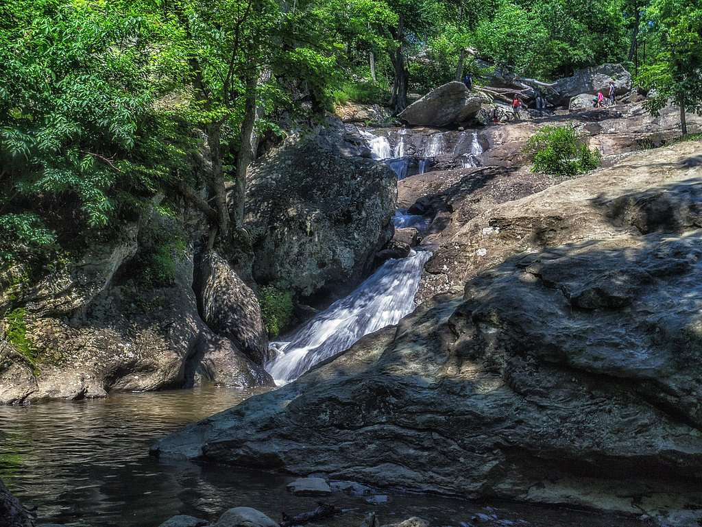
Cunningham Falls
Maryland • 78 ft
By Armen Suny · Last verified Mar 2026
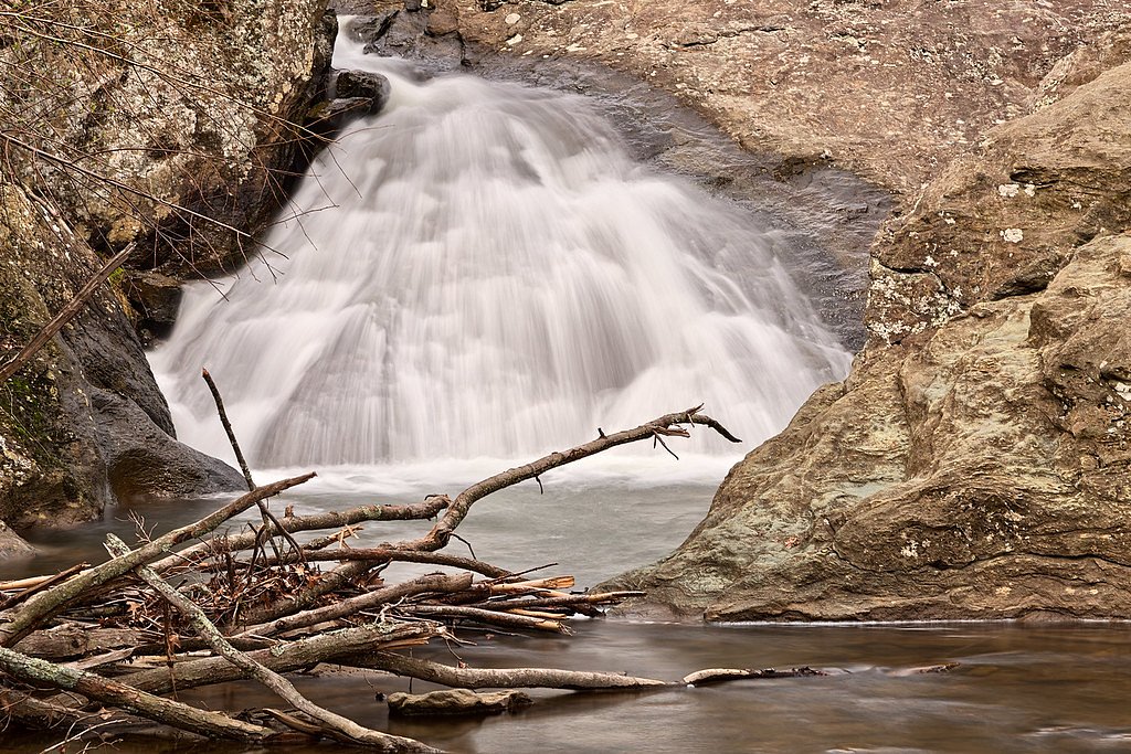
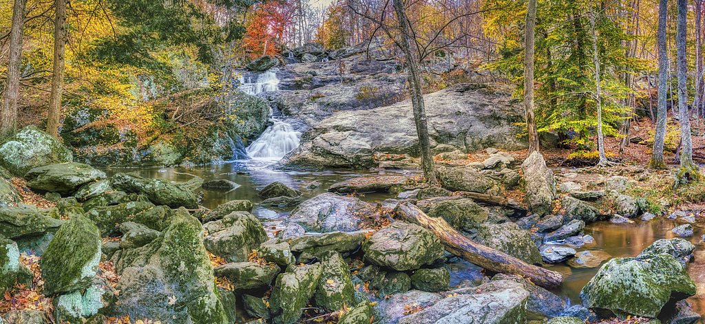
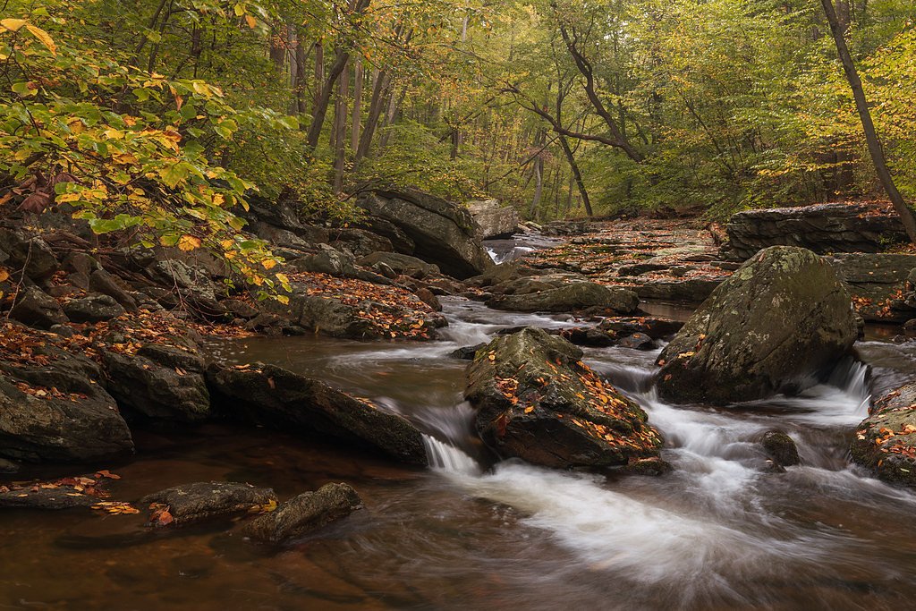


Photo Credits (5)
Difficulty
Easy
Trail Length
0.9 miles
Trail Type
Out And Back
Elevation Gain
200 ft
About Cunningham Falls
Cunningham Falls is Maryland’s largest cascading waterfall, plunging about 78 feet within the wooded folds of Cunningham Falls State Park in the Catoctin Mountains west of Thurmont. The park — one of several protected areas along the roughly 50-mile Catoctin Mountain ridge — also features a 43-acre man-made lake and the remains of a historic iron furnace, making the area a rich mix of scenic and cultural attractions. The park is bordered to the north by Catoctin Mountain Park and to the south by Frederick Municipal Forest, which together create a broad swath of protected forestland.
The Setting
Cunningham Falls sits at 1,273 feet along the Antietam Creek, in the foothills of Maryland. The falls drop 78 feet.
Height: 78 feet
Trail & Hike Details
The Approach
The easy 0.9-mile out-and-back trail gains 200 feet of elevation on the way to the falls.
Trail Description
The trail to Cunningham Falls is a short, well-maintained out-and-back path of about 0.9 miles with roughly 200 feet of elevation gain, rated easy and suitable for most visitors. Expect a forested route with gentle inclines and occasional rocky sections that lead directly to a viewing area near the base of the 78-foot cascade. Camping is nearby — the Adirondack Shelters are approximately 1.91 km away — making this a convenient day hike or stop on a longer overnight outing.
What to Expect
The falls cascade 78 feet. Dogs are welcome.
Accessibility
The trail is not wheelchair accessible. Uneven terrain and elevation changes require steady footing.
Frequently Asked Questions
🐶 Are Dogs Allowed at Cunningham Falls?
✅ Dogs are allowed
Are There Any Fees or Permits Required?
🤑 Fee: $3.00
🏊 Is There Swimming at Cunningham Falls?
❌ Swimming is not allowed
When to Visit
Spring and early summer are the best times to visit, as the water flow is typically strongest during these seasons. Fall offers beautiful foliage, while summer is popular for outdoor activities.
Seasonal Access
The best time to visit is Spring, Summer, and Fall. Winter access may be limited.
Safety Information
Stay on marked trails to avoid injury and protect the environment. The rocks near the falls can be slippery, so exercise caution. Be aware of ticks and other insects in the area.
Current Water Conditions
41 ft³/s
Current discharge — how much water is flowing
Lower than usual for this time of year
Based on 41 years of record
2.30 ft
Water depth at gauge
7-Day Discharge Trend
What does this mean for your visit?
Flow is lower than usual for this time of year.
About This Gauge
This gauge is on a nearby waterway and may not reflect exact conditions at the falls.
7-Day Flow Outlook
Based on the USGS gauge ANTIETAM CREEK NEAR WAYNESBORO, PA (15 km away).
Today
Roaring
41 cfs
8/10Tomorrow
Roaring
41 cfs
9/10Wed
Roaring
39 cfs
9/10Thu
Roaring
39 cfs
9/10Fri
Roaring
43 cfs
6/10Sat
Roaring
44 cfs
6/10Sun
Roaring
42 cfs
6/10Best window: Tomorrow — roaring flow, mostly sunny (trip score 9/10).
Best time of year: this gauge typically runs highest from early March to late April, peaking in April.
How we calculate this
This is a transparent outlook, not a precise forecast. We take the waterfall's current flow strength (how it ranks against its historical normal for today, from the nearest USGS stream gauge), carry that ranking forward along the gauge's seasonal curve, and nudge it for forecast rain. Confidence is highest for the next day or two and falls further out. Always check official conditions and your own judgment before visiting — high flows can be dangerous.
Know when to go.
Get a free email alert when waterfalls near Thurmont hit peak flow. We only send when conditions are worth the trip — no weekly newsletters, no spam.
Weather Forecast
Location & Access
Getting There
Cunningham Falls is located in Cunningham Falls State Park, near Thurmont, Maryland. The falls can be accessed via the William Houck Area of the park, which is off Route 77.
Get Directions on Google MapsParking
Parking is available at the William Houck Area parking lot. It can fill up quickly during peak seasons, so arriving early is recommended.
Elevation
1,273 feet above sea level
Coordinates
39.631487° N, -77.471377° W
Visitor Tips & Gear
Arrive early to secure parking, especially on weekends and holidays. Wear sturdy shoes as the trail can be rocky in places. Bring water and a camera to capture the scenic views.
As an Amazon Associate, we earn from qualifying purchases.
For this easy 0.9 miles trail, lightweight trail shoes and a water bottle are usually sufficient. Sun exposure on the trail makes good sun protection a must in summer.

Polarized Sunglasses (Knockaround)
Cuts glare off the water so you actually see the falls — and your photos turn out better too.

Columbia Watertight II Rain Jacket
Packs into its own pocket, seam-sealed, and keeps you dry from spray and surprise rain.

Earth Pak Waterproof Dry Bag
Keeps your phone and gear dry when waterfall mist soaks everything else.

Waterproof Phone Pouch (AiRunTech)
Cheap insurance — take photos right next to the falls without killing your phone.

JOBY GorillaPod Starter Kit
Wraps around railings and rocks for long-exposure waterfall shots — no flat surface needed.

Osprey Daylite Daypack
Light, organized, and just the right size for a day hike — fits water, snacks, and layers.
Where to Stay

Cobblestone Hotel & Suites - Waynesboro

SpringHill Suites By Marriott Frederick

Tru By Hilton Hagerstown

Best Western Historic Frederick
Browse vacation cabins and private rentals nearby
Unique outdoor stays — tents, yurts, and treehouses
Rent a campervan or RV for your waterfall road trip
Some links are affiliate links. We may earn a commission at no extra cost to you.
Nearby Campground
Adirondack Shelters
1.2 miles away · 2 sites
Overview The Adirondack Shelters, located near the northern most point of Catoctin Mountain Park, provide a destination for true nature immersion and an alternative to drive-up camping. A moderate three-mile uphill hike over rocky but generally gently rolling terrain leads to the three-sided shelters similar to those found on the Appalachian Trail. Please plan to pack out everything you bring to the site. At Catoctin Mountain Park, the beauty and solitude of nearly 6,000 acres (2428 ha) of mature
Book on Recreation.govNearby Hot Springs
Hot springs near Thurmont, Maryland

Swan Pond Spring
Swan Pond Spring emerges at 72°F from a low-elevation site at just 460 feet in Jefferson County, West Virginia. Located 66.9 me...

Berkeley Springs
Berkeley Springs flows at 72 degrees Fahrenheit in the historic spa town of the same name in Morgan County, West Virginia, repr...
Looking for a soak after your hike? Explore more hot springs near Thurmont, Maryland on SoakingSprings.
Explore Maryland springsAdditional Information
Nearby Attractions
Nearby attractions include the Catoctin Mountain Park, the Catoctin Wildlife Preserve, and the historic town of Thurmont.
Wildlife
The area is home to a variety of wildlife, including deer, birds, and small mammals. Visitors may also spot wildflowers and native plants along the trail.
Cities near Cunningham Falls
Nearby Waterfalls
Writing about Cunningham Falls? Embed this waterfall on your site for free.