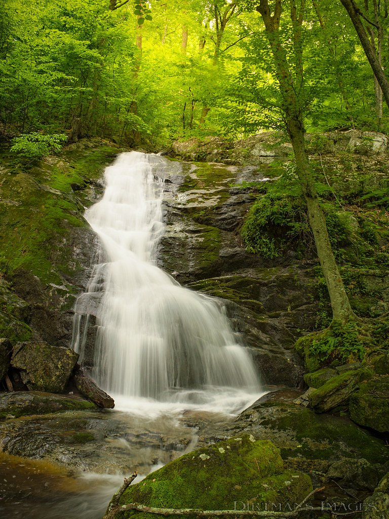
Crabtree Falls
Virginia • 1200 ft
By Armen Suny · Last verified Mar 2026
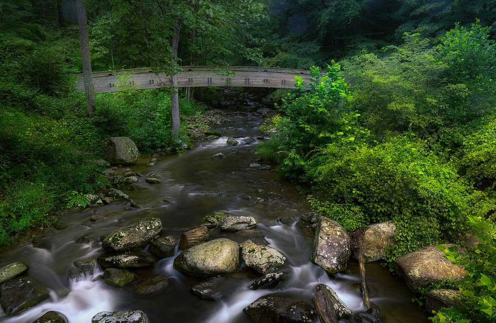
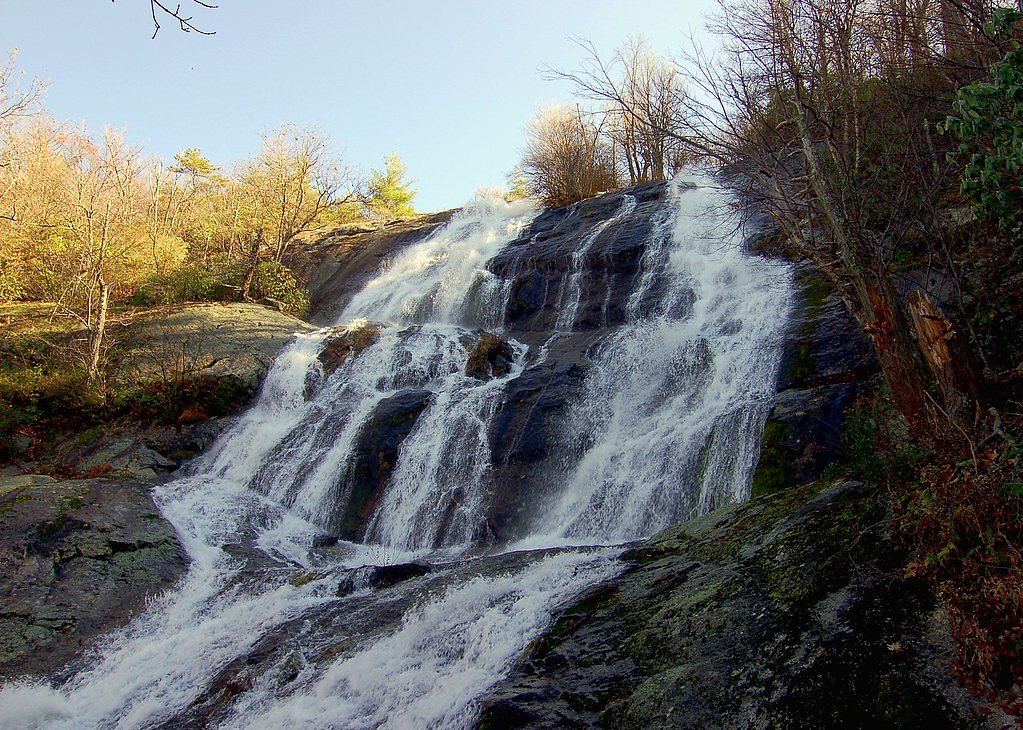
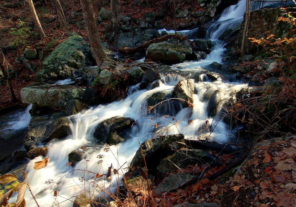
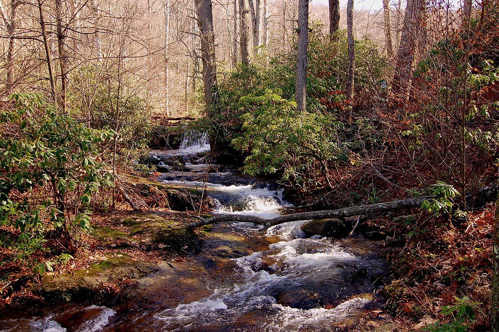

Photo Credits (5)
Difficulty
Moderate
Trail Length
3.8 miles
Trail Type
Out And Back
Elevation Gain
1,073 ft
About Crabtree Falls
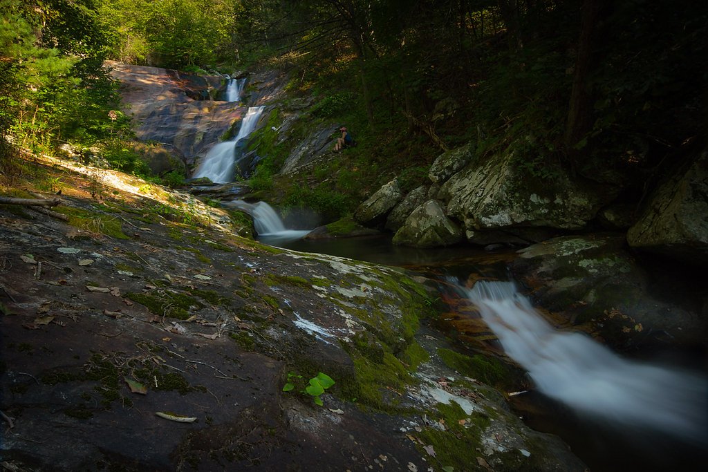
Crabtree Falls, located in the George Washington National Forest in Virginia, is one of the tallest sets of waterfalls east of the Mississippi River. It features a series of cascading falls with a total drop of approximately 1,200 feet, making it a popular destination for hikers and nature enthusiasts.
The Setting
Crabtree Falls sits at 2,694 feet within George Washington National Forest, fed by the Piney River, in the hills of Virginia. At 1,200 feet, it is among the taller waterfalls in Virginia.
Height: 1200 feet
Trail & Hike Details
The Approach
The moderate hike follows Crabtree Falls (#526), a 3.8-mile out-and-back trail over pavement. Expect 1,073 feet of elevation gain with grades of +10-12%. The trail is fully developed (Class 5).
USFS Trail
CRABTREE FALLS #526
Trail Class
Fully Developed
Surface
Avg Grade
USFS Segment
0.01 miTrail Description
The Crabtree Falls Trail is a well-maintained path that follows the cascading falls. The trail includes several switchbacks and observation platforms, offering stunning views of the waterfalls. The path can be steep and rocky in sections, especially near the upper falls.
What to Expect
The falls plunge a dramatic 1200 feet. Dogs are welcome.
Accessibility
The trail is paved and may be accessible to wheelchairs and strollers. Contact the managing agency to confirm current conditions.
Frequently Asked Questions
🐶 Are Dogs Allowed at Crabtree Falls?
✅ Dogs are allowed
Are There Any Fees or Permits Required?
🤑 Fee: $3.00
🏊 Is There Swimming at Crabtree Falls?
❌ Swimming is not allowed
When to Visit
Spring and fall are the best times to visit, as the waterfalls are typically at their fullest during these seasons, and the surrounding foliage is particularly beautiful.
Seasonal Access
The best time to visit is Spring, Summer, and Fall. Winter access may be limited. Check with George Washington National Forest for seasonal road closures.
Safety Information
Stay on the designated trail and observation platforms. Do not climb on the rocks near the falls, as they are extremely slippery and have resulted in fatalities in the past. Be prepared for changing weather conditions.
Current Water Conditions
13 ft³/s
Current discharge — how much water is flowing
Much lower than usual for this time of year
Based on 76 years of record
2.19 ft
Water depth at gauge
7-Day Discharge Trend
What does this mean for your visit?
Flow is well below normal for this time of year, so the waterfall may be a trickle.
About This Gauge
This gauge is on a nearby waterway and may not reflect exact conditions at the falls.
7-Day Flow Outlook
Based on the USGS gauge PINEY RIVER AT PINEY RIVER, VA (16 km away).
Today
Moderate
16 cfs
6/10Tomorrow
Moderate
16 cfs
6/10Sun
Moderate
15 cfs
6/10Mon
Moderate
13 cfs
9/10Tue
Moderate
12 cfs
8/10Wed
Moderate
11 cfs
8/10Thu
Moderate
12 cfs
6/10Best window: Mon — moderate flow, sunny (trip score 9/10).
Best time of year: this gauge typically runs highest from late February to late April, peaking in March.
How we calculate this
This is a transparent outlook, not a precise forecast. We take the waterfall's current flow strength (how it ranks against its historical normal for today, from the nearest USGS stream gauge), carry that ranking forward along the gauge's seasonal curve, and nudge it for forecast rain. Confidence is highest for the next day or two and falls further out. Always check official conditions and your own judgment before visiting — high flows can be dangerous.
Know when to go.
Get a free email alert when waterfalls near Wintergreen hit peak flow. We only send when conditions are worth the trip — no weekly newsletters, no spam.
Weather Forecast
Location & Access
Getting There
Crabtree Falls is located off Route 56 near Montebello, Virginia. The trailhead is well-marked and accessible via paved roads.
Get Directions on Google MapsParking
There is a designated parking area at the trailhead, which requires a small fee (cash only). Parking can fill up quickly on weekends and holidays.
Elevation
2,694 feet above sea level
Coordinates
37.843193° N, -79.074472° W
Land Management
Managed by USFS
Visitor Tips & Gear
Arrive early to secure parking and avoid crowds. Wear sturdy hiking shoes, as the trail can be slippery, especially after rain. Bring water and snacks, as there are no facilities along the trail. Be cautious near the falls, as rocks can be wet and dangerous.
As an Amazon Associate, we earn from qualifying purchases.
With 3.8 miles and 1,073 ft of elevation gain, sturdy boots and trekking poles will help on this moderate trail. Sun exposure on the trail makes good sun protection a must in summer.

Polarized Sunglasses (Knockaround)
Cuts glare off the water so you actually see the falls — and your photos turn out better too.

Columbia Watertight II Rain Jacket
Packs into its own pocket, seam-sealed, and keeps you dry from spray and surprise rain.

Earth Pak Waterproof Dry Bag
Keeps your phone and gear dry when waterfall mist soaks everything else.

Waterproof Phone Pouch (AiRunTech)
Cheap insurance — take photos right next to the falls without killing your phone.

Timberland Euro Sprint Mid Waterproof
Trusted waterproof boot with premium leather and grippy rubber sole — reliable on rocky, wet trails.

TrailBuddy Trekking Poles
Lightweight aluminum, cork grips, and flip-locks that actually hold — a best-seller for good reason.
Where to Stay

Howard Johnson by Wyndham Lexington

Comfort Inn & Suites Raphine - Lexington near I-81 and I-64

Sleep Inn Staunton

Best Western Lexington Inn
Browse vacation cabins and private rentals nearby
Unique outdoor stays — tents, yurts, and treehouses
Rent a campervan or RV for your waterfall road trip
Some links are affiliate links. We may earn a commission at no extra cost to you.
Nearby Campground
SHERANDO LAKE RECREATION AREA FAMILY CAMPING
6.4 miles away · 65 sites
Overview Sherando Lake Recreation Area's Family Campground provides an ideal camping destination. It is situated in the Blue Ridge Mountains and is known locally as the jewel of the Blue Ridge Mountains, where visitors enjoy hiking, picnicking in the shade, fishing in the lakes, or swimming and relaxing on the sandy beach.Recreation The 25 acre Lower Lake offers opportunities for swimming in a designated area with a sand beach, accessible ramp to the water's edge, and a beach bathhouse with chang
Book on Recreation.govNearby Hot Springs
Hot springs near Wintergreen, Virginia
Rockbridge Baths
Rockbridge Baths emerges at 72 degrees Fahrenheit, flowing 18.9 degrees above ambient temperature at 1,807 feet elevation in Ro...
Falling Spring
Falling Spring emerges at 77 degrees Fahrenheit, flowing 25 degrees above the ambient temperature in the City of Covington, Vir...
Healing Springs
Healing Springs flows at 86 degrees Fahrenheit, producing water 34 degrees above ambient temperature at 2,218 feet elevation in...
Layton Spring
Layton Spring produces 72-degree water that flows 17.2 degrees above ambient temperature at 1,334 feet elevation in the City of...

Hot Springs
Hot Springs produces 106-degree water that flows 54.4 degrees above ambient temperature at 2,298 feet elevation in Bath County,...

Warm Springs
Warm Springs flows at 95 degrees Fahrenheit, producing water 43.7 degrees above ambient temperature at 2,335 feet elevation in ...
Looking for a soak after your hike? Explore more hot springs near Wintergreen, Virginia on SoakingSprings.
Explore Virginia springsAdditional Information
Nearby Attractions
Nearby attractions include the Blue Ridge Parkway, Montebello Fish Hatchery, and the Appalachian Trail.
Wildlife
The area is home to a variety of wildlife, including deer, birds, and small mammals. Visitors may also encounter snakes, so caution is advised.
Cities near Crabtree Falls
Nearby Waterfalls
 CC
CC
Other waterfalls named Crabtree Falls
1 other waterfall shares this name across the U.S.
Writing about Crabtree Falls? Embed this waterfall on your site for free.