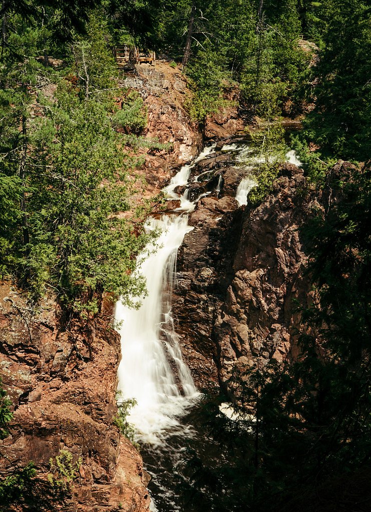
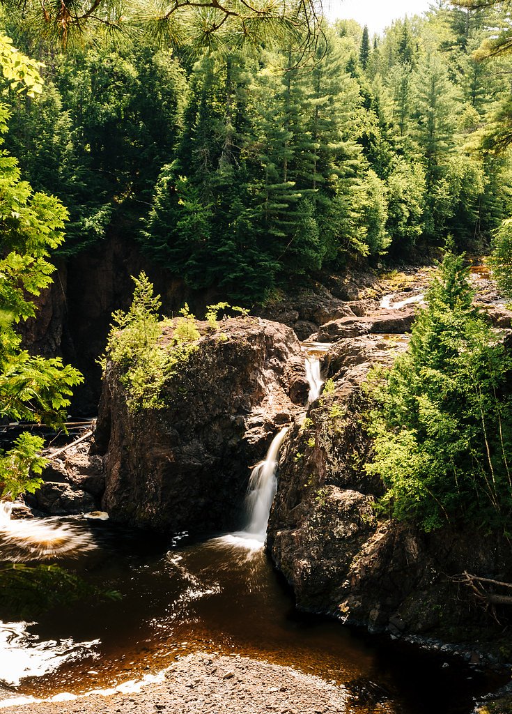
Brownstone Falls
By Armen Suny · Last verified May 2026
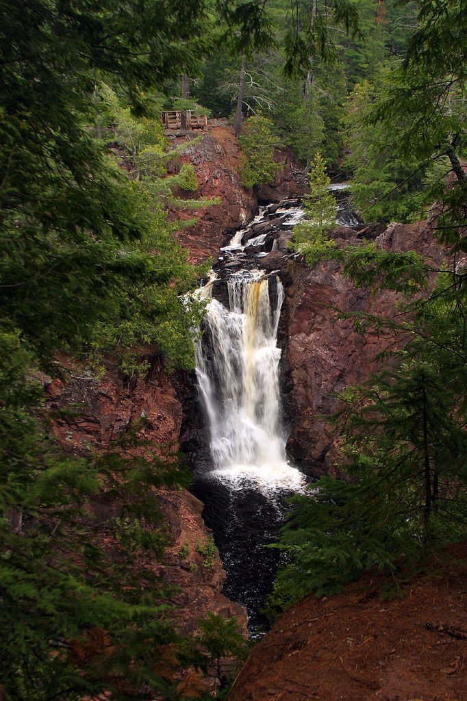
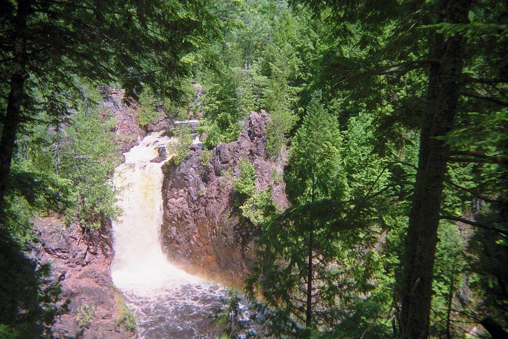
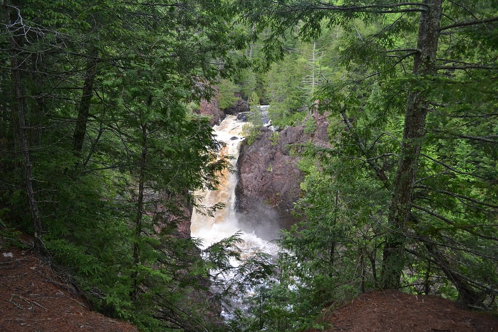

Photo Credits (5)
Difficulty
Easy
Trail Length
1.2 miles
Trail Type
Out And Back
Elevation Gain
100 ft
About Brownstone Falls
Brownstone Falls is a stunning waterfall located in Copper Falls State Park, Wisconsin. It is part of the Bad River and is known for its dramatic drop and reddish-brown rock formations, which give the falls its name.
The Setting
Brownstone Falls sits at 971 feet within Copper Falls State Park, fed by the Tyler Forks River, in the foothills of Wisconsin.
Nearby Falls Worth Visiting
Potato River Falls (90 ft) lies 7.9 miles to the northeast.
Trail & Hike Details
The Approach
The easy 1.2-mile out-and-back trail gains 100 feet of elevation on the way to the falls.
Trail Description
The trail to Brownstone Falls is part of the Doughboys Nature Trail, a well-maintained loop that also includes views of Copper Falls. The trail is relatively flat with some stairs and boardwalks, making it accessible for most visitors.
What to Expect
Dogs are welcome.
Accessibility
The trail is not wheelchair accessible. Uneven terrain and elevation changes require steady footing.
Frequently Asked Questions
🐶 Are Dogs Allowed at Brownstone Falls?
✅ Dogs are allowed
Are There Any Fees or Permits Required?
🤑 Fee: $8.00
🏊 Is There Swimming at Brownstone Falls?
❌ Swimming is not allowed
When to Visit
The best time to visit is in the spring when water flow is at its peak, or in the fall for stunning foliage. Summer is also popular for warm weather and clear trails.
Seasonal Access
The best time to visit is Spring, Summer, and Fall. Winter access may be limited.
Safety Information
Stay on marked trails and observe caution near the edges of the falls. Rocks can be slippery, especially after rain. Be aware of ticks and other insects in the area.
Current Water Conditions
11 ft³/s
Current discharge — how much water is flowing
Much lower than usual for this time of year
Based on 15 years of record
3.04 ft
Water depth at gauge
66°F
CoolRefreshing for swimming
7-Day Discharge Trend
What does this mean for your visit?
Flow is well below normal for this time of year, so the waterfall may be a trickle. Water temperature is a refreshing 66 degrees F, good for a quick swim. Expect excellent dissolved oxygen levels. Mineral content is typical.
Water Quality
Dissolved Oxygen
ExcellentSupports aquatic life
Conductance
Dissolved minerals in the water
About This Gauge
7-Day Flow Outlook
Based on the USGS gauge TYLER FORKS RIVER AT STRICKER ROAD NEAR MELLEN, WI (4 km away).
Today
Low
11 cfs
6/10Tomorrow
Low
8 cfs
6/10Mon
Low
11 cfs
4/10Tue
Moderate
11 cfs
4/10Wed
Moderate
12 cfs
4/10Thu
Moderate
9 cfs
4/10Fri
Moderate
8 cfs
4/10Best window: Today — low flow, partly sunny (trip score 6/10).
Best time of year: this gauge typically runs highest from mid March to early June, peaking in April.
How we calculate this
This is a transparent outlook, not a precise forecast. We take the waterfall's current flow strength (how it ranks against its historical normal for today, from the nearest USGS stream gauge), carry that ranking forward along the gauge's seasonal curve, and nudge it for forecast rain. Confidence is highest for the next day or two and falls further out. Always check official conditions and your own judgment before visiting — high flows can be dangerous.
Know when to go.
Get a free email alert when waterfalls near Mellen hit peak flow. We only send when conditions are worth the trip — no weekly newsletters, no spam.
Weather Forecast
Location & Access
Getting There
Brownstone Falls is located within Copper Falls State Park, near Mellen, Wisconsin. The park is accessible via State Highway 169. Once inside the park, follow signs to the main parking area near the trailheads.
Get Directions on Google MapsParking
Ample parking is available at Copper Falls State Park, including spaces near the trailhead leading to Brownstone Falls.
Elevation
971 feet above sea level
Coordinates
46.376339° N, -90.641017° W
Land Management
Managed by SDNR
Visitor Tips & Gear
Wear sturdy shoes as the trail may be slippery in wet conditions. Bring a camera to capture the scenic views. Arrive early during peak seasons to avoid crowds.
As an Amazon Associate, we earn from qualifying purchases.
This easy 1.2 miles hike is straightforward — comfortable trail shoes and plenty of water should do. Sun exposure on the trail makes good sun protection a must in summer.

Polarized Sunglasses (Knockaround)
Cuts glare off the water so you actually see the falls — and your photos turn out better too.

Columbia Watertight II Rain Jacket
Packs into its own pocket, seam-sealed, and keeps you dry from spray and surprise rain.

Earth Pak Waterproof Dry Bag
Keeps your phone and gear dry when waterfall mist soaks everything else.

Waterproof Phone Pouch (AiRunTech)
Cheap insurance — take photos right next to the falls without killing your phone.

JOBY GorillaPod Starter Kit
Wraps around railings and rocks for long-exposure waterfall shots — no flat surface needed.

Osprey Daylite Daypack
Light, organized, and just the right size for a day hike — fits water, snacks, and layers.
Where to Stay

Snow Otter Haus - 2

Snow Otter Haus - 1

Quality Inn Ironwood

Davos Chalet
Browse vacation cabins and private rentals nearby
Unique outdoor stays — tents, yurts, and treehouses
Rent a campervan or RV for your waterfall road trip
Some links are affiliate links. We may earn a commission at no extra cost to you.
Nearby Campground
MINERAL LAKE
10.7 miles away · 10 sites
Overview We apologize, this campground is currently closed. Recreation Boating, swimming and fishing are popular activities among visitors. A boat ramp to the lake is provided off of Forest Service Road 187, about a mile from the campground. Anglers can expect a catch of a variety of freshwater lake and river species, including musky, bass, walleye and pan fish. Eagle watching is also a popular pastime. The forest is home to hundreds of miles of off-road vehicle, hiking and mountain biking trails
Book on Recreation.govAdditional Information
Nearby Attractions
Copper Falls, Loon Lake, and the North Country National Scenic Trail.
Wildlife
The area is home to deer, birds, and other wildlife. Keep an eye out for bald eagles and other native species.
Cities near Brownstone Falls
Nearby Waterfalls
Writing about Brownstone Falls? Embed this waterfall on your site for free.