Difficulty
Moderate
Trail Length
2.4 miles
Trail Type
Out And Back
Elevation Gain
350 ft
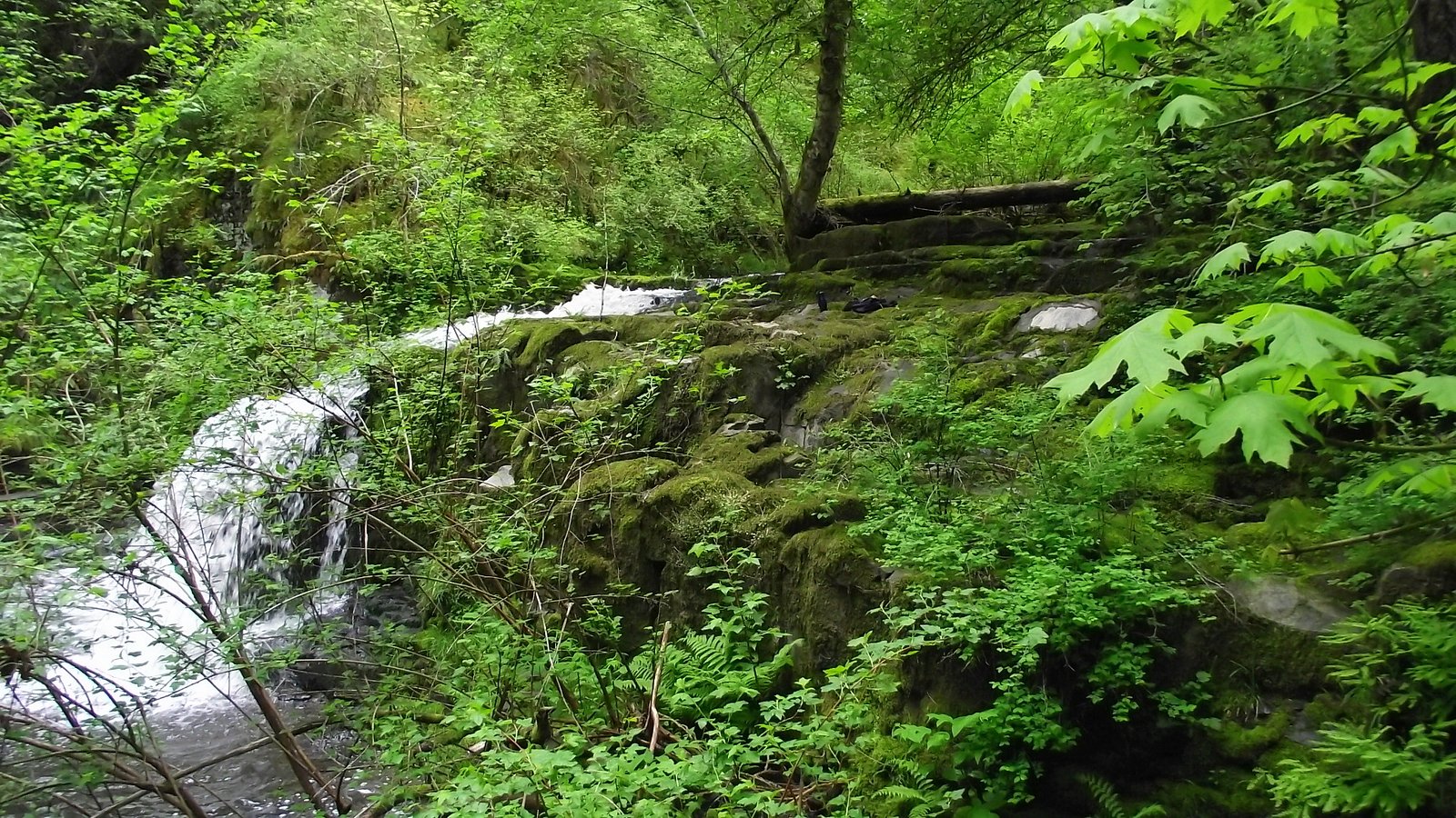
About Coosauk Fall
Coosauk Fall is a tucked-away cascade nestled within the White Mountain National Forest and managed by the U.S. Forest Service. Framed by lush northern hardwoods, the falls make for a peaceful half-day outing away from busier viewpoints — popular with hikers and photographers looking for a quiet woodland setting. The recommended route includes a short USFS spur (SCAR "LOOP" SPUR A, Trail #31449A) that brings you close to the water and the surrounding rock outcrops. Most visitors reach Coosauk Fall via a moderate 2.4-mile out-and-back route with roughly 350 feet of elevation gain; the final approach is a very short 0.12-mile native-surface spur (the USFS #31449A) from the main trail. If you’re making a weekend of it, Barnes Field Campground sits about 4.92 km away and provides convenient nearby camping in the same National Forest.
The Setting
Coosauk Fall sits at 1,644 feet within White Mountain National Forest, fed by the Peabody River, in the hills of New Hampshire.
Trail & Hike Details
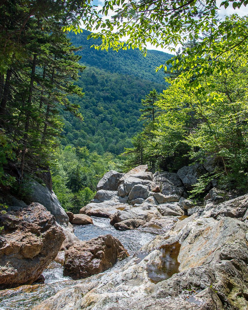
The Approach
The moderate hike follows Scar "Loop" Spur A (#31449A), a 2.4-mile out-and-back trail over natural surface. Expect 350 feet of elevation gain with grades of 10-12%. The trail is developed (Class 3).
USFS Trail
SCAR "LOOP" SPUR A #31449A
Trail Class
Developed
Surface
Avg Grade
USFS Segment
0.12 miTrail Description
Trail type: out-and-back, total length 2.4 miles, elevation gain ~350 ft, difficulty: moderate. The official USFS spur to the falls is SCAR "LOOP" SPUR A (Trail #31449A), a very short 0.12‑mile segment with a native material surface. Typical grade on the spur is about 10–12% and it’s rated Class 3; expect uneven, natural footing and some short, moderately steep sections. The longer route to reach the spur follows maintained forest trails through White Mountain National Forest; wear sturdy footwear and be prepared for native trail conditions on the final approach.
What to Expect
Visitors can expect a peaceful waterfall surrounded by forested scenery. The area may be less crowded due to its relative obscurity.
Accessibility
The trail is not wheelchair accessible. Uneven terrain and elevation changes require steady footing.
Frequently Asked Questions
🐶 Are Dogs Allowed at Coosauk Fall?
❌ Dogs are not allowed
Are There Any Fees or Permits Required?
🆖 No fees required
🏊 Is There Swimming at Coosauk Fall?
❌ Swimming is not allowed
When to Visit
Spring and early summer are ideal for visiting, as the waterfall is likely to have the most water flow during these seasons.
Seasonal Access
The best time to visit is Spring, Summer, and Fall. Winter access may be limited. Check with White Mountain National Forest for seasonal road closures.
Safety Information
The trail may be unmarked and uneven. Visitors should exercise caution, especially in wet or icy conditions. Cell service may be limited in the area.
Current Water Conditions
104 ft³/s
Current discharge — how much water is flowing
Higher than usual for this time of year
Based on 12 years of record
2.72 ft
Water depth at gauge
7-Day Discharge Trend
What does this mean for your visit?
The water is flowing higher than usual for this time of year.
About This Gauge
This gauge is on a nearby waterway and may not reflect exact conditions at the falls.
7-Day Flow Outlook
Based on the USGS gauge Peabody River at Gorham, New Hampshire (8 km away).
Today
Moderate
119 cfs
4/10Tomorrow
Moderate
133 cfs
6/10Mon
Moderate
177 cfs
8/10Tue
Moderate
272 cfs
4/10Wed
Moderate
224 cfs
6/10Thu
Moderate
328 cfs
5/10Fri
Moderate
186 cfs
5/10Best window: Mon — moderate flow, sunny (trip score 8/10).
Best time of year: this gauge typically runs highest from late March to mid June, peaking in April.
How we calculate this
This is a transparent outlook, not a precise forecast. We take the waterfall's current flow strength (how it ranks against its historical normal for today, from the nearest USGS stream gauge), carry that ranking forward along the gauge's seasonal curve, and nudge it for forecast rain. Confidence is highest for the next day or two and falls further out. Always check official conditions and your own judgment before visiting — high flows can be dangerous.
Know when to go.
Get a free email alert when waterfalls near Berlin hit peak flow. We only send when conditions are worth the trip — no weekly newsletters, no spam.
Weather Forecast
Location & Access
Getting There
The exact location of Coosauk Fall is not widely documented. Visitors may need to consult local maps or guides for precise directions.
Get Directions on Google MapsParking
Parking availability is unclear, but visitors should prepare for limited or roadside parking near the trailhead.
Elevation
1,644 feet above sea level
Coordinates
44.362840° N, -71.270631° W
Land Management
Managed by USFS
Visitor Tips & Gear
Bring a map or GPS device as the trail may not be well-marked. Wear sturdy footwear and be prepared for uneven terrain.
As an Amazon Associate, we earn from qualifying purchases.
With 2.4 miles and 350 ft of elevation gain, sturdy boots and trekking poles will help on this moderate trail. Sun exposure on the trail makes good sun protection a must in summer.

Columbia Watertight II Rain Jacket
Packs into its own pocket, seam-sealed, and keeps you dry from spray and surprise rain.

Earth Pak Waterproof Dry Bag
Keeps your phone and gear dry when waterfall mist soaks everything else.

Waterproof Phone Pouch (AiRunTech)
Cheap insurance — take photos right next to the falls without killing your phone.

Timberland Euro Sprint Mid Waterproof
Trusted waterproof boot with premium leather and grippy rubber sole — reliable on rocky, wet trails.

TrailBuddy Trekking Poles
Lightweight aluminum, cork grips, and flip-locks that actually hold — a best-seller for good reason.

Polarized Sunglasses (Knockaround)
Cuts glare off the water so you actually see the falls — and your photos turn out better too.
Where to Stay

Top Notch Inn

Town & Country Inn & Resort

The Glen House

Mount Jefferson View
Browse vacation cabins and private rentals nearby
Unique outdoor stays — tents, yurts, and treehouses
Rent a campervan or RV for your waterfall road trip
Some links are affiliate links. We may earn a commission at no extra cost to you.
Nearby Campground
BARNES FIELD CAMPGROUND
3.1 miles away · 11 sites
Overview Located 6 miles south of Gorham, New Hampshire, at the base of New England's tallest peak, the historic Barnes Field Campground provides a scenic and private space for organizations, families and others to gather. The campground is one of a few in the area that remains open in winter, providing first-come, first-served winter camping for individuals or groups. It is adjacent to Dolly Copp Campground. Lush forests, spectacular mountain views and convenience to outdoor recreation and sceni
Book on Recreation.govAdditional Information
Nearby Attractions
Explore other natural attractions in New Hampshire, such as Franconia Notch State Park or the White Mountains.
Wildlife
The area may feature typical New Hampshire wildlife, including birds, deer, and small mammals.
Cities near Coosauk Fall
Nearby Waterfalls
Writing about Coosauk Fall? Embed this waterfall on your site for free.