Columbine Cascade
Wyoming • Grand Teton National Park
By Armen Suny · Last verified May 2026
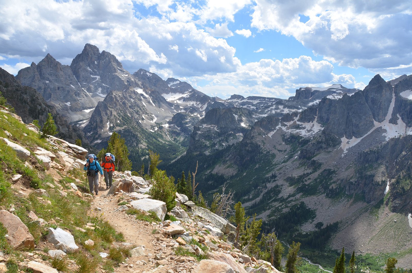
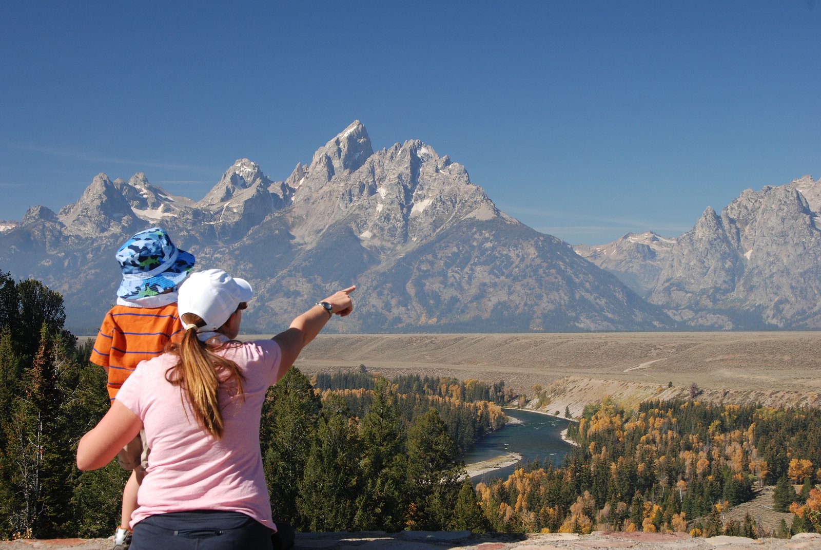
Photo Credits (3)
Difficulty
Easy
Trail Length
1.0 miles
Trail Type
Out And Back
Elevation Gain
200 ft
About Columbine Cascade
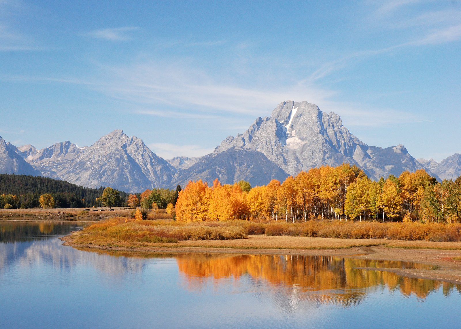
Columbine Cascade is a peaceful, easy-to-enjoy waterfall tucked inside Grand Teton National Park and managed by the National Park Service. The cascade offers a classic Tetons experience—framed by alpine forest and high-country ridgelines—and is a great option for hikers looking for a short nature break. Like many of the park’s cascades, its flow is seasonal and typically fattens with late-spring snowmelt from the surrounding high peaks, so visit in spring for the most impressive run.
The Setting
Columbine Cascade sits at 8,438 feet within Grand Teton National Park, fed by the Snake River, in the high alpine of Wyoming.
Trail & Hike Details
The Approach
The easy 1.0-mile out-and-back trail gains 200 feet of elevation on the way to the falls.
Trail Description
The approach to Columbine Cascade is a short, easy out-and-back hike of approximately 1.0 mile with about 200 feet of elevation gain. Rated easy, the route is suitable for most visitors and makes a good half-day or afternoon outing from nearby trailheads in Grand Teton National Park. The trail is managed by the National Park Service; note that cascade flows are seasonal and are often highest in late spring and early summer. Colter Bay Campground is the closest developed campsite, roughly 8.8 km away, for those planning an overnight stay.
What to Expect
Dogs are welcome.
Accessibility
The trail is not wheelchair accessible. Uneven terrain and elevation changes require steady footing.
Frequently Asked Questions
🐶 Are Dogs Allowed at Columbine Cascade?
✅ Dogs are allowed
Are There Any Fees or Permits Required?
🆖 No fees required
🏊 Is There Swimming at Columbine Cascade?
❌ Swimming is not allowed
When to Visit
The best time to visit is late spring through early fall when the Beartooth Highway is open and the water flow is strongest.
Seasonal Access
The best time to visit is Spring, Summer, and Fall. Access roads and trails may close during winter due to snow. Check with Grand Teton National Park for current conditions.
Safety Information
Be cautious of slippery rocks near the waterfall. Always stay on marked trails and carry bear spray as the area is within bear country.
Current Water Conditions
5,050 ft³/s
Current discharge — how much water is flowing
Higher than usual for this time of year
Based on 122 years of record
7.30 ft
Water depth at gauge
60°F
WarmVery comfortable
7-Day Discharge Trend
What does this mean for your visit?
The water is flowing higher than usual for this time of year. Water temperature is a bracing 60 degrees F, limit your time in the water.
About This Gauge
This gauge is on a nearby waterway and may not reflect exact conditions at the falls.
7-Day Flow Outlook
Based on the USGS gauge SNAKE RIVER NEAR MORAN, WY (15 km away).
Today
Roaring
5050 cfs
9/10Tomorrow
Roaring
5499 cfs
6/10Fri
Roaring
6076 cfs
6/10Sat
Roaring
6111 cfs
6/10Sun
Roaring
5742 cfs
6/10Mon
Roaring
5102 cfs
6/10Tue
Roaring
4561 cfs
9/10Best window: Today — roaring flow, mostly sunny (trip score 9/10).
Best time of year: this gauge typically runs highest from early June to early September, peaking in June.
How we calculate this
This is a transparent outlook, not a precise forecast. We take the waterfall's current flow strength (how it ranks against its historical normal for today, from the nearest USGS stream gauge), carry that ranking forward along the gauge's seasonal curve, and nudge it for forecast rain. Confidence is highest for the next day or two and falls further out. Always check official conditions and your own judgment before visiting — high flows can be dangerous.
Know when to go.
Get a free email alert when waterfalls near Alta hit peak flow. We only send when conditions are worth the trip — no weekly newsletters, no spam.
Weather Forecast
Location & Access
Getting There
Columbine Cascade is accessible via the Beartooth Highway (US 212), a scenic route that connects Wyoming and Montana. The waterfall is located near the Clay Butte Lookout area. Visitors may need to hike a short distance from the highway to reach the cascade.
Get Directions on Google MapsParking
Parking is available along the Beartooth Highway at designated pullouts or trailheads near the Clay Butte Lookout area.
Elevation
8,438 feet above sea level
Coordinates
43.916602° N, -110.749380° W
Land Management
Managed by NPS
Visitor Tips & Gear
Wear sturdy shoes as the trail may be uneven in places. Bring insect repellent during the summer months. Check road conditions for the Beartooth Highway before visiting, as it may be closed during winter or early spring.
This trail sits at 8,438 ft — the air is noticeably thinner
High AltitudeSome visitors experience headaches, fatigue, or shortness of breath at this elevation. Take it slow, stay hydrated, and consider supplemental oxygen if you're coming from a lower altitude.
As an Amazon Associate, we earn from qualifying purchases.

Coppertone Sport SPF 50 Sunscreen
UV intensity jumps ~4% per 1,000 ft — at this elevation you can burn in half the time.

Sun Bum SPF 30 Lip Balm (3-Pack)
Lips have almost no natural UV protection and burn fast in thin, dry mountain air.

Liquid I.V. Electrolyte Packets
You lose moisture ~2x faster at elevation — electrolytes help you absorb water efficiently.

ROCKNIGHT Polarized UV400 Sunglasses
High-altitude glare off rock and water is intense — UV400 lenses block 99%+ of UVA/UVB.

Boost Oxygen 10L Canister (2-Pack)
Portable supplemental oxygen for quick relief from headaches and shortness of breath.

Altitude Rx OxyBoost Complex
Antioxidant formula designed to support your body's natural altitude acclimation.
As an Amazon Associate, we earn from qualifying purchases.
This easy 1.0 miles hike is straightforward — comfortable trail shoes and plenty of water should do. Sun exposure on the trail makes good sun protection a must in summer.
America the Beautiful Annual Pass
Covers entrance fees at 2,000+ federal recreation sites — required at most National Parks.

Polarized Sunglasses (Knockaround)
Cuts glare off the water so you actually see the falls — and your photos turn out better too.

Columbia Watertight II Rain Jacket
Packs into its own pocket, seam-sealed, and keeps you dry from spray and surprise rain.

Earth Pak Waterproof Dry Bag
Keeps your phone and gear dry when waterfall mist soaks everything else.

Waterproof Phone Pouch (AiRunTech)
Cheap insurance — take photos right next to the falls without killing your phone.

JOBY GorillaPod Starter Kit
Wraps around railings and rocks for long-exposure waterfall shots — no flat surface needed.

Osprey Daylite Daypack
Light, organized, and just the right size for a day hike — fits water, snacks, and layers.
Where to Stay

Headwaters Lodge & Cabins at Flagg Ranch

Colter Bay Village

Teton Teepee Lodge

Jackson Lake Lodge
Browse vacation cabins and private rentals nearby
Unique outdoor stays — tents, yurts, and treehouses
Rent a campervan or RV for your waterfall road trip
Some links are affiliate links. We may earn a commission at no extra cost to you.
Nearby Campground
Colter Bay Campground
5.5 miles away · 360 sites
Overview The vast Colter Bay Campground at Colter Bay Village is set amidst towering lodgepole pines just a short, picturesque stroll away from Jackson Lake. The campground offers camping for tents and dry camping for RVs. (For full hookup RV sites, check out the Colter Bay RV Park.) Campsites include 338 individual campsites, 12 large group sites, 10 hiker-bicycler sites, and 13 electric-only ADA-accessible sites. Generator Loops are H, J, K M, & O. The campground is open from mid-May to late-Se
Book on Recreation.govNearby Hot Springs
Hot springs near Alta, Wyoming
Jackson Lake Hot Springs
Jackson Lake Hot Springs emerges at 162 degrees Fahrenheit along Jackson Lake's northwestern shore in Grand Teton National Park...

Abercrombie Warm Springs
Abercrombie Warm Springs flows at 81°F within Grand Teton National Park, requiring a 104-meter walk from Warm Springs Road. The...

Kelly Warm Spring
Kelly Warm Spring flows at 81 degrees Fahrenheit just 108 meters from Gros Ventre Road at 6,684 feet elevation in Grand Teton N...

North Buffalo Fork Springs
North Buffalo Fork Springs flows at 113 degrees Fahrenheit—76 degrees above the frigid 36-degree ambient—at 7,420 feet elevatio...
Boyles Hill Springs
Boyles Hill Springs emerges at 86°F near Wilson in Teton County's valley floor, flowing 45.8 degrees above ambient temperature ...
Boundary Creek Hot Springs
Boundary Creek Hot Springs flows at 181°F in one of Yellowstone's most remote backcountry locations, requiring a 3.8-mile hike ...
Looking for a soak after your hike? Explore more hot springs near Alta, Wyoming on SoakingSprings.
Explore Wyoming springsAdditional Information
Nearby Attractions
Nearby attractions include the Beartooth Highway, Clay Butte Lookout, and other scenic spots in the Shoshone National Forest.
Wildlife
The area is home to wildlife such as deer, elk, and various bird species. Visitors should be cautious of bears and carry bear spray.
Cities near Columbine Cascade
Nearby Waterfalls

Writing about Columbine Cascade? Embed this waterfall on your site for free.