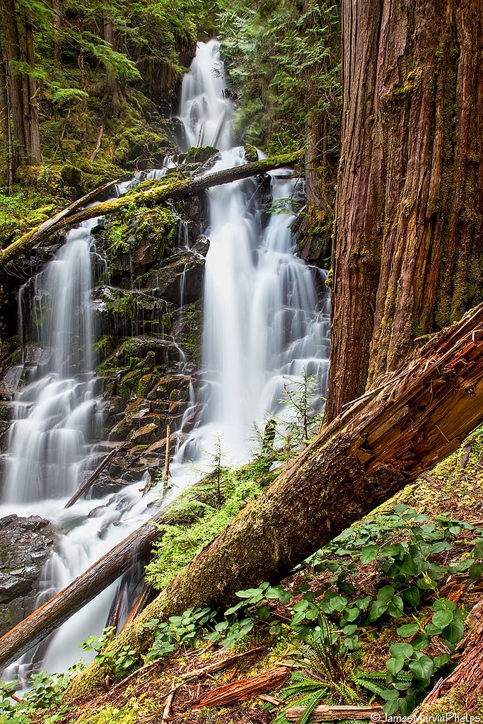
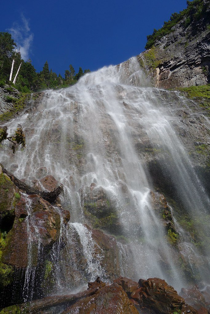
Chenuis Falls
Washington • Mount Rainier National Park
By Armen Suny · Last verified May 2026
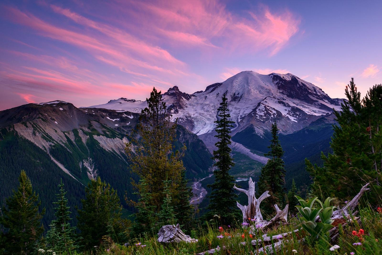
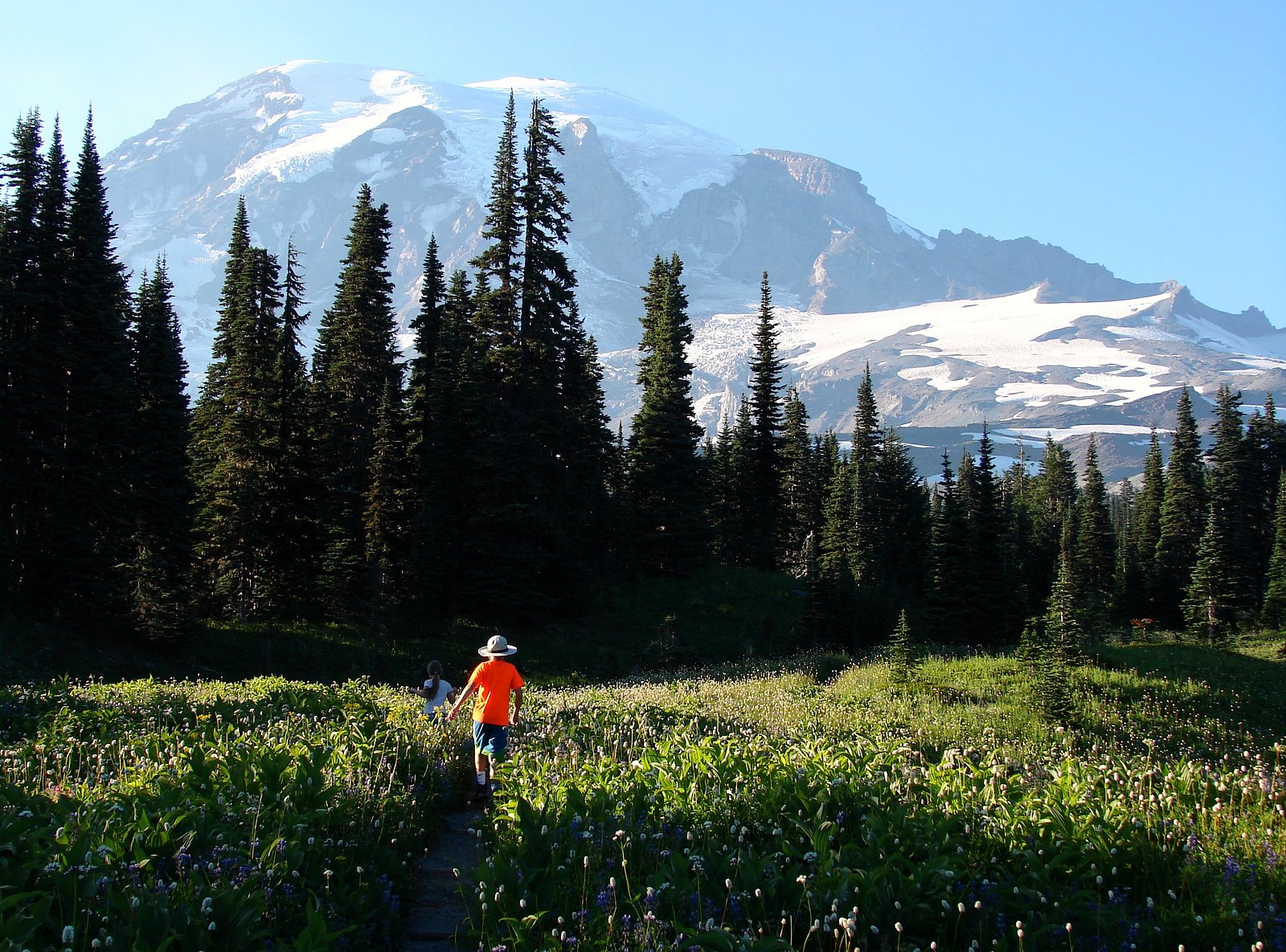
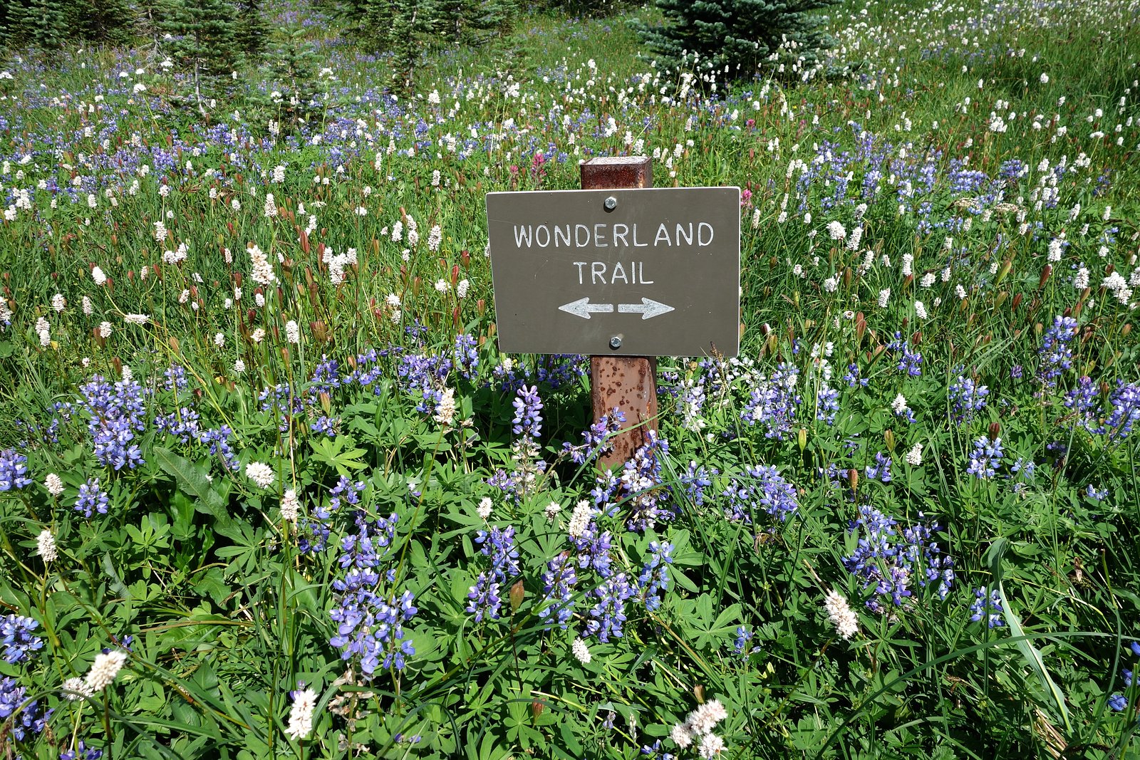
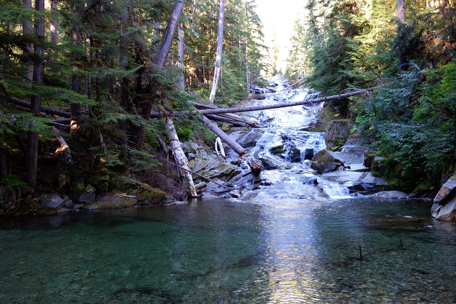

Photo Credits (5)
Difficulty
Moderate
Trail Length
8.4 miles
Trail Type
Out And Back
Elevation Gain
300 ft
About Chenuis Falls
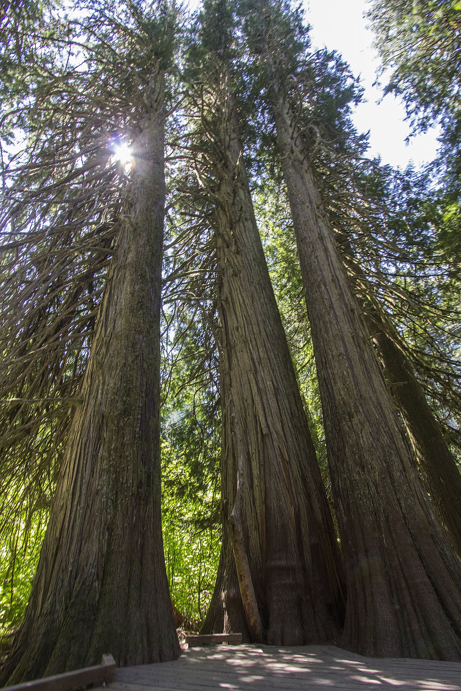
Chenuis Falls is a picturesque waterfall located in Mount Rainier National Park, Washington. It is a multi-tiered waterfall that cascades beautifully along the Chenuis Creek, offering visitors a serene and scenic experience.
The Setting
Chenuis Falls sits at 2,244 feet within Mount Rainier National Park, fed by the Carbon River, in the hills of Washington.
Trail & Hike Details
The Approach
The moderate 8.4-mile out-and-back trail gains 300 feet of elevation on the way to the falls.
Trail Description
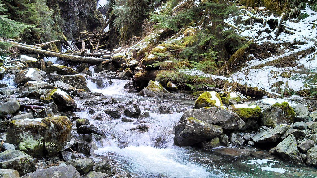
The trail to Chenuis Falls follows the Carbon River Road, which is a wide, relatively flat path through lush forest. After reaching the Ipsut Creek Campground, a short spur trail leads to the falls. The trail may involve crossing Chenuis Creek, which can be challenging during high water levels.
What to Expect
Visitors can expect a peaceful hike through old-growth forest, with opportunities to see wildlife and enjoy the sounds of the Carbon River. The waterfall itself is a stunning sight, especially during spring and early summer when water flow is at its peak.
Accessibility
The trail is not wheelchair accessible. Uneven terrain and elevation changes require steady footing.
Frequently Asked Questions
🐶 Are Dogs Allowed at Chenuis Falls?
❌ Dogs are not allowed
Are There Any Fees or Permits Required?
🤑 Fee: $35.00
🏊 Is There Swimming at Chenuis Falls?
❌ Swimming is not allowed
When to Visit
Spring and early summer are the best times to visit Chenuis Falls, as the water flow is typically strongest during this period.
Seasonal Access
The best time to visit is Spring, Summer, and Fall. Winter access may be limited. Check with Mount Rainier National Park for current conditions.
Safety Information
Be cautious when crossing Chenuis Creek, especially during high water levels. Always check weather conditions before your visit, and carry the Ten Essentials for hiking.
Current Water Conditions
384 ft³/s
Current discharge — how much water is flowing
Lower than usual for this time of year
Based on 82 years of record
6.69 ft
Water depth at gauge
7-Day Discharge Trend
What does this mean for your visit?
Flow is lower than usual for this time of year.
About This Gauge
This gauge is on a nearby waterway and may not reflect exact conditions at the falls.
7-Day Flow Outlook
Based on the USGS gauge CARBON RIVER NEAR FAIRFAX, WA (15 km away).
Today
Moderate
438 cfs
6/10Tomorrow
Moderate
437 cfs
6/10Mon
Moderate
397 cfs
6/10Tue
Moderate
386 cfs
6/10Wed
Moderate
386 cfs
6/10Thu
Moderate
382 cfs
6/10Fri
Moderate
388 cfs
6/10Best window: Today — moderate flow, showers and thunderstorms likely (trip score 6/10).
Best time of year: this gauge typically runs highest from late April to late July, peaking in June.
How we calculate this
This is a transparent outlook, not a precise forecast. We take the waterfall's current flow strength (how it ranks against its historical normal for today, from the nearest USGS stream gauge), carry that ranking forward along the gauge's seasonal curve, and nudge it for forecast rain. Confidence is highest for the next day or two and falls further out. Always check official conditions and your own judgment before visiting — high flows can be dangerous.
Know when to go.
Get a free email alert when waterfalls near Carbonado hit peak flow. We only send when conditions are worth the trip — no weekly newsletters, no spam.
Weather Forecast
Location & Access
Getting There
Chenuis Falls is accessed via the Carbon River Entrance of Mount Rainier National Park. From the entrance, visitors must hike along the Carbon River Road, which is closed to vehicles but open to hikers and bikers. The trail to the falls begins near the Ipsut Creek Campground.
Get Directions on Google MapsParking
Parking is available near the Carbon River Entrance of Mount Rainier National Park. Visitors should note that parking can be limited during peak seasons.
Elevation
2,244 feet above sea level
Coordinates
46.993161° N, -121.841492° W
Land Management
Managed by NPS
Visitor Tips & Gear
Wear sturdy waterproof footwear, as the trail may be muddy or involve creek crossings. Check weather conditions and water levels before visiting, as high water can make the creek crossing dangerous. Arrive early to secure parking and enjoy a quieter experience.
As an Amazon Associate, we earn from qualifying purchases.
With 8.4 miles and 300 ft of elevation gain, sturdy boots and trekking poles will help on this moderate trail. Sun exposure on the trail makes good sun protection a must in summer.
America the Beautiful Annual Pass
Covers entrance fees at 2,000+ federal recreation sites — required at most National Parks.

Polarized Sunglasses (Knockaround)
Cuts glare off the water so you actually see the falls — and your photos turn out better too.

Columbia Watertight II Rain Jacket
Packs into its own pocket, seam-sealed, and keeps you dry from spray and surprise rain.

Earth Pak Waterproof Dry Bag
Keeps your phone and gear dry when waterfall mist soaks everything else.

Waterproof Phone Pouch (AiRunTech)
Cheap insurance — take photos right next to the falls without killing your phone.

Timberland Euro Sprint Mid Waterproof
Trusted waterproof boot with premium leather and grippy rubber sole — reliable on rocky, wet trails.

TrailBuddy Trekking Poles
Lightweight aluminum, cork grips, and flip-locks that actually hold — a best-seller for good reason.
Where to Stay

Buckley Inn

Lake Tapps Bungalow

Comfort Inn & Suites Pacific - Auburn

Secluded Greenwater Cabin with Loft Near Rainier
Browse vacation cabins and private rentals nearby
Unique outdoor stays — tents, yurts, and treehouses
Rent a campervan or RV for your waterfall road trip
Some links are affiliate links. We may earn a commission at no extra cost to you.
Nearby Campground
The Dalles Campground
13.5 miles away · 44 sites
Overview Situated on the banks of the White River in Mt. Baker-Snoqualmie National Forest, Dalles Campground offers visitors stunning scenery and access to a multitude of recreational activities within the Cascade region. Scattered beneath a towering canopy of diverse forest, the sites in this campground are widely-spaced and many are at the water's edge.Recreation Hiking and fishing top the list of recreational activities in the area. For visitors wanting a glimpse at the wonders of the area, hi
Book on Recreation.govNearby Hot Springs
Hot springs near Carbonado, Washington

Mt Rainier Fumaroles
Mount Rainier fumaroles reach 162 degrees at 14,217 feet elevation, emerging 154.8 degrees above ambient at Washington's highes...

Longmire Mineral Springs
Longmire Mineral Springs flows at 77 degrees within Mount Rainier National Park at 2,758 feet elevation, emerging 31.9 degrees ...
Lester Hot Springs
This 120-degree spring sits within the City of Tacoma Watershed at 1,582 feet elevation, emerging 72.3 degrees above ambient in...

Ohanapecosh Hot Springs
Ohanapecosh Hot Springs flows at 122 degrees within Mount Rainier National Park at 1,920 feet elevation, emerging 74.5 degrees ...
Packwood Hot Spring
Packwood Hot Spring flows at 100 degrees at 1,002 feet elevation in the lower Cascade foothills near Morton, emerging 49.8 degr...
Orr Creek Warm Springs
Orr Creek Warm Springs emerges at 72 degrees in the Gifford Pinchot National Forest at 2,910 feet elevation, flowing 26.5 degre...
Looking for a soak after your hike? Explore more hot springs near Carbonado, Washington on SoakingSprings.
Explore Washington springsAdditional Information
Nearby Attractions
Nearby attractions include the Carbon Glacier, Ipsut Falls, and the Wonderland Trail.
Wildlife
Visitors may encounter deer, birds, and other wildlife along the trail. Be cautious and avoid feeding animals.
Cities near Chenuis Falls
Nearby Waterfalls
Writing about Chenuis Falls? Embed this waterfall on your site for free.