
Photo Credits (2)
Difficulty
Easy
Trail Length
1.5 miles
Trail Type
Out And Back
Elevation Gain
200 ft
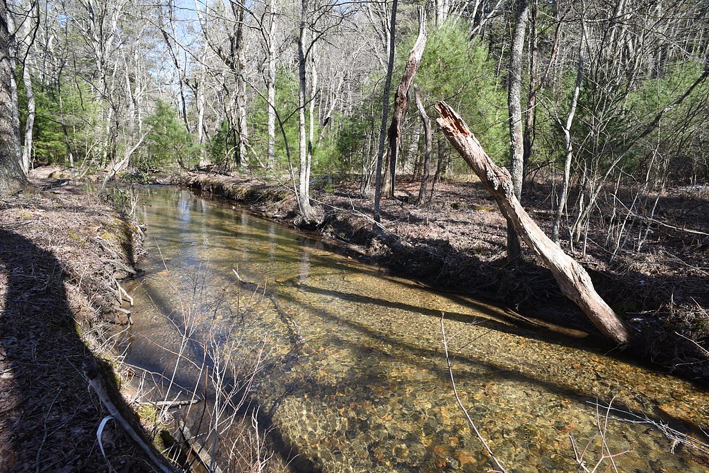
About Carter Falls
Carter Falls is a pretty cascade tucked into the forested hills near Elkin, North Carolina, easily reached from the nearby stretch of the Mountains-to-Sea Trail. The falls drop through a scenic, wooded corridor that makes for a compact, rewarding outing — perfect for a quick afternoon hike or a peaceful nature stop. The land here is owned by SPR and carries the Mountains-to-Sea Trail land-unit designation (SP); management details for the site are not specified. The short approach keeps the focus on the fall line and surrounding hardwoods, offering dappled light and mossy rock accents that are especially lovely in spring and fall. Because the route is brief and accessible, Carter Falls is popular with hikers looking for a restful view of moving water without committing to a long backcountry trek.
The Setting
Carter Falls sits at 1,040 feet within Mountains-to-Sea Trail, fed by the Yadkin River, in the foothills of North Carolina.
Trail & Hike Details
The Approach
The easy 1.5-mile out-and-back trail gains 200 feet of elevation on the way to the falls.
Trail Description
The trail to Carter Falls is a 1.5-mile out-and-back route with about 200 feet of elevation gain, rated easy. The path is a short, well-worn walk with a gentle incline that leads directly to the base of the cascade, making for an approachable hike for most abilities. Expect a mostly natural tread and modest grading rather than steep, technical sections; the route is suitable for families and casual hikers seeking a quick waterfall visit.
What to Expect
Dogs are welcome.
Accessibility
The trail is not wheelchair accessible. Uneven terrain and elevation changes require steady footing.
Frequently Asked Questions
🐶 Are Dogs Allowed at Carter Falls?
✅ Dogs are allowed
Are There Any Fees or Permits Required?
🆖 No fees required
🏊 Is There Swimming at Carter Falls?
❌ Swimming is not allowed
When to Visit
Spring and fall are ideal times to visit due to pleasant weather and vibrant foliage. Summer is also popular, but the trail may be busier.
Seasonal Access
The best time to visit is Spring, Summer, and Fall. Winter access may be limited.
Safety Information
Exercise caution near the waterfall as rocks may be slippery. Stay on marked trails to avoid getting lost or damaging the environment.
Current Water Conditions
510 ft³/s
Current discharge — how much water is flowing
Lower than usual for this time of year
Based on 62 years of record
1.18 ft
Water depth at gauge
7-Day Discharge Trend
What does this mean for your visit?
Flow is lower than usual for this time of year.
About This Gauge
7-Day Flow Outlook
Based on the USGS gauge YADKIN RIVER AT ELKIN, NC (6 km away).
Today
Moderate
581 cfs
4/10Tomorrow
Moderate
565 cfs
5/10Wed
Moderate
538 cfs
8/10Thu
Low
532 cfs
6/10Fri
Low
499 cfs
6/10Sat
Moderate
562 cfs
4/10Sun
Moderate
580 cfs
4/10Best window: Wed — moderate flow, sunny (trip score 8/10).
Best time of year: this gauge typically runs highest from late February to early April, peaking in April.
How we calculate this
This is a transparent outlook, not a precise forecast. We take the waterfall's current flow strength (how it ranks against its historical normal for today, from the nearest USGS stream gauge), carry that ranking forward along the gauge's seasonal curve, and nudge it for forecast rain. Confidence is highest for the next day or two and falls further out. Always check official conditions and your own judgment before visiting — high flows can be dangerous.
Know when to go.
Get a free email alert when waterfalls near Pleasant Hill hit peak flow. We only send when conditions are worth the trip — no weekly newsletters, no spam.
Weather Forecast
Location & Access
Getting There
Carter Falls is located near Elkin, North Carolina. Visitors can access the falls via the Carter Falls Trailhead, which is part of the Elkin & Alleghany Rail Trail system. The trailhead is accessible by car, and directions can be found using GPS or local signage.
Get Directions on Google MapsParking
There is a designated parking area near the Carter Falls Trailhead. Parking availability may vary depending on the season and visitor volume.
Elevation
1,040 feet above sea level
Coordinates
36.288341° N, -80.884837° W
Land Management
Managed by UNK
Visitor Tips & Gear
Wear sturdy shoes as the trail may be uneven in some areas. Bring water and snacks, especially during warmer months. Visit early in the day to avoid crowds, particularly on weekends.
As an Amazon Associate, we earn from qualifying purchases.
This easy 1.5 miles hike is straightforward — comfortable trail shoes and plenty of water should do. Sun exposure on the trail makes good sun protection a must in summer.

Polarized Sunglasses (Knockaround)
Cuts glare off the water so you actually see the falls — and your photos turn out better too.

Columbia Watertight II Rain Jacket
Packs into its own pocket, seam-sealed, and keeps you dry from spray and surprise rain.

Earth Pak Waterproof Dry Bag
Keeps your phone and gear dry when waterfall mist soaks everything else.

Waterproof Phone Pouch (AiRunTech)
Cheap insurance — take photos right next to the falls without killing your phone.

JOBY GorillaPod Starter Kit
Wraps around railings and rocks for long-exposure waterfall shots — no flat surface needed.

Osprey Daylite Daypack
Light, organized, and just the right size for a day hike — fits water, snacks, and layers.
Where to Stay

Rushing Stone Cottage

Hampton Inn Jonesville/Elkin

Quality Inn Jonesville I-77

Fairfield Inn Suites Elkin Jonesville
Browse vacation cabins and private rentals nearby
Unique outdoor stays — tents, yurts, and treehouses
Rent a campervan or RV for your waterfall road trip
Some links are affiliate links. We may earn a commission at no extra cost to you.
Nearby Campground
Basin Cove Backcountry Camping
17 miles away · 8 sites
Overview Basin Cove backcountry is a primitive camp located in historic Basin Cove at Doughton Park on the Blue Ridge Parkway in North Carolina.. Multiple trails allow access to the primitive campground. Click to see a map Doughton Park Hiking Trails Overnight parking for backcountry is permitted at designated areas. From the parkway, the trails descend over 1500 feet into the Basin Cove Area. Easiest trail is the Grassy Gap Fire Road entrance from Longbottom Road. This year-round campground has
Book on Recreation.govAdditional Information
Nearby Attractions
The Elkin & Alleghany Rail Trail offers additional hiking opportunities. The town of Elkin features wineries, shops, and restaurants for visitors to explore.
Wildlife
The area is home to various bird species, deer, and other small wildlife. Visitors may also encounter insects such as mosquitoes, especially in warmer months.
Cities near Carter Falls
Nearby Waterfalls
Other waterfalls named Carter Falls
1 other waterfall shares this name across the U.S.
Writing about Carter Falls? Embed this waterfall on your site for free.