Bushkill Falls
By Armen Suny · Last verified Sep 2026
LiDAR & 3D terrain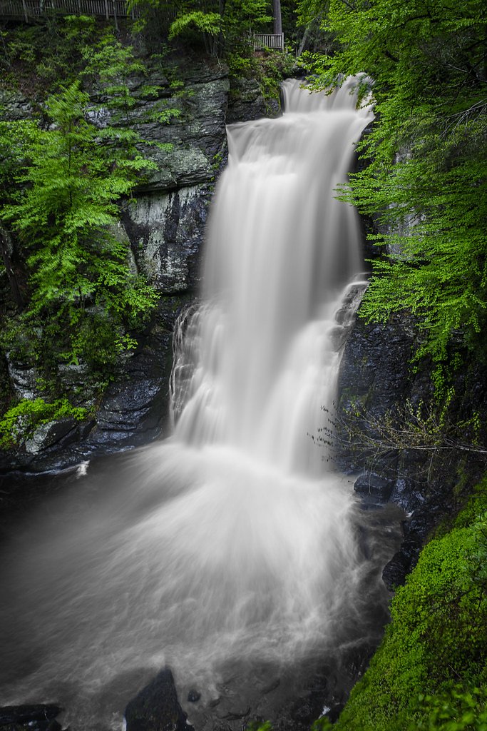
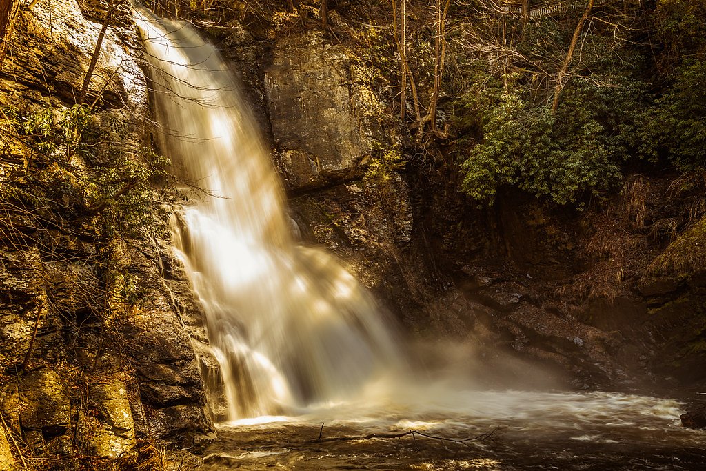
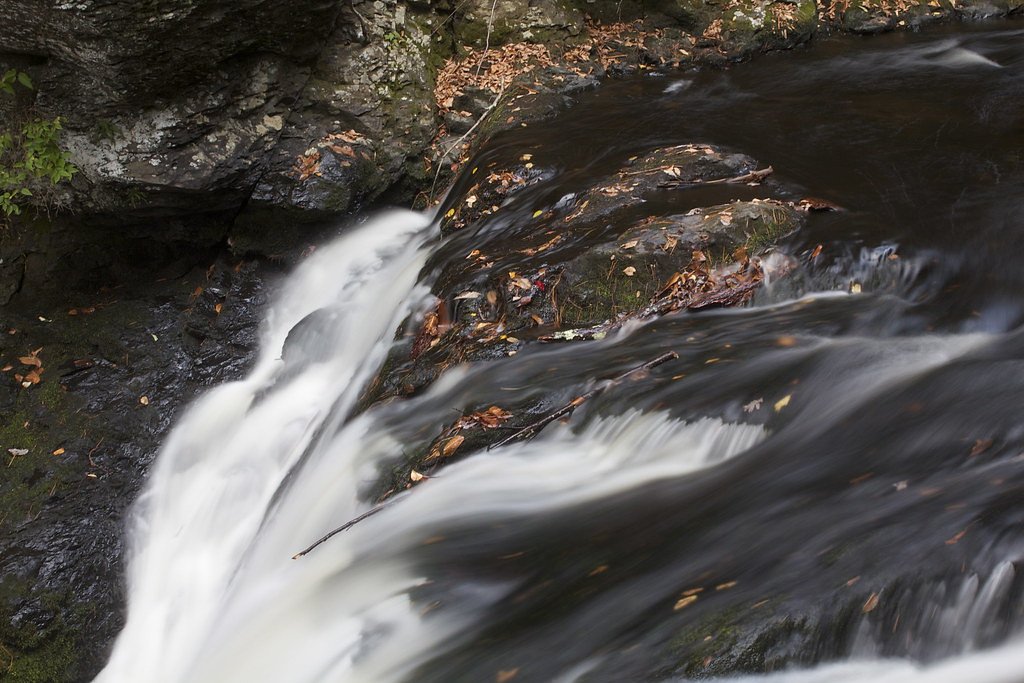

Photo Credits (5)
Difficulty
Moderate
Trail Length
0.3 miles
Trail Type
Loop
About Bushkill Falls
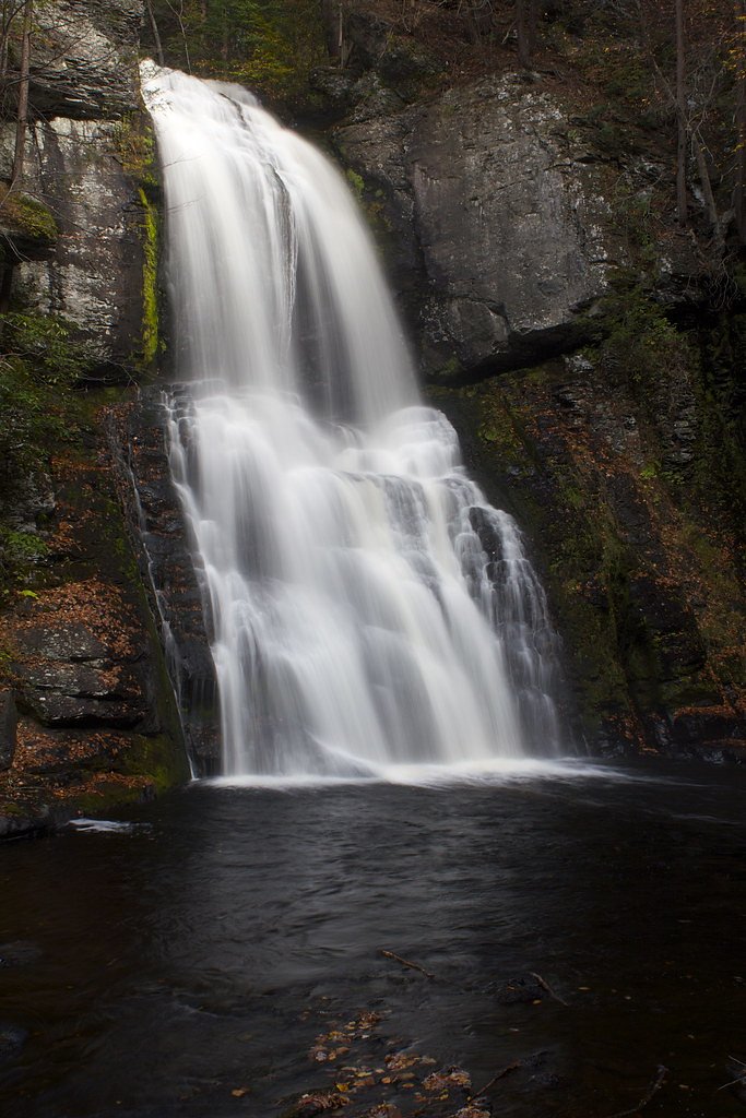
Bushkill Falls is a series of eight privately owned waterfalls tucked into Lehman Township in the Pocono Mountains, often nicknamed the “Niagara of Pennsylvania.” Water from the Little Bush Kill and Pond Run Creek tumbles down the mountain toward the Delaware River, feeding named cascades such as Bridal Veil Falls, Bridesmaid Falls, Laurel Glen Falls and Pennell Falls; the tallest drop on the property plunges over 100 feet. The setting combines dramatic plunging falls with mixed hardwood forest, making the area a favorite for hikers and birdwatchers alike. The property is operated as a privately managed attraction with a network of maintained trails, footbridges and viewing areas that make the falls accessible to a wide range of visitors. Trails range from a short, easy walk to the main falls to longer routes that visit the smaller cascades and quieter streamside sections. If you’re camping nearby, Alosa Campsites lies about 4.75 km away, making Bushkill an easy day outing or evening stop after a night under the pines.
The Setting
Bushkill Falls sits at 545 feet along the Bush Kill, in the foothills of Pennsylvania.
Trail & Hike Details
Trail Description
Trail type: out-and-back. Length: 2.4 miles round-trip with approximately 350 feet of elevation gain. Difficulty: moderate. Surface and features: a privately maintained network of natural footpaths and footbridges with built viewing areas and trails that vary in grade; the route is non-technical and suitable for day hikers. The trail system provides an easy short walk to the main falls and longer segments that access the series of eight cascades, with moderate uphill sections as you move between viewpoints.
What to Expect
Dogs are welcome.
Accessibility
The trail is not wheelchair accessible. Uneven terrain and elevation changes require steady footing.
Frequently Asked Questions
🐶 Are Dogs Allowed at Bushkill Falls?
✅ Dogs are allowed
Are There Any Fees or Permits Required?
🤑 Fee: $18.00
🏊 Is There Swimming at Bushkill Falls?
❌ Swimming is not allowed
When to Visit
Spring and fall are the best times to visit, as the waterfalls are typically at their fullest in spring, and the fall foliage adds stunning colors to the scenery.
Seasonal Access
The best time to visit is Spring, Summer, and Fall. Winter access may be limited.
Safety Information
Trails can be slippery, especially after rain. Stay on marked paths and avoid getting too close to the edges near the waterfalls. Supervise children closely.
Current Water Conditions
68 ft³/s
Current discharge — how much water is flowing
About average for this time of year
Based on 117 years of record
1.85 ft
Water depth at gauge
7-Day Discharge Trend
What does this mean for your visit?
Flow is about average for this time of year.
About This Gauge
7-Day Flow Outlook
Based on the USGS gauge Bush Kill at Shoemakers, PA (4 km away).
Today
Roaring
68 cfs
8/10Tomorrow
Roaring
75 cfs
8/10Thu
Roaring
80 cfs
8/10Fri
Roaring
87 cfs
9/10Sat
Roaring
96 cfs
6/10Sun
Roaring
99 cfs
6/10Mon
Roaring
93 cfs
6/10Best window: Fri — roaring flow, mostly sunny (trip score 9/10).
Best time of year: this gauge typically runs highest from late February to late May, peaking in April.
How we calculate this
This is a transparent outlook, not a precise forecast. We take the waterfall's current flow strength (how it ranks against its historical normal for today, from the nearest USGS stream gauge), carry that ranking forward along the gauge's seasonal curve, and nudge it for forecast rain. Confidence is highest for the next day or two and falls further out. Always check official conditions and your own judgment before visiting — high flows can be dangerous.
Know when to go.
Get a free email alert when waterfalls near Saw Creek hit peak flow. We only send when conditions are worth the trip — no weekly newsletters, no spam.
Weather Forecast
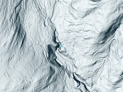
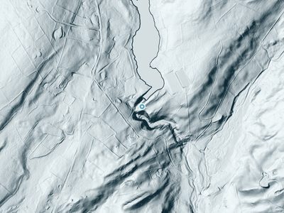
The Terrain, Seen by LiDAR
Aircraft-mounted lasers measured this ground to within inches. Trees and buildings are digitally stripped away, leaving the bare shape of the land the water has carved.
The ground through the falls loses about 166 feet in steep steps rather than one leap. The ground at the falls is roughly 548 feet above sea level.
The whole reach is steep: about 247 feet of descent in the 500 feet above the falls and another 210 feet in the 500 feet below. The falls face southwest and sit in full sun for most of the day, best photographed early or late.
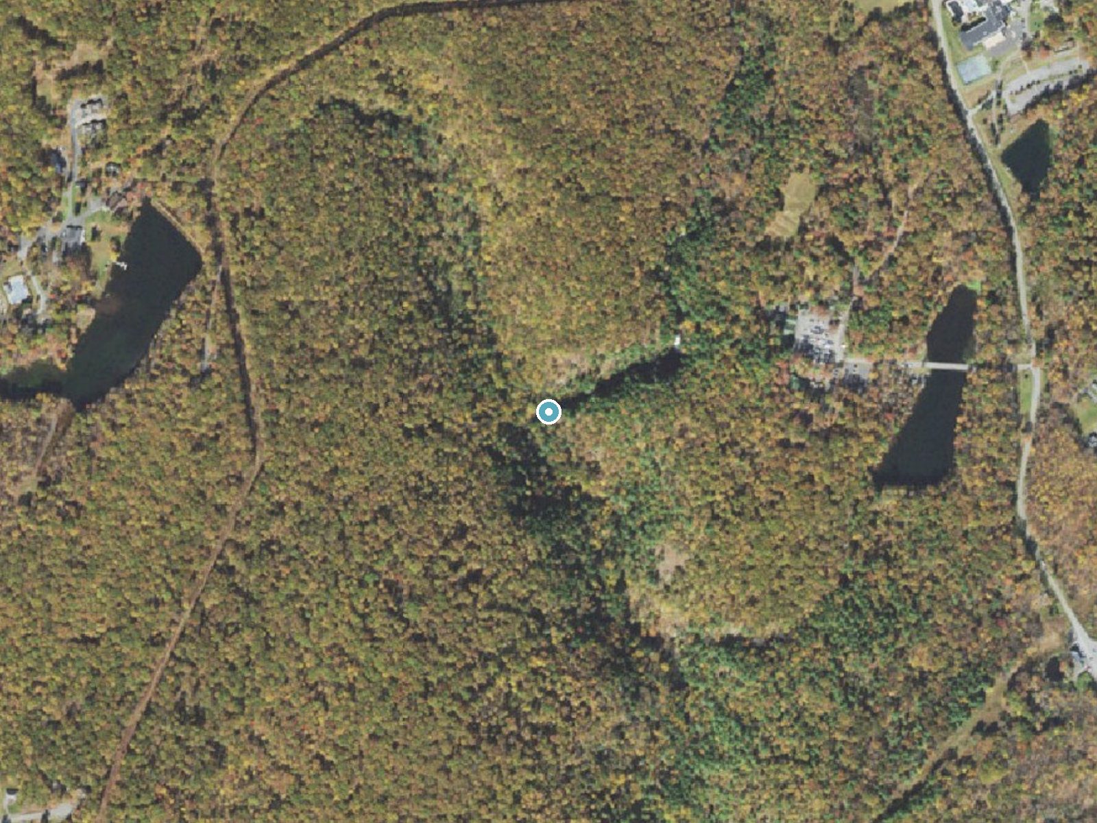
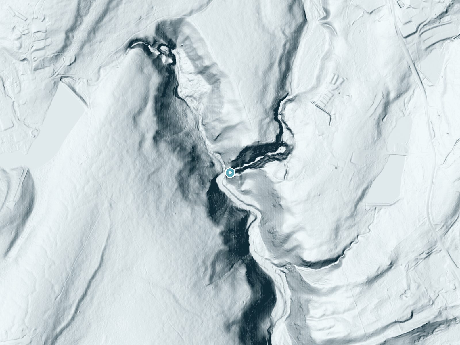
Drag to compare. The dot marks the waterfall. The frame is about a mile across.
- Ground elevation
- 548 feet
- Measured by 1-meter lidar
- Drop at the falls
- About 166 feet
- Change in ground height within ~250 feet of the falls
- Faces
- Southwest
- Sunlit most of the day. Go early or late for softer light.
A slice through the lidar ground surface, from above the falls to downstream (heading southwest).
Elevation data: USGS 3D Elevation Program. Aerial imagery: USGS The National Map. Public domain.
Location & Access
Getting There
Bushkill Falls is located in the Pocono Mountains of northeastern Pennsylvania. The address is 138 Bushkill Falls Trail, Bushkill, PA 18324. It is accessible by car and well-signposted from major highways.
Get Directions on Google MapsParking
Ample parking is available on-site near the entrance to the park.
Elevation
545 feet above sea level
Coordinates
41.116484° N, -75.012118° W
Visitor Tips & Gear
Wear sturdy footwear as some trails can be slippery, especially after rain. Arrive early to avoid crowds, particularly on weekends and during peak seasons. Bring water and snacks, as the trails can take some time to explore fully.
Where to Stay
Pocono Mountain Villas MOD Collection by Sonesta
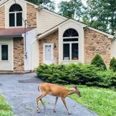
Serenity Falls - Stylish 4Bdr Mountain Retreat, Hot Tub, Pool

Hampton Inn & Suites Stroudsburg Bartonsville Poconos
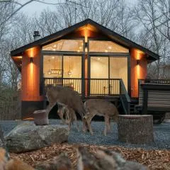
Modern Retreat Poconos 3BR Fire Pit Skiing
Browse vacation cabins and private rentals nearby
Unique outdoor stays — tents, yurts, and treehouses
Rent a campervan or RV for your waterfall road trip
Some links are affiliate links. We may earn a commission at no extra cost to you.
Nearby Campground
Alosa Campsites
3 miles away · 6 sites
Overview The Alosa Campsites are boat-in only sites located on the west (Pennsylvanian) shore of the Delaware River near Bushkill, Pennsylvania. The side of the river with the campsites will be on your right while traveling downstream. This section of the river offers unspoiled views, excellent boating, fishing, and birding opportunities within the Delaware Water Gap National Recreation Area and the Middle Delaware National Scenic and Recreational River. These reservation-only campsites are avail
Book on Recreation.govAdditional Information
Nearby Attractions
Delaware Water Gap National Recreation Area, Pocono Environmental Education Center, and Shawnee Mountain Ski Area.
Wildlife
The area is home to various wildlife, including deer, birds, and small mammals. Visitors may also see native plants and wildflowers along the trails.
Cities near Bushkill Falls
Nearby Waterfalls
 LiDAR
LiDAR
 LiDAR
LiDAR
Writing about Bushkill Falls? Embed this waterfall on your site for free.