Burgess Falls
Tennessee • 136 ft
By Armen Suny · Last verified Mar 2026
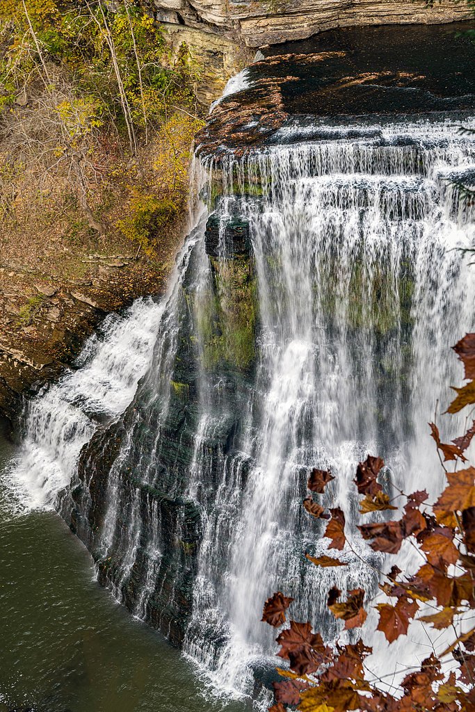
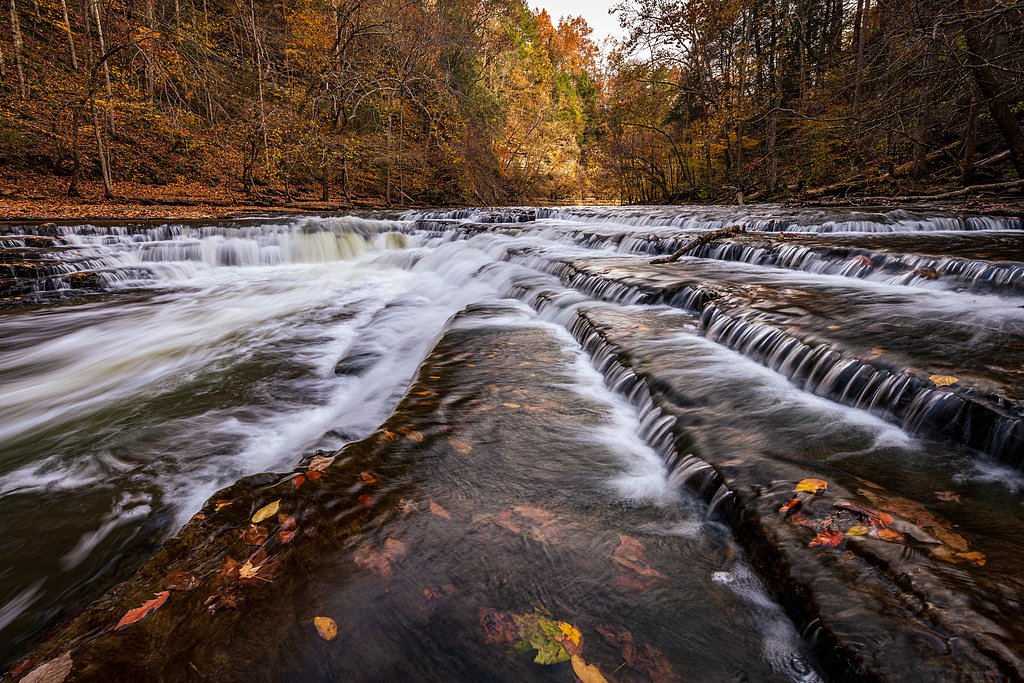
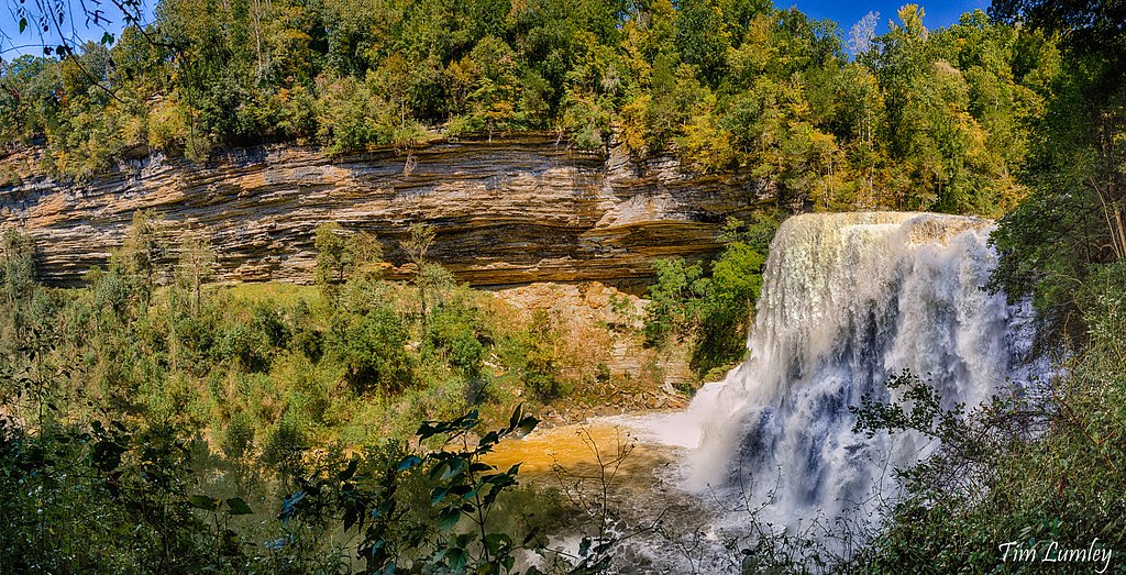
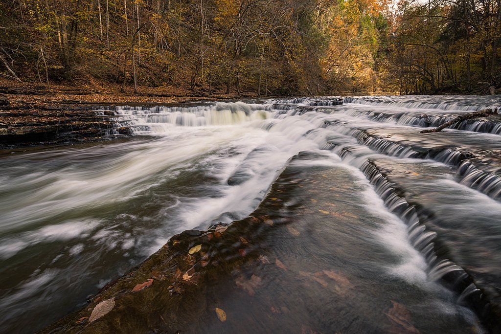

Photo Credits (5)
Difficulty
Moderate
Trail Length
1.5 miles
Trail Type
Out And Back
Elevation Gain
200 ft
About Burgess Falls
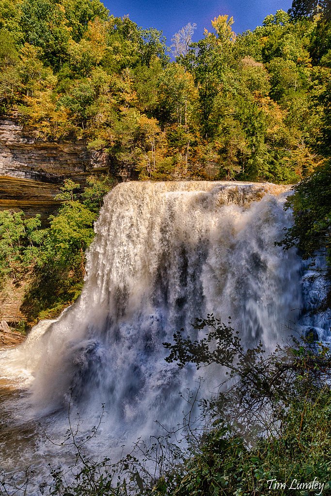
Burgess Falls is a stunning waterfall located in Burgess Falls State Park, Tennessee. It is known for its dramatic drop of approximately 136 feet into a limestone gorge, making it one of the most picturesque waterfalls in the state.
The Setting
Burgess Falls sits at 768 feet within Burgess Falls, fed by the Falling Water River, in the foothills of Tennessee. At 136 feet, it is among the taller waterfalls in Tennessee.
Height: 136 feet
Trail & Hike Details
The Approach
The moderate 1.5-mile out-and-back trail gains 200 feet of elevation on the way to the falls.
Trail Description
The trail to Burgess Falls is a well-maintained path that follows the Falling Water River. Along the way, visitors can view three smaller waterfalls before reaching the main Burgess Falls. The trail includes some steep sections and stairs, particularly near the overlook.
What to Expect
The falls cascade 136 feet. Dogs are welcome.
Accessibility
The trail is not wheelchair accessible. Uneven terrain and elevation changes require steady footing.
Frequently Asked Questions
🐶 Are Dogs Allowed at Burgess Falls?
✅ Dogs are allowed
Are There Any Fees or Permits Required?
🆖 No fees required
🏊 Is There Swimming at Burgess Falls?
❌ Swimming is not allowed
When to Visit
Spring and early summer are the best times to visit, as the waterfall is typically at its fullest due to seasonal rainfall.
Seasonal Access
The best time to visit is Spring, Summer, and Fall. Winter access may be limited.
Safety Information
The trail includes steep sections and can be slippery, especially after rain. Stay on marked trails and avoid getting too close to the edge of the gorge. The final section of the trail to the base of the falls is closed for safety reasons.
Current Water Conditions
41 ft³/s
Current discharge — how much water is flowing
About average for this time of year
Based on 34 years of record
4.51 ft
Water depth at gauge
7-Day Discharge Trend
What does this mean for your visit?
Flow is about average for this time of year.
About This Gauge
7-Day Flow Outlook
Based on the USGS gauge FALLING WATER RIVER NEAR COOKEVILLE, TN (8 km away).
Today
Strong
41 cfs
9/10Tomorrow
Strong
36 cfs
10/10Wed
Strong
33 cfs
10/10Thu
Strong
34 cfs
10/10Fri
Roaring
43 cfs
6/10Sat
Roaring
39 cfs
6/10Sun
Roaring
48 cfs
6/10Best window: Tomorrow — strong flow, sunny (trip score 10/10).
Best time of year: this gauge typically runs highest from early February to early April, peaking in March.
How we calculate this
This is a transparent outlook, not a precise forecast. We take the waterfall's current flow strength (how it ranks against its historical normal for today, from the nearest USGS stream gauge), carry that ranking forward along the gauge's seasonal curve, and nudge it for forecast rain. Confidence is highest for the next day or two and falls further out. Always check official conditions and your own judgment before visiting — high flows can be dangerous.
Know when to go.
Get a free email alert when waterfalls near Baxter hit peak flow. We only send when conditions are worth the trip — no weekly newsletters, no spam.
Weather Forecast
Location & Access
Getting There
Burgess Falls State Park is located near Cookeville, Tennessee, and is accessible via Burgess Falls Drive off Highway 135. The park is well-signposted and easy to locate.
Get Directions on Google MapsParking
There is a designated parking area at Burgess Falls State Park near the trailhead. Parking is free but may fill up during peak seasons.
Elevation
768 feet above sea level
Coordinates
36.043952° N, -85.598313° W
Land Management
Managed by OTHS
Visitor Tips & Gear
Arrive early to secure parking, especially during weekends and peak seasons. Wear sturdy shoes as the trail can be uneven and slippery in places. Bring water and a camera to capture the stunning scenery.
As an Amazon Associate, we earn from qualifying purchases.
With 1.5 miles and 200 ft of elevation gain, sturdy boots and trekking poles will help on this moderate trail. Sun exposure on the trail makes good sun protection a must in summer.

Polarized Sunglasses (Knockaround)
Cuts glare off the water so you actually see the falls — and your photos turn out better too.

Columbia Watertight II Rain Jacket
Packs into its own pocket, seam-sealed, and keeps you dry from spray and surprise rain.

Earth Pak Waterproof Dry Bag
Keeps your phone and gear dry when waterfall mist soaks everything else.

Waterproof Phone Pouch (AiRunTech)
Cheap insurance — take photos right next to the falls without killing your phone.

Timberland Euro Sprint Mid Waterproof
Trusted waterproof boot with premium leather and grippy rubber sole — reliable on rocky, wet trails.

TrailBuddy Trekking Poles
Lightweight aluminum, cork grips, and flip-locks that actually hold — a best-seller for good reason.
Where to Stay

Country Inn & Suites by Radisson, Cookeville, TN

Best Western Thunderbird Motel

Home2 Suites By Hilton Cookeville

La Quinta by Wyndham Cookeville
Browse vacation cabins and private rentals nearby
Unique outdoor stays — tents, yurts, and treehouses
Rent a campervan or RV for your waterfall road trip
Some links are affiliate links. We may earn a commission at no extra cost to you.
Nearby Campground
Lakeside Resort (Formerly Tech Aqua)
7.7 miles away · 0 sites
This recreation area is part of Center Hill Lake
Book on Recreation.govAdditional Information
Nearby Attractions
Other nearby attractions include Cummins Falls State Park and Window Cliffs State Natural Area.
Wildlife
The area is home to a variety of wildlife, including birds, deer, and small mammals. Visitors may also see fish and turtles in the river.
Cities near Burgess Falls
Nearby Waterfalls
Writing about Burgess Falls? Embed this waterfall on your site for free.