


Photo Credits (5)
Difficulty
Easy
Trail Length
0.6 miles
Trail Type
Out And Back
Elevation Gain
100 ft
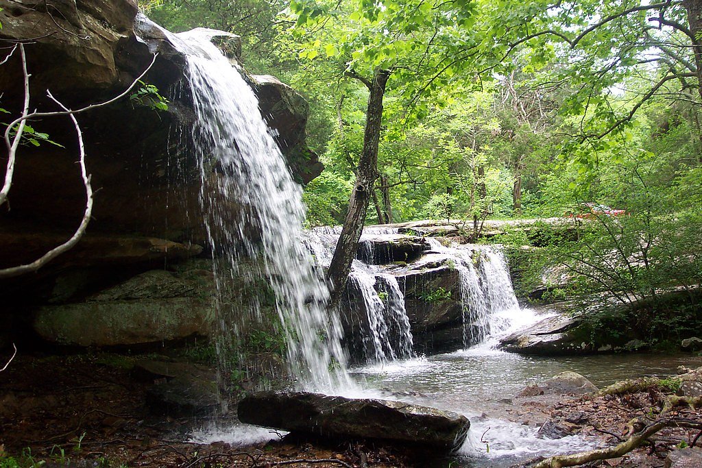
About Burden Falls
Burden Falls is a picturesque waterfall located in the Shawnee National Forest in southern Illinois. It is known for its cascading tiers and rugged natural beauty, making it a popular destination for hikers and nature enthusiasts. The falls are particularly impressive after heavy rainfall.
The Setting
Burden Falls sits at 558 feet within Shawnee National Forest, fed by the South Fork Saline River, in the foothills of Illinois.
Nearby Falls Worth Visiting
Cedar Falls, the tallest waterfall in Illinois at 80 feet, lies 6.1 miles to the southwest.
Trail & Hike Details
The Approach
The easy hike follows 499 B (#499B), a 0.6-mile out-and-back trail over natural surface. Expect 100 feet of elevation gain with grades of 12-20%. The trail is moderately developed (Class 2).
USFS Trail
499B #499B
Trail Class
Moderately Developed
Surface
Avg Grade
USFS Segment
0.01 miTrail Description
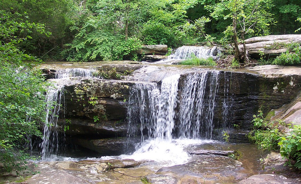
The trail to Burden Falls is short and relatively easy, making it accessible for most visitors. It leads to the top of the falls, where visitors can enjoy views of the cascading water. The area around the falls is rocky and uneven, so caution is advised.
What to Expect
Dogs are welcome.
Accessibility
The trail is short and relatively flat, but the surface may be uneven. Contact the managing agency for accessibility details.
Frequently Asked Questions
🐶 Are Dogs Allowed at Burden Falls?
✅ Dogs are allowed
Are There Any Fees or Permits Required?
🆖 No fees required
🏊 Is There Swimming at Burden Falls?
❌ Swimming is not allowed
When to Visit
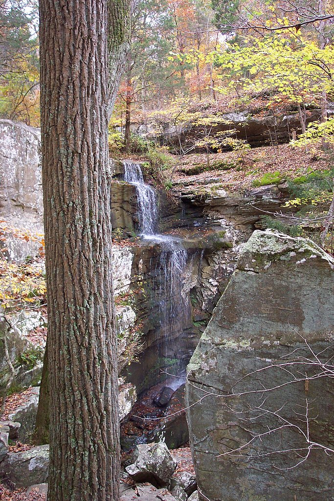
Spring and early summer are the best times to visit, as the falls are typically more active due to seasonal rainfall.
Seasonal Access
The best time to visit is Spring, Summer, Fall, and Winter. Check with Shawnee National Forest for seasonal road closures.
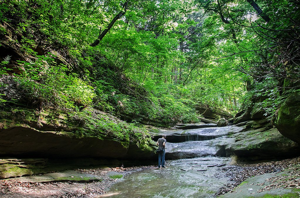
Safety Information
Exercise caution around the falls, as the rocks can be slippery, especially after rain. Stay on marked trails and avoid getting too close to the edge of the falls.
Current Water Conditions
10 ft³/s
Current discharge — how much water is flowing
Lower than usual for this time of year
Based on 60 years of record
2.32 ft
Water depth at gauge
7-Day Discharge Trend
What does this mean for your visit?
Flow is lower than usual for this time of year.
About This Gauge
This gauge is on a nearby waterway and may not reflect exact conditions at the falls.
7-Day Flow Outlook
Based on the USGS gauge SOUTH FORK SALINE RIVER NR CARRIER MILLS, IL (9 km away).
Today
Low
10 cfs
6/10Tomorrow
Moderate
11 cfs
4/10Sat
Moderate
12 cfs
4/10Sun
Moderate
13 cfs
4/10Mon
Moderate
13 cfs
8/10Tue
Low
10 cfs
6/10Wed
Low
9 cfs
6/10Best window: Mon — moderate flow, sunny (trip score 8/10).
Best time of year: this gauge typically runs highest from mid February to early May, peaking in March.
How we calculate this
This is a transparent outlook, not a precise forecast. We take the waterfall's current flow strength (how it ranks against its historical normal for today, from the nearest USGS stream gauge), carry that ranking forward along the gauge's seasonal curve, and nudge it for forecast rain. Confidence is highest for the next day or two and falls further out. Always check official conditions and your own judgment before visiting — high flows can be dangerous.
Know when to go.
Get a free email alert when waterfalls near Stonefort hit peak flow. We only send when conditions are worth the trip — no weekly newsletters, no spam.
Weather Forecast
Location & Access
Getting There
Burden Falls is located in the Shawnee National Forest, approximately 20 miles south of Harrisburg, Illinois. The falls can be accessed via Burden Falls Road, which is a gravel road leading to a small parking area near the falls.
Get Directions on Google MapsParking
There is a small, unpaved parking area near the falls. Parking is limited, so it is recommended to arrive early, especially during peak seasons.
Elevation
558 feet above sea level
Coordinates
37.563661° N, -88.641998° W
Land Management
Managed by USFS
Visitor Tips & Gear
Wear sturdy shoes with good traction, as the area around the falls can be rocky and slippery. Bring water and snacks, as there are no facilities nearby. Visit after recent rainfall for the best views of the falls.
As an Amazon Associate, we earn from qualifying purchases.
For this easy 0.6 miles trail, lightweight trail shoes and a water bottle are usually sufficient. Icy conditions are common in winter — traction cleats are a smart addition.

Columbia Watertight II Rain Jacket
Packs into its own pocket, seam-sealed, and keeps you dry from spray and surprise rain.

Polarized Sunglasses (Knockaround)
Cuts glare off the water so you actually see the falls — and your photos turn out better too.

Earth Pak Waterproof Dry Bag
Keeps your phone and gear dry when waterfall mist soaks everything else.

Waterproof Phone Pouch (AiRunTech)
Cheap insurance — take photos right next to the falls without killing your phone.

Kahtoola MICROspikes
Cult-favorite traction cleats that grip ice and wet rock — essential for winter waterfall hikes.

JOBY GorillaPod Starter Kit
Wraps around railings and rocks for long-exposure waterfall shots — no flat surface needed.
Where to Stay

Carlton Cabin at Lake of Egypt 500 Sq Ft

ECONOMY INN & SUITES

Parkfield Inn

Peaceful Custom Carbondale Home w/ Deck, Near SIU!
Browse vacation cabins and private rentals nearby
Unique outdoor stays — tents, yurts, and treehouses
Rent a campervan or RV for your waterfall road trip
Some links are affiliate links. We may earn a commission at no extra cost to you.
Nearby Campground
Hidden Springs Ranger District
16.9 miles away · 0 sites
East side of the Shawnee National Forest
Book on Recreation.govAdditional Information
Nearby Attractions
Other attractions in the Shawnee National Forest include Garden of the Gods, Bell Smith Springs, and Rim Rock Trail.
Wildlife
The area is home to a variety of wildlife, including deer, birds, and small mammals. Visitors may also encounter snakes, so caution is advised.
Cities near Burden Falls
Nearby Waterfalls
Writing about Burden Falls? Embed this waterfall on your site for free.