Bolton Falls
By Armen Suny · Last verified Mar 2026
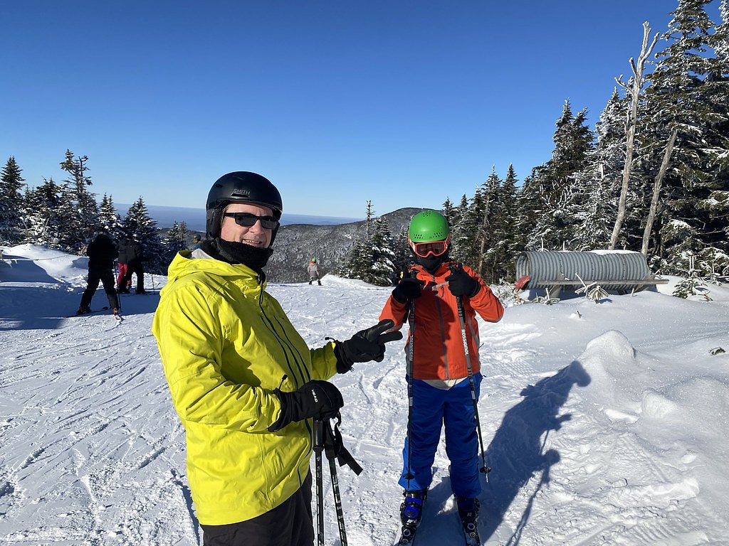
Photo Credits (5)
Difficulty
Moderate
Trail Length
2.4 miles
Trail Type
Out And Back
Elevation Gain
350 ft
About Bolton Falls
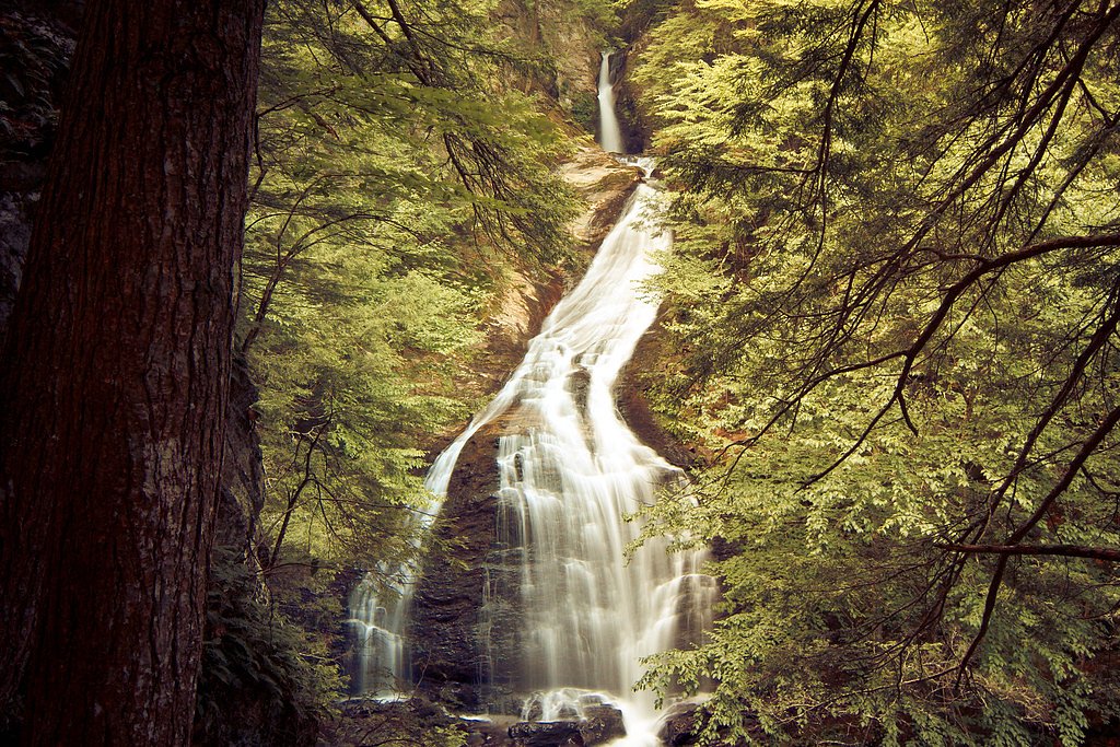
Bolton Falls is a scenic waterfall located in Bolton, Vermont, along the Winooski River. It is a popular spot for photography and nature enthusiasts due to its picturesque setting and accessibility. The falls are relatively small but charming, with cascading water over rocky ledges.
The Setting
Bolton Falls sits at 397 feet along the Little River, in the coastal lowlands of Vermont.
Nearby Falls Worth Visiting
Moss Glen Falls, the tallest waterfall in Vermont at 125 feet, lies 12.7 miles to the northeast.
Trail & Hike Details
The Approach
The moderate 2.4-mile out-and-back trail gains 350 feet of elevation on the way to the falls.
Trail Description
The trail to Bolton Falls is very short and easy, making it accessible for most visitors. It involves a brief walk from the roadside parking area to the viewing spot near the falls. The terrain is relatively flat but may be uneven in some areas.
What to Expect
Dogs are welcome.
Accessibility
The trail is not wheelchair accessible. Uneven terrain and elevation changes require steady footing.
Frequently Asked Questions
🐶 Are Dogs Allowed at Bolton Falls?
✅ Dogs are allowed
Are There Any Fees or Permits Required?
🆖 No fees required
🏊 Is There Swimming at Bolton Falls?
❌ Swimming is not allowed
When to Visit
Spring and early summer are ideal for visiting Bolton Falls, as the water flow is typically stronger due to snowmelt and rainfall. Fall offers beautiful foliage, while winter provides a serene, icy landscape.
Seasonal Access
The best time to visit is Spring, Summer, Fall, and Winter.
Safety Information
Exercise caution near the water as the rocks can be slippery. Avoid visiting during heavy rain or high water levels, as the currents may be dangerous.
Current Water Conditions
529 ft³/s
Current discharge — how much water is flowing
Much higher than usual for this time of year
Based on 90 years of record
7.58 ft
Water depth at gauge
7-Day Discharge Trend
What does this mean for your visit?
The water is flowing much higher than usual, expect an impressive display.
About This Gauge
7-Day Flow Outlook
Based on the USGS gauge LITTLE RIVER NEAR WATERBURY, VT (4 km away).
Today
Moderate
529 cfs
6/10Tomorrow
Moderate
549 cfs
8/10Mon
Moderate
677 cfs
4/10Tue
Moderate
616 cfs
6/10Wed
Moderate
517 cfs
6/10Thu
Moderate
453 cfs
6/10Fri
Moderate
350 cfs
6/10Best window: Tomorrow — moderate flow, sunny (trip score 8/10).
Best time of year: this gauge typically runs highest from mid March to late May, peaking in May.
How we calculate this
This is a transparent outlook, not a precise forecast. We take the waterfall's current flow strength (how it ranks against its historical normal for today, from the nearest USGS stream gauge), carry that ranking forward along the gauge's seasonal curve, and nudge it for forecast rain. Confidence is highest for the next day or two and falls further out. Always check official conditions and your own judgment before visiting — high flows can be dangerous.
Know when to go.
Get a free email alert when waterfalls near Bolton hit peak flow. We only send when conditions are worth the trip — no weekly newsletters, no spam.
Weather Forecast
Location & Access
Getting There
Bolton Falls is located off Route 2 in Bolton, Vermont. The falls are near the Bolton Dam and can be accessed via a short walk from nearby parking areas.
Get Directions on Google MapsParking
There is limited roadside parking available near the falls. Visitors should exercise caution when parking and ensure they are not blocking traffic or private property.
Elevation
397 feet above sea level
Coordinates
44.359497° N, -72.816788° W
Visitor Tips & Gear
Visit early in the day to avoid crowds, especially during peak seasons. Wear sturdy shoes as the ground near the falls may be slippery. Be cautious of traffic when parking along the roadside.
As an Amazon Associate, we earn from qualifying purchases.
With 2.4 miles and 350 ft of elevation gain, sturdy boots and trekking poles will help on this moderate trail. Icy conditions are common in winter — traction cleats are a smart addition.

Columbia Watertight II Rain Jacket
Packs into its own pocket, seam-sealed, and keeps you dry from spray and surprise rain.

Polarized Sunglasses (Knockaround)
Cuts glare off the water so you actually see the falls — and your photos turn out better too.

Earth Pak Waterproof Dry Bag
Keeps your phone and gear dry when waterfall mist soaks everything else.

Waterproof Phone Pouch (AiRunTech)
Cheap insurance — take photos right next to the falls without killing your phone.

Timberland Euro Sprint Mid Waterproof
Trusted waterproof boot with premium leather and grippy rubber sole — reliable on rocky, wet trails.

TrailBuddy Trekking Poles
Lightweight aluminum, cork grips, and flip-locks that actually hold — a best-seller for good reason.
Where to Stay

Green Mountain Inn

Outbound Stowe

Sun & Ski Inn and Suites

Northern Lights Lodge
Browse vacation cabins and private rentals nearby
Unique outdoor stays — tents, yurts, and treehouses
Rent a campervan or RV for your waterfall road trip
Some links are affiliate links. We may earn a commission at no extra cost to you.
Additional Information
Nearby Attractions
Nearby attractions include Bolton Valley Resort for skiing and hiking, and the Long Trail for more extensive hiking opportunities.
Wildlife
The area around Bolton Falls is home to various bird species, small mammals, and aquatic life in the Winooski River.
Cities near Bolton Falls
Nearby Waterfalls

Writing about Bolton Falls? Embed this waterfall on your site for free.