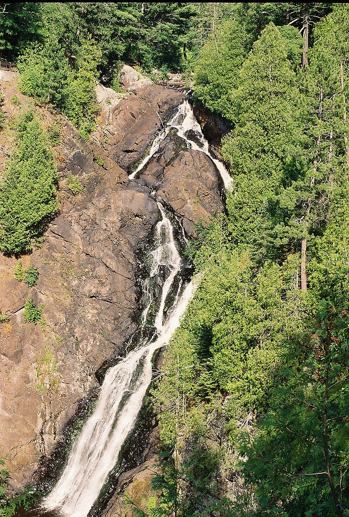
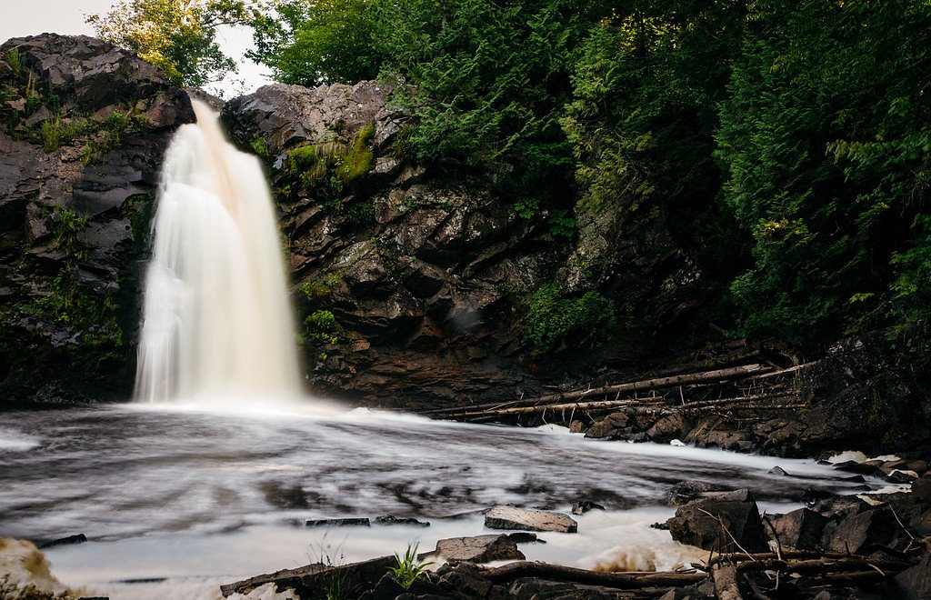
Big Manitou Falls
Wisconsin • 165 ft
By Armen Suny · Last verified Mar 2026
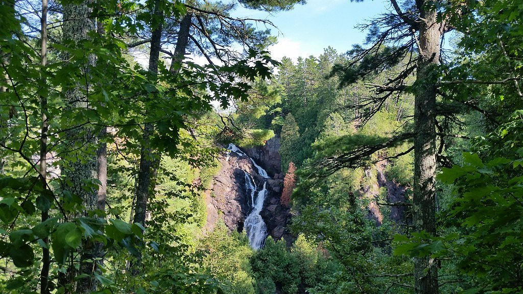
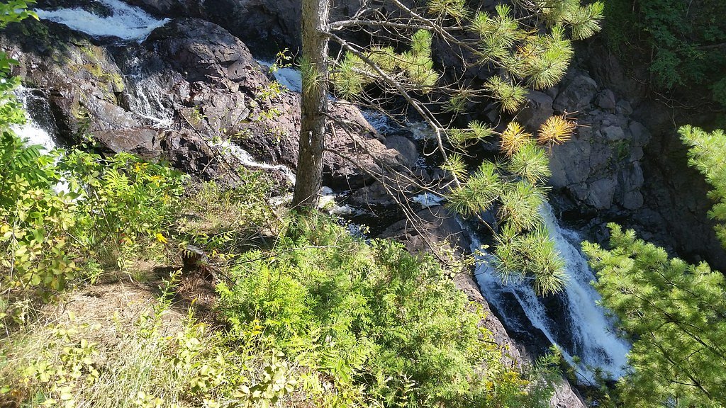
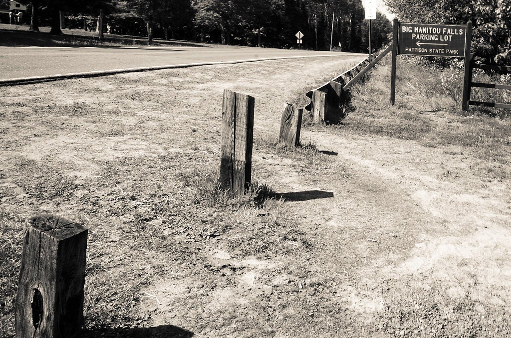
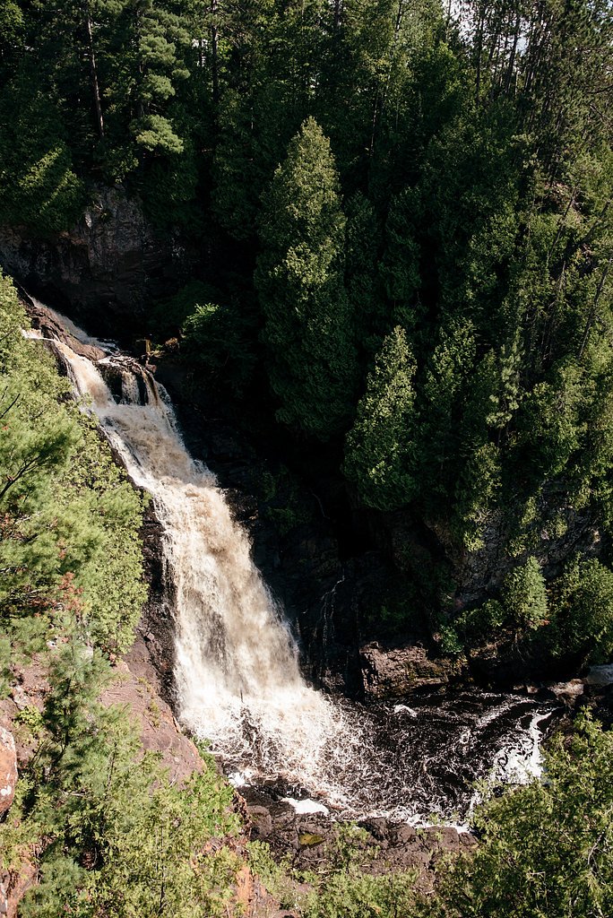

Photo Credits (5)
Difficulty
Easy
Trail Length
0.4 miles
Trail Type
Out And Back
Elevation Gain
50 ft
About Big Manitou Falls
Big Manitou Falls, located in Pattison State Park in Wisconsin, is the tallest waterfall in the state, standing at an impressive 165 feet. It is a stunning natural feature surrounded by lush forest and offers breathtaking views year-round.
The Setting
Big Manitou Falls sits at 958 feet within Pattison State Park, fed by the Nemadji River, in the foothills of Wisconsin. At 165 feet, it is among the taller waterfalls in Wisconsin.
Height: 165 feet
Nearby Falls Worth Visiting
Little Manitou Falls (31 ft) lies 1.0 miles to the south.
Trail & Hike Details
The Approach
The easy 0.4-mile out-and-back trail gains 50 feet of elevation on the way to the falls.
Trail Description
The trail to Big Manitou Falls is well-maintained and features a loop that provides multiple viewpoints of the waterfall. The path is relatively flat and suitable for most visitors, including families with children.
What to Expect
The falls plunge 165 feet. Dogs are welcome.
Accessibility
The trail is short and relatively flat, but the surface may be uneven. Contact the managing agency for accessibility details.
Frequently Asked Questions
🐶 Are Dogs Allowed at Big Manitou Falls?
✅ Dogs are allowed
Are There Any Fees or Permits Required?
🤑 Fee: $8.00
🏊 Is There Swimming at Big Manitou Falls?
❌ Swimming is not allowed
When to Visit
Spring and early summer are ideal for visiting, as the waterfall is at its fullest due to snowmelt and rainfall. Fall offers beautiful foliage, while winter provides a unique view of the frozen falls.
Seasonal Access
The best time to visit is Spring, Summer, Fall, and Winter.
Safety Information
Stay on designated trails and observation areas, as the terrain near the falls can be slippery and dangerous. Exercise caution near the edges of cliffs.
Current Water Conditions
117 ft³/s
Current discharge — how much water is flowing
About average for this time of year
Based on 52 years of record
4.62 ft
Water depth at gauge
7-Day Discharge Trend
What does this mean for your visit?
Flow is about average for this time of year.
About This Gauge
This gauge is on a nearby waterway and may not reflect exact conditions at the falls.
7-Day Flow Outlook
Based on the USGS gauge NEMADJI RIVER NEAR SOUTH SUPERIOR, WI (11 km away).
Today
Low
133 cfs
3/10Tomorrow
Low
134 cfs
4/10Tue
Low
134 cfs
3/10Wed
Low
148 cfs
3/10Thu
Low
136 cfs
3/10Fri
Low
148 cfs
3/10Sat
Low
148 cfs
3/10Best window: Tomorrow — low flow, slight chance rain showers then partly sunny (trip score 4/10).
Best time of year: this gauge typically runs highest from late March to early June, peaking in April.
How we calculate this
This is a transparent outlook, not a precise forecast. We take the waterfall's current flow strength (how it ranks against its historical normal for today, from the nearest USGS stream gauge), carry that ranking forward along the gauge's seasonal curve, and nudge it for forecast rain. Confidence is highest for the next day or two and falls further out. Always check official conditions and your own judgment before visiting — high flows can be dangerous.
Know when to go.
Get a free email alert when waterfalls near Oliver hit peak flow. We only send when conditions are worth the trip — no weekly newsletters, no spam.
Weather Forecast
Location & Access
Getting There
Big Manitou Falls is located within Pattison State Park, approximately 13 miles south of Superior, Wisconsin. The park is accessible via Highway 35.
Get Directions on Google MapsParking
Parking is available within Pattison State Park near the visitor center and designated trailheads.
Elevation
958 feet above sea level
Coordinates
46.536052° N, -92.121304° W
Land Management
Managed by SDNR
Visitor Tips & Gear
Arrive early during peak seasons to secure parking and enjoy the falls with fewer crowds. Wear sturdy shoes, as some sections of the trail may be uneven. Bring a camera to capture the scenic views.
As an Amazon Associate, we earn from qualifying purchases.
For this easy 0.4 miles trail, lightweight trail shoes and a water bottle are usually sufficient. Icy conditions are common in winter — traction cleats are a smart addition.

Columbia Watertight II Rain Jacket
Packs into its own pocket, seam-sealed, and keeps you dry from spray and surprise rain.

Polarized Sunglasses (Knockaround)
Cuts glare off the water so you actually see the falls — and your photos turn out better too.

Earth Pak Waterproof Dry Bag
Keeps your phone and gear dry when waterfall mist soaks everything else.

Waterproof Phone Pouch (AiRunTech)
Cheap insurance — take photos right next to the falls without killing your phone.

Kahtoola MICROspikes
Cult-favorite traction cleats that grip ice and wet rock — essential for winter waterfall hikes.

JOBY GorillaPod Starter Kit
Wraps around railings and rocks for long-exposure waterfall shots — no flat surface needed.
Where to Stay

Willard Munger Inn

Super 8 by Wyndham Superior WI

Holiday Inn Express & Suites Superior by IHG

Comfort Inn Duluth West
Browse vacation cabins and private rentals nearby
Unique outdoor stays — tents, yurts, and treehouses
Rent a campervan or RV for your waterfall road trip
Some links are affiliate links. We may earn a commission at no extra cost to you.
Additional Information
Nearby Attractions
Little Manitou Falls, another waterfall within Pattison State Park, is located nearby. The city of Superior offers additional dining and lodging options.
Wildlife
The park is home to a variety of wildlife, including deer, birds, and small mammals. Visitors may also spot wildflowers and other native plants along the trails.
Cities near Big Manitou Falls
Nearby Waterfalls
Writing about Big Manitou Falls? Embed this waterfall on your site for free.