
Photo Credits (5)
Difficulty
Easy
Trail Length
0.6 miles
Trail Type
Out And Back
Elevation Gain
100 ft
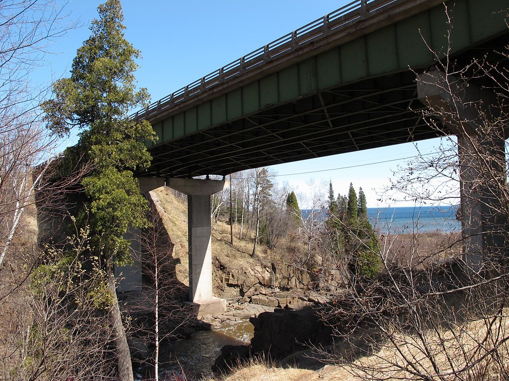
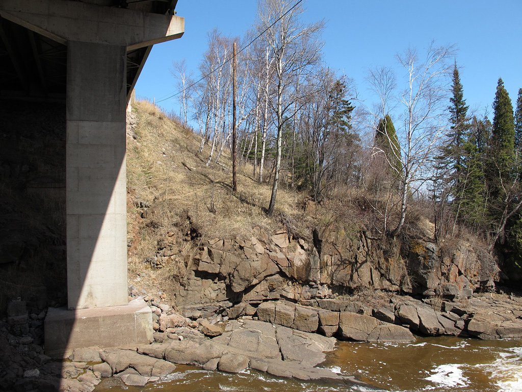
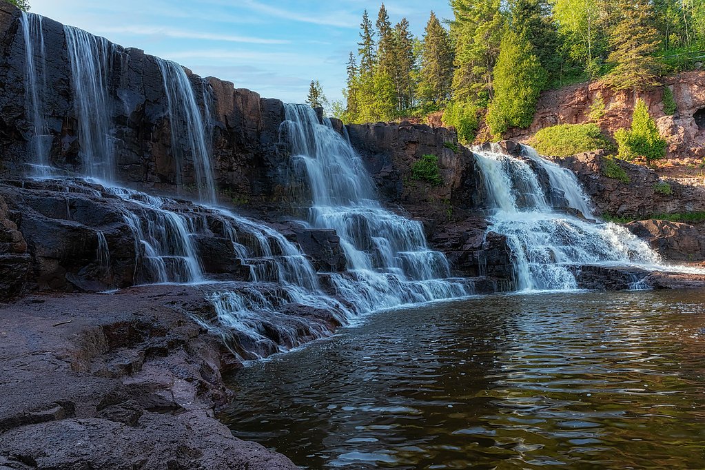
About Beaver River Falls
Beaver River Falls is a classic North Shore stop just off scenic Highway 61 near Beaver Bay, Minnesota. The falls tumble over layered bedrock in a compact, photogenic cascade that swells in spring runoff and remains rewarding year-round thanks to its easy roadside visibility. Many visitors pull off at the highway viewing area for a quick look and photos, making it a perfect short nature break on a Lake Superior drive. If you want a closer vantage, a brief 0.6-mile out-and-back route (about 100 feet of elevation gain) leads from the roadside pullout to more intimate viewpoints of the falls. Its short distance, low climb, and family-friendly footing make this an ideal stop for hikers who prefer a quick walk to a scenic overlook rather than a long trek into the woods.
Trail & Hike Details
The Approach
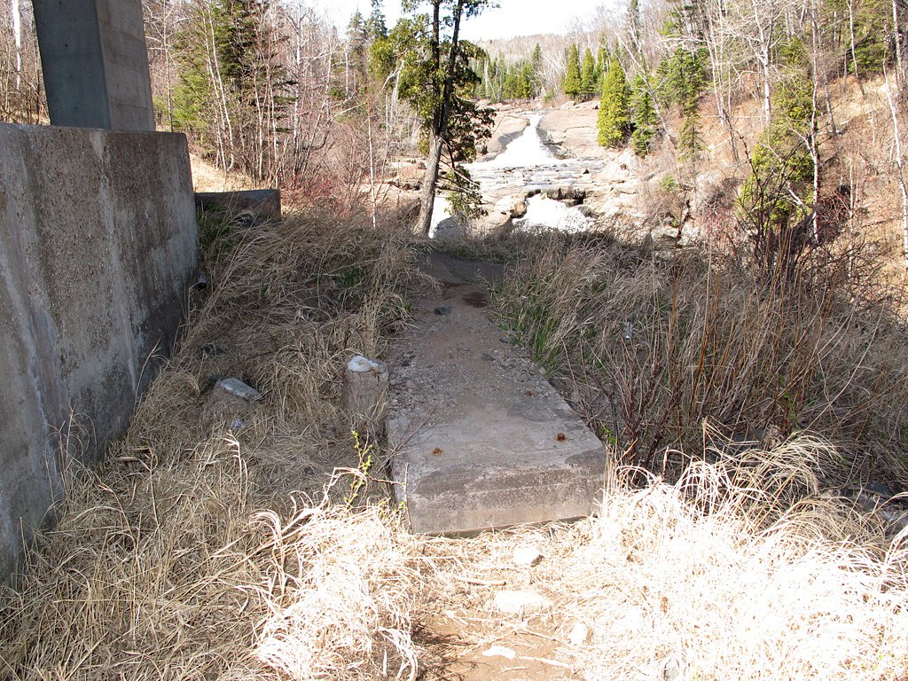
The easy 0.6-mile out-and-back trail gains 100 feet of elevation on the way to the falls.
Trail Description
Distance: 0.6 miles round-trip (out-and-back). Elevation gain: ~100 feet. Difficulty: Easy. Trail type: Out-and-back. Though the falls are clearly visible from Highway 61, the short path from the roadside parking area provides closer viewpoints. This route functions more as a brief roadside footpath and informal access rather than a developed U.S. Forest Service trail with an assigned trail number; expect a simple, unmarked route from the pullout to the viewing spots.
What to Expect
Dogs are welcome.
Accessibility
The trail is short and relatively flat, but the surface may be uneven. Contact the managing agency for accessibility details.
Frequently Asked Questions
🐶 Are Dogs Allowed at Beaver River Falls?
✅ Dogs are allowed
Are There Any Fees or Permits Required?
🆖 No fees required
🏊 Is There Swimming at Beaver River Falls?
❌ Swimming is not allowed
When to Visit
Spring and early summer are the best times to visit due to higher water flow, but the falls are accessible and scenic year-round.
Seasonal Access
The best time to visit is Spring, Summer, Fall, and Winter.
Safety Information
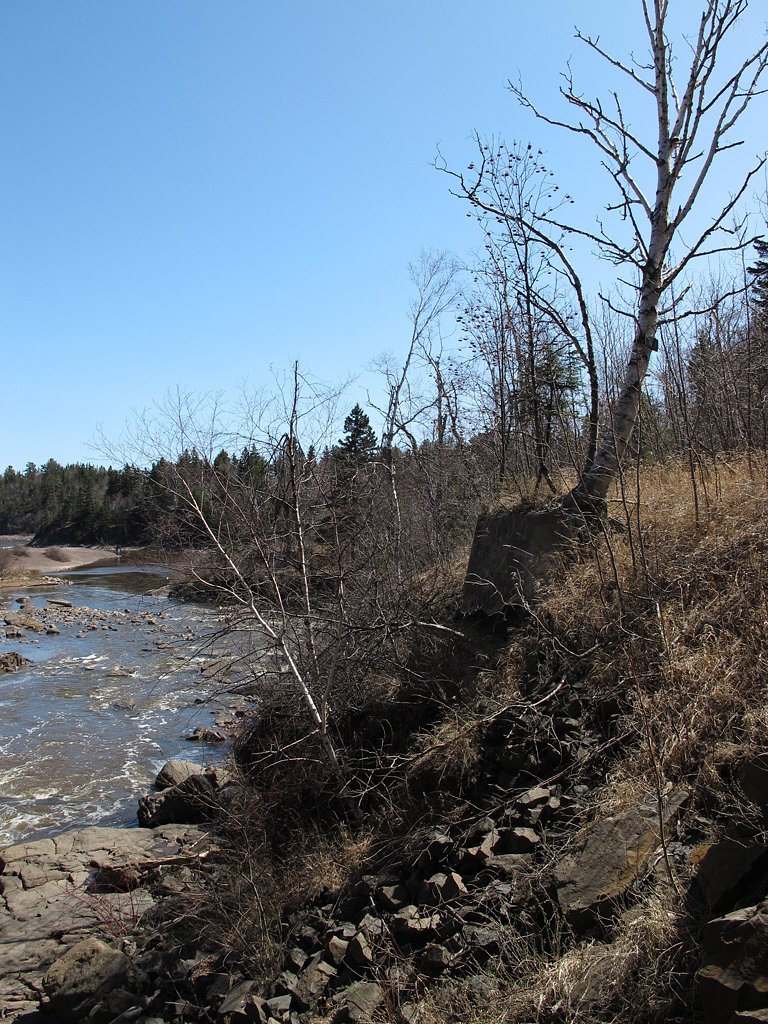
Be cautious near the riverbank as rocks can be slippery. Avoid getting too close to the edge, especially during high water flow.
Know when to go.
Get a free email alert when waterfalls near Beaver Bay hit peak flow. We only send when conditions are worth the trip — no weekly newsletters, no spam.
Weather Forecast
Location & Access
Getting There
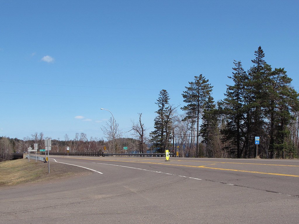
Beaver River Falls is located just off Highway 61 in Beaver Bay, Minnesota. The falls are visible from the bridge crossing the Beaver River.
Get Directions on Google MapsParking
There is a small parking area near the bridge on Highway 61 where visitors can stop to view the falls.
Elevation
781 feet above sea level
Coordinates
47.265200° N, -91.297666° W
Visitor Tips & Gear
Visit during spring or after rainfall for the most impressive water flow. Be cautious near the riverbank as rocks may be slippery.
As an Amazon Associate, we earn from qualifying purchases.
For this easy 0.6 miles trail, lightweight trail shoes and a water bottle are usually sufficient. Icy conditions are common in winter — traction cleats are a smart addition.

Columbia Watertight II Rain Jacket
Packs into its own pocket, seam-sealed, and keeps you dry from spray and surprise rain.

Polarized Sunglasses (Knockaround)
Cuts glare off the water so you actually see the falls — and your photos turn out better too.

Earth Pak Waterproof Dry Bag
Keeps your phone and gear dry when waterfall mist soaks everything else.

Waterproof Phone Pouch (AiRunTech)
Cheap insurance — take photos right next to the falls without killing your phone.

Kahtoola MICROspikes
Cult-favorite traction cleats that grip ice and wet rock — essential for winter waterfall hikes.

JOBY GorillaPod Starter Kit
Wraps around railings and rocks for long-exposure waterfall shots — no flat surface needed.
Where to Stay

Cove Point Lodge

Gooseberry Trailside Suites by Heirloom Boutique Collection

North Shore A-Frame Sauna, Firepit, 10 min Lutsen

Grand Superior Lodge
Browse vacation cabins and private rentals nearby
Unique outdoor stays — tents, yurts, and treehouses
Rent a campervan or RV for your waterfall road trip
Some links are affiliate links. We may earn a commission at no extra cost to you.
Nearby Campground
Ninemile Lake Campground
24.1 miles away · 28 sites
Overview Ninemile Lake Campground is perfect for people wanting to do some exploring while camping. A boat ramp leads to Ninemile Lake, complete with islands and hidden bays. For birders and hikers, there is a trail through boreal hardwoods, beginning across the road from the campground entrance, with 0.5 miles of maintained hiking trail. North of the campground, on County 7, is access to Echo Lake, a portage access to Goldeneye Lake. Recreation Ninemile Lake is close to 300 acres in size. It is
Book on Recreation.govAdditional Information
Nearby Attractions
Split Rock Lighthouse State Park, Gooseberry Falls State Park, Tettegouche State Park.
Wildlife
The area around the falls may feature common North Shore wildlife such as birds, deer, and small mammals.
Cities near Beaver River Falls
Nearby Waterfalls

Writing about Beaver River Falls? Embed this waterfall on your site for free.