
Difficulty
Moderate
Trail Length
2.4 miles
Trail Type
Out And Back
Elevation Gain
350 ft
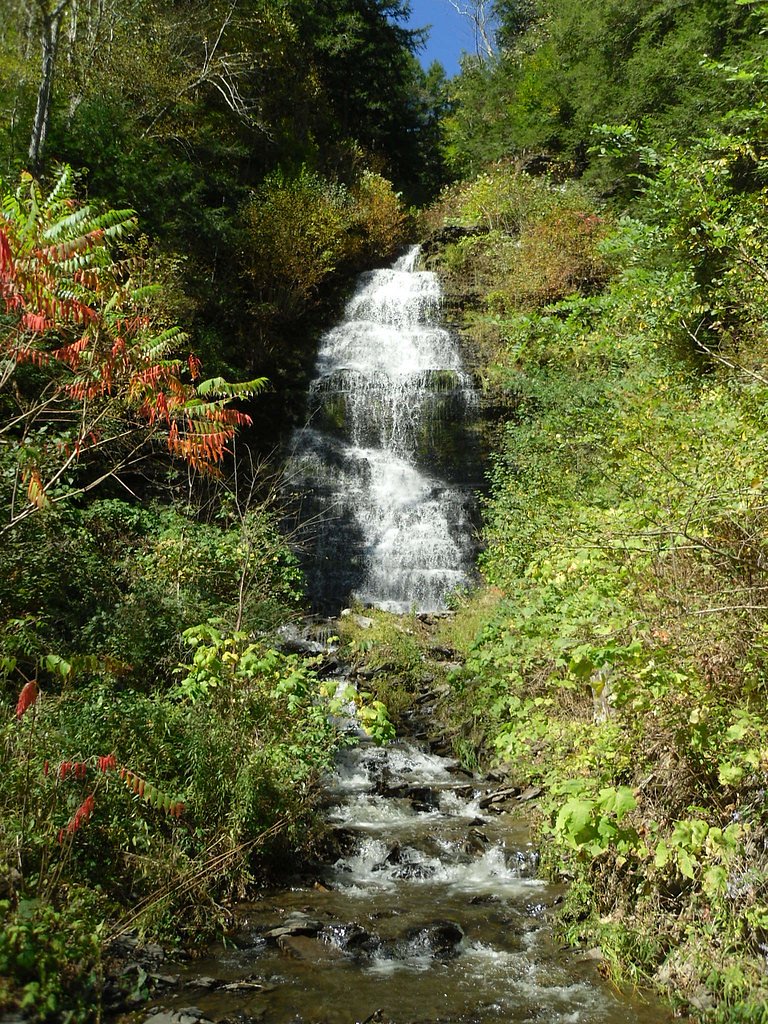
About Bakers Falls
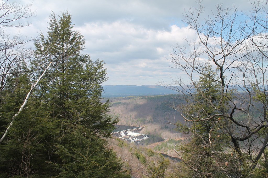
Bakers Falls is a compact, scenic cascade on the Hudson River tucked into the Village of Hudson Falls in Washington County, New York. Located right in the village, the falls are framed by riverside trees and nearby streets, making them an easy-access destination that draws photographers and locals alike. The drop provides classic Hudson River views that are especially striking during spring runoff and autumn color, offering the feel of a short urban-natural escape rather than a backcountry trek. Reaching the falls works well as a half-day outing: the commonly used route is a moderate out-and-back of about 2.4 miles round trip with roughly 350 feet of elevation gain, so most hikers comfortable with a bit of climb will find it accessible. Because the site sits on village-managed land rather than in a national forest, there is no USFS trail number; Bakers Falls pairs nicely with a stroll through nearby historic areas and riverfront viewpoints for a compact hike-and-photo loop.
The Setting
Bakers Falls sits at 207 feet along the Hudson River, in the coastal lowlands of New York.
Trail & Hike Details
The Approach
The moderate 2.4-mile out-and-back trail gains 350 feet of elevation on the way to the falls.
Trail Description
Trail type: out-and-back. Distance: 2.4 miles (round trip). Elevation gain: approximately 350 feet. Difficulty: moderate. Surface/grade/class: no USFS surface, grade, or classification data available — the falls are accessed via village land in Hudson Falls rather than a Forest Service trail system. Common use: short village-access hike for viewing the falls and combining with nearby riverfront walks and historic-district strolls.
What to Expect
Visitors can expect a scenic view of cascading waterfalls surrounded by natural beauty. The area may be quiet and peaceful, but it is not a heavily developed tourist site.
Accessibility
The trail is not wheelchair accessible. Uneven terrain and elevation changes require steady footing.
Frequently Asked Questions
🐶 Are Dogs Allowed at Bakers Falls?
❌ Dogs are not allowed
Are There Any Fees or Permits Required?
🆖 No fees required
🏊 Is There Swimming at Bakers Falls?
❌ Swimming is not allowed
When to Visit
Spring and early summer are ideal times to visit, as the water flow is typically stronger due to snowmelt and rainfall.
Seasonal Access
The best time to visit is Spring, Summer, and Fall. Winter access may be limited.
Safety Information
Exercise caution near the water, as the rocks can be slippery, and the currents may be strong. Avoid visiting during heavy rain or icy conditions.
Current Water Conditions
2,920 ft³/s
Current discharge — how much water is flowing
About average for this time of year
Based on 49 years of record
21.12 ft
Water depth at gauge
7-Day Discharge Trend
What does this mean for your visit?
Flow is about average for this time of year.
About This Gauge
7-Day Flow Outlook
Based on the USGS gauge HUDSON RIVER AT FORT EDWARD NY (3 km away).
Today
Moderate
3329 cfs
6/10Tomorrow
Moderate
3453 cfs
6/10Thu
Moderate
3297 cfs
8/10Fri
Moderate
2901 cfs
8/10Sat
Moderate
3134 cfs
6/10Sun
Moderate
3625 cfs
6/10Mon
Moderate
3659 cfs
6/10Best window: Thu — moderate flow, sunny (trip score 8/10).
Best time of year: this gauge typically runs highest from late March to mid May, peaking in April.
How we calculate this
This is a transparent outlook, not a precise forecast. We take the waterfall's current flow strength (how it ranks against its historical normal for today, from the nearest USGS stream gauge), carry that ranking forward along the gauge's seasonal curve, and nudge it for forecast rain. Confidence is highest for the next day or two and falls further out. Always check official conditions and your own judgment before visiting — high flows can be dangerous.
Know when to go.
Get a free email alert when waterfalls near Hudson Falls hit peak flow. We only send when conditions are worth the trip — no weekly newsletters, no spam.
Weather Forecast
Location & Access
Getting There
Bakers Falls is located in Hudson Falls, New York, near the Feeder Canal Heritage Trail. It is accessible via local roads, and the falls are visible from nearby areas.
Get Directions on Google MapsParking
There is limited parking available near the falls, typically along nearby streets or designated areas near the Feeder Canal Trail.
Elevation
207 feet above sea level
Coordinates
43.297295° N, -73.590949° W
Visitor Tips & Gear
Wear sturdy shoes if exploring the area near the falls, as the terrain may be uneven. Bring a camera to capture the scenic views.
As an Amazon Associate, we earn from qualifying purchases.
With 2.4 miles and 350 ft of elevation gain, sturdy boots and trekking poles will help on this moderate trail. Sun exposure on the trail makes good sun protection a must in summer.

Polarized Sunglasses (Knockaround)
Cuts glare off the water so you actually see the falls — and your photos turn out better too.

Columbia Watertight II Rain Jacket
Packs into its own pocket, seam-sealed, and keeps you dry from spray and surprise rain.

Earth Pak Waterproof Dry Bag
Keeps your phone and gear dry when waterfall mist soaks everything else.

Waterproof Phone Pouch (AiRunTech)
Cheap insurance — take photos right next to the falls without killing your phone.

Timberland Euro Sprint Mid Waterproof
Trusted waterproof boot with premium leather and grippy rubber sole — reliable on rocky, wet trails.

TrailBuddy Trekking Poles
Lightweight aluminum, cork grips, and flip-locks that actually hold — a best-seller for good reason.
Where to Stay

Country Inn & Suites by Radisson, Queensbury - Lake George , NY

Landmark Motor Inn

Depe Dene Lakeside Resort

Adirondack Waterfront Cabin Upper Hudson Tributary
Browse vacation cabins and private rentals nearby
Unique outdoor stays — tents, yurts, and treehouses
Rent a campervan or RV for your waterfall road trip
Some links are affiliate links. We may earn a commission at no extra cost to you.
Nearby Hot Springs
Hot springs near Hudson Falls, New York
Looking for a soak after your hike? Explore more hot springs near Hudson Falls, New York on SoakingSprings.
Explore New York springsAdditional Information
Nearby Attractions
The Feeder Canal Heritage Trail and other scenic spots along the Hudson River are nearby.
Wildlife
Visitors may encounter birds, small mammals, and other typical wildlife of the region.
Cities near Bakers Falls
Nearby Waterfalls
Writing about Bakers Falls? Embed this waterfall on your site for free.