Photo Credits (4)
Difficulty
Moderate
Trail Length
2.4 miles
Trail Type
Out And Back
Elevation Gain
350 ft
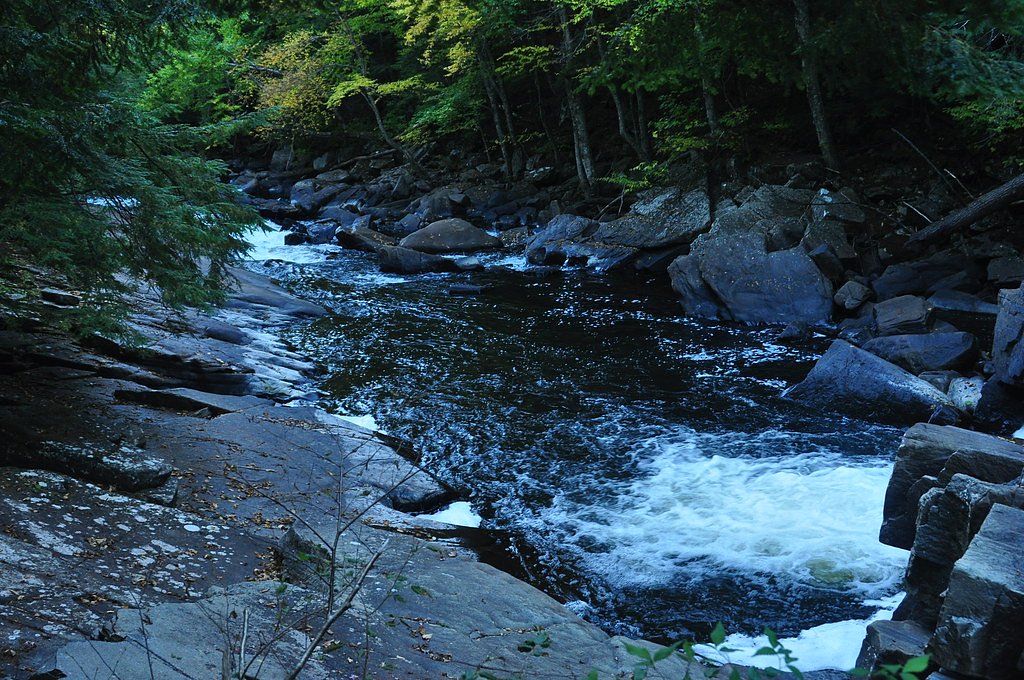
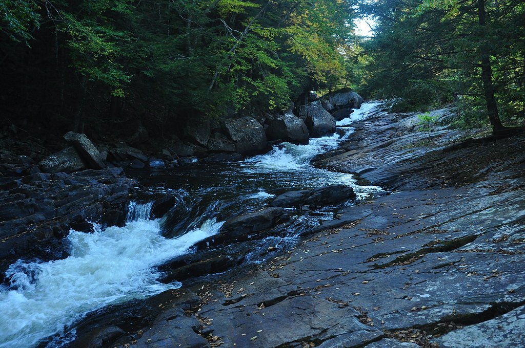
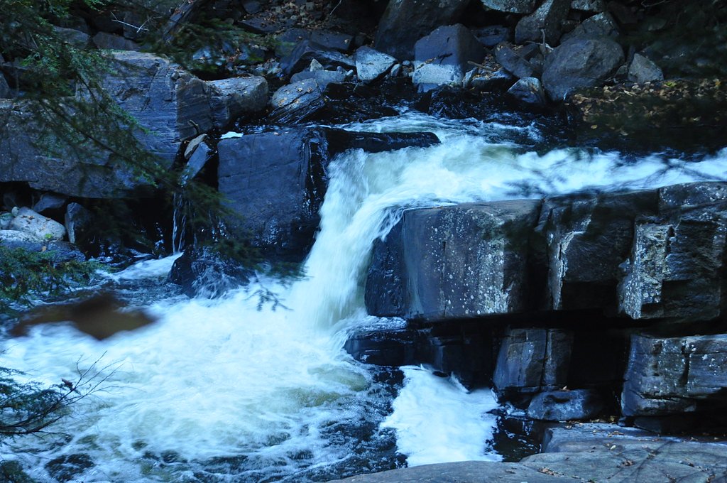
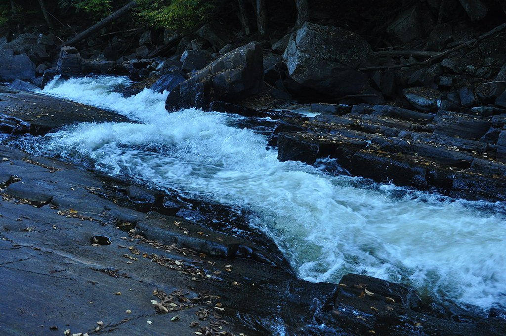
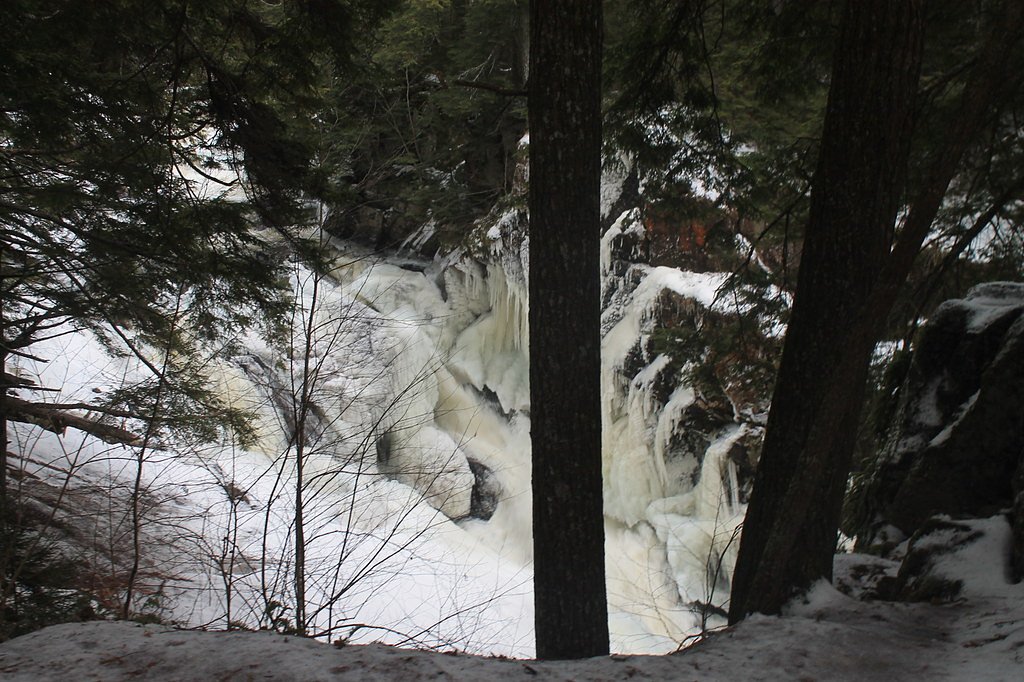
About Austin Falls
Austin Falls is a scenic waterfall in New York’s Adirondack region where water tumbles over rocky ledges, making it a favorite stop for photographers and hikers seeking a compact, scenic cascade. Framed by mixed forest, the falls offer a peaceful spot to enjoy the sound of falling water without a long backcountry commitment. The access route lies within the IP Easement A - Speculator Tree Farm and is managed by SDC, so visitors should be respectful of the easement lands. The most common approach is a 2.4-mile out-and-back trail that climbs about 350 feet and is rated moderate; expect a short, concentrated effort to reach the viewing area. Short sections near the falls can be uneven or muddy after rain, so sturdy footwear and basic trail caution are recommended.
The Setting
Austin Falls sits at 1,519 feet within IP Easement A - Speculator Tree Farm, fed by the Sacandaga River, in the hills of New York.
Trail & Hike Details
The Approach
The moderate 2.4-mile out-and-back trail gains 350 feet of elevation on the way to the falls.
Trail Description
Trail type: out-and-back. Length: 2.4 miles round trip. Elevation gain: approximately 350 feet. Difficulty: moderate. Official USFS trail name/number and detailed USFS surface/grade/class data are not provided for this route; the approach is an unpaved footpath with brief uneven or muddy sections, especially after wet weather. Hikers should plan for moderate grades on the climb and bring appropriate footwear and water.
What to Expect
Dogs are welcome.
Accessibility
The trail is not wheelchair accessible. Uneven terrain and elevation changes require steady footing.
Frequently Asked Questions
🐶 Are Dogs Allowed at Austin Falls?
✅ Dogs are allowed
Are There Any Fees or Permits Required?
🆖 No fees required
🏊 Is There Swimming at Austin Falls?
❌ Swimming is not allowed
When to Visit
Spring and early summer are ideal times to visit, as the water flow is typically strongest during these seasons. Fall offers beautiful foliage, adding to the scenic appeal.
Seasonal Access
The best time to visit is Spring, Summer, and Fall. Winter access may be limited.
Safety Information
Exercise caution around the falls, as rocks can be slippery and the water current may be strong. Avoid visiting during heavy rain or icy conditions.
Current Water Conditions
280 ft³/s
Current discharge — how much water is flowing
About average for this time of year
Based on 114 years of record
2.01 ft
Water depth at gauge
7-Day Discharge Trend
What does this mean for your visit?
Flow is about average for this time of year.
About This Gauge
This gauge is on a nearby waterway and may not reflect exact conditions at the falls.
7-Day Flow Outlook
Based on the USGS gauge SACANDAGA RIVER NEAR HOPE NY (16 km away).
Today
Low
300 cfs
6/10Tomorrow
Low
297 cfs
6/10Tue
Moderate
361 cfs
4/10Wed
Moderate
342 cfs
4/10Thu
Low
329 cfs
6/10Fri
Moderate
312 cfs
4/10Sat
Moderate
353 cfs
4/10Best window: Today — low flow, mostly sunny (trip score 6/10).
Best time of year: this gauge typically runs highest from mid March to late May, peaking in April.
How we calculate this
This is a transparent outlook, not a precise forecast. We take the waterfall's current flow strength (how it ranks against its historical normal for today, from the nearest USGS stream gauge), carry that ranking forward along the gauge's seasonal curve, and nudge it for forecast rain. Confidence is highest for the next day or two and falls further out. Always check official conditions and your own judgment before visiting — high flows can be dangerous.
Know when to go.
Get a free email alert when waterfalls near Speculator hit peak flow. We only send when conditions are worth the trip — no weekly newsletters, no spam.
Weather Forecast
Location & Access
Getting There
Austin Falls is located off Route 30 near the town of Wells, New York. The falls can be accessed via a short walk from the roadside.
Get Directions on Google MapsParking
There is limited roadside parking available near the falls. Visitors should ensure their vehicles are parked safely and not obstructing traffic.
Elevation
1,519 feet above sea level
Coordinates
43.501455° N, -74.279306° W
Land Management
Managed by SDC
Visitor Tips & Gear
Wear sturdy shoes as the area around the falls can be slippery. Visit during the spring or after rainfall for the most impressive water flow. Be cautious of wet rocks and swift currents near the falls.
As an Amazon Associate, we earn from qualifying purchases.
With 2.4 miles and 350 ft of elevation gain, sturdy boots and trekking poles will help on this moderate trail. Sun exposure on the trail makes good sun protection a must in summer.

Polarized Sunglasses (Knockaround)
Cuts glare off the water so you actually see the falls — and your photos turn out better too.

Columbia Watertight II Rain Jacket
Packs into its own pocket, seam-sealed, and keeps you dry from spray and surprise rain.

Earth Pak Waterproof Dry Bag
Keeps your phone and gear dry when waterfall mist soaks everything else.

Waterproof Phone Pouch (AiRunTech)
Cheap insurance — take photos right next to the falls without killing your phone.

Timberland Euro Sprint Mid Waterproof
Trusted waterproof boot with premium leather and grippy rubber sole — reliable on rocky, wet trails.

TrailBuddy Trekking Poles
Lightweight aluminum, cork grips, and flip-locks that actually hold — a best-seller for good reason.
Where to Stay

Adirondack Waterfront Cabin Upper Hudson Tributary

The Alpine Lodge

Motel Luzerne

The Elms Waterfront Cottages
Browse vacation cabins and private rentals nearby
Unique outdoor stays — tents, yurts, and treehouses
Rent a campervan or RV for your waterfall road trip
Some links are affiliate links. We may earn a commission at no extra cost to you.
Additional Information
Nearby Attractions
Nearby attractions include the town of Wells, other waterfalls in the Adirondacks, and hiking trails in the surrounding area.
Wildlife
The area is home to various wildlife, including birds, deer, and small mammals. Visitors may also encounter insects such as mosquitoes and black flies, especially in warmer months.
Cities near Austin Falls
Nearby Waterfalls
Writing about Austin Falls? Embed this waterfall on your site for free.