Photo Credits (5)
Difficulty
Moderate
Trail Length
2.4 miles
Trail Type
Out And Back
Elevation Gain
350 ft
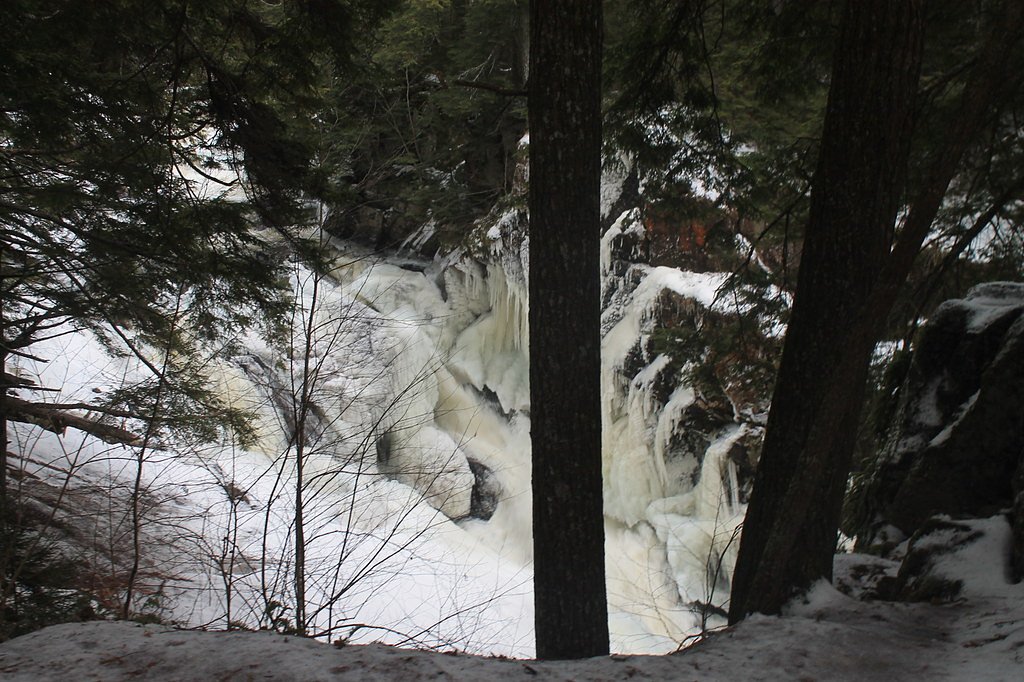
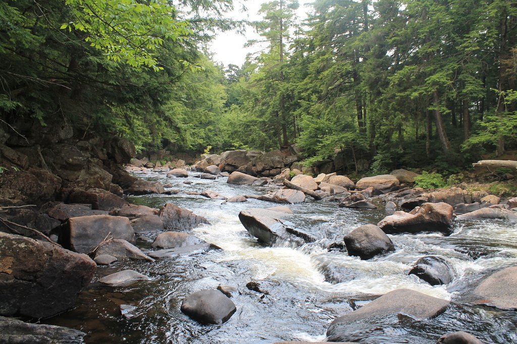
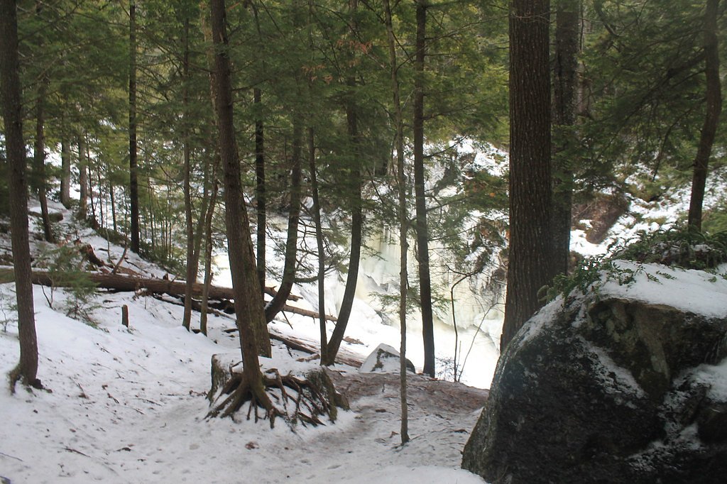
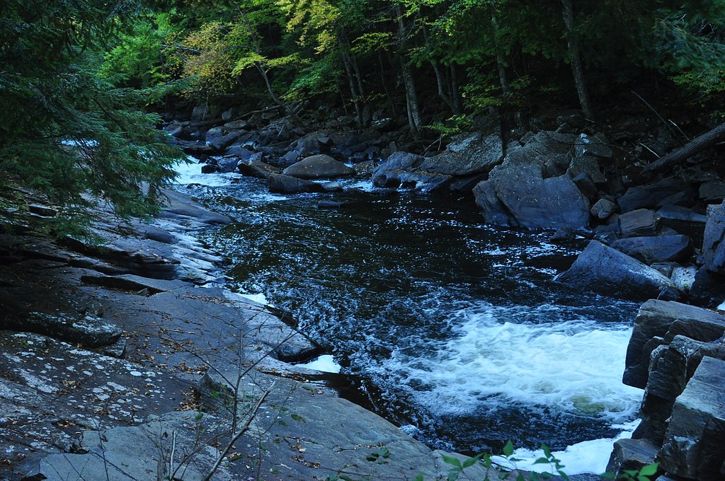
About Auger Falls
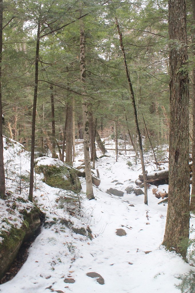
Auger Falls is a picturesque series of cascades on the Sacandaga River tucked into the Adirondack Mountains. The falls sit within the Siamese Ponds Wilderness (land unit designation: SW) and are managed and owned by SDC, so visiting feels like stepping into a quiet, protected patch of northern hardwood forest. Towering trees and mossy ledges frame several drop points, offering a variety of vantage points for photographers and anyone craving an easy taste of Adirondack river scenery. The site is popular with day hikers and nature lovers seeking a relatively short outing into wilderness surroundings without committing to a long trek. Because the falls are inside the Siamese Ponds Wilderness, expect a peaceful, undeveloped setting that rewards visitors with seasonal flow and recreational solitude rather than developed facilities.
The Setting
Auger Falls sits at 1,273 feet within Siamese Ponds Wilderness, fed by the Sacandaga River, in the foothills of New York.
Trail & Hike Details
The Approach
The moderate 2.4-mile out-and-back trail gains 350 feet of elevation on the way to the falls.
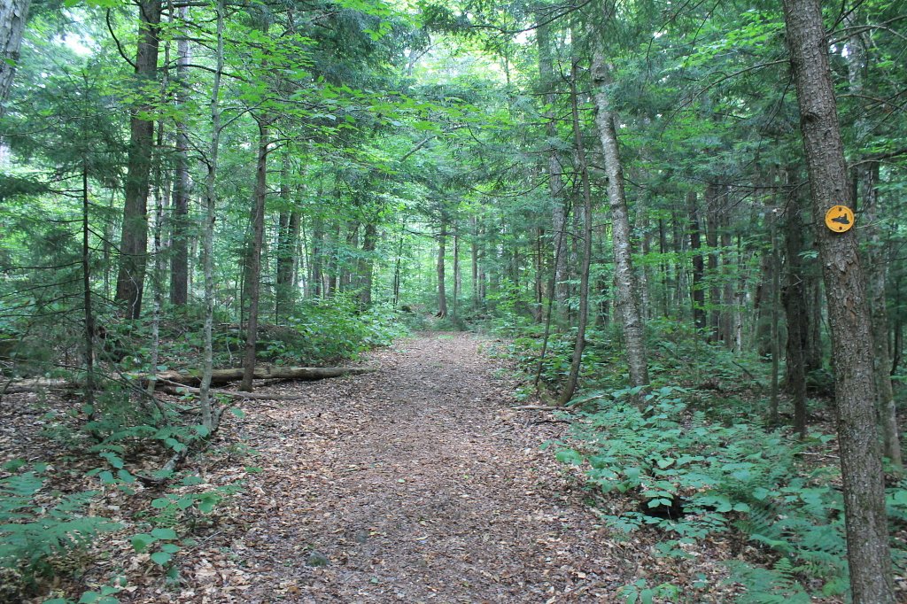
Trail Description
The trail to Auger Falls is an out-and-back route of about 2.4 miles round trip with roughly 350 feet of elevation gain and is rated moderate. The path threads through mixed hardwood forest, generally following the Sacandaga River toward a designated viewing area at the cascades. The route is well-marked and suitable for hikers comfortable with moderate grades and uneven wooded footing; plan for a steady but not overly steep climb on the return.
What to Expect
Dogs are welcome.
Accessibility
The trail is not wheelchair accessible. Uneven terrain and elevation changes require steady footing.
Frequently Asked Questions
🐶 Are Dogs Allowed at Auger Falls?
✅ Dogs are allowed
Are There Any Fees or Permits Required?
🆖 No fees required
🏊 Is There Swimming at Auger Falls?
❌ Swimming is not allowed
When to Visit
Spring and early summer are ideal for visiting Auger Falls, as the water flow is typically strongest during these seasons. Fall offers beautiful foliage, while winter provides a unique view of the frozen cascades.
Seasonal Access
The best time to visit is Spring, Summer, and Fall. Winter access may be limited.
Safety Information
Exercise caution near the water, as the rocks can be slippery and the currents strong. Be prepared for muddy or wet conditions on the trail, especially after rain.
Current Water Conditions
239 ft³/s
Current discharge — how much water is flowing
About average for this time of year
Based on 114 years of record
1.92 ft
Water depth at gauge
7-Day Discharge Trend
What does this mean for your visit?
Flow is about average for this time of year.
About This Gauge
This gauge is on a nearby waterway and may not reflect exact conditions at the falls.
7-Day Flow Outlook
Based on the USGS gauge SACANDAGA RIVER NEAR HOPE NY (13 km away).
Today
Low
277 cfs
3/10Tomorrow
Low
262 cfs
3/10Thu
Low
252 cfs
6/10Fri
Low
240 cfs
3/10Sat
Low
271 cfs
3/10Sun
Low
245 cfs
3/10Mon
Low
254 cfs
3/10Best window: Thu — low flow, sunny (trip score 6/10).
Best time of year: this gauge typically runs highest from mid March to late May, peaking in April.
How we calculate this
This is a transparent outlook, not a precise forecast. We take the waterfall's current flow strength (how it ranks against its historical normal for today, from the nearest USGS stream gauge), carry that ranking forward along the gauge's seasonal curve, and nudge it for forecast rain. Confidence is highest for the next day or two and falls further out. Always check official conditions and your own judgment before visiting — high flows can be dangerous.
Know when to go.
Get a free email alert when waterfalls near Speculator hit peak flow. We only send when conditions are worth the trip — no weekly newsletters, no spam.
Weather Forecast
Location & Access
Getting There
Auger Falls is located off Route 30 near Wells, New York. The trailhead is accessible via a small parking area along the road. Look for signs indicating the trailhead.
Get Directions on Google MapsParking
There is a small parking area near the trailhead, but it may fill up quickly during peak seasons.
Elevation
1,273 feet above sea level
Coordinates
43.467289° N, -74.246526° W
Land Management
Managed by SDC
Visitor Tips & Gear
Arrive early during weekends or peak seasons to secure parking. Wear sturdy shoes as the trail may be muddy or slippery, especially after rain. Bring insect repellent during warmer months.
As an Amazon Associate, we earn from qualifying purchases.
With 2.4 miles and 350 ft of elevation gain, sturdy boots and trekking poles will help on this moderate trail. Sun exposure on the trail makes good sun protection a must in summer.

Polarized Sunglasses (Knockaround)
Cuts glare off the water so you actually see the falls — and your photos turn out better too.

Columbia Watertight II Rain Jacket
Packs into its own pocket, seam-sealed, and keeps you dry from spray and surprise rain.

Earth Pak Waterproof Dry Bag
Keeps your phone and gear dry when waterfall mist soaks everything else.

Waterproof Phone Pouch (AiRunTech)
Cheap insurance — take photos right next to the falls without killing your phone.

Timberland Euro Sprint Mid Waterproof
Trusted waterproof boot with premium leather and grippy rubber sole — reliable on rocky, wet trails.

TrailBuddy Trekking Poles
Lightweight aluminum, cork grips, and flip-locks that actually hold — a best-seller for good reason.
Where to Stay

Rustic North Creek Getaway ~ 4 Mi to Gore Mtn!

Adirondack Waterfront Cabin Upper Hudson Tributary

River House

North Creek Chalet w/ Fire Pit Near Gore Mountain!
Browse vacation cabins and private rentals nearby
Unique outdoor stays — tents, yurts, and treehouses
Rent a campervan or RV for your waterfall road trip
Some links are affiliate links. We may earn a commission at no extra cost to you.
Additional Information
Nearby Attractions
Nearby attractions include the town of Wells, NY, and other hiking trails in the Adirondack Park.
Wildlife
The area is home to various wildlife, including birds, deer, and small mammals. Be cautious of ticks during warmer months.
Cities near Auger Falls
Nearby Waterfalls
Other waterfalls named Auger Falls
1 other waterfall shares this name across the U.S.
Writing about Auger Falls? Embed this waterfall on your site for free.