Amicalola Falls
Georgia • 729 ft
By Armen Suny · Last verified Mar 2026
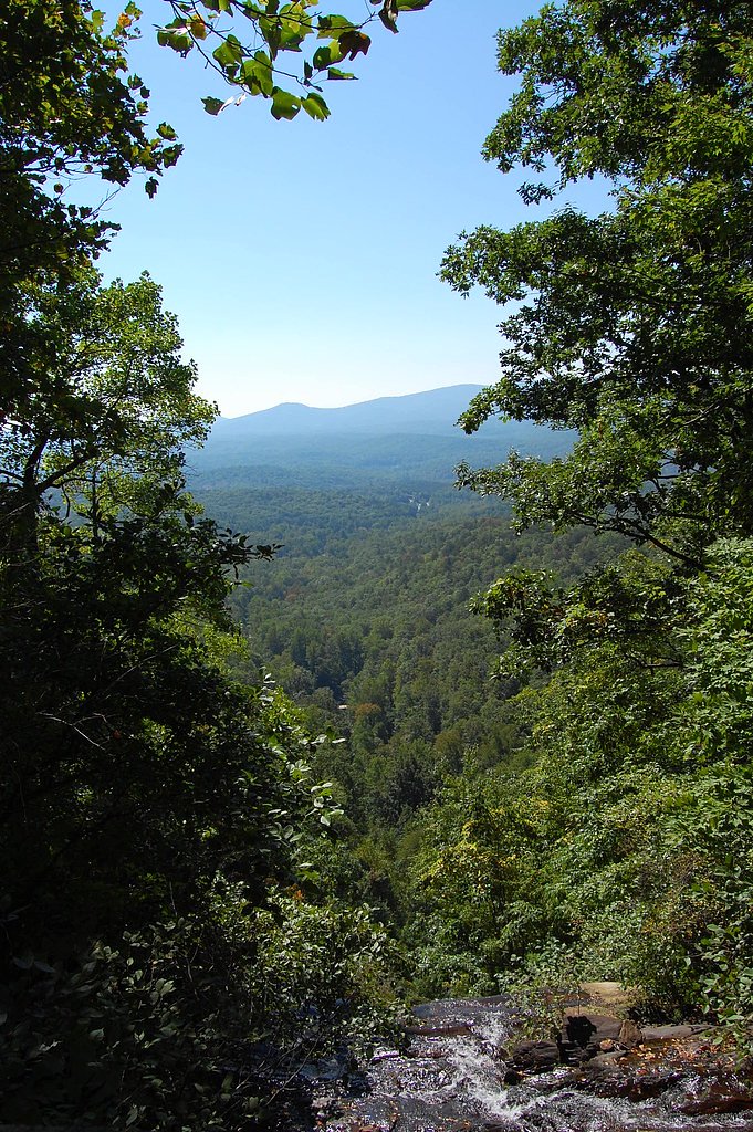
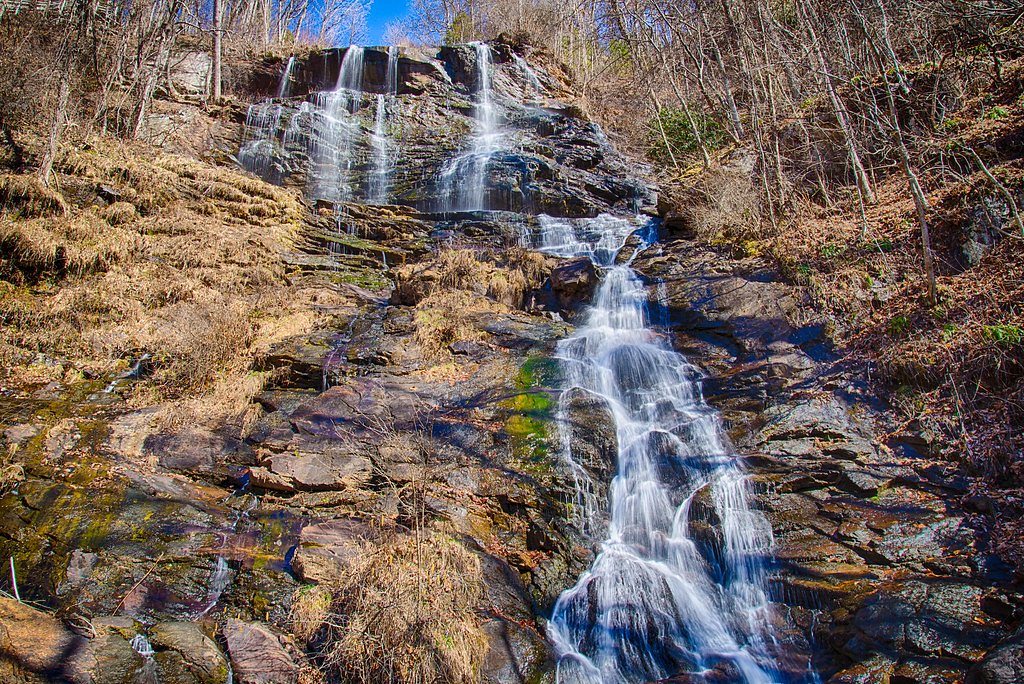
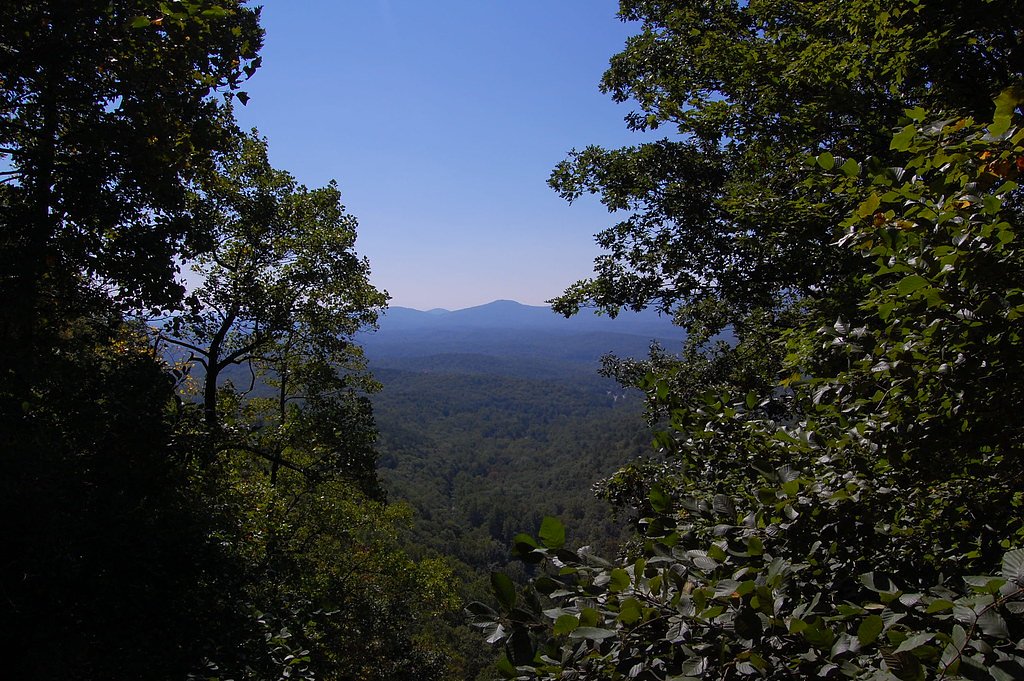
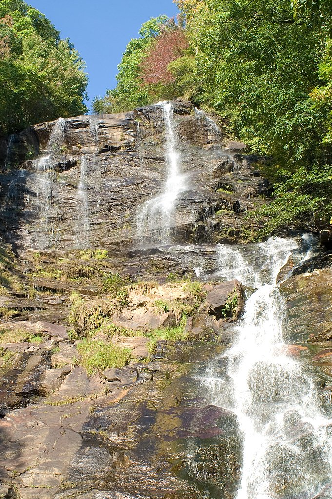

Photo Credits (5)
Difficulty
Moderate
Trail Length
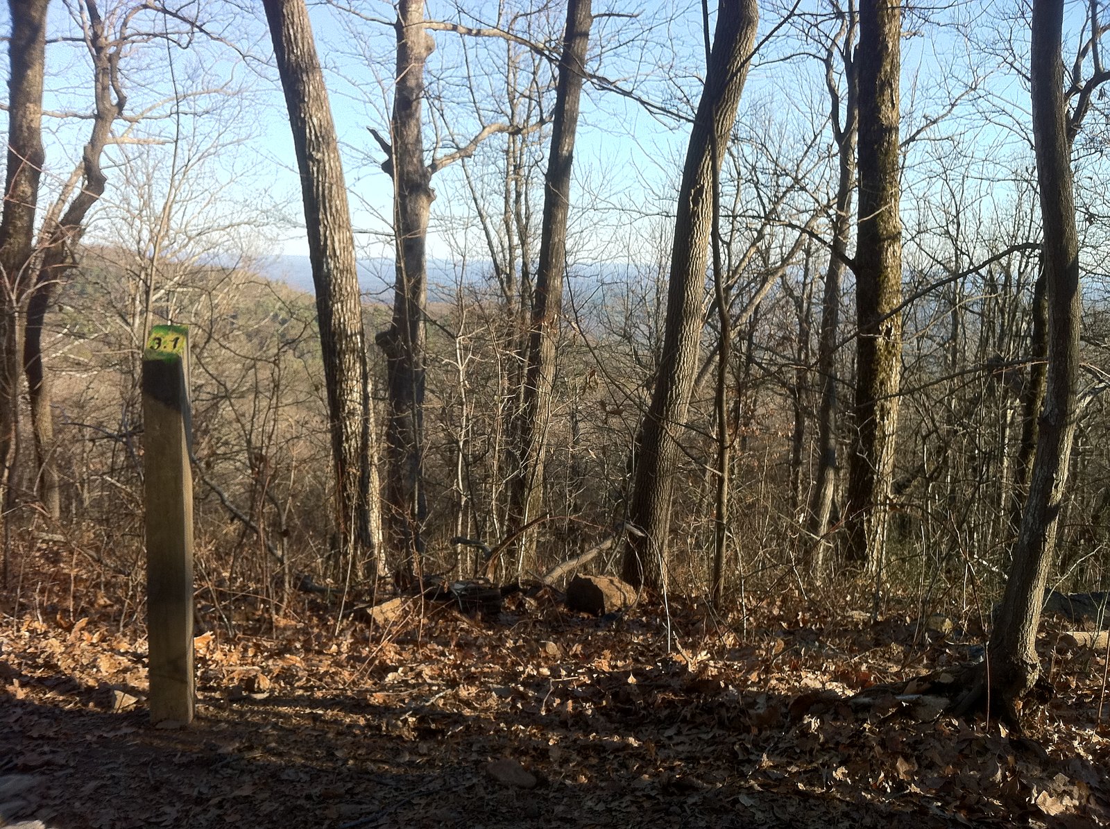
2.1 miles
Trail Type
Out And Back
Elevation Gain
600 ft
About Amicalola Falls
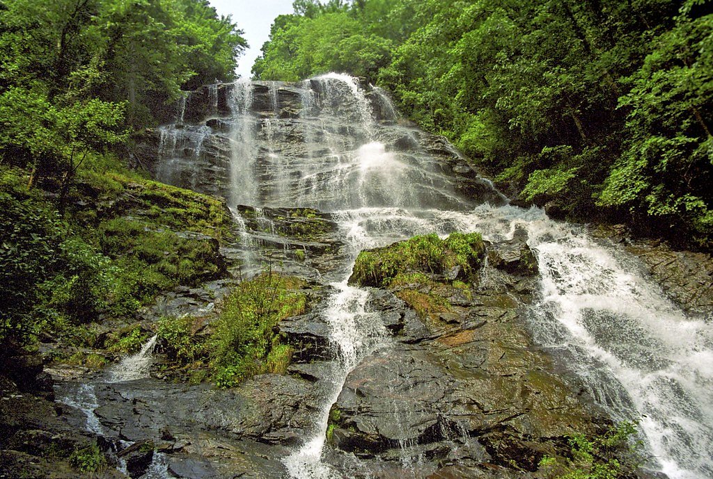
Amicalola Falls is a stunning 729-foot waterfall located in Amicalola Falls State Park in Georgia. It is the tallest waterfall in Georgia and one of the most popular natural attractions in the state. The name 'Amicalola' is derived from a Cherokee word meaning 'tumbling waters.'
The Setting
Amicalola Falls sits at 2,487 feet within Amicalola Falls State Park, fed by the Amicalola Creek, in the hills of Georgia. At 729 feet, it is among the taller waterfalls in Georgia.
Height: 729 feet
Trail & Hike Details
The Approach
The moderate 2.1-mile out-and-back trail gains 600 feet of elevation on the way to the falls.
Trail Description
The main trail to Amicalola Falls is a well-maintained path that includes a combination of dirt trails and staircases. Visitors can choose to hike from the base of the falls to the top, which involves climbing over 600 steps, or take shorter routes to various viewpoints. The trail offers beautiful views of the cascading waterfall and surrounding forest.
What to Expect
The falls plunge a dramatic 729 feet. Dogs are welcome.
Accessibility
The trail is not wheelchair accessible. Uneven terrain and elevation changes require steady footing.
Frequently Asked Questions
🐶 Are Dogs Allowed at Amicalola Falls?
✅ Dogs are allowed
Are There Any Fees or Permits Required?
🤑 Fee: $5.00
🏊 Is There Swimming at Amicalola Falls?
❌ Swimming is not allowed
When to Visit
Spring and fall are the best times to visit, as the waterfall is typically at its fullest in spring, and the fall foliage adds vibrant colors to the scenery.
Seasonal Access
The best time to visit is Spring, Summer, Fall, and Winter.
Safety Information
The stairs can be slippery when wet, so use caution. Stay on designated trails and avoid climbing on rocks near the waterfall. Bring plenty of water, especially during warmer months, to stay hydrated.
Current Water Conditions
81 ft³/s
Current discharge — how much water is flowing
Much lower than usual for this time of year
Based on 33 years of record
0.53 ft
Water depth at gauge
7-Day Discharge Trend
What does this mean for your visit?
Flow is well below normal for this time of year, so the waterfall may be a trickle.
About This Gauge
This gauge is on a nearby waterway and may not reflect exact conditions at the falls.
7-Day Flow Outlook
Based on the USGS gauge AMICALOLA CREEK NEAR DAWSONVILLE, GA. (16 km away).
Today
Moderate
92 cfs
4/10Tomorrow
Low
87 cfs
6/10Tue
Moderate
97 cfs
4/10Wed
Moderate
99 cfs
4/10Thu
Moderate
99 cfs
4/10Fri
Moderate
97 cfs
4/10Sat
Moderate
97 cfs
4/10Best window: Tomorrow — low flow, sunny (trip score 6/10).
Best time of year: this gauge typically runs highest from mid February to early May, peaking in February.
How we calculate this
This is a transparent outlook, not a precise forecast. We take the waterfall's current flow strength (how it ranks against its historical normal for today, from the nearest USGS stream gauge), carry that ranking forward along the gauge's seasonal curve, and nudge it for forecast rain. Confidence is highest for the next day or two and falls further out. Always check official conditions and your own judgment before visiting — high flows can be dangerous.
Know when to go.
Get a free email alert when waterfalls near Dawsonville hit peak flow. We only send when conditions are worth the trip — no weekly newsletters, no spam.
Weather Forecast
Location & Access
Getting There
Amicalola Falls is located in Amicalola Falls State Park, approximately 8 miles from Dawsonville, Georgia. The park is accessible via paved roads, and the falls can be reached by car or by hiking trails within the park.
Get Directions on Google MapsParking
Parking is available at the state park, with designated lots near the visitor center and trailheads. A parking fee is required.
Elevation
2,487 feet above sea level
Coordinates
34.563979° N, -84.239639° W
Land Management
Managed by SDNR
Visitor Tips & Gear
Arrive early to avoid crowds, especially on weekends and during peak seasons. Wear sturdy shoes for the hike, and bring water, as the climb can be strenuous. Check the weather before visiting, as trails may be slippery after rain.
As an Amazon Associate, we earn from qualifying purchases.
With 2.1 miles and 600 ft of elevation gain, sturdy boots and trekking poles will help on this moderate trail. Icy conditions are common in winter — traction cleats are a smart addition.

Columbia Watertight II Rain Jacket
Packs into its own pocket, seam-sealed, and keeps you dry from spray and surprise rain.

Polarized Sunglasses (Knockaround)
Cuts glare off the water so you actually see the falls — and your photos turn out better too.

Earth Pak Waterproof Dry Bag
Keeps your phone and gear dry when waterfall mist soaks everything else.

Waterproof Phone Pouch (AiRunTech)
Cheap insurance — take photos right next to the falls without killing your phone.

Timberland Euro Sprint Mid Waterproof
Trusted waterproof boot with premium leather and grippy rubber sole — reliable on rocky, wet trails.

TrailBuddy Trekking Poles
Lightweight aluminum, cork grips, and flip-locks that actually hold — a best-seller for good reason.
Where to Stay

Cozy Cottage in Big Canoe

Bearly Behavin

Petit Crest Villas

Quality Inn Dahlonega Near University
Browse vacation cabins and private rentals nearby
Unique outdoor stays — tents, yurts, and treehouses
Rent a campervan or RV for your waterfall road trip
Some links are affiliate links. We may earn a commission at no extra cost to you.
Nearby Campground
Toccoa River Sandy Bottoms Campground
15.4 miles away · 6 sites
Overview This small campground is located along the banks of the Toccoa River just south of Blue Ridge, GA. This recreation area is the take-out for the 13.8 mile Toccoa River Canoe Trail. The recreation area offers camping, fishing and a canoe take-out. Same day Reservations are accepted. Quiet hours 10pm to 6 am. Sandy Bottoms provides a rustic experience for the outdoor enthusiast to camp, swim, fish or just to sit back and enjoy the scenery. Recreation The Chattahoochee National Forest offer
Book on Recreation.govAdditional Information
Nearby Attractions
The Appalachian Trail approach trail begins at Amicalola Falls State Park. Other nearby attractions include the town of Dahlonega, known for its gold rush history, and the Chattahoochee National Forest.
Wildlife
Visitors may encounter deer, birds, and other native wildlife in the park. Be cautious and avoid feeding or approaching animals.
Cities near Amicalola Falls
Nearby Waterfalls
Writing about Amicalola Falls? Embed this waterfall on your site for free.