Abrams Falls
Virginia • 20 ft
By Armen Suny · Last verified May 2026
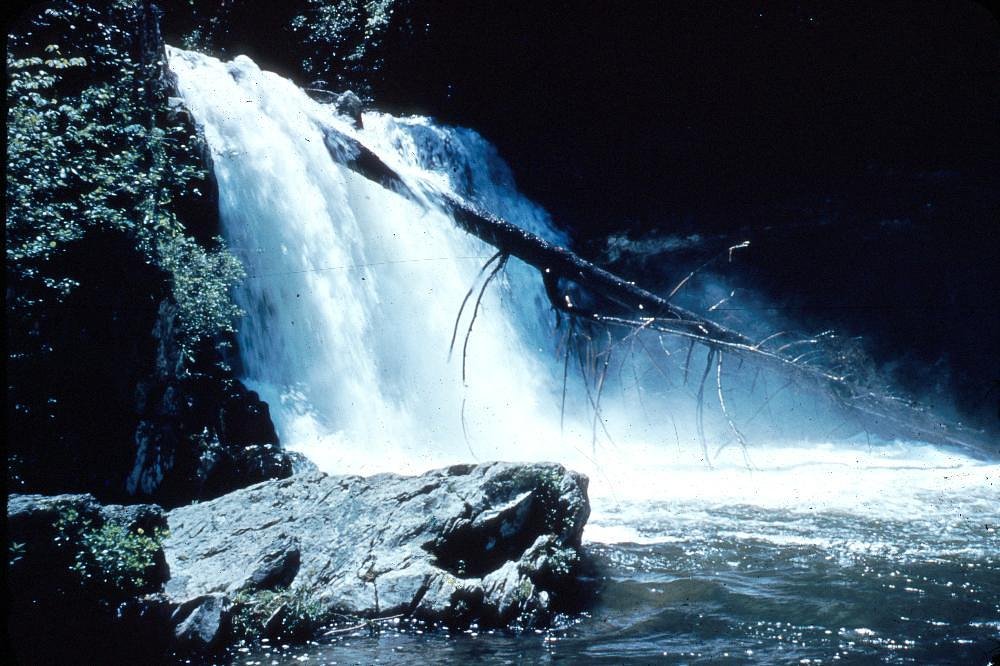
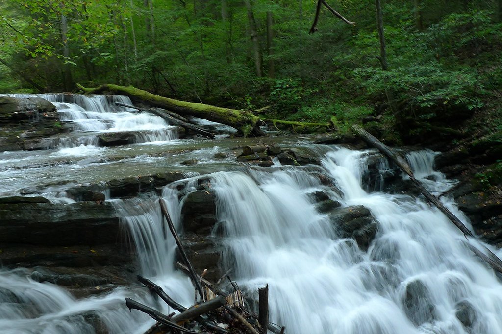
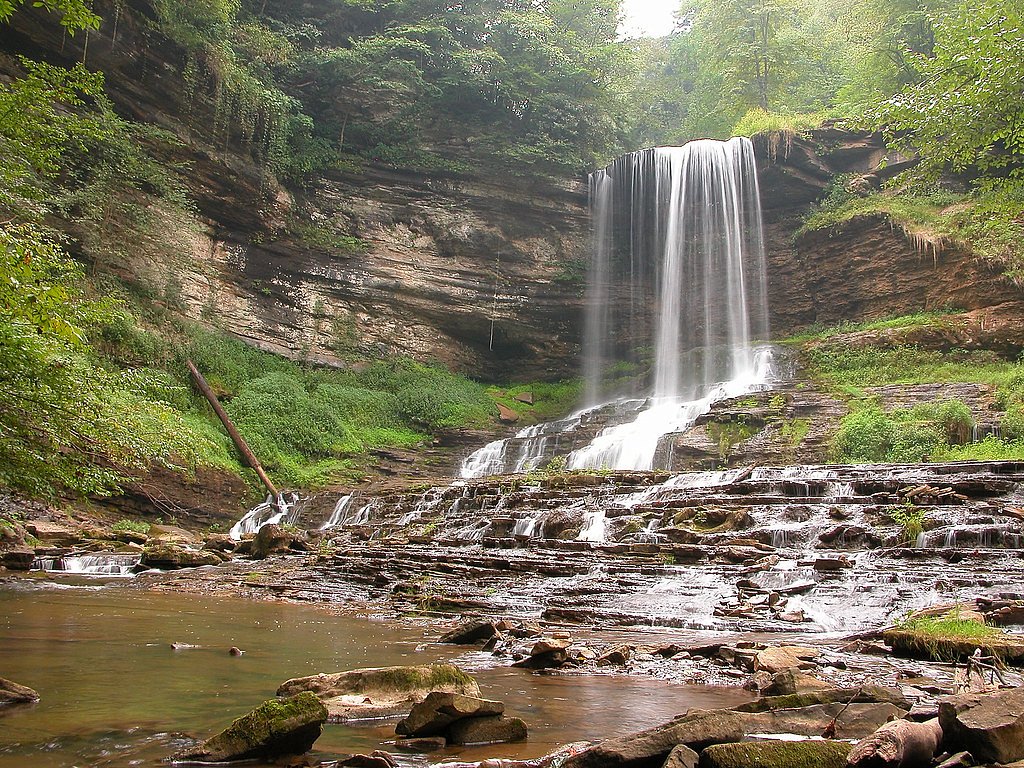
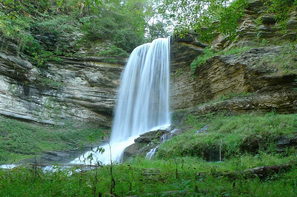
Photo Credits (5)
Difficulty
Moderate
Trail Length
5.0 miles
Trail Type
Out And Back
Elevation Gain
675 ft
About Abrams Falls
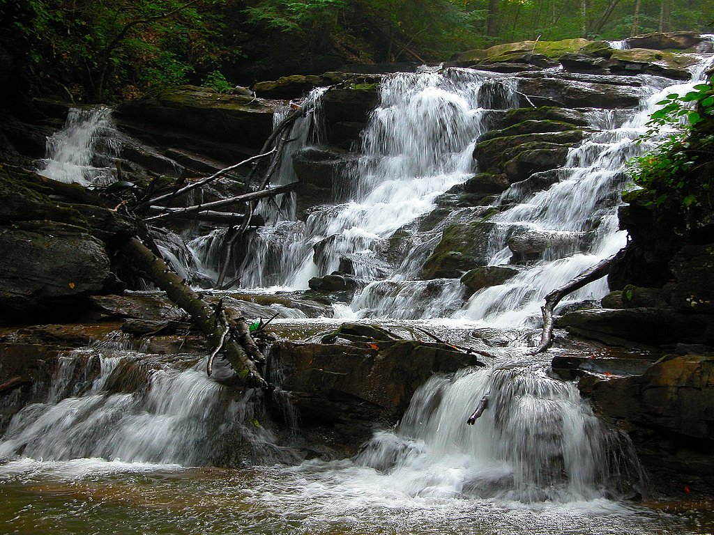
Abrams Falls is a photogenic 20-foot cascade tucked into the forested valleys of Great Smoky Mountains National Park. Fed by Abrams Creek, the waterfall plunges into a broad pool and delivers surprisingly powerful flow for its modest height, framed by rhododendron thickets and mixed hardwoods. Managed by the National Park Service, the falls feel pleasantly remote even with steady foot traffic, making them a favorite stop for families, photographers, and day hikers who want big scenery without a long trek. The hike to Abrams Falls is a satisfying, moderate outing: the Abrams Falls Trail is an out-and-back covering 5.0 miles round trip with about 675 feet of elevation gain. The route winds through classic Smokies forest and finishes at the broad plunge pool below the cascade, offering a high-reward destination well suited to half-day excursions and casual exploration.
The Setting
Abrams Falls sits at 1,650 feet along the Beaver Creek, in the hills of Virginia. The falls drop 20 feet.
Height: 20 feet
Trail & Hike Details
The Approach
The moderate 5.0-mile out-and-back trail gains 675 feet of elevation on the way to the falls.
Trail Description
Abrams Falls Trail — out-and-back, 5.0 miles round trip, ~675 ft elevation gain, difficulty: moderate. Surface is primarily singletrack on packed dirt with rocky, uneven sections and exposed roots; hikers will cross several small streams and may encounter occasional mud after rain. Grade is generally moderate with a few short, steeper pitches; overall hiking is non-technical (Class 1). The route winds through mixed hardwoods and rhododendron and terminates at the broad plunge pool below the 20-foot cascade. This is a National Park Service route (no USFS trail number applies).
What to Expect
The falls drop a gentle 20 feet.
Accessibility
The trail is not wheelchair accessible. Uneven terrain and elevation changes require steady footing.
Frequently Asked Questions
🐶 Are Dogs Allowed at Abrams Falls?
❌ Dogs are not allowed
Are There Any Fees or Permits Required?
🤑 Fee: $5.00
🏊 Is There Swimming at Abrams Falls?
❌ Swimming is not allowed
When to Visit
Spring and fall are ideal for visiting due to pleasant weather and vibrant foliage. Summer is also popular, but the trail can be crowded.
Seasonal Access
The best time to visit is Spring, Summer, and Fall. Winter access may be limited.
Safety Information
Be cautious of slippery rocks near the falls and strong currents in the water. Stay on marked trails and carry a map or GPS. Watch for wildlife and avoid feeding or approaching animals.
Current Water Conditions
15 ft³/s
Current discharge — how much water is flowing
Lower than usual for this time of year
Based on 67 years of record
3.30 ft
Water depth at gauge
7-Day Discharge Trend
What does this mean for your visit?
Flow is lower than usual for this time of year.
About This Gauge
This gauge is on a nearby waterway and may not reflect exact conditions at the falls.
7-Day Flow Outlook
Based on the USGS gauge BEAVER CREEK AT BRISTOL, VA (12 km away).
Today
Moderate
15 cfs
9/10Tomorrow
Moderate
16 cfs
6/10Tue
Strong
18 cfs
7/10Wed
Moderate
16 cfs
9/10Thu
Moderate
16 cfs
6/10Fri
Strong
18 cfs
7/10Sat
Strong
18 cfs
7/10Best window: Today — moderate flow, sunny (trip score 9/10).
Best time of year: this gauge typically runs highest from late January to late April, peaking in February.
How we calculate this
This is a transparent outlook, not a precise forecast. We take the waterfall's current flow strength (how it ranks against its historical normal for today, from the nearest USGS stream gauge), carry that ranking forward along the gauge's seasonal curve, and nudge it for forecast rain. Confidence is highest for the next day or two and falls further out. Always check official conditions and your own judgment before visiting — high flows can be dangerous.
Know when to go.
Get a free email alert when waterfalls near Mendota hit peak flow. We only send when conditions are worth the trip — no weekly newsletters, no spam.
Weather Forecast
Location & Access
Getting There
Abrams Falls is accessed via the Abrams Falls Trail, which begins at the Cades Cove Loop Road in the Great Smoky Mountains National Park. Visitors should follow signs to the trailhead parking area.
Get Directions on Google MapsParking
Parking is available at the trailhead near Cades Cove. However, it can fill up quickly during peak seasons, so arriving early is recommended.
Elevation
1,650 feet above sea level
Coordinates
36.675660° N, -82.256249° W
Visitor Tips & Gear
Start early to avoid crowds, especially during weekends and peak seasons. Wear sturdy hiking shoes and bring plenty of water. Be cautious on wet or slippery rocks near the falls.
As an Amazon Associate, we earn from qualifying purchases.
With 5.0 miles and 675 ft of elevation gain, sturdy boots and trekking poles will help on this moderate trail. Sun exposure on the trail makes good sun protection a must in summer.

Polarized Sunglasses (Knockaround)
Cuts glare off the water so you actually see the falls — and your photos turn out better too.

Columbia Watertight II Rain Jacket
Packs into its own pocket, seam-sealed, and keeps you dry from spray and surprise rain.

Earth Pak Waterproof Dry Bag
Keeps your phone and gear dry when waterfall mist soaks everything else.

Waterproof Phone Pouch (AiRunTech)
Cheap insurance — take photos right next to the falls without killing your phone.

Timberland Euro Sprint Mid Waterproof
Trusted waterproof boot with premium leather and grippy rubber sole — reliable on rocky, wet trails.

TrailBuddy Trekking Poles
Lightweight aluminum, cork grips, and flip-locks that actually hold — a best-seller for good reason.
Where to Stay

Tru By Hilton West Bristol Tn

Fairfield Inn & Suites by Marriott Bristol

Delta Hotels by Marriott Bristol

Quality Inn & Suites Bristol North
Browse vacation cabins and private rentals nearby
Unique outdoor stays — tents, yurts, and treehouses
Rent a campervan or RV for your waterfall road trip
Some links are affiliate links. We may earn a commission at no extra cost to you.
Nearby Campground
Jacobs Creek Campground (TN)
16.2 miles away · 29 sites
Overview PLEASE NOTE: AS THE HURRICANE BANNER DESCRIBES, JACOBS CREEK CAMPGROUND AND DAY-USE AREA IS CLOSED UNTIL FURTHER NOTICE. READ THE NEED TO KNOW SECTION (LOCATED UNDER FACILITY INFORMATION TAB) FOR FURTHER DETAILS. PLEASE READ IT BEFORE MAKING ANY RESERVATIONS. Jacobs Creek Campground is situated along the shores of beautiful South Holston Lake in Sullivan County, Tennessee, at an elevation of 1,730 ft. With a view of miles of undeveloped shoreline and the water, the campsites at Jacobs Cr
Book on Recreation.govAdditional Information
Nearby Attractions
Cades Cove, Clingmans Dome, Laurel Falls, and other trails within the Great Smoky Mountains National Park.
Wildlife
The area is home to diverse wildlife, including black bears, deer, and various bird species. Always maintain a safe distance from wildlife.
Cities near Abrams Falls
Other waterfalls named Abrams Falls
1 other waterfall shares this name across the U.S.
Writing about Abrams Falls? Embed this waterfall on your site for free.