Waterfall Hikes Near Sonoita, AZ
within 50 miles
Looking for the best waterfalls to hike near Sonoita? There are 3 waterfall hiking trails within a 50-mile radius of Sonoita. These trails range from hard to moderate difficulty, providing options for both casual hikers and experienced adventurers looking to explore the region's natural beauty.
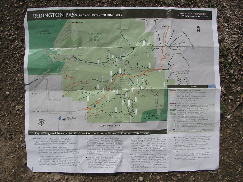
Map of Waterfalls Near Sonoita
Today's Conditions
Live data from USGS gauges & National Weather Service
Best Day to Hike
Saturday
Sunny · 82°F
Know when to go.
Get a free email alert when waterfalls near Sonoita hit peak flow. We only send when conditions are worth the trip — no weekly newsletters, no spam.
Find waterfalls to hike near Sonoita
Have your own travel site? Embed these waterfalls for free.
🐕 Dog-Friendly Waterfall Hikes Around Sonoita (2 waterfalls)
Bring your four-legged friend along! These waterfalls welcome dogs on their trails.
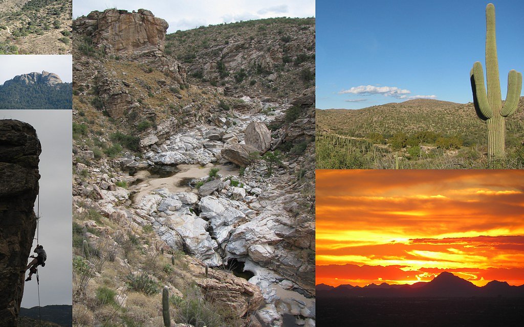
All 3 Waterfalls Near Sonoita
Frequently Asked Questions About Waterfalls Near Sonoita
Are there free waterfalls near Sonoita?
There are 3 free waterfalls near Sonoita, including Chiva Falls.
Are there dog friendly waterfalls in Sonoita?
There are 2 dog-friendly waterfalls near Sonoita, including Chiva Falls.
Are there kid-friendly waterfalls near Sonoita?
There are 2 kid-friendly waterfalls near Sonoita, including Seven Cataracts.
Can you swim in any waterfalls near Sonoita?
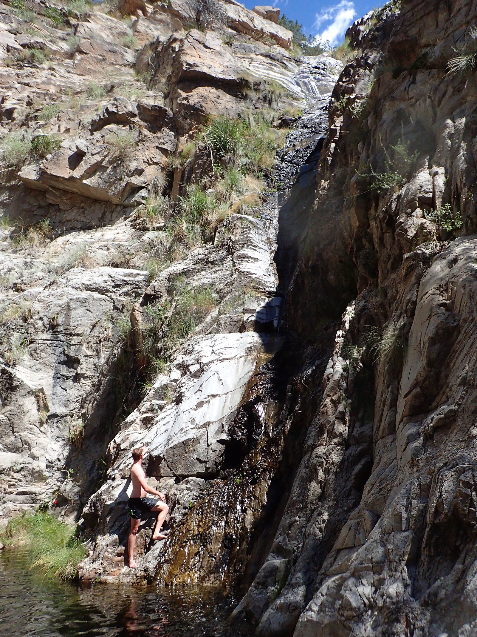
There is 1 waterfall that allows swimming near Sonoita, including Tanque Verde Falls.
What is the shortest waterfall hike near Sonoita?
The shortest waterfall hike near Sonoita is Chiva Falls at 1.8 miles round trip.
Can I camp near the waterfalls around Sonoita?
Yes, 3 waterfalls near Sonoita have nearby campgrounds.
What is the closest waterfall to Sonoita?
The closest waterfall to Sonoita is Tanque Verde Falls, approximately 29.4 miles away.
🏙️ Other Cities Near Sonoita With Waterfalls
Nearby Hot Springs
Hot springs near Sonoita, Arizona
Monkey Spring
Monkey Spring emerges at 82°F in the Santa Cruz County mountains near Rio Rico, flowing 18 degrees above the 64°F ambient tempe...

Agua Caliente Spring
Agua Caliente Spring near Arivaca Junction flows at 90 degrees Fahrenheit at 3,882 feet elevation, emerging 23.6 degrees above ...
Antelope Spring
Antelope Spring near Tombstone flows at 79 degrees Fahrenheit at 4,716 feet elevation in Cochise County's high desert, emerging...

Agua Caliente
Agua Caliente in Roy Drachman Park flows at 86 degrees Fahrenheit with confirmed USGS measurements at 30 Celsius (86°F), contai...

Mercer Spring
Mercer Spring flows at 77°F in the Santa Catalina Mountains above Tucson, running 14 degrees warmer than the surrounding 63°F e...
Hookers Hot Springs
Hookers Hot Springs reaches 127°F within the permanently protected Muleshoe Ranch Preserve, managed by conservation organizatio...
Looking for a soak after your hike? Explore more hot springs near Sonoita, Arizona on SoakingSprings.
Explore Arizona springsWhere to Stay
Browse vacation cabins and private rentals nearby
Unique outdoor stays — tents, yurts, and treehouses
Rent a campervan or RV for your waterfall road trip
Some links are affiliate links. We may earn a commission at no extra cost to you.