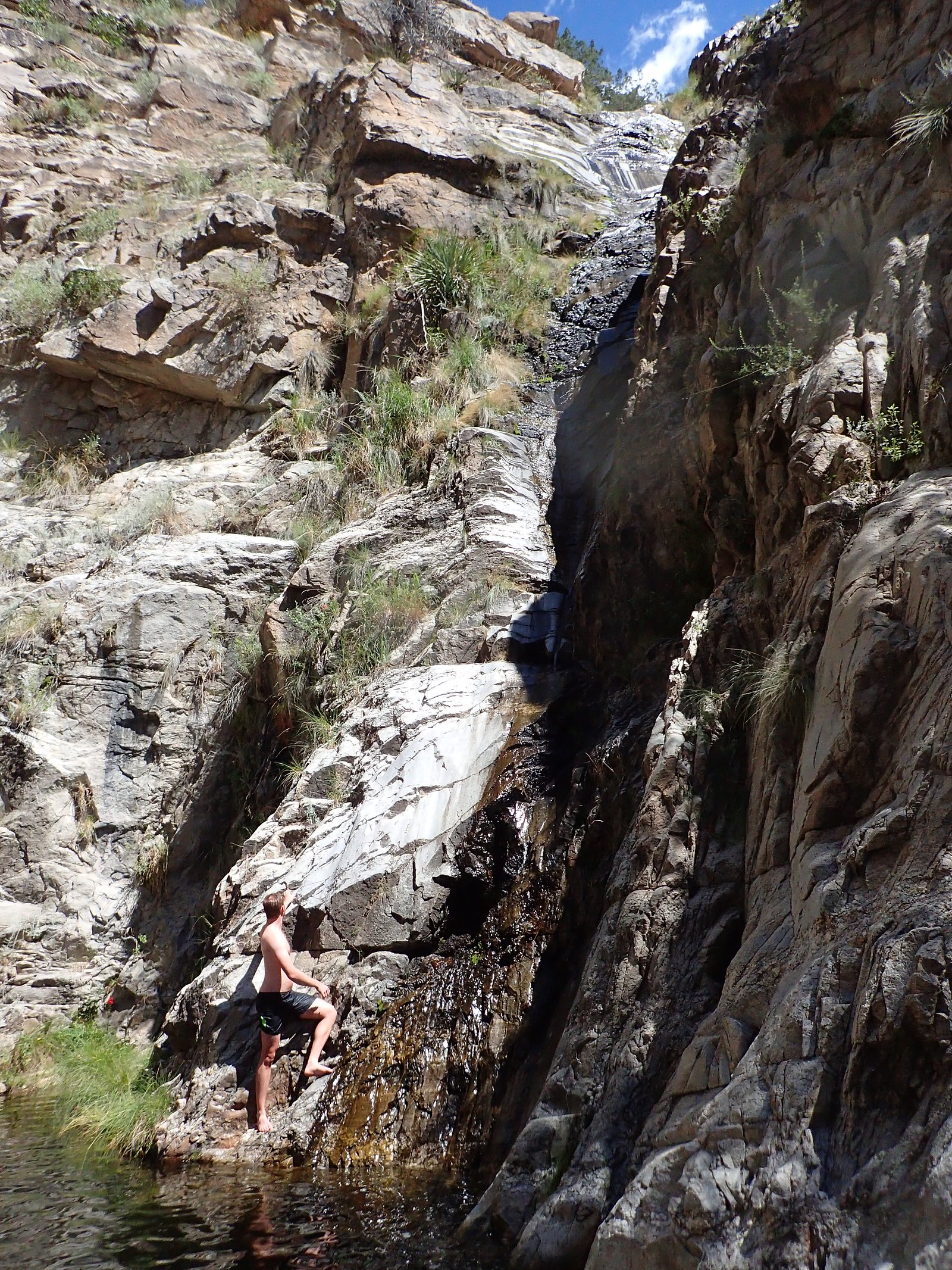
Chiva Falls
Arizona • Saguaro National Park
By Armen Suny · Last verified Mar 2026
Photo Credits (1)
Difficulty
Hard
Trail Length
6.5 miles
Trail Type
Out And Back
Elevation Gain
800 ft
About Chiva Falls
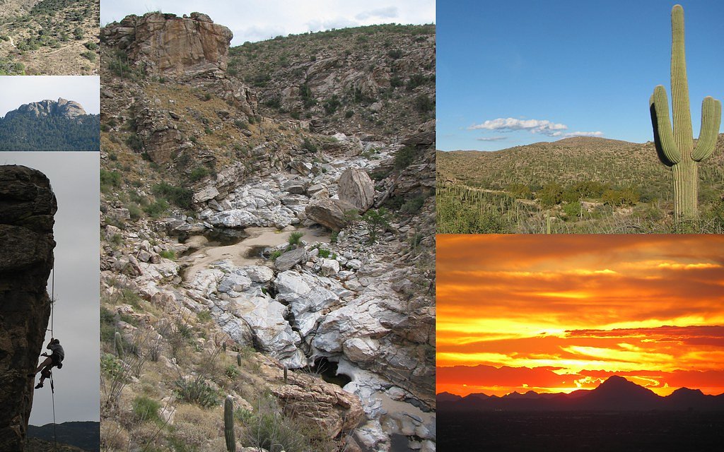
Chiva Falls sits in the Rincon Mountains just east of Tucson, tucked into the Coronado National Forest and managed by the U.S. Forest Service. This seasonal cascade is at its most dramatic after summer monsoons or heavy rains, when water spills through desert canyons and contrasts with the surrounding saguaro-studded slopes. The spot’s mix of rugged desert scenery and a short, lively waterfall makes it a rewarding goal for hikers who don’t mind a rough approach. The route to Chiva Falls is popular with off-road enthusiasts but is also reachable on foot for experienced hikers. Expect a fairly strenuous outing: the commonly used approach is an out-and-back of about 6.5 miles with roughly 800 feet of elevation gain, and it’s rated hard. Its location near Saguaro National Park means you’ll be hiking where high desert and mountain environments meet—bring plenty of water, sun protection, and plan for variable trail conditions after storms.
The Setting
Chiva Falls sits at 4,029 feet within Saguaro National Park, fed by the Rincon Creek, in the mountains of Arizona.
Trail & Hike Details
The Approach
The hard 6.5-mile out-and-back trail gains 800 feet of elevation on the way to the falls.
Trail Description
Length: 6.5 miles round-trip (out-and-back). Elevation gain: ~800 feet. Difficulty: Hard. Surface and grade: the route is rugged and primarily unpaved—expect rocky tread, loose soil, and washes; short steep pitches make sections strenuous. Trail use: commonly traveled by off-road vehicles and hikers, so tread can be irregular and minimally maintained. Conditions change after rain, with occasional water crossings and muddier footing; plan accordingly and be prepared for route-finding in places.
What to Expect
Dogs are welcome.
Accessibility
The trail involves steep, uneven terrain with significant elevation change and is not accessible to mobility devices.
Frequently Asked Questions
🐶 Are Dogs Allowed at Chiva Falls?
✅ Dogs are allowed
Are There Any Fees or Permits Required?
🆖 No fees required
🏊 Is There Swimming at Chiva Falls?
❌ Swimming is not allowed
When to Visit
The best time to visit is after significant rainfall, typically during the monsoon season (July to September) or in the spring when water flow is more likely.
Seasonal Access
The best time to visit is Spring, Fall, and Winter. Watch for flash flood warnings during monsoon season (July through September). Check with Saguaro National Park for current conditions.
Safety Information
The trail is remote and rugged. Bring sufficient supplies, including water and a first aid kit. Be cautious of flash flooding during the monsoon season. Cell service may be limited.
Current Water Conditions
0 ft³/s
Current discharge — how much water is flowing
Based on 59 years of record
1.90 ft
Water depth at gauge
About This Gauge
This gauge is on a nearby waterway and may not reflect exact conditions at the falls.
7-Day Flow Outlook
Based on the USGS gauge RINCON CREEK NEAR TUCSON, AZ. (15 km away).
Best time of year: this gauge typically runs highest from late February to mid March, peaking in March.
How we calculate this
This is a transparent outlook, not a precise forecast. We take the waterfall's current flow strength (how it ranks against its historical normal for today, from the nearest USGS stream gauge), carry that ranking forward along the gauge's seasonal curve, and nudge it for forecast rain. Confidence is highest for the next day or two and falls further out. Always check official conditions and your own judgment before visiting — high flows can be dangerous.
Know when to go.
Get a free email alert when waterfalls near Tanque Verde hit peak flow. We only send when conditions are worth the trip — no weekly newsletters, no spam.
Weather Forecast
Location & Access
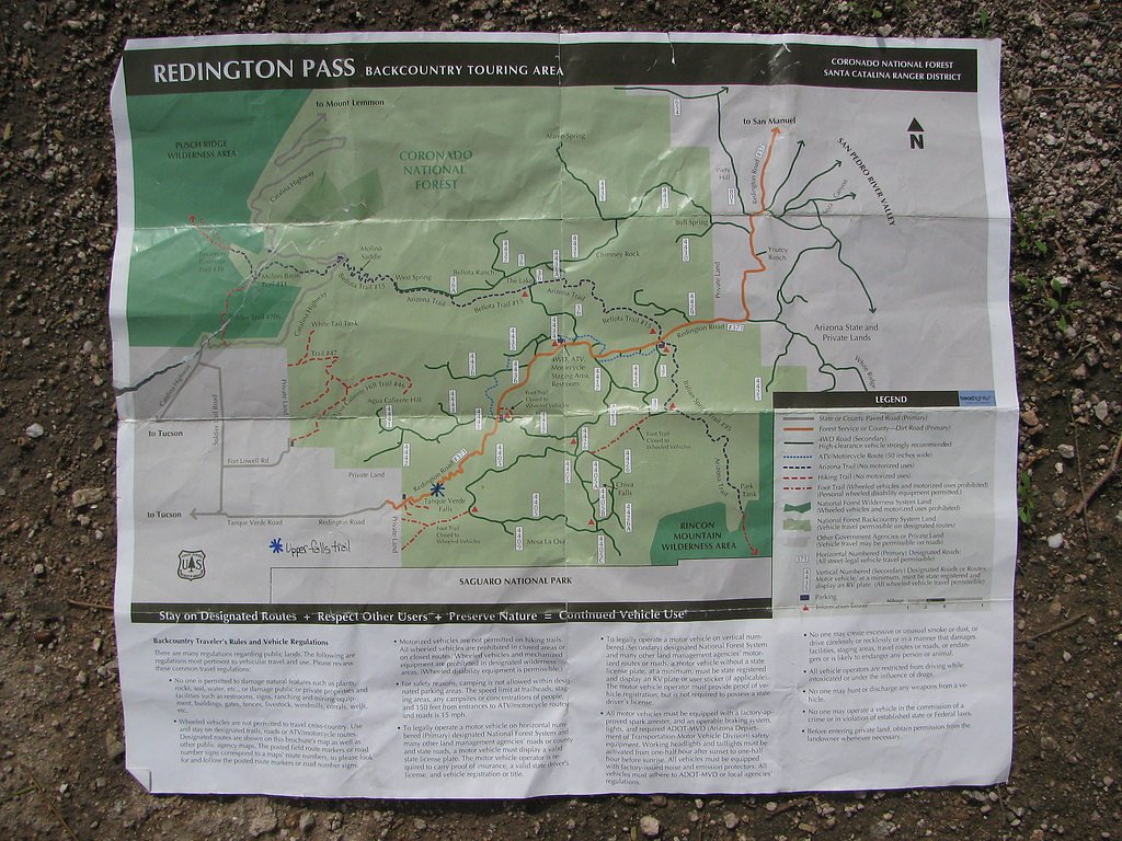
Getting There
Chiva Falls is accessed via Redington Road, a dirt road that requires a high-clearance or 4WD vehicle. The trailhead is located approximately 12 miles northeast of Tucson.
Get Directions on Google MapsParking
Parking is available at the trailhead, but space may be limited. Ensure your vehicle is parked safely off the road.
Elevation
4,029 feet above sea level
Coordinates
32.258130° N, -110.595914° W
Land Management
Managed by USFS
Visitor Tips & Gear
Check weather conditions before visiting, as the trail can become impassable after heavy rain. Bring plenty of water, sunscreen, and sturdy footwear. If driving, ensure your vehicle is equipped for off-road conditions.
As an Amazon Associate, we earn from qualifying purchases.
This challenging 6.5 miles trail gains 800 ft in elevation — come prepared with proper hiking boots and trekking poles. Icy conditions are common in winter — traction cleats are a smart addition.

Columbia Watertight II Rain Jacket
Packs into its own pocket, seam-sealed, and keeps you dry from spray and surprise rain.

Sawyer Squeeze Water Filter
The backcountry standard — filters 99.9% of bacteria and weighs just 3 oz.

Earth Pak Waterproof Dry Bag
Keeps your phone and gear dry when waterfall mist soaks everything else.

Waterproof Phone Pouch (AiRunTech)
Cheap insurance — take photos right next to the falls without killing your phone.

Timberland Euro Sprint Mid Waterproof
Trusted waterproof boot with premium leather and grippy rubber sole — reliable on rocky, wet trails.

TrailBuddy Trekking Poles
Lightweight aluminum, cork grips, and flip-locks that actually hold — a best-seller for good reason.
Where to Stay

Embassy Suites by Hilton Tucson East

Hilton Tucson East

Hacienda del Sol Guest Ranch Resort

Hyatt Place Tucson Airport
Browse vacation cabins and private rentals nearby
Unique outdoor stays — tents, yurts, and treehouses
Rent a campervan or RV for your waterfall road trip
Some links are affiliate links. We may earn a commission at no extra cost to you.
Nearby Campground
MOLINO
7.9 miles away · 1 sites
Overview Visitors are drawn to Molino Campground for its group camping area, scenic mountain surroundings and hiking and mountain biking opportunities. While most other campgrounds in the Catalina Mountains are closed in winter, Molino Campground and its picnic area are open in late fall, winter and early spring. The pleasant winter weather at this elevation makes it a great time to visit. Molino Basin is conveniently located 5.5 miles from the base of Mt. Lemmon on the Catalina Highway, and abou
Book on Recreation.govNearby Hot Springs
Hot springs near Tanque Verde, Arizona

Agua Caliente
Agua Caliente in Roy Drachman Park flows at 86 degrees Fahrenheit with confirmed USGS measurements at 30 Celsius (86°F), contai...

Mercer Spring
Mercer Spring flows at 77°F in the Santa Catalina Mountains above Tucson, running 14 degrees warmer than the surrounding 63°F e...
Hookers Hot Springs
Hookers Hot Springs reaches 127°F within the permanently protected Muleshoe Ranch Preserve, managed by conservation organizatio...
N O Spring
N-O Spring flows at 73°F near Benson in Cochise County, emerging just 8 degrees above the 65°F average at 4,195 feet elevation....

Warm Springs
Warm Springs flows at 91 degrees Fahrenheit on the Muleshoe Ranch Preserve in Cochise County, permanently protected by a conser...
Monkey Spring
Monkey Spring emerges at 82°F in the Santa Cruz County mountains near Rio Rico, flowing 18 degrees above the 64°F ambient tempe...
Looking for a soak after your hike? Explore more hot springs near Tanque Verde, Arizona on SoakingSprings.
Explore Arizona springsAdditional Information
Nearby Attractions
Other trails and off-road routes in the Redington Pass area.
Wildlife
The area is home to desert wildlife, including lizards, snakes, and various bird species. Be cautious of rattlesnakes.
Cities near Chiva Falls
Nearby Waterfalls
Writing about Chiva Falls? Embed this waterfall on your site for free.