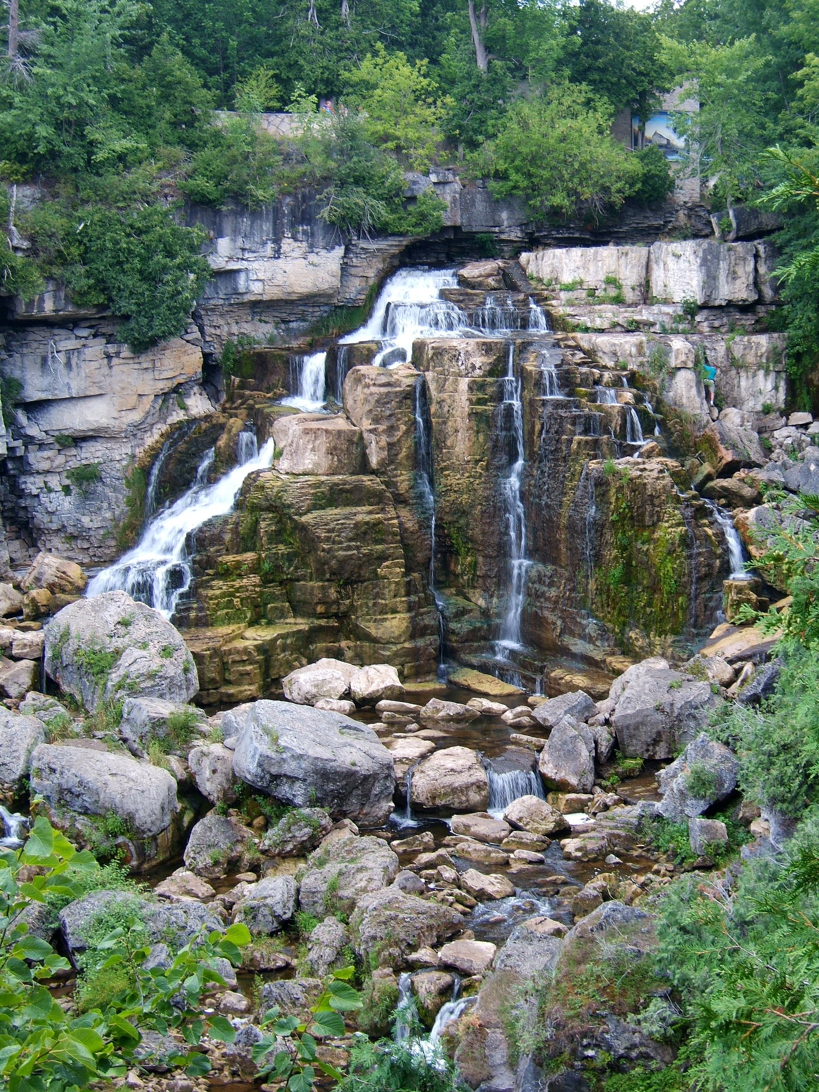
Weaver Creek Falls
By Armen Suny · Last verified Jun 2026
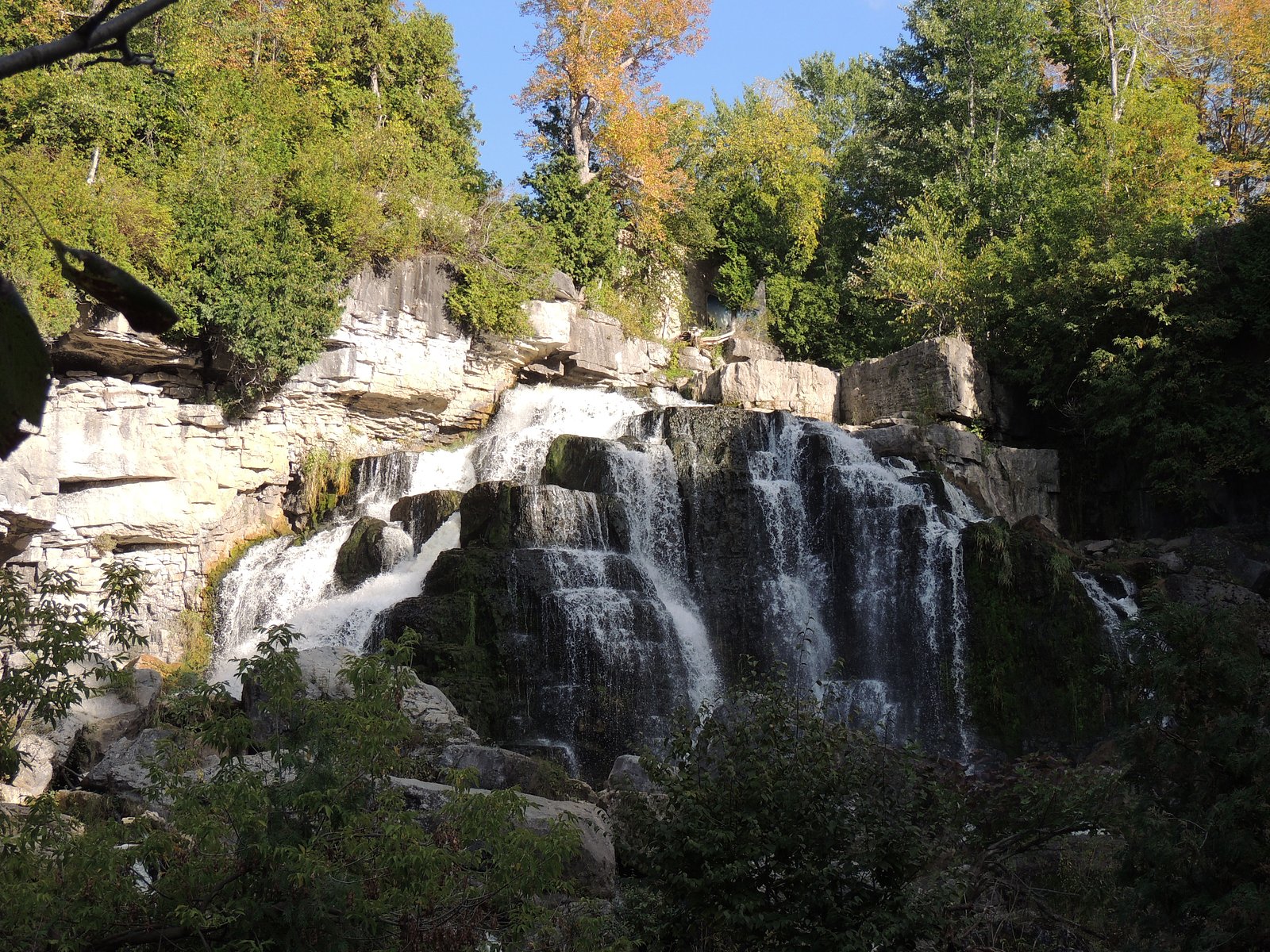
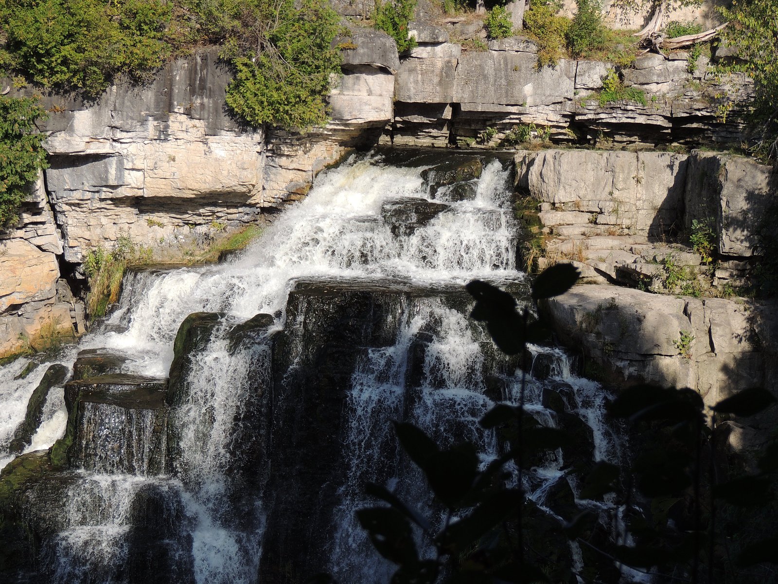
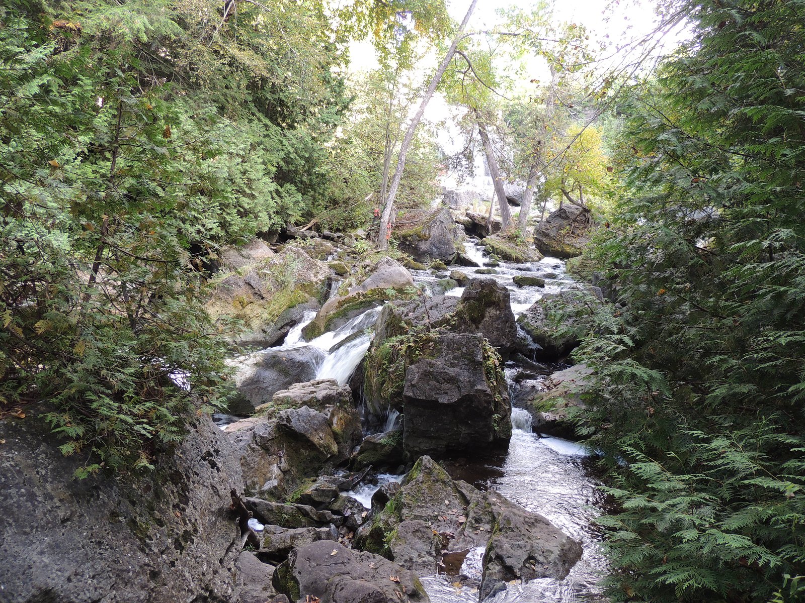
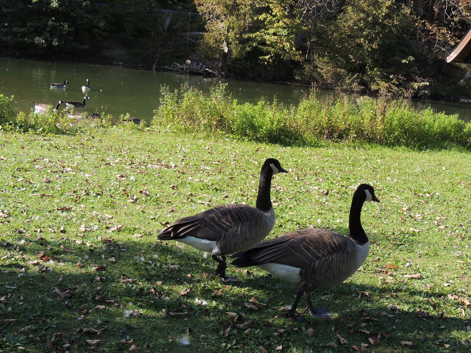
Photo Credits (5)
Difficulty
Easy
Trail Length
2.3 km
Trail Type
Loop
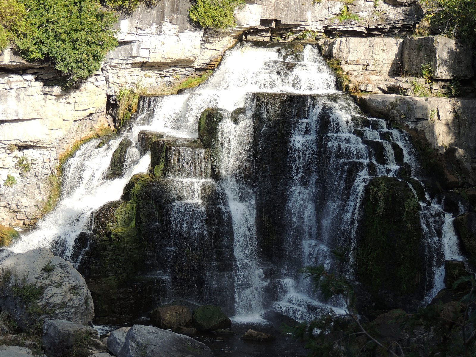
About Weaver Creek Falls
Weaver Creek Falls is a small cascade-style waterfall located in the Owen Sound region of southern Ontario (coordinates 44.5416, -80.9392). The falls are on a tributary known locally as Weaver Creek and are most impressive during spring snowmelt and after heavy rains. Exact public access details and developed infrastructure (boardwalks, viewing platforms) are not well documented; visitors should expect a natural setting with limited facilities and possibly short, unmaintained approaches. Information below uses conservative language where specifics are not confirmed.
Why This Waterfall Exists
Weaver Creek Falls flows over layered sedimentary rock laid down about 419-444 million years ago. Over time, the stream has worn through these layers at different rates, creating the step that forms the waterfall.
Trail & Hike Details
Trail Description
Trail access appears to be via an informal or lightly developed path from a nearby rural road or small parking area. The approach may include uneven footing, exposed roots, rocks, and short stretches of bushwhack. There may be no formal signage or maintained boardwalks. Trail conditions can deteriorate after heavy rain (mud, slick surfaces) and in winter (ice/snow). Visitors should wear sturdy footwear and be prepared for a short walk through natural terrain. Because detailed trail metrics are not confidently known, assume variable conditions and limited facilities.
What to Expect
A small, natural waterfall and creek channel set in mixed woods typical of the Bruce/Grey County region. Expect bedrock outcrops, a narrow cascade or series of drops rather than a single high plunge, and a scenic woodland setting. Water flow can vary widely by season, highest in spring and after rain, reduced in late summer dry periods. There may be no established viewpoints, railings, or developed amenities. Wildlife in the area can include songbirds, small mammals, deer, and occasional sightings of larger mammals; ticks and poison ivy may be present during warmer months. Cell reception may be spotty in places.
Accessibility
The trail is not wheelchair accessible. Uneven terrain and elevation changes require steady footing.
Frequently Asked Questions
🐶 Are Dogs Allowed at Weaver Creek Falls?
❌ Dogs are not allowed
Are There Any Fees or Permits Required?
🆖 No fees required
🏊 Is There Swimming at Weaver Creek Falls?
❌ Swimming is not allowed
When to Visit
Late spring (after snowmelt) and early summer for strongest flow and fullest creek levels. Fall offers good colors and cooler conditions but may have lower flows. Winter can produce interesting ice features but increases risk from slippery surfaces, visit only if you are prepared for winter conditions.
Seasonal Access
The best time to visit is Spring, Summer, Fall, and Winter. Check with the managing park or local authority for current conditions.
Safety Information
Hazards can include slippery and unstable rocks near the water, sudden changes in water flow after rain, limited cell service, and seasonal ice in winter. Wear appropriate footwear, supervise children closely, avoid getting onto wet rock ledges or into fast-moving water, and be prepared for limited facilities. Check local conservation authority or municipal advisories before visiting.
Current Water Conditions
1.0 m³/s
Current discharge — how much water is flowing
About average for this time of year
Based on 91 years of record
4.93 m
Water depth at gauge
7-Day Discharge Trend
What does this mean for your visit?
Flow is about average for this time of year.
About This Gauge
7-Day Flow Outlook
Based on the WSC gauge SYDENHAM RIVER NEAR OWEN SOUND (2 km away).
Today
Moderate
1.0 m³/s
9/10Tomorrow
Moderate
1.0 m³/s
8/10Tue
Strong
1.1 m³/s
7/10Wed
Strong
1.1 m³/s
8/10Thu
Moderate
0.9 m³/s
9/10Fri
Strong
1.0 m³/s
8/10Sat
Moderate
0.9 m³/s
8/10Best window: Today — moderate flow, mainly sunny (trip score 9/10).
Best time of year: this gauge typically runs highest from early March to mid May, peaking in April.
How we calculate this
This is a transparent outlook, not a precise forecast. We take the waterfall's current flow strength (how it ranks against its historical normal for today, from the nearest WSC stream gauge), carry that ranking forward along the gauge's seasonal curve, and nudge it for forecast rain. Confidence is highest for the next day or two and falls further out. Always check official conditions and your own judgment before visiting — high flows can be dangerous.
Know when to go.
Get a free email alert when waterfalls near Owen Sound hit peak flow. We only send when conditions are worth the trip — no weekly newsletters, no spam.
Weather Forecast
Location & Access
Getting There
The falls are located near Owen Sound (approx. 5.0 miles), with Wiarton ~17.6 miles and Orangeville ~66.2 miles from the given coordinates (44.5416, -80.9392). Expect to drive on local rural roads to reach the nearest roadside parking or trailhead. Use a detailed map or GPS coordinates to locate the access point; cell service may be intermittent in some rural sections. Check municipal or conservation authority pages for any recent access changes.
Get Directions on Google MapsParking
Parking may be limited to a small unpaved pullout or roadside parking near the trailhead. There may be no formal parking lot, signage, or facilities. Park responsibly off the road where permitted and avoid blocking driveways or gates.
Elevation
223 metres above sea level
Coordinates
44.541580° N, -80.939247° W
Visitor Tips & Gear
1) Use the provided coordinates and a local map to find the trailhead; do not rely solely on vague signage. 2) Wear sturdy, waterproof footwear, rocks and trails can be slippery. 3) Bring insect repellent and check for ticks after your visit. 4) Leave no trace, pack out garbage and avoid disturbing vegetation. 5) Stay off wet rocks near the falls; slippery surfaces and strong currents are hazards. 6) If visiting in winter, be cautious of ice and falling ice; approach slowly or avoid if unsure. 7) Expect limited or no toilet facilities; plan accordingly.
Where to Stay
Browse vacation cabins and private rentals nearby
Unique outdoor stays — tents, yurts, and treehouses
Rent a campervan or RV for your waterfall road trip
Some links are affiliate links. We may earn a commission at no extra cost to you.
Nearby Campground
Harrison Park Family Campground
0.3 km away
Additional Information
Nearby Attractions
Owen Sound city amenities and parks (restaurants, shops), Inglis Falls and the Bruce Trail corridor are notable nearby outdoor attractions in the broader region. Georgian Bay shoreline and provincial parks on the Bruce Peninsula are within driving distance and offer additional hiking and scenic opportunities.
Wildlife
Typical southern Ontario forest and riparian wildlife: songbirds, waterfowl nearby, small mammals (squirrels, raccoons), white-tailed deer. Ticks (Lyme disease risk) are present in the region; black bears are uncommon but possible in broader Bruce Peninsula/woodland areas, take normal wildlife precautions.
Cities near Weaver Creek Falls
Nearby Waterfalls
Writing about Weaver Creek Falls? Embed this waterfall on your site for free.