Photo Credits (1)
Difficulty
Easy
Trail Length
0.8 km
Trail Type
Out And Back
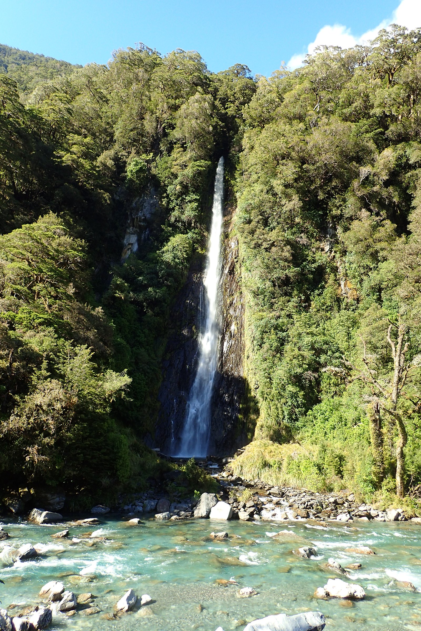
About Wantage Falls
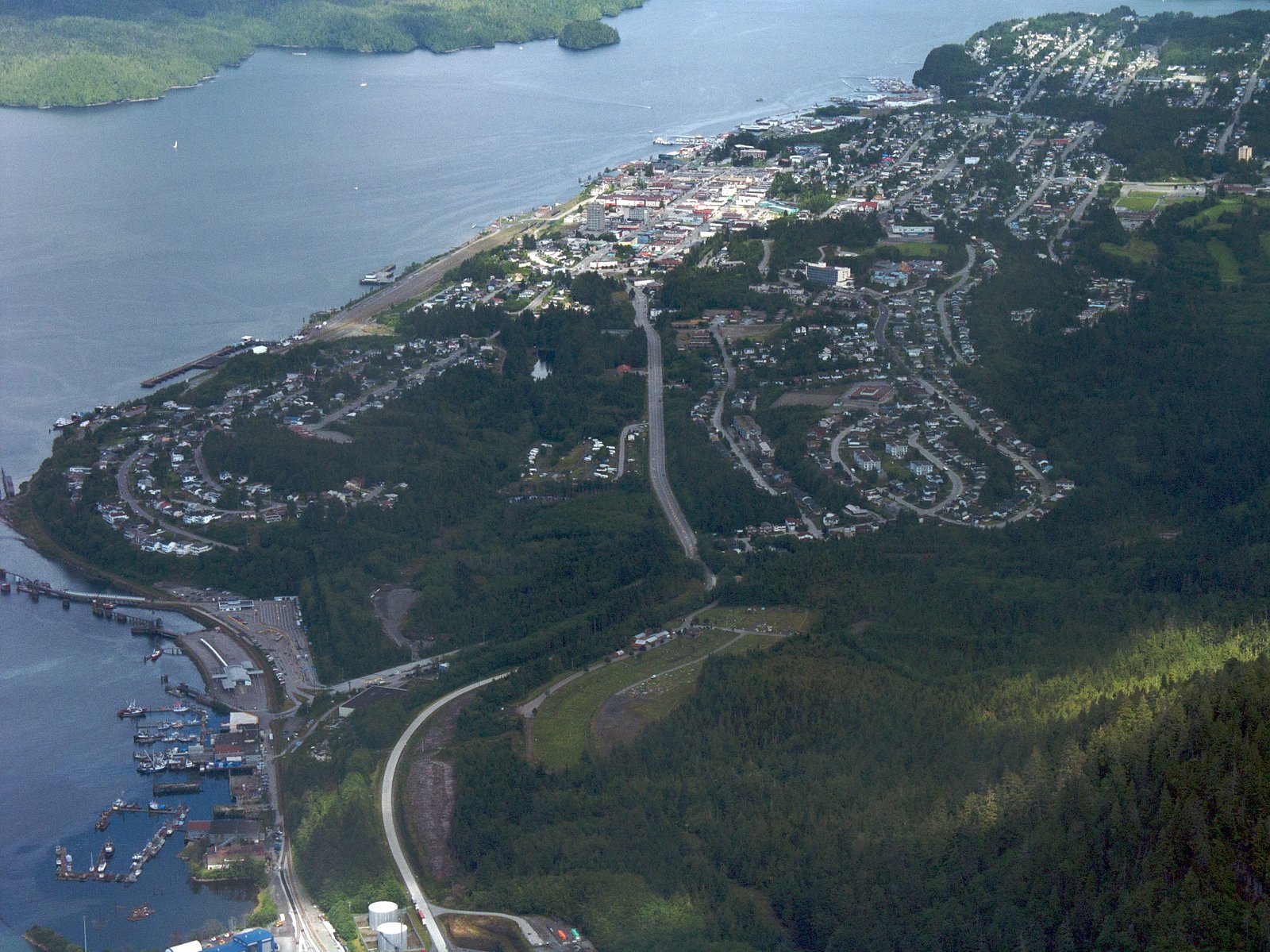
Wantage Falls is a small coastal temperate rainforest waterfall located approximately 1.8 miles (about 3 km) south of downtown Prince Rupert, British Columbia (approximate coordinates: 54.2858, -130.3404). The fall appears to drop on a small tributary in a forested setting and is primarily of local interest rather than a developed park site. Precise published information on the waterfall (official name usage, measured height, and an established maintained trail) is limited; visitors should expect an informal access situation and variable water flow depending on season and recent rainfall.
Why This Waterfall Exists
Wantage Falls flows over hard metamorphic rock, primarily amphibolite, laid down about 66-201 million years ago. These resistant rocks form a durable ledge that water cannot easily wear away, creating the falls where softer material downstream has already eroded.
Trail & Hike Details
Trail Description
There is no widely documented maintained trail to Wantage Falls. Visiting likely requires following an informal boot path, forested skid trails, or brief bushwhack from a nearby access road. Terrain may include wet/peaty ground, uneven roots and rocks, and short steep sections near the stream channel. Expect minimal signage and no constructed viewing platforms or safety railings. Because official route descriptions are sparse, plan for route-finding and limited emergency access.
What to Expect
A small, forested waterfall with a short drop on a creek or tributary. Surroundings are coastal temperate rainforest, moss, ferns, alder, and conifers, with slippery rocks and potentially steep stream banks. Flow varies seasonally: higher in spring and after heavy rain, lower in late summer. No visitor facilities such as toilets, benches or maintained viewpoints are known. Wildlife typical of the Pacific Northwest coast (e.g., birds of prey, waterfowl, small mammals) may be present.
Accessibility
The trail is short and relatively flat, but the surface may be uneven. Contact the managing agency for accessibility details.
Frequently Asked Questions
🐶 Are Dogs Allowed at Wantage Falls?
❌ Dogs are not allowed
Are There Any Fees or Permits Required?
🆖 No fees required
🏊 Is There Swimming at Wantage Falls?
❌ Swimming is not allowed
When to Visit
Late spring (snowmelt and seasonal rains) and early summer for fuller flows and lush vegetation; summer for easier access and more stable trails. Avoid periods of heavy rain if concerned about slippery conditions and potential flashy stream behavior. Fall can offer good color but shorter daylight hours.
Seasonal Access
The best time to visit is Spring, Summer, and Fall. Winter access may be limited. Check with the managing park or local authority for current conditions.
Safety Information
Hazards may include slippery wet rocks, steep and unstable banks, cold water, sudden stream level rises during heavy rain, limited cell coverage, potential forestry traffic on access roads, and wildlife encounters (including bears). There may be no signage or emergency services nearby. Wear appropriate footwear, avoid getting too close to the lip or edge, and do not attempt to climb icy or wet rock faces. If access uses logging roads, be aware they may be active and gated, do not trespass where signed. When uncertain, opt for safety and local guidance.
Know when to go.
Get a free email alert when waterfalls near Prince Rupert hit peak flow. We only send when conditions are worth the trip — no weekly newsletters, no spam.
Weather Forecast
Location & Access
Getting There
Wantage Falls is located roughly 1.8 miles south of Prince Rupert (coordinates 54.2858, -130.3404). There is no widely advertised official trailhead. Access typically involves driving from Prince Rupert toward the south side of the island/peninsula and then locating an informal access point or logging/forest access road followed by a short walk. Exact access routes are not well-documented; a GPS with the coordinates above is recommended. Expect unmarked or informal trails and possible crossing of wet/steep terrain.
Get Directions on Google MapsParking
No formal parking lot is documented. Visitors may need to use street parking in nearby Prince Rupert and/or pullouts along local access roads. If using forest or logging roads, park only where permitted and avoid blocking gates or private driveways. Availability of parking and pullouts may change with logging activity.
Elevation
225 metres above sea level
Coordinates
54.285810° N, -130.340424° W
Visitor Tips & Gear
1) Use GPS coordinates and a map; access is not well signed. 2) Wear sturdy waterproof footwear with good traction, stream banks and rocks are slippery. 3) Expect limited or no cell service in some forested areas; tell someone your plan. 4) Respect private property and industrial/forestry operations; obey gates and posted signs. 5) Bring insect repellent in spring/summer and rain gear year-round. 6) If unsure about access routes, contact local Visitor Information in Prince Rupert for the latest advice.
Where to Stay
Browse vacation cabins and private rentals nearby
Unique outdoor stays — tents, yurts, and treehouses
Rent a campervan or RV for your waterfall road trip
Some links are affiliate links. We may earn a commission at no extra cost to you.
Nearby Campground
Prudhomme Lake Campground
14.4 km away
Additional Information
Nearby Attractions
Prince Rupert downtown, the Museum of Northern British Columbia, Cow Bay and nearby coastal viewpoints. Many scenic coastal trails, fishing and boating opportunities exist in the greater Prince Rupert area.
Wildlife
Expect coastal wildlife such as bald eagles, gulls, waterfowl, small mammals, and typical Pacific Northwest forest species. Black bears and cougars can occur in the region, practice standard wildlife safety. Salmon runs may be present in larger streams nearby, but no specific salmon presence at this unnamed tributary is confirmed.
Cities near Wantage Falls
Nearby Waterfalls
Writing about Wantage Falls? Embed this waterfall on your site for free.