Turner Brook
Nova Scotia • Margaree River Wilderness Area
By Armen Suny · Last verified Jun 2026
Difficulty
Moderate
Trail Length
3.0 km
Trail Type
Out And Back
About Turner Brook
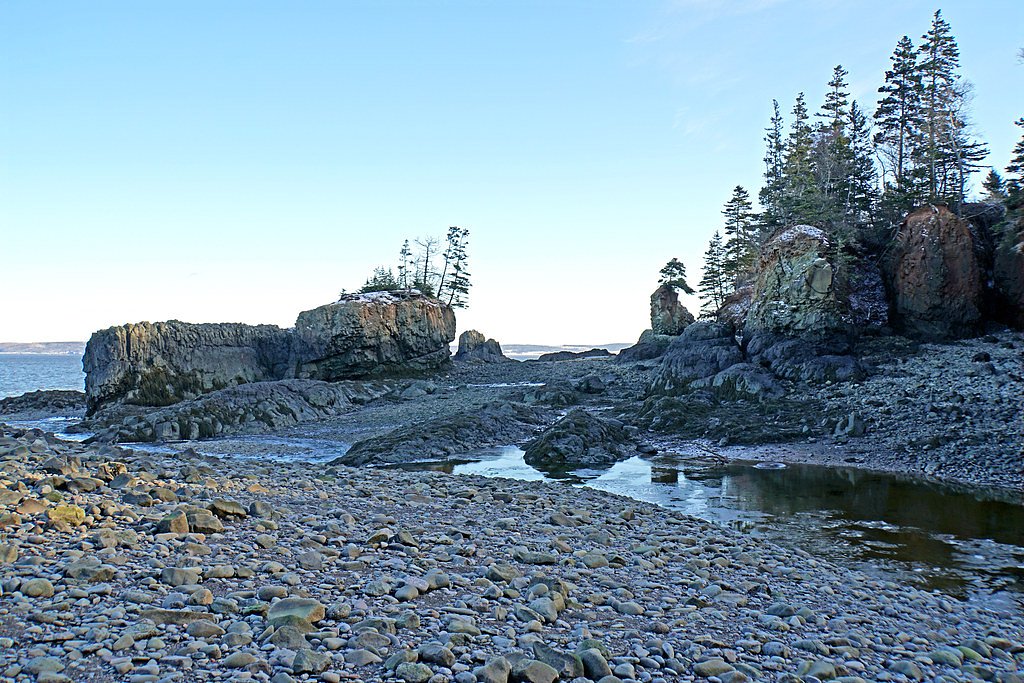
Turner Brook is a small forested brook and series of cascades on Cape Breton Island, Nova Scotia. The falls are typical of small rural brooks in the region, a combination of low drops and rocky, stepped cascades rather than a single tall plunge. The setting is wooded and remote-feeling; water flow is highly seasonal (highest in spring and after heavy rains). Exact publicly documented trail infrastructure and official measurements for height are not readily available, so details below are conservative and may require local confirmation.
The Setting
Turner Brook sits at 404 metres within Margaree River Wilderness Area, in the foothills of Nova Scotia.
Why This Waterfall Exists
Turner Brook flows over hard intrusive rock laid down about 359-419 million years ago. These resistant rocks form a durable ledge that water cannot easily wear away, creating the falls where softer material downstream has already eroded.
Trail & Hike Details
Trail Description
Reported visitor notes and typical conditions for similar small Cape Breton brook sites suggest the approach may be on an unmaintained footpath or involve a short bushwhack through mixed forest. The route is likely rocky, muddy, and steep in places near the water. Expect no formal boardwalks, railings, or signage. Because there is limited documentation, exact trail length and elevation gain are not confirmed here.
What to Expect
A small, wooded waterfall site with stepped cascades and pools among bedrock. Flow varies with season, high in spring and after rain, lower in late summer. The area is forested (balsam fir, spruce, birch) with typical Cape Breton undergrowth. Terrain near the falls is uneven and slippery; standing water or small wet ledges may be present. Limited or no facilities (no toilets, trash service, or maintained viewpoints). Cell service may be intermittent.
Accessibility
The trail is not wheelchair accessible. Uneven terrain and elevation changes require steady footing.
Frequently Asked Questions
🐶 Are Dogs Allowed at Turner Brook?
❌ Dogs are not allowed
Are There Any Fees or Permits Required?
🆖 No fees required
🏊 Is There Swimming at Turner Brook?
❌ Swimming is not allowed
When to Visit
Spring (snowmelt and spring rains) for highest water flow and dramatic cascades. Early to mid-summer for access and foliage (watch for insects). Fall for colorful foliage and cooler weather; water flow may be lower. Winter access is possible with snowshoes or winter tires but expect icy conditions and limited visibility; approach only if experienced and properly equipped.
Seasonal Access
The best time to visit is Spring, Summer, Fall, and Winter. Check with Margaree River Wilderness Area for current conditions.
Safety Information
Hazards include slippery and unstable rocks, steep banks, sudden increases in water flow after rain, seasonal high flows and cold water temperatures, limited or no cell service, tick exposure, and the possibility of private land/active forestry operations. Wear appropriate footwear, avoid the water during high flows, do not stand on wet overhanging ledges, and confirm legal access before crossing private property. During hunting seasons, wear high-visibility clothing and check local restrictions.
Current Water Conditions
1.9 m³/s
Current discharge — how much water is flowing
Lower than usual for this time of year
Based on 64 years of record
0.95 m
Water depth at gauge
7-Day Discharge Trend
What does this mean for your visit?
Flow is lower than usual for this time of year.
About This Gauge
This gauge is on a nearby waterway and may not reflect exact conditions at the falls.
7-Day Flow Outlook
Based on the WSC gauge CHETICAMP RIVER ABOVE ROBERT BROOK (15 km away).
Today
Moderate
2.1 m³/s
5/10Tomorrow
Moderate
2.0 m³/s
6/10Wed
Moderate
2.2 m³/s
5/10Thu
Moderate
2.3 m³/s
4/10Fri
Moderate
2.4 m³/s
5/10Sat
Moderate
2.0 m³/s
6/10Sun
Moderate
2.1 m³/s
5/10Best window: Tomorrow — moderate flow, cloudy (trip score 6/10).
Best time of year: this gauge typically runs highest from early April to early June, peaking in May.
How we calculate this
This is a transparent outlook, not a precise forecast. We take the waterfall's current flow strength (how it ranks against its historical normal for today, from the nearest WSC stream gauge), carry that ranking forward along the gauge's seasonal curve, and nudge it for forecast rain. Confidence is highest for the next day or two and falls further out. Always check official conditions and your own judgment before visiting — high flows can be dangerous.
Know when to go.
Get a free email alert when waterfalls near Baddeck hit peak flow. We only send when conditions are worth the trip — no weekly newsletters, no spam.
Weather Forecast
Location & Access
Getting There
Turner Brook is located on Cape Breton Island (coordinates 46.506, -60.9216), roughly 27 miles from Baddeck and about 49 miles from Sydney by road. Access is most commonly by secondary and local roads; reaching the brook may require driving on gravel or logging roads and a short walk through forest. There does not appear to be a widely advertised or signed trailhead from major highways. Visitors should use detailed maps/GPS and confirm local access before travelling.
Get Directions on Google MapsParking
There is no confirmed official parking lot. Expect limited roadside pullouts or informal parking on a nearby logging/forestry road. Do not block gates or private driveways; if in doubt, seek local permission.
Elevation
404 metres above sea level
Coordinates
46.505990° N, -60.921586° W
Land Management
Managed by Nova Scotia Environment and Climate Change
Visitor Tips & Gear
1) Tell someone your route and expected return time; remote forest roads can be confusing. 2) Wear waterproof, grippy footwear and expect slippery rocks. 3) Carry insect repellent (mosquitoes/black flies in spring/summer) and tick checks after the visit. 4) Respect private property, many small brooks cross or border private land. 5) Park legally off the road and avoid blocking gates. 6) Bring a map or GPS with the given coordinates. 7) Check weather and stream conditions; avoid approaching during high flows or heavy rain.
Where to Stay
Browse vacation cabins and private rentals nearby
Unique outdoor stays — tents, yurts, and treehouses
Rent a campervan or RV for your waterfall road trip
Some links are affiliate links. We may earn a commission at no extra cost to you.
Nearby Campground
Waves End Rv & Campground
10.8 km away
Additional Information
Nearby Attractions
Baddeck (Alexander Graham Bell Historic Sites) and Bras d'Or Lake are the nearest notable attractions by town; the Cabot Trail and Cape Breton Highlands National Park are within driving distance of many Cape Breton locations. Exact driving times will vary based on the route and road conditions.
Wildlife
Typical Cape Breton wildlife: white-tailed deer, moose (in parts of the island), black bear (infrequent but possible), songbirds, raptors (including bald eagles), and small mammals. Expect insects such as black flies, mosquitoes, and ticks seasonally.
Cities near Turner Brook
Nearby Waterfalls
Writing about Turner Brook? Embed this waterfall on your site for free.