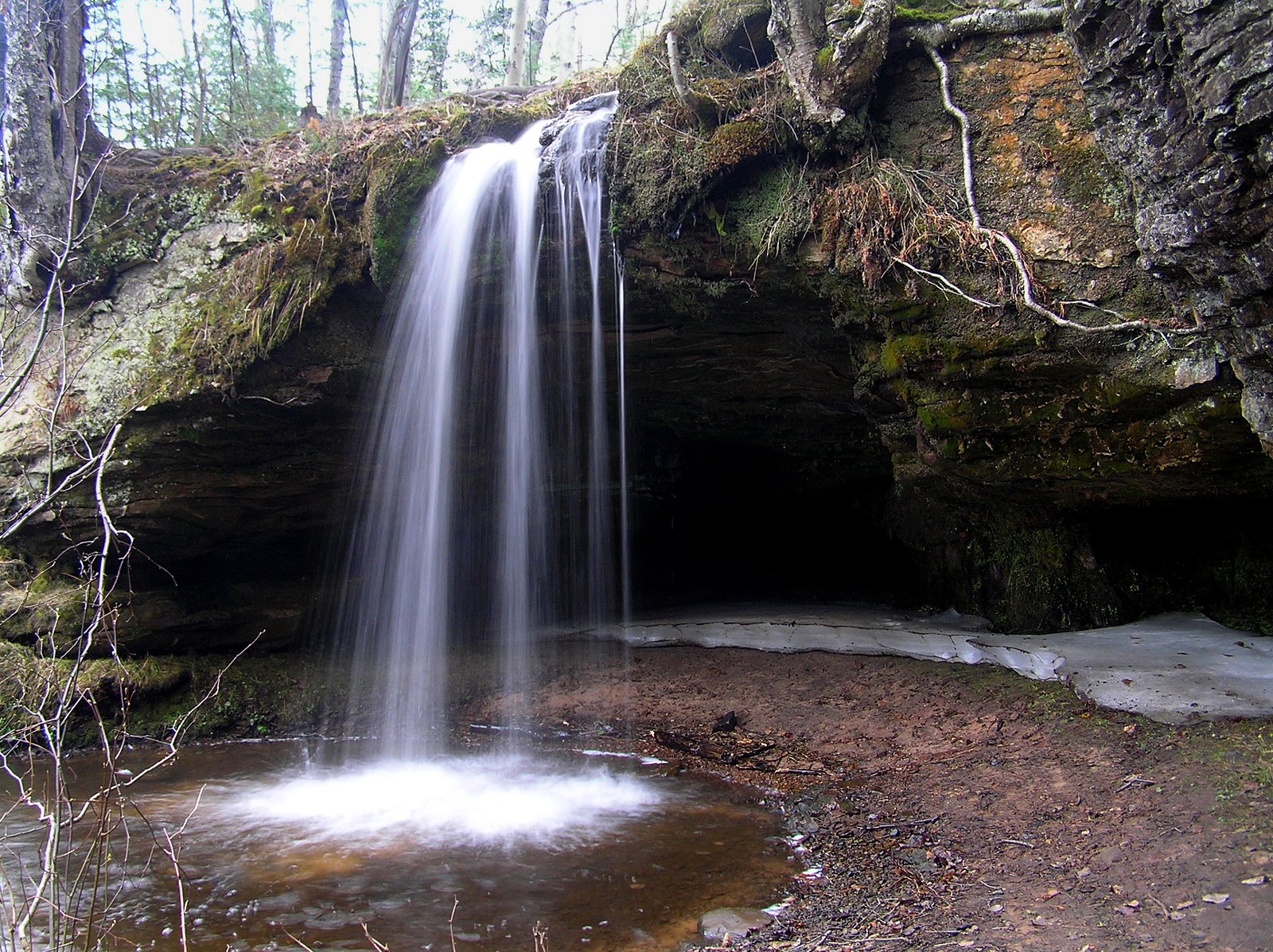
Photo Credits (5)
About Scott Falls
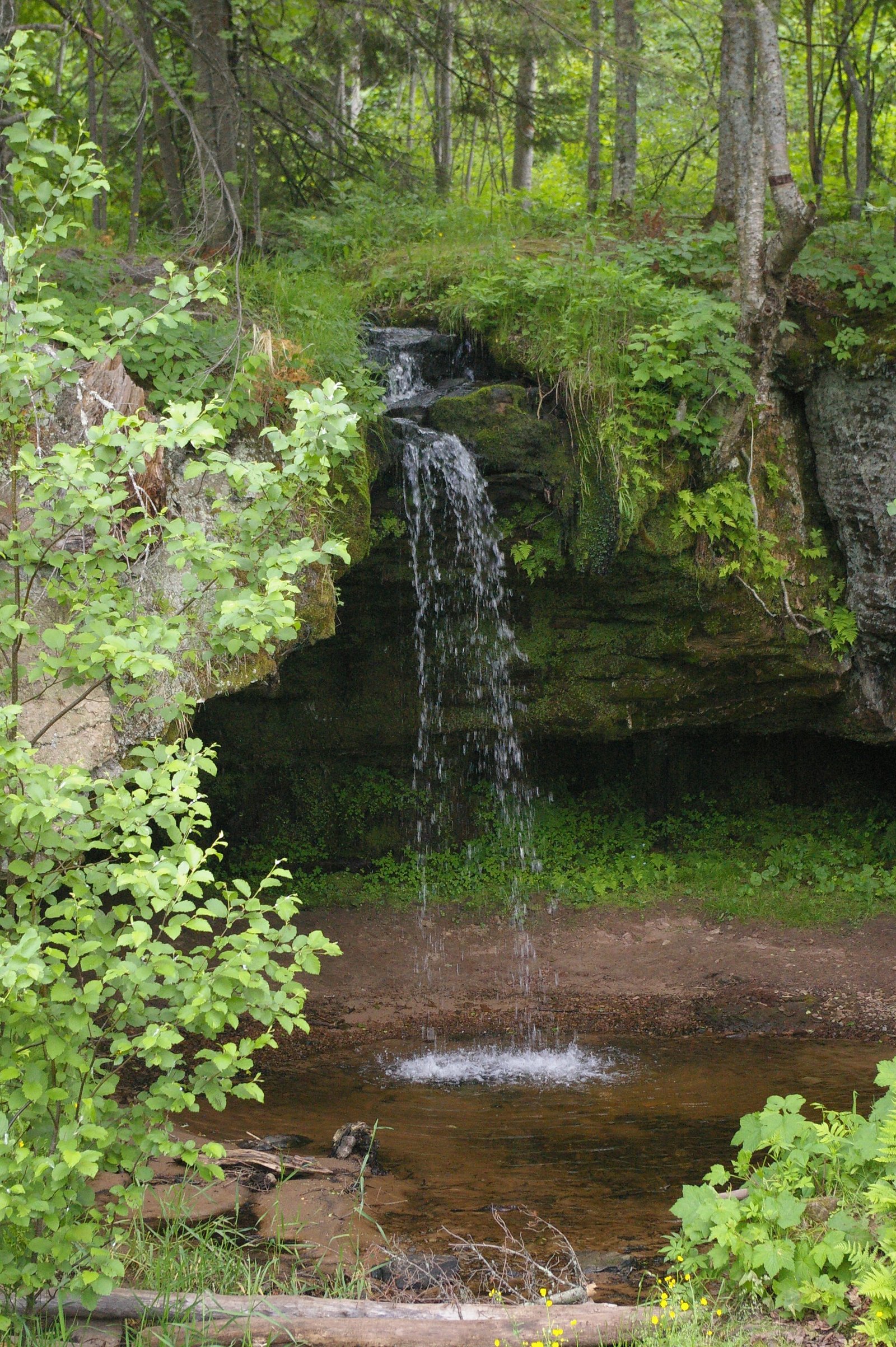
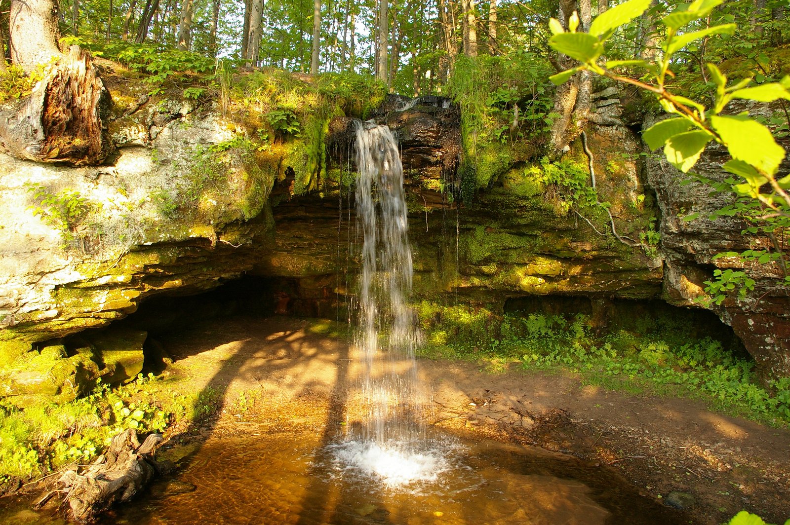
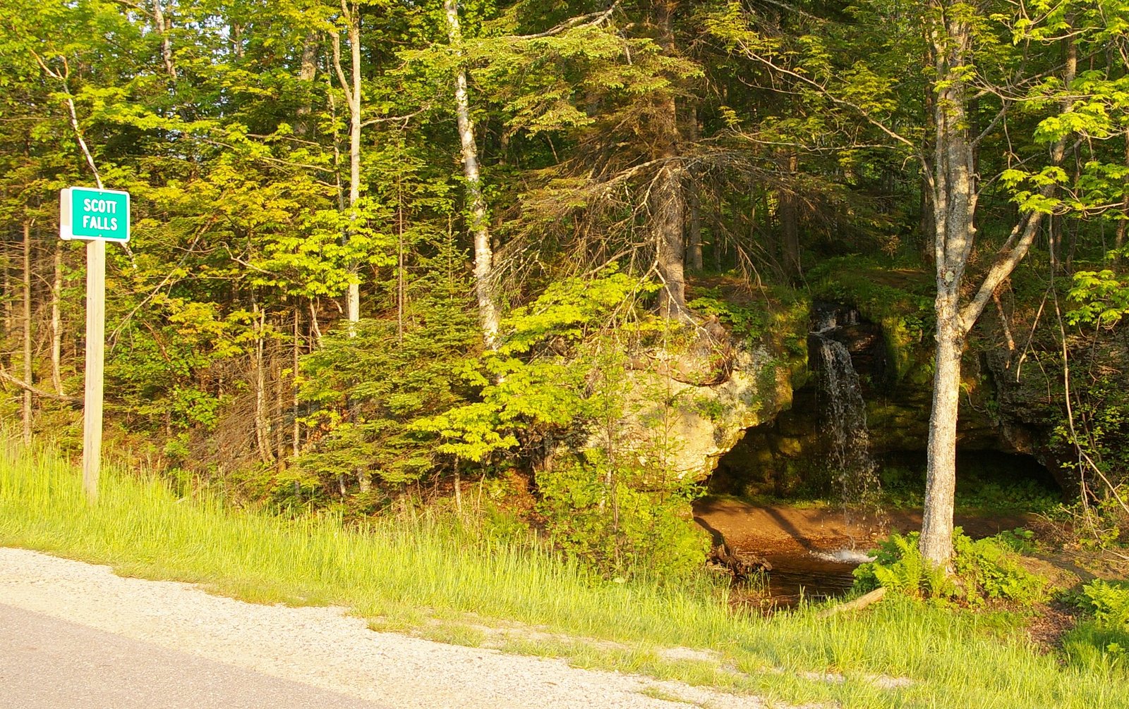
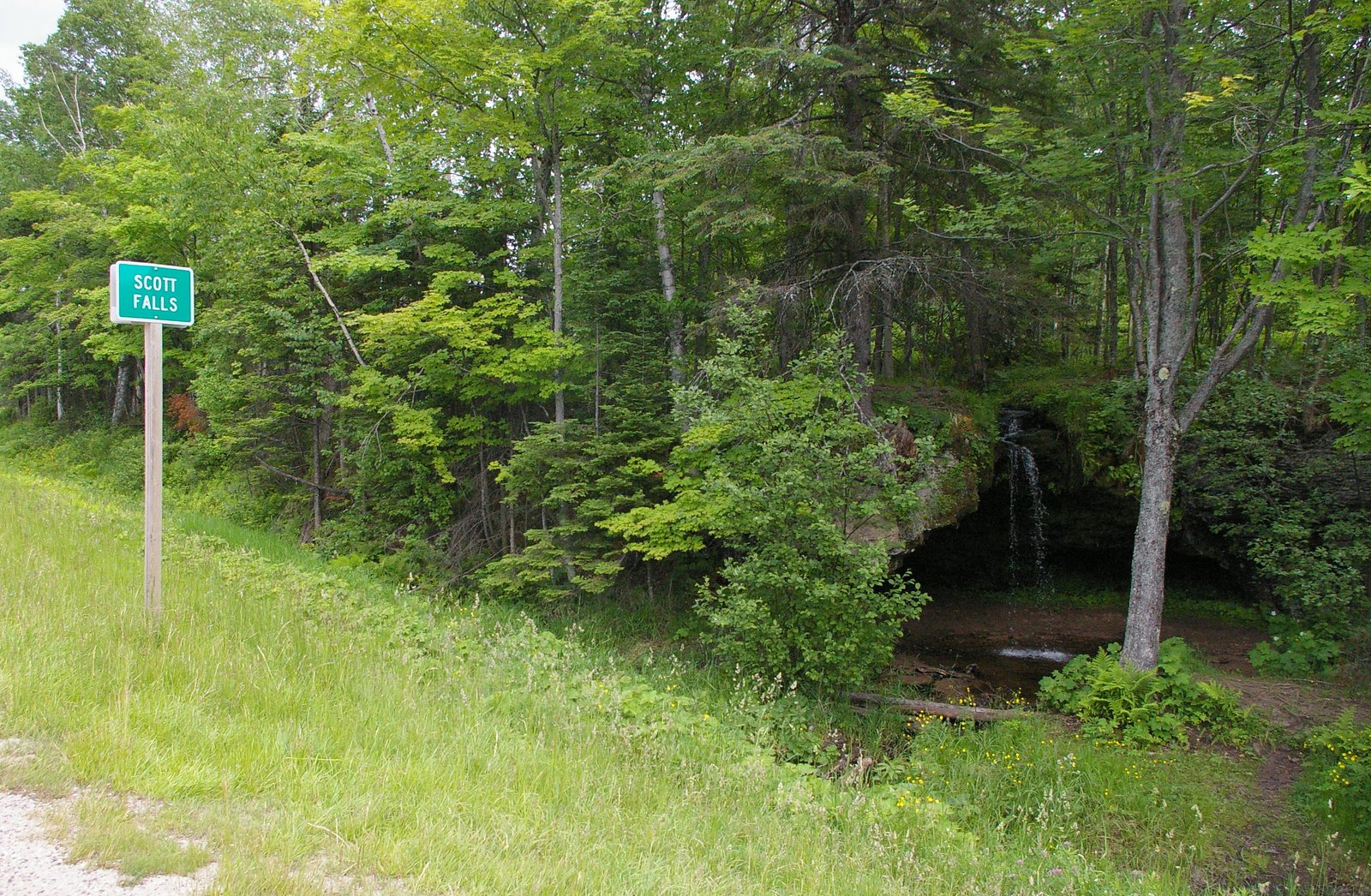
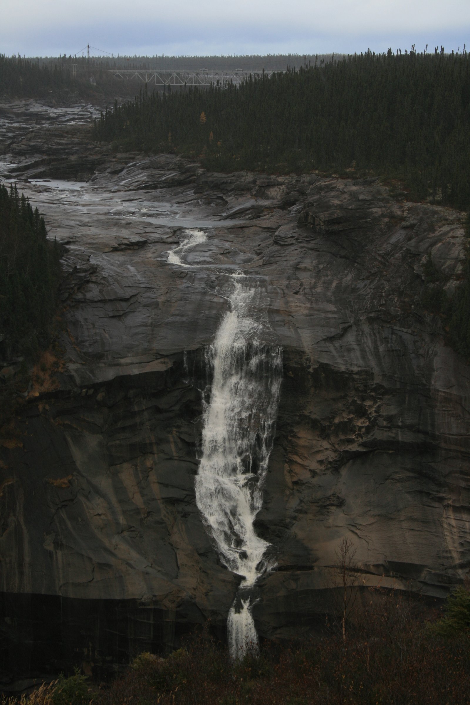
Scott Falls (Newfoundland & Labrador) appears to be a small to medium waterfall located in the boreal/riverine landscape of central Labrador. Based on its coordinates (53.4976, -64.54) it is in a remote, sparsely developed area with typical Labrador terrain: mixed forest, rocky outcrops and rivers. Visitor reports for waterfalls in this region commonly describe limited infrastructure (no formal viewing platforms) and a natural, undeveloped setting. Exact published details on Scott Falls (height, official trailhead) are not widely available; the description below therefore uses cautious language where specifics are not confirmed.
Why This Waterfall Exists
Scott Falls flows over hard crystalline rock laid down over 1.6-1.8 billion years ago. These resistant rocks form a durable ledge that water cannot easily wear away, creating the falls where softer material downstream has already eroded.
Nearby Falls Worth Visiting
Churchill Falls (75 m) lies 18.8 kilometres to the northeast.
Trail & Hike Details
Trail Description
There is no widely published, maintained trail description for Scott Falls available in common trail resources. Based on typical falls in central Labrador, access may involve a short, informal path over uneven ground, wet/mossy rock, and potentially boggy forest. Expect roots, rocks and natural obstacles rather than boardwalks or stairs. If a formal trail exists, it is likely short (but this is not confirmed).
What to Expect
Expect a natural, undeveloped waterfall setting with boreal forest (spruce, fir), rocky banks, and possibly steep or slippery approaches near the water. Water flow will vary seasonally, higher flows during spring melt and after heavy rain, lower flow in late summer. Mosquitoes and blackflies can be abundant in warm months. Wildlife in the area may include moose and black bear; birdlife typical of northern forests is common. Facilities (toilets, trash cans, signage) are likely absent.
Accessibility
There is no information indicating developed, accessible infrastructure. The site is likely not wheelchair accessible and will require negotiating uneven, wet and potentially steep terrain. Accessibility may be seasonally dependent.
Frequently Asked Questions
🐶 Are Dogs Allowed at Scott Falls?
❌ Dogs are not allowed
Are There Any Fees or Permits Required?
🆖 No fees required
🏊 Is There Swimming at Scott Falls?
❌ Swimming is not allowed
When to Visit
Late spring (during snowmelt) for highest flows; summer for easier road access and safer footing; early fall for foliage and lower insect activity. Winter access is possible but can be hazardous due to ice, deep snow and extremely cold temperatures and should be attempted only by experienced winter travelers with appropriate equipment.
Seasonal Access
The best time to visit is Spring, Summer, Fall, and Winter. Check with the managing park or local authority for current conditions.
Safety Information
Hazards include slippery rocks, steep or unstable banks, strong currents, cold water temperatures, rapidly changing weather, insects (mosquitoes/blackflies), limited cell coverage and potentially long distances to emergency services. In winter expect ice, deep snow and avalanche risk on steep slopes. Be conservative in assessing ability to approach water edges; do not climb on wet rocks near falls. If travelling on remote roads, carry emergency supplies and inform someone of your itinerary.
Current Water Conditions
Based on a Water Survey of Canada gauge 28.3 km away
37.2 m³/s
Current discharge — how much water is flowing
About average for this time of year
Based on 12 years of record
138.37 m
Water depth at gauge
7-Day Discharge Trend
What does this mean for your visit?
Flow is about average for this time of year.
About This Gauge
This gauge is on a regional waterway. Conditions at the falls may differ, especially after local rain.
7-Day Flow Outlook
Based on the WSC gauge CHURCHILL RIVER ABOVE CHURCHILL FALLS TAILRACE (28 km away).
Today
Moderate
40 m³/s
5/10Tomorrow
Moderate
40 m³/s
5/10Tue
Moderate
36 m³/s
6/10Wed
Moderate
36 m³/s
6/10Thu
Moderate
39 m³/s
4/10Fri
Moderate
36 m³/s
5/10Sat
Moderate
37 m³/s
5/10Best window: Tue — moderate flow, cloudy (trip score 6/10).
Best time of year: this gauge typically runs highest from early May to early July, peaking in May.
How we calculate this
This is a transparent outlook, not a precise forecast. We take the waterfall's current flow strength (how it ranks against its historical normal for today, from the nearest WSC stream gauge), carry that ranking forward along the gauge's seasonal curve, and nudge it for forecast rain. Confidence is highest for the next day or two and falls further out. Always check official conditions and your own judgment before visiting — high flows can be dangerous.
Weather Forecast
Location & Access
Getting There
Scott Falls is in a remote part of Labrador. Approaches are likely by secondary/unpaved roads or by boat/river access depending on exact local geography. Visitors should plan for long drives from the nearest service centers and for limited signage. If travelling by road, expect gravel/seasonal roads and possible use of a high-clearance vehicle. Cell service may be intermittent or absent.
Get Directions on Google MapsParking
No confirmed formal parking lot or maintained parking area. Parking may be a roadside pullout or informal clearing; exercise caution parking on narrow or soft shoulders. If accessing by river, parking may be at a nearby community or staging area.
Elevation
430 metres above sea level
Coordinates
53.497582° N, -64.540038° W
Visitor Tips & Gear
• Travel prepared for remote conditions: carry a map, GPS, spare fuel and extra food/water. • Expect limited or no cell service, tell someone your route and expected return. • Wear sturdy, waterproof footwear; rocks near falls are slippery and may be covered in moss or ice. • Insect repellent and head nets are useful in spring/summer. • Practice Leave No Trace: pack out what you pack in. • Check local road conditions and weather forecasts before travel; roads can be seasonal and washouts are possible. • If unsure about land status, respect private property and industrial (forestry/hydro) land boundaries; permits or permission may be required in some areas.
Where to Stay
Browse vacation cabins and private rentals nearby
Unique outdoor stays — tents, yurts, and treehouses
Rent a campervan or RV for your waterfall road trip
Some links are affiliate links. We may earn a commission at no extra cost to you.
Additional Information
Nearby Attractions
The area around these coordinates is typical Labrador wilderness, scenic rivers, boreal forest and provincial backcountry. Nearest larger service centers in central Labrador include communities such as Churchill Falls and Happy Valley–Goose Bay, but exact proximity should be confirmed for your route. Hydroelectric facilities and access roads related to major river systems exist in the region and may be of interest; verify access and safety before approaching such infrastructure.
Wildlife
Moose, black bear, foxes, migratory birds, and abundant insects in warmer months. Expect typical boreal flora and fauna; keep distance from wildlife and store food securely.
Nearby Waterfalls
Other waterfalls named Scott Falls
1 other waterfall shares this name across Canada.
Writing about Scott Falls? Embed this waterfall on your site for free.