Churchill Falls
Newfoundland and Labrador • 75 m
By Armen Suny · Last verified Jun 2026
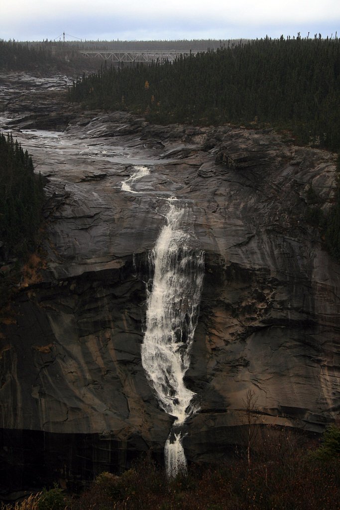
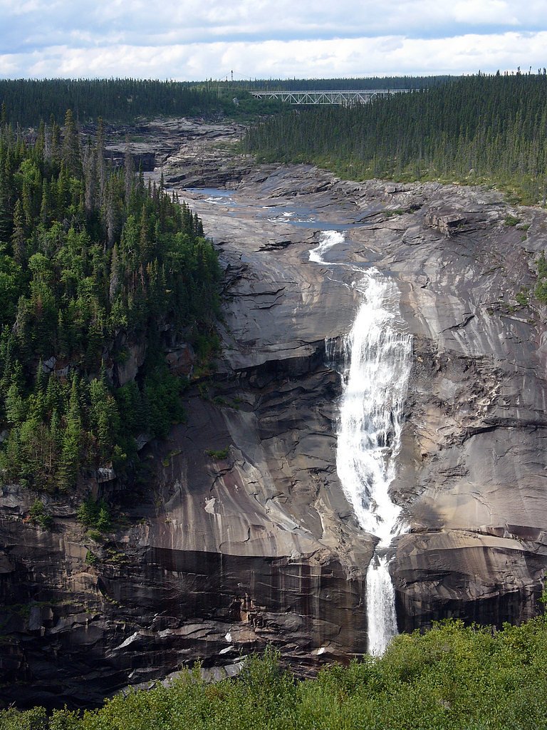
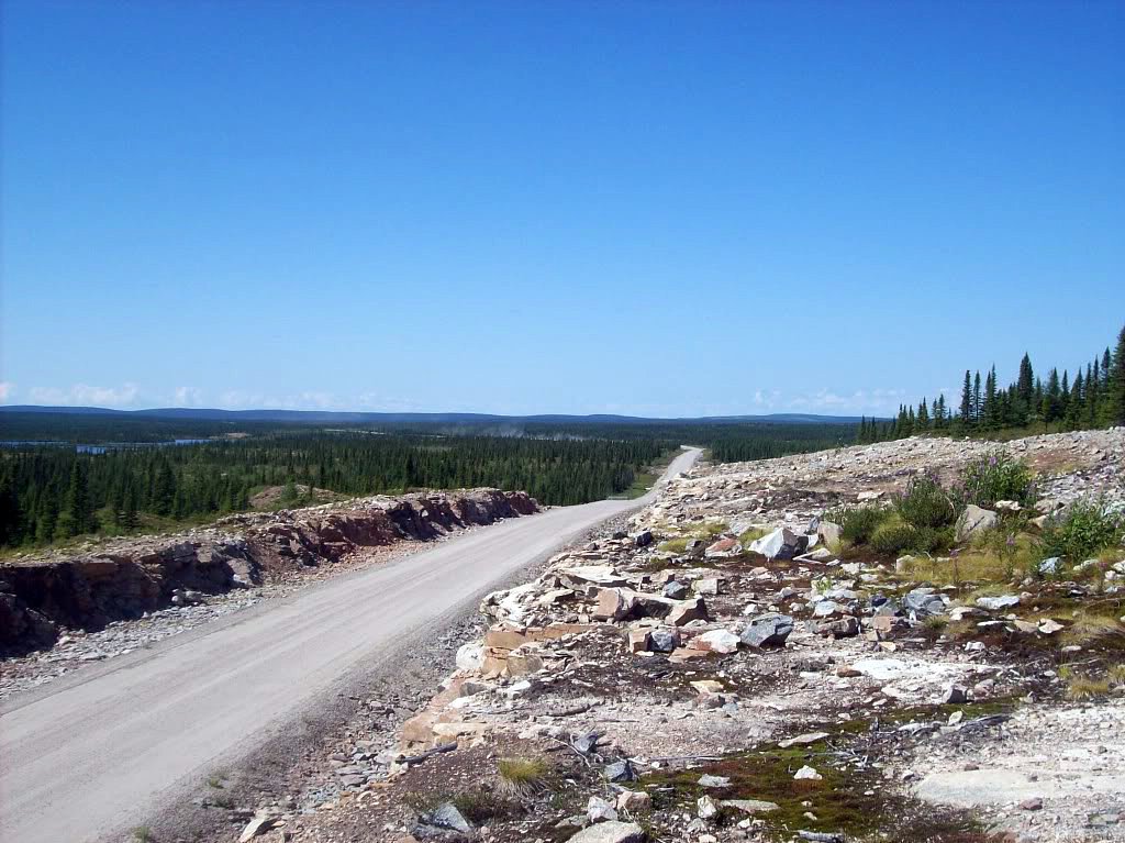
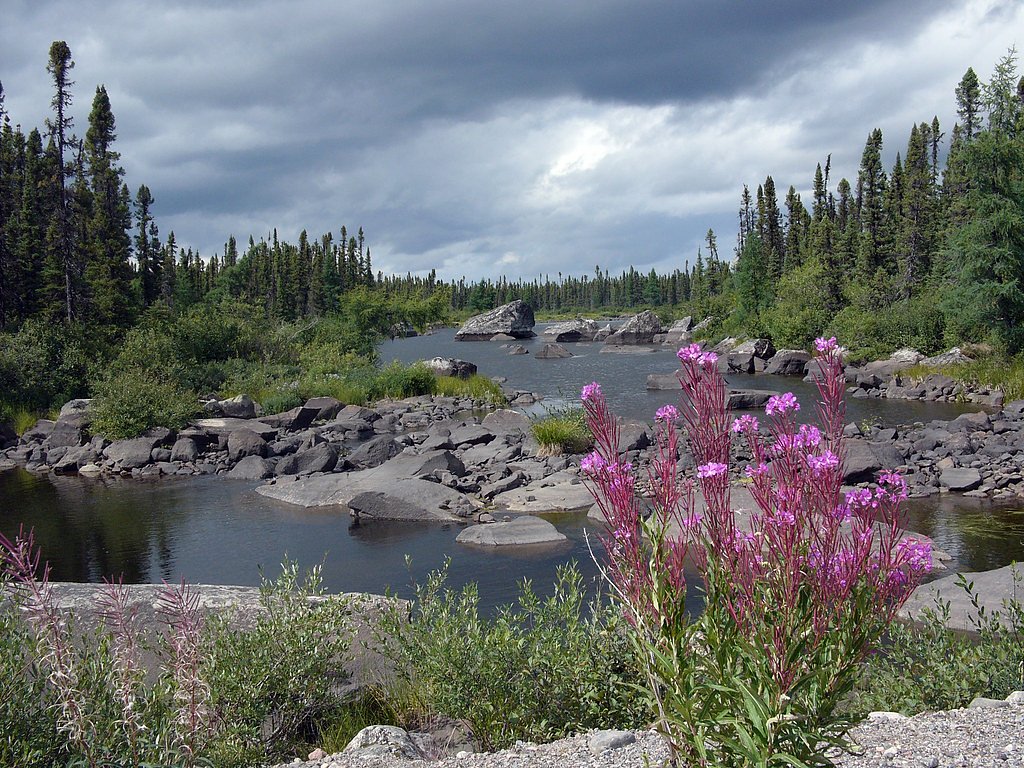
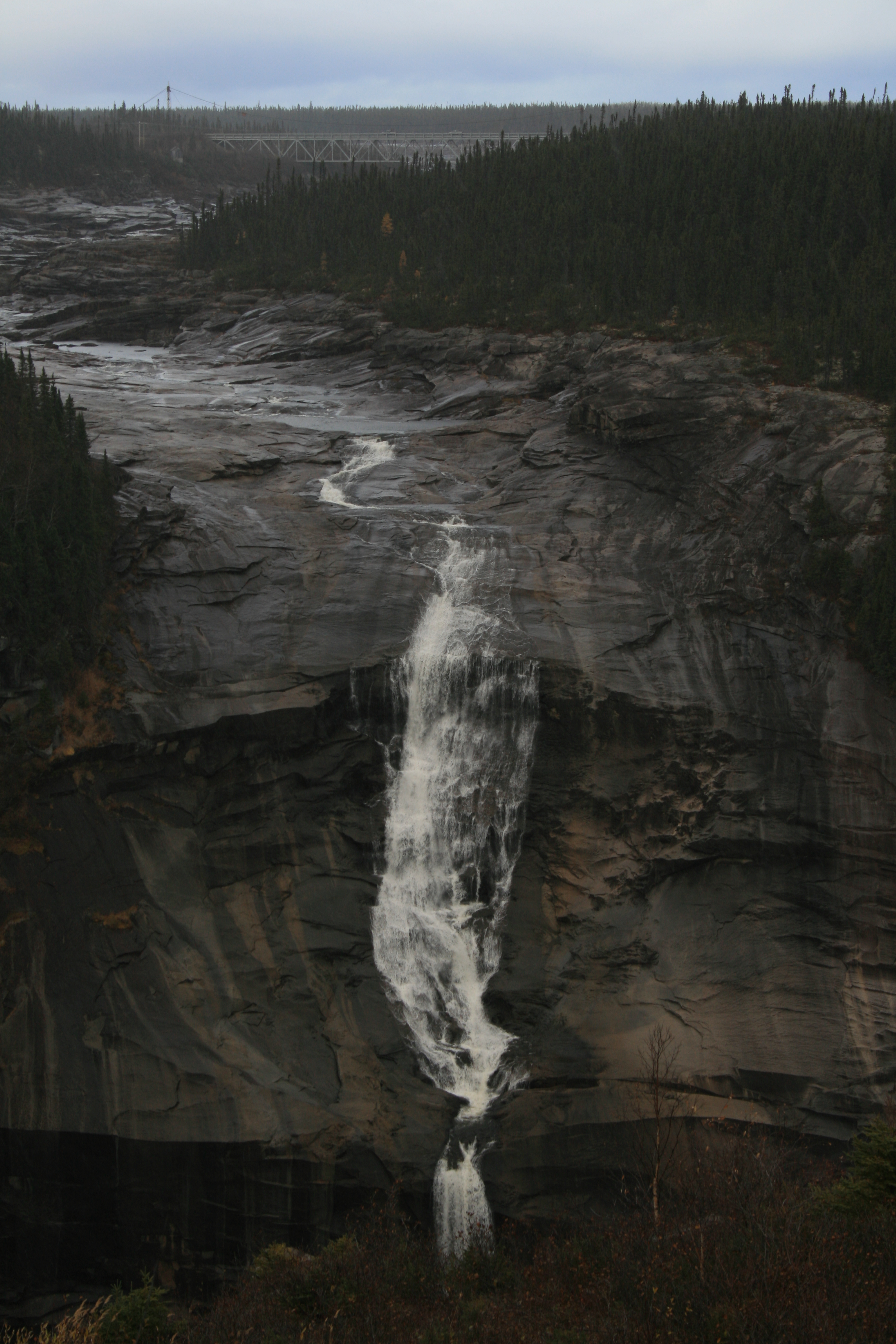
Photo Credits (5)
Difficulty
Easy
Trail Length
2.6 km
Trail Type
Out And Back
Elevation Gain
6 m
About Churchill Falls
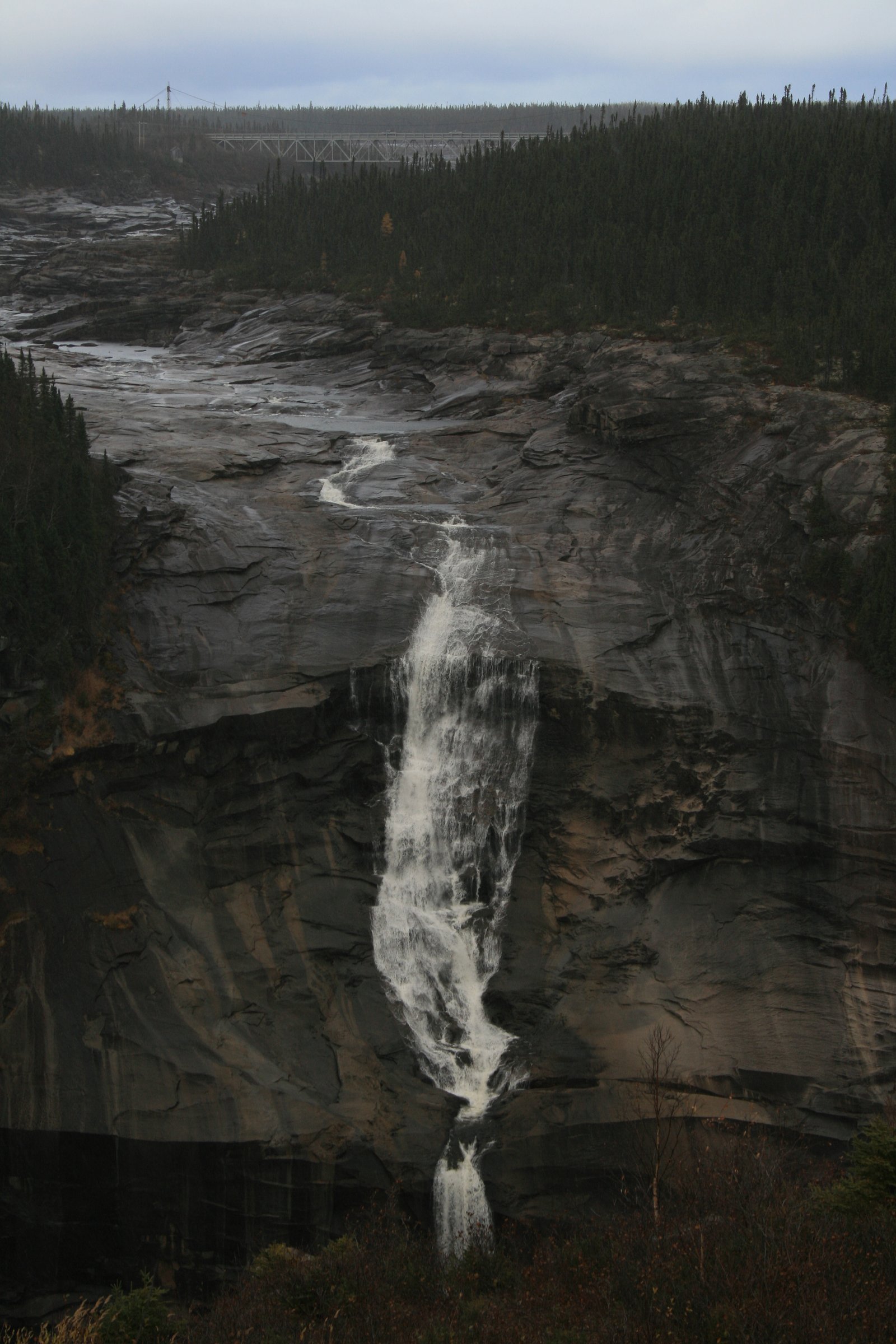
Churchill Falls is a 245 ft (74.7 m) high waterfall on the Churchill River in Labrador, Canada. Formerly counted among the most impressive natural features of Canada, the diversion of the river for the Churchill Falls Generating Station has cut off almost all of the falls' former flow, leaving a small stream winding through its old bed and trickling down the rocks.
The Setting
Churchill Falls sits at 373 metres in the foothills of Newfoundland and Labrador. At 75 metres, it is among the taller waterfalls in Newfoundland and Labrador.
Why This Waterfall Exists
Churchill Falls flows over hard crystalline rock, primarily gneiss, laid down over 1.6-2.5 billion years ago. These resistant rocks form a durable ledge that water cannot easily wear away, creating a 245-foot drop where softer material downstream has already eroded.
Trail & Hike Details
The Approach
The easy 2.6-km out-and-back trail gains 6 metres of elevation on the way to the falls.
Trail Description
There is no developed long hiking trail to a classic waterfall amphitheater at this location. Most visitors view Churchill Falls and the associated hydroelectric structures from roadside viewpoints or short paved/unpaved walkways near the town. Access beyond public viewing areas may be restricted for safety and security around the generating station.
What to Expect
The falls plunge 75 metres over hard crystalline rock.
Accessibility
The trail is not wheelchair accessible. Uneven terrain and elevation changes require steady footing.
Frequently Asked Questions
🐶 Are Dogs Allowed at Churchill Falls?
❌ Dogs are not allowed
Are There Any Fees or Permits Required?
🆖 No fees required
🏊 Is There Swimming at Churchill Falls?
❌ Swimming is not allowed
When to Visit
Late spring through early fall is typically best for road access, milder weather, and seeing higher flows if water releases are scheduled. Winter visits are possible but require proper winter gear, a capable vehicle, and awareness of snow/ice conditions. Hydro operations can cause variable flows at any time of year.
Seasonal Access
The best time to visit is Spring, Summer, Fall, and Winter. Check with the managing park or local authority for current conditions.
Safety Information
Hazards include restricted/industrial areas around the hydroelectric facility, strong currents and dangerous hydraulics near spillways, steep or slippery riverbanks, rapidly changing weather, and limited emergency services due to remoteness. Do not cross fences or enter fenced zones. Dress for sudden weather changes, carry emergency supplies, and travel with communication plans. If boating or approaching the river, be aware that flow releases can occur without notice and are extremely hazardous.
Current Water Conditions
45.2 m³/s
Current discharge — how much water is flowing
About average for this time of year
Based on 12 years of record
138.45 m
Water depth at gauge
7-Day Discharge Trend
What does this mean for your visit?
Flow is about average for this time of year.
About This Gauge
This gauge is on a nearby waterway and may not reflect exact conditions at the falls.
7-Day Flow Outlook
Based on the WSC gauge CHURCHILL RIVER ABOVE CHURCHILL FALLS TAILRACE (15 km away).
Today
Moderate
49 m³/s
5/10Tomorrow
Moderate
48 m³/s
5/10Sat
Moderate
45 m³/s
6/10Sun
Moderate
45 m³/s
5/10Mon
Moderate
43 m³/s
5/10Tue
Moderate
42 m³/s
5/10Wed
Moderate
42 m³/s
5/10Best window: Sat — moderate flow, cloudy (trip score 6/10).
Best time of year: this gauge typically runs highest from early May to early July, peaking in May.
How we calculate this
This is a transparent outlook, not a precise forecast. We take the waterfall's current flow strength (how it ranks against its historical normal for today, from the nearest WSC stream gauge), carry that ranking forward along the gauge's seasonal curve, and nudge it for forecast rain. Confidence is highest for the next day or two and falls further out. Always check official conditions and your own judgment before visiting — high flows can be dangerous.
Weather Forecast
Location & Access
Getting There
The site is reached by driving to the community of Churchill Falls in Labrador. Roads are remote and may be unpaved or affected by seasonal conditions; long distances to services are typical. If traveling from Labrador City or Goose Bay, expect multi-hour drives on regional highways. Follow local signage for viewing areas and any restricted zones around the hydroelectric facility.
Get Directions on Google MapsParking
There is typically roadside or small public parking near viewpoints in the town area. Parking at or adjacent to the generating station may be restricted; observe signage and do not park in marked or gated areas. Availability may be limited during peak visitor periods or maintenance operations.
Elevation
373 metres above sea level
Coordinates
53.594508° N, -64.307697° W
Visitor Tips & Gear
• Respect all signage and fenced/restricted areas near the generating station. Do not attempt to approach spillways or riverbanks where access is prohibited. • Check local road conditions and facility notices before traveling; seasonal closures or maintenance can affect access. • Bring adequate fuel, food, and emergency supplies, services are limited and distances between towns are large. • Expect bugs (black flies/mosquitoes) in late spring and summer; bring repellant. • Wear sturdy footwear for uneven or icy surfaces near riverbanks and viewpoints. • Cell coverage may be spotty; carry a map and let someone know your plans.
As an Amazon Associate, we earn from qualifying purchases.
This easy 2.6 km hike is straightforward — comfortable trail shoes and plenty of water should do. Icy conditions are common in winter — traction cleats are a smart addition.

Columbia Watertight II Rain Jacket
Packs into its own pocket, seam-sealed, and keeps you dry from spray and surprise rain.

Polarized Sunglasses (Knockaround)
Cuts glare off the water so you actually see the falls — and your photos turn out better too.

Earth Pak Waterproof Dry Bag
Keeps your phone and gear dry when waterfall mist soaks everything else.

Waterproof Phone Pouch (AiRunTech)
Cheap insurance — take photos right next to the falls without killing your phone.

Kahtoola MICROspikes
Cult-favorite traction cleats that grip ice and wet rock — essential for winter waterfall hikes.

JOBY GorillaPod Starter Kit
Wraps around railings and rocks for long-exposure waterfall shots — no flat surface needed.
Where to Stay
Browse vacation cabins and private rentals nearby
Unique outdoor stays — tents, yurts, and treehouses
Rent a campervan or RV for your waterfall road trip
Some links are affiliate links. We may earn a commission at no extra cost to you.
Additional Information
Nearby Attractions
Churchill Falls community and viewpoint areas; Churchill Falls Generating Station (industrial viewpoint only, tours or entry may be restricted); broader Labrador attractions such as Labrador City to the west and scenic river/backcountry areas for experienced travelers.
Wildlife
Typical Labrador wildlife may be present: moose, black bear, arctic hare/lemming in nearby tundra areas, and a variety of waterfowl and shorebirds. Always observe wildlife at a distance and store food securely.
Nearby Waterfalls
Writing about Churchill Falls? Embed this waterfall on your site for free.