Rosewall Creek Falls
By Armen Suny · Last verified Jun 2026
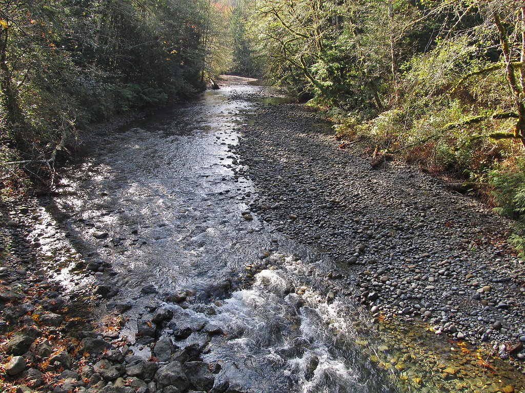
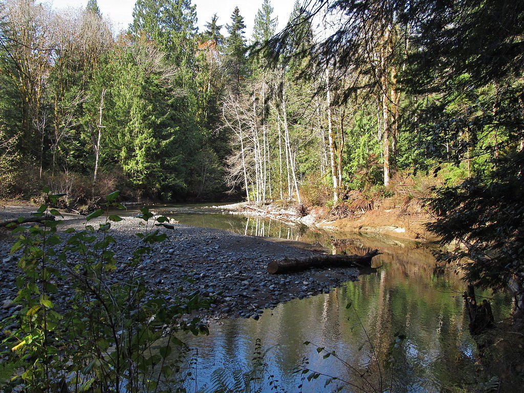
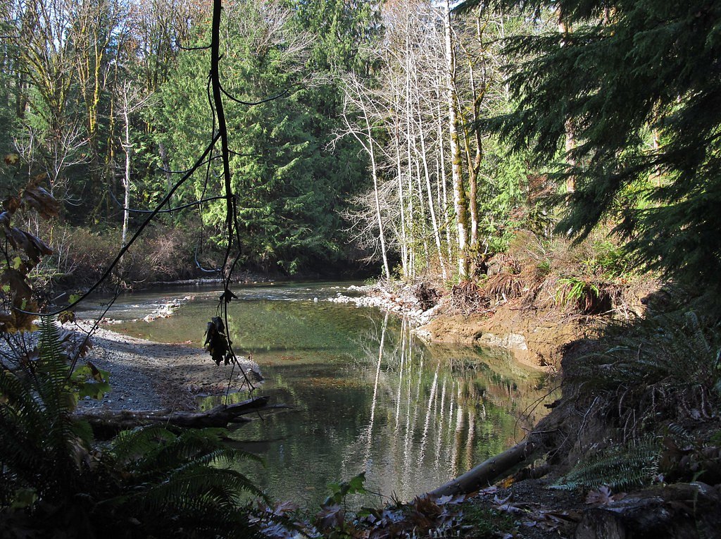
Photo Credits (5)
Difficulty
Moderate
Trail Length
6.1 km
Trail Type
Out And Back
Elevation Gain
143 m
About Rosewall Creek Falls
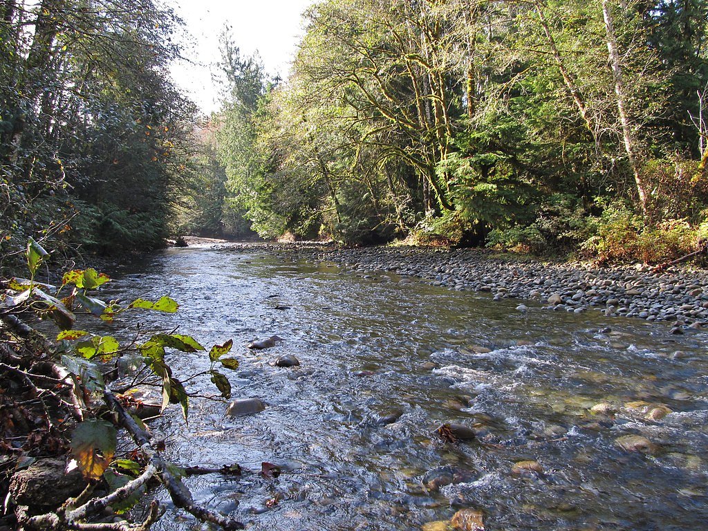
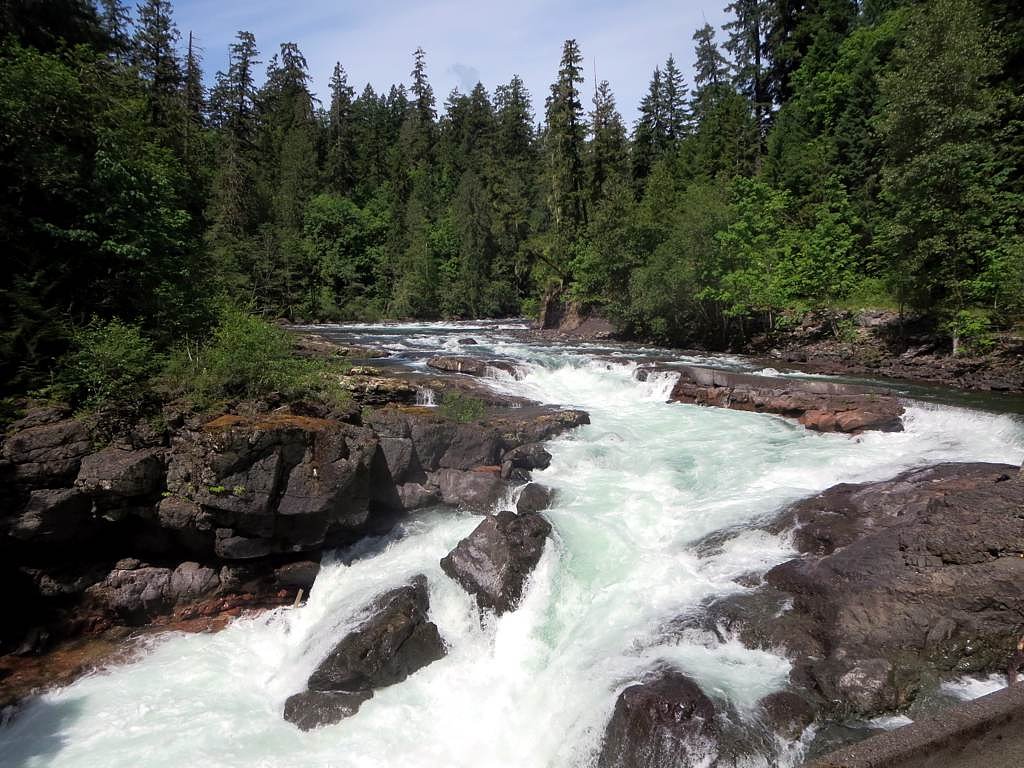
Rosewall Creek Falls is a small forested cascade on Rosewall Creek on eastern Vancouver Island (Comox Valley area). The falls sit in mixed coastal forest and are most impressive in spring and after heavy rain. The site is relatively undeveloped with limited infrastructure and short, often muddy footpaths to viewpoints.
Why This Waterfall Exists
Rosewall Creek Falls flows over layered sedimentary rock laid down about 66-101 million years ago. Over time, the stream has worn through these layers at different rates, creating the step that forms the waterfall.
Trail & Hike Details
The Approach
The moderate 6.1-km out-and-back trail gains 143 metres of elevation on the way to the falls.
Trail Description
The approach is a short forested walk on an unmaintained or minimally maintained trail. Expect a narrow, rooty and possibly muddy path through coastal forest (alder, cedar, fir). The final viewpoint(s) are close to the creek and may require negotiating wet, rocky terrain. There may be short steep or slippery sections; scrambling closer to the water is often required to reach the best views.
What to Expect
A modest cascade or multi-tiered falls rather than a large single-drop waterfall. Flow varies seasonally, highest in spring and after heavy rain, lower in late summer. The area is undeveloped with few or no facilities, limited signage, and potentially limited cell service. Rocks and banks near the creek are frequently slippery and unstable.
Accessibility
The trail is not wheelchair accessible. Uneven terrain and elevation changes require steady footing.
Frequently Asked Questions
🐶 Are Dogs Allowed at Rosewall Creek Falls?
❌ Dogs are not allowed
Are There Any Fees or Permits Required?
🆖 No fees required
🏊 Is There Swimming at Rosewall Creek Falls?
❌ Swimming is not allowed
When to Visit
Spring (snowmelt and rain) for highest flows and dramatic water; late spring to early summer for good access and green forest; fall can be good after autumn rains. Winter access is possible but trails and roads may be affected by storm damage, mud, or washouts, use caution and check conditions.
Seasonal Access
The best time to visit is Spring, Summer, Fall, and Winter. Check with the managing park or local authority for current conditions.
Safety Information
Hazards include slippery rocks and banks, cold and fast-moving water, unstable edges, seasonal high flows, and limited cell service. Trails and access roads may be muddy or degraded after storms. Be bear-aware in forested areas. Supervise children closely and do not climb on wet rocks near the creek. Check recent local trip reports for current conditions before visiting.
Current Water Conditions
0.2 m³/s
Current discharge — how much water is flowing
About average for this time of year
Based on 66 years of record
1.14 m
Water depth at gauge
7-Day Discharge Trend
What does this mean for your visit?
Flow is about average for this time of year.
About This Gauge
This gauge is on a nearby waterway and may not reflect exact conditions at the falls.
7-Day Flow Outlook
Based on the WSC gauge NILE CREEK NEAR BOWSER (12 km away).
Today
Moderate
0.2 m³/s
6/10Tomorrow
Moderate
0.2 m³/s
8/10Tue
Moderate
0.2 m³/s
6/10Wed
Moderate
0.2 m³/s
6/10Thu
Moderate
0.2 m³/s
6/10Fri
Moderate
0.2 m³/s
6/10Sat
Moderate
0.2 m³/s
6/10Best window: Tomorrow — moderate flow, sunny (trip score 8/10).
Best time of year: this gauge typically runs highest from early January to early February, peaking in January.
How we calculate this
This is a transparent outlook, not a precise forecast. We take the waterfall's current flow strength (how it ranks against its historical normal for today, from the nearest WSC stream gauge), carry that ranking forward along the gauge's seasonal curve, and nudge it for forecast rain. Confidence is highest for the next day or two and falls further out. Always check official conditions and your own judgment before visiting — high flows can be dangerous.
Know when to go.
Get a free email alert when waterfalls near Courtenay hit peak flow. We only send when conditions are worth the trip — no weekly newsletters, no spam.
Weather Forecast
Location & Access
Getting There
Located at approximately 49.4522, -124.8044 on Vancouver Island’s east side, roughly 20 miles from Courtenay. Access is typically from local roads off the main Island Highway (Highway 19) and may involve short gravel or forest roads and a short footpath to the creek. Signage may be minimal; consult recent local trail reports or maps before visiting.
Get Directions on Google MapsParking
Parking is limited and likely informal (small pullout or roadside parking). Expect narrow shoulders and no formal lot or restroom facilities. Park well off the road and avoid blocking driveways or gates.
Elevation
135 metres above sea level
Coordinates
49.452203° N, -124.804384° W
Visitor Tips & Gear
Wear sturdy, grippy footwear and expect mud and wet roots. Bring insect repellent in warmer months and dress in layers; weather can change quickly. Do not attempt to climb wet rocks near the falls, they can be very slippery. Park only in safe, legal areas; be prepared for limited or no cell service and carry a map or offline directions. Check recent trip reports or local resources for current access conditions.
As an Amazon Associate, we earn from qualifying purchases.
With 6.1 km and 143 m of elevation gain, sturdy boots and trekking poles will help on this moderate trail. Icy conditions are common in winter — traction cleats are a smart addition.

Columbia Watertight II Rain Jacket
Packs into its own pocket, seam-sealed, and keeps you dry from spray and surprise rain.

Polarized Sunglasses (Knockaround)
Cuts glare off the water so you actually see the falls — and your photos turn out better too.

Earth Pak Waterproof Dry Bag
Keeps your phone and gear dry when waterfall mist soaks everything else.

Waterproof Phone Pouch (AiRunTech)
Cheap insurance — take photos right next to the falls without killing your phone.

Timberland Euro Sprint Mid Waterproof
Trusted waterproof boot with premium leather and grippy rubber sole — reliable on rocky, wet trails.

TrailBuddy Trekking Poles
Lightweight aluminum, cork grips, and flip-locks that actually hold — a best-seller for good reason.
Where to Stay
Browse vacation cabins and private rentals nearby
Unique outdoor stays — tents, yurts, and treehouses
Rent a campervan or RV for your waterfall road trip
Some links are affiliate links. We may earn a commission at no extra cost to you.
Nearby Campground
Fillongley Provincial Campground
10.6 km away
Additional Information
Nearby Attractions
Comox Valley communities (Courtenay, Comox), regional parks and lakes in the Comox Valley, and other east-Vancouver Island hiking and beach access points. Mount Washington (recreation area) and several local provincial parks are in the broader region.
Wildlife
Typical Vancouver Island wildlife may be present: black bears, deer, small mammals, occasional cougar in remote forested areas, and diverse birdlife. Salmon runs may occur in some regional streams (check local sources for specifics). Practice standard wildlife awareness: keep distance, store food securely, and be alert.
Cities near Rosewall Creek Falls
Nearby Waterfalls
Writing about Rosewall Creek Falls? Embed this waterfall on your site for free.