Robertson River Falls
By Armen Suny · Last verified Jun 2026
Photo Credits (1)
Difficulty
Moderate
Trail Length
8.2 km
Trail Type
Out And Back
Elevation Gain
150 m
About Robertson River Falls
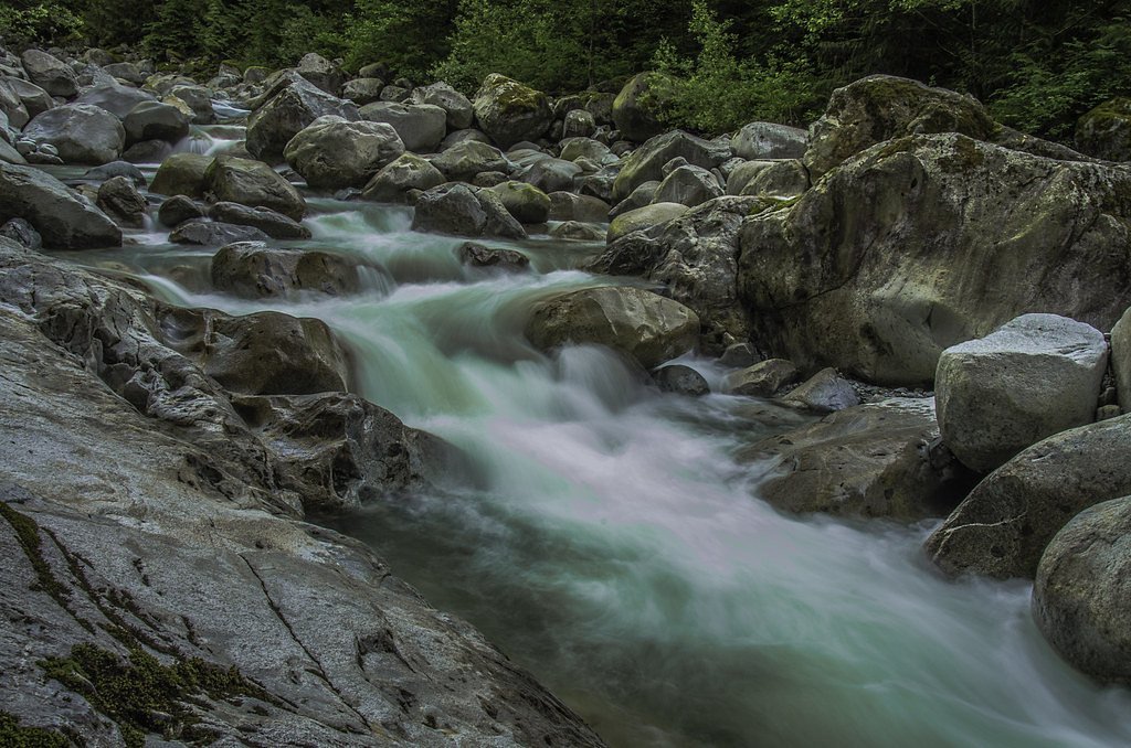
Robertson River Falls is reported at coordinates 48.7621, -124.1005 in the coastal/upland area between southern Vancouver Island and the northern Olympic Peninsula. Public information about this specific named waterfall is limited and sources vary on jurisdiction and exact access routes. The falls are described by some visitors as a forested, coastal-stream cascade with seasonal flow that is highest in spring and after heavy rains. Visitors should verify location and land status before travelling.
Why This Waterfall Exists
Robertson River Falls flows over hard volcanic rock laid down about 201-252 million years ago. These resistant rocks form a durable ledge that water cannot easily wear away, creating the falls where softer material downstream has already eroded.
Trail & Hike Details
The Approach
The moderate 8.2-km out-and-back trail gains 150 metres of elevation on the way to the falls.
Trail Description
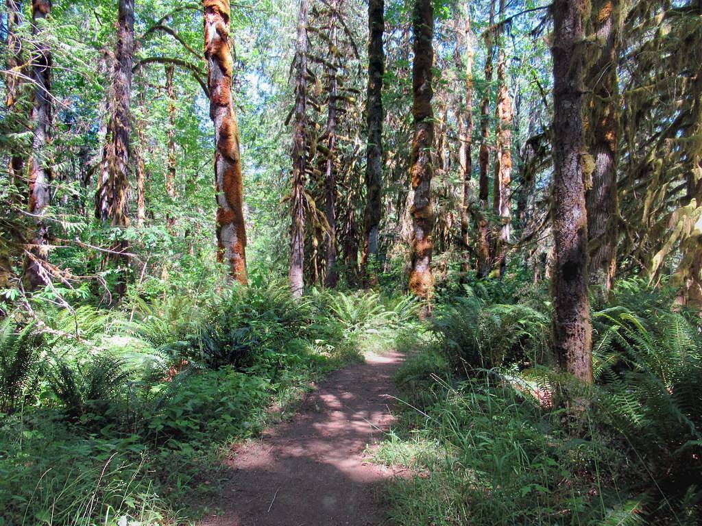
There is no well-documented maintained trail widely published for Robertson River Falls. Approaches reported for similar remote coastal waterfalls often include forested singletrack, short scrambles over roots and rocks, and route-finding through second-growth or mature coastal forest. Expect limited signage and potentially steep, slippery sections near the stream. If there is a formal trail it is likely short but may be rough; be prepared for off-trail navigation.
What to Expect
Dense coastal forest, mossy rocks, streams and wet ground. The waterfall may be a multi-step cascade or single drop depending on seasonal flow. Flow is likely highest in spring and after heavy rains and reduced in late summer. Limited or no facilities (no restrooms, no maintained viewpoints). Cell coverage may be intermittent or absent.
Accessibility
The trail is not wheelchair accessible. Uneven terrain and elevation changes require steady footing.
Frequently Asked Questions
🐶 Are Dogs Allowed at Robertson River Falls?
❌ Dogs are not allowed
Are There Any Fees or Permits Required?
🆖 No fees required
🏊 Is There Swimming at Robertson River Falls?
❌ Swimming is not allowed
When to Visit
Late spring through early fall for easier road conditions and good water flow. Spring typically offers the highest flows. Avoid heavy winter storms and periods when seasonal logging or forestry operations restrict access.
Seasonal Access
The best time to visit is Spring, Summer, and Fall. Winter access may be limited. Check with the managing park or local authority for current conditions.
Safety Information
Hazards may include slippery rocks, steep drop-offs, fast or cold water, flashy stream flows after rain events, unstable banks, poor or no cell reception, and potential private-vehicle restrictions on logging or forest roads. Roads to trailheads in remote coastal areas may be washed out or gated seasonally. Check recent trip reports and local authorities (provincial park, forest service, or local municipality) for the most current conditions and closures before travelling. Bring appropriate safety gear and avoid visiting alone in very remote areas.
Current Water Conditions
5.5 m³/s
Current discharge — how much water is flowing
Much lower than usual for this time of year
Based on 91 years of record
0.24 m
Water depth at gauge
7-Day Discharge Trend
What does this mean for your visit?
Flow is well below normal for this time of year, so the waterfall may be a trickle.
About This Gauge
7-Day Flow Outlook
Based on the WSC gauge COWICHAN RIVER AT LAKE COWICHAN (8 km away).
Today
Barely Flowing
5.5 m³/s
4/10Tomorrow
Barely Flowing
5.4 m³/s
4/10Tue
Barely Flowing
5.4 m³/s
4/10Wed
Barely Flowing
5.3 m³/s
4/10Thu
Barely Flowing
5.3 m³/s
4/10Fri
Barely Flowing
5.2 m³/s
4/10Sat
Barely Flowing
5.7 m³/s
3/10Best window: Today — barely flowing flow, cloudy (trip score 4/10).
Best time of year: this gauge typically runs highest from mid November to early February, peaking in December.
How we calculate this
This is a transparent outlook, not a precise forecast. We take the waterfall's current flow strength (how it ranks against its historical normal for today, from the nearest WSC stream gauge), carry that ranking forward along the gauge's seasonal curve, and nudge it for forecast rain. Confidence is highest for the next day or two and falls further out. Always check official conditions and your own judgment before visiting — high flows can be dangerous.
Know when to go.
Get a free email alert when waterfalls near Nanaimo hit peak flow. We only send when conditions are worth the trip — no weekly newsletters, no spam.
Weather Forecast
Location & Access
Getting There
Use the provided coordinates (48.7621, -124.1005) in a reliable GPS or mapping app. The site is in a remote coastal/forest area; approach may require travel on secondary/unpaved roads and possible short cross-country travel. Nearest population centers cited: Nanaimo (~26.7 miles), Clallam Bay (~31.5 miles), Sekiu (~32.8 miles). Confirm route with local maps, park/forest service, or recent trip reports before you go.
Get Directions on Google MapsParking
Parking information is not well-documented. Expect limited or informal roadside parking; vehicles may need to park on a pullout off a forest or logging road. If access crosses private land, parking may be restricted. Arrive prepared to walk from the nearest legal parking area.
Elevation
271 metres above sea level
Coordinates
48.762130° N, -124.100455° W
Visitor Tips & Gear
• Confirm exact location and access (public vs private land) before visiting. • Wear waterproof, grippy footwear, rocks and roots near the stream will be slippery. • Expect low or informal signage; carry a map and GPS coordinates. • Tell someone your plans and expected return time, cell service may be unreliable. • Avoid approaching cliff edges or standing directly under the lip during high flow. • Respect private property and posted closures; do not park where you block gates or roads.
As an Amazon Associate, we earn from qualifying purchases.
With 8.2 km and 150 m of elevation gain, sturdy boots and trekking poles will help on this moderate trail. Sun exposure on the trail makes good sun protection a must in summer.

Polarized Sunglasses (Knockaround)
Cuts glare off the water so you actually see the falls — and your photos turn out better too.

Columbia Watertight II Rain Jacket
Packs into its own pocket, seam-sealed, and keeps you dry from spray and surprise rain.

Earth Pak Waterproof Dry Bag
Keeps your phone and gear dry when waterfall mist soaks everything else.

Waterproof Phone Pouch (AiRunTech)
Cheap insurance — take photos right next to the falls without killing your phone.

Timberland Euro Sprint Mid Waterproof
Trusted waterproof boot with premium leather and grippy rubber sole — reliable on rocky, wet trails.

TrailBuddy Trekking Poles
Lightweight aluminum, cork grips, and flip-locks that actually hold — a best-seller for good reason.
Where to Stay
Browse vacation cabins and private rentals nearby
Unique outdoor stays — tents, yurts, and treehouses
Rent a campervan or RV for your waterfall road trip
Some links are affiliate links. We may earn a commission at no extra cost to you.
Nearby Campground
Lakeview Park Campground
6.6 km away
Additional Information
Nearby Attractions
Nearest named communities referenced are Nanaimo (~26.7 miles), Clallam Bay (~31.5 miles), and Sekiu (~32.8 miles). Regional attractions in the broader area may include coastal viewpoints, local beaches, and forested parkland, confirm exact distances and routing locally.
Wildlife
Typical coastal Pacific Northwest wildlife may be present: black bear, deer, small mammals, bald eagles and other raptors, and potentially cougar. Standard wildlife precautions apply (store food securely, give animals space).
Cities near Robertson River Falls
Nearby Waterfalls
Writing about Robertson River Falls? Embed this waterfall on your site for free.