Rearguard Waterfalls
British Columbia • 6 m
By Armen Suny · Last verified Jun 2026
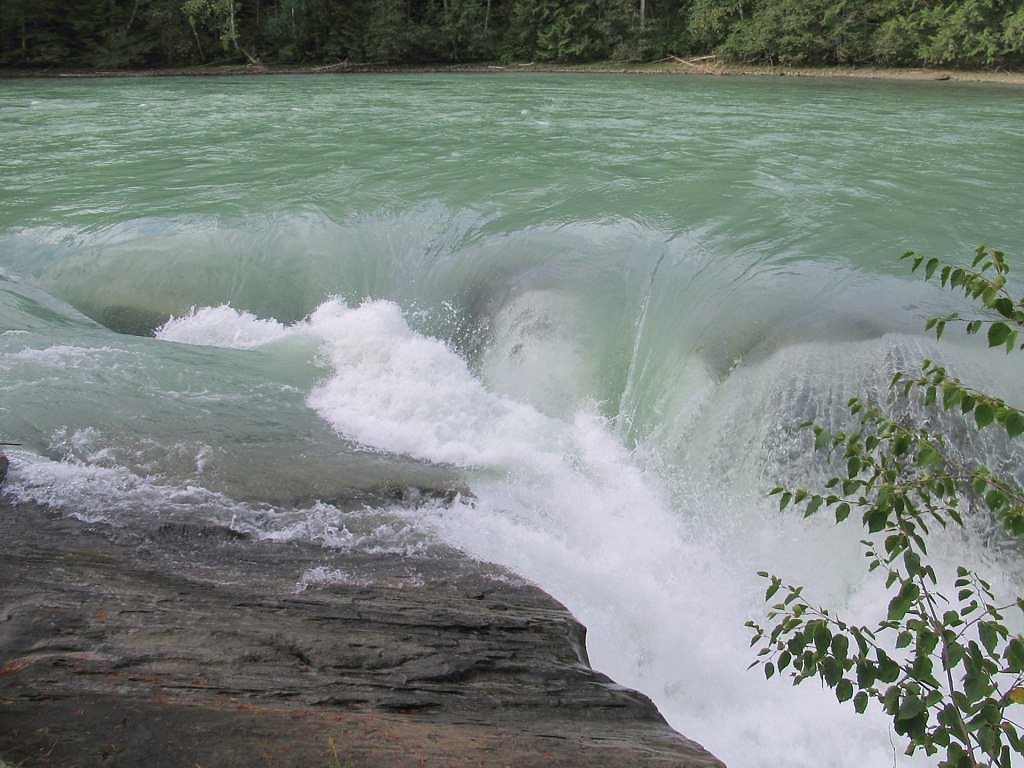
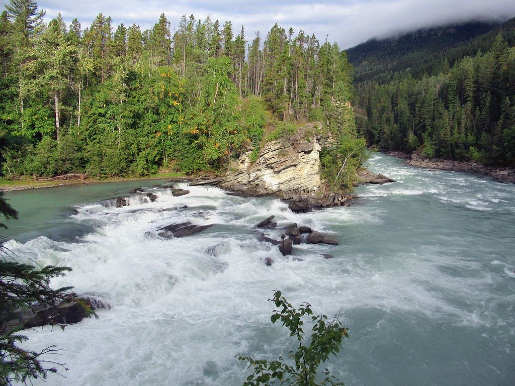
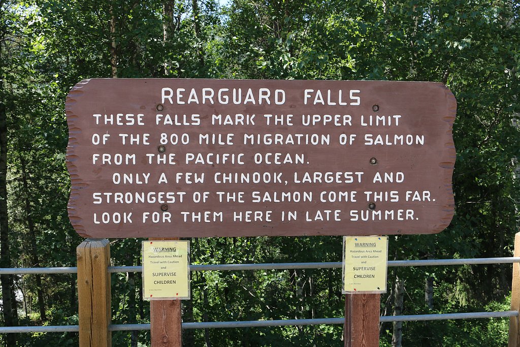

Photo Credits (5)
Difficulty
Easy
Trail Length
0.8 km
Trail Type
Out And Back
Elevation Gain
28 m
About Rearguard Waterfalls
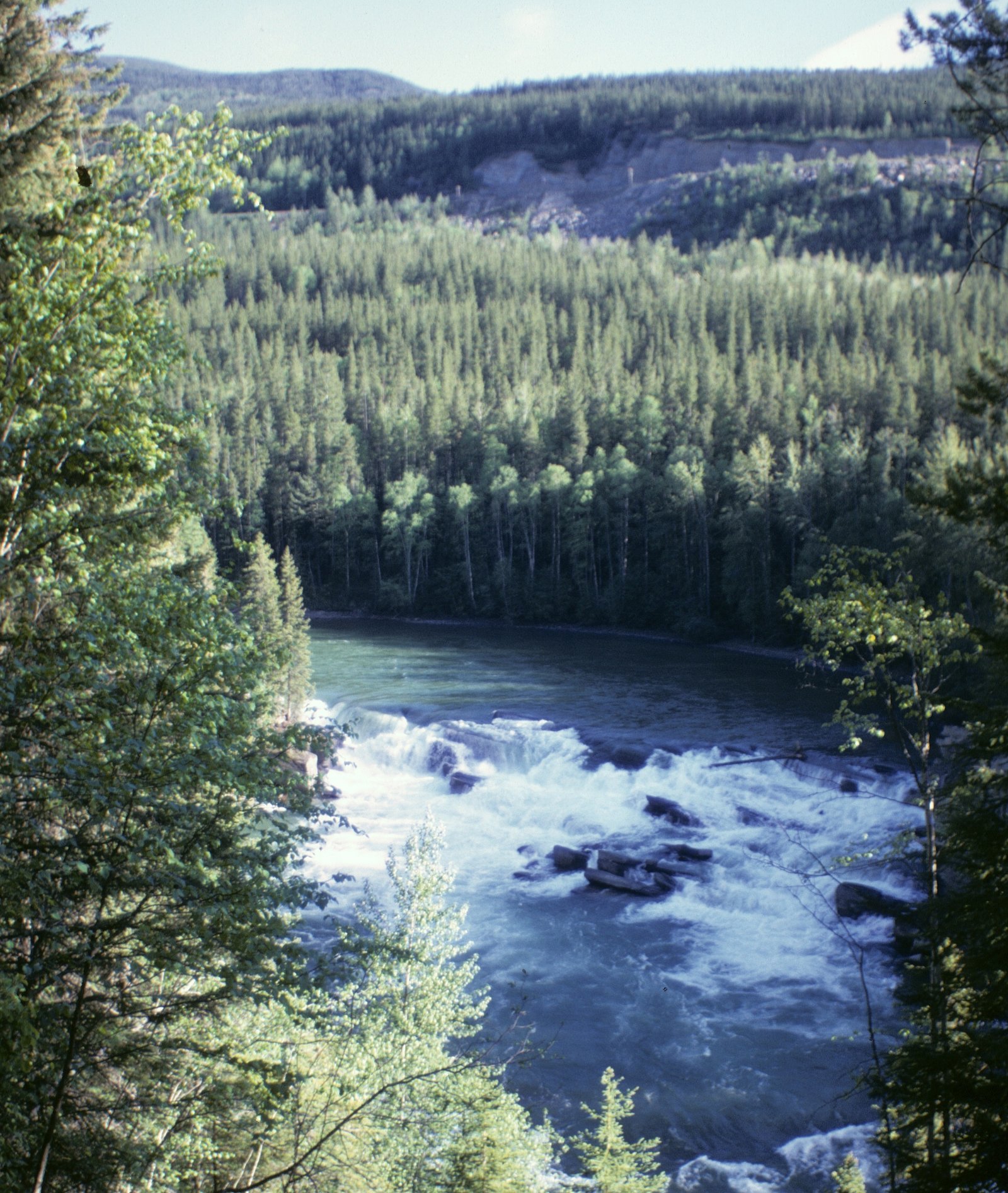
Rearguard Falls is located in Rearguard Falls Provincial Park on the Fraser River in British Columbia. The falls are located 115 km (71 mi) downstream from the river's source at Fraser Pass. This is the farthest point that salmon migrate up the Fraser River to spawn, about 1,260 km (783 mi) from the ocean. A boardwalk is installed on the trail leading from the rest area on Yellowhead Highway to the falls, allowing travellers to get a close-up view.
The Setting
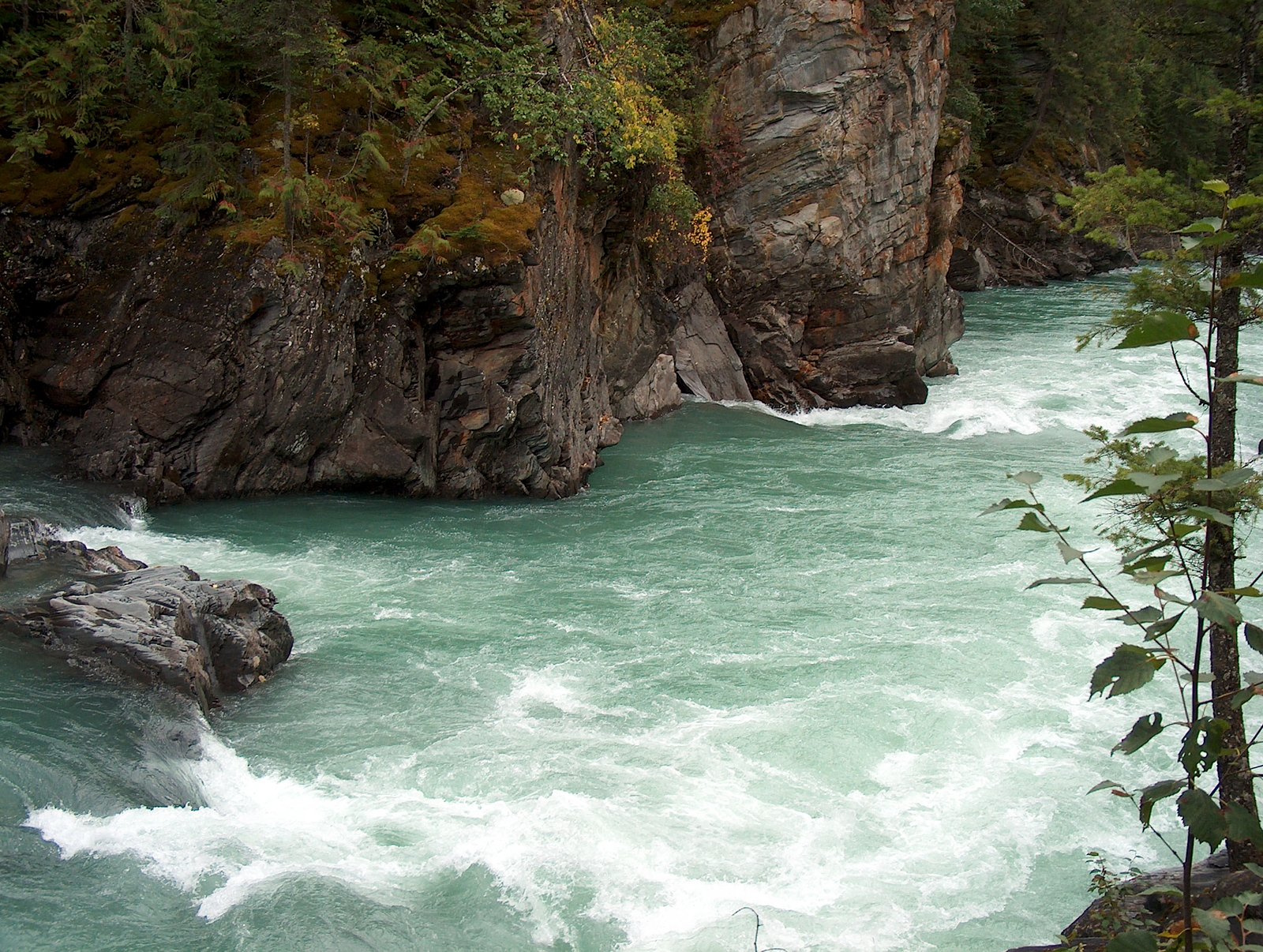
Rearguard Waterfalls sits at 780 metres within REARGUARD FALLS PARK, in the hills of British Columbia. The falls drop 6 metres.
Why This Waterfall Exists
Rearguard Waterfalls flows over Miette Group, a layered sedimentary rock layer deposited about 539 million to 1.0 billion years ago. Over time, the stream has worn through these layers at different rates, creating a 19-foot drop that forms the waterfall.
Nearby Falls Worth Visiting
Overlander Falls (9 m) lies 12.4 kilometres to the east.
Trail & Hike Details
The Approach
The easy 0.8-km out-and-back trail gains 28 metres of elevation on the way to the falls.
Trail Description
A very short, mostly boardwalked path from the roadside parking area leads to one or more viewing platforms overlooking the falls and the Fraser River. The route is flat with minimal elevation change and is intended for short visits rather than long hikes. Interpretive signage is often present describing the river and salmon migration.
What to Expect
The falls drop a gentle 6 metres over layered sedimentary rock.
Accessibility
The trail is short and relatively flat, but the surface may be uneven. Contact the managing agency for accessibility details.
Frequently Asked Questions
🐶 Are Dogs Allowed at Rearguard Waterfalls?
❌ Dogs are not allowed
Are There Any Fees or Permits Required?
🆖 No fees required
🏊 Is There Swimming at Rearguard Waterfalls?
❌ Swimming is not allowed
When to Visit
Late summer to early fall (August–October) for salmon runs and wildlife viewing. Spring (snowmelt) and early summer offer higher flows and more dramatic water volume. Winter visits are possible but may be icy and cold with limited access, use appropriate winter gear.
Seasonal Access
The best time to visit is Spring, Summer, Fall, and Winter. Check with the managing park or local authority for current conditions.
Safety Information
Hazards include strong currents, slippery rocks, cold water and risk of hypothermia, seasonal flooding or high flows, and wildlife encounters (bears during salmon runs). Stay on designated trails and platforms, keep a safe distance from wildlife, carry and know how to use bear spray, maintain good footing on slick surfaces, and do not attempt to approach or enter the river. Limited cell service, let someone know your plans.
Current Water Conditions
124.0 m³/s
Current discharge — how much water is flowing
About average for this time of year
Based on 71 years of record
3.27 m
Water depth at gauge
7-Day Discharge Trend
What does this mean for your visit?
Flow is about average for this time of year.
About This Gauge
This gauge is on a nearby waterway and may not reflect exact conditions at the falls.
7-Day Flow Outlook
Based on the WSC gauge FRASER RIVER AT RED PASS (24 km away).
Today
Moderate
124 m³/s
9/10Tomorrow
Moderate
122 m³/s
9/10Thu
Moderate
120 m³/s
8/10Fri
Moderate
116 m³/s
9/10Sat
Moderate
126 m³/s
6/10Sun
Moderate
128 m³/s
6/10Mon
Moderate
119 m³/s
8/10Best window: Today — moderate flow, mainly sunny (trip score 9/10).
Best time of year: this gauge typically runs highest from late May to mid August, peaking in June.
How we calculate this
This is a transparent outlook, not a precise forecast. We take the waterfall's current flow strength (how it ranks against its historical normal for today, from the nearest WSC stream gauge), carry that ranking forward along the gauge's seasonal curve, and nudge it for forecast rain. Confidence is highest for the next day or two and falls further out. Always check official conditions and your own judgment before visiting — high flows can be dangerous.
Weather Forecast
Location & Access
Getting There
The trailhead and small parking pullout are on the Yellowhead Highway (BC-16) within or adjacent to Rearguard Falls Provincial Park near Mount Robson. Look for signed turnout and interpretive panels; the site is reached directly from the highway and is commonly visited from the Mount Robson area. Expect limited cell service; follow highway access rules and use caution entering/exiting the pullout.
Get Directions on Google MapsParking
Small paved/unpaved turnout adjacent to the highway with limited spaces. Parking may fill during peak season (salmon run and summer). Use designated parking only and do not block the highway; larger vehicles should take extra care when turning around.
Elevation
780 metres above sea level
Coordinates
52.973631° N, -119.363967° W
Land Management
Managed by Government of British Columbia
Visitor Tips & Gear
Stay on the boardwalk and viewing platforms, rocks near the river are slippery and currents are powerful. Bring binoculars for wildlife and salmon viewing. Arrive early in peak season to secure parking. Carry bear spray and know how to use it; make noise on approach and keep dogs under control. Check BC Parks or local visitor centre for current conditions before travel.
As an Amazon Associate, we earn from qualifying purchases.
For this easy 0.8 km trail, lightweight trail shoes and a water bottle are usually sufficient. Icy conditions are common in winter — traction cleats are a smart addition.

Columbia Watertight II Rain Jacket
Packs into its own pocket, seam-sealed, and keeps you dry from spray and surprise rain.

Polarized Sunglasses (Knockaround)
Cuts glare off the water so you actually see the falls — and your photos turn out better too.

Earth Pak Waterproof Dry Bag
Keeps your phone and gear dry when waterfall mist soaks everything else.

Waterproof Phone Pouch (AiRunTech)
Cheap insurance — take photos right next to the falls without killing your phone.

Kahtoola MICROspikes
Cult-favorite traction cleats that grip ice and wet rock — essential for winter waterfall hikes.

JOBY GorillaPod Starter Kit
Wraps around railings and rocks for long-exposure waterfall shots — no flat surface needed.
Where to Stay
Browse vacation cabins and private rentals nearby
Unique outdoor stays — tents, yurts, and treehouses
Rent a campervan or RV for your waterfall road trip
Some links are affiliate links. We may earn a commission at no extra cost to you.
Nearby Campground
Tete Jaune Lodge
5.1 km away
Additional Information
Nearby Attractions
Mount Robson Visitor Centre and viewpoints, Kinney Lake, Robson River, and the Mount Robson summit viewpoints and trailheads (including the Berg Lake trail access points). The Yellowhead Highway corridor has additional scenic pullouts and provincial park sites.
Wildlife
The area is active wildlife habitat, possible sightings include black and grizzly bears (especially during salmon runs), moose, elk, deer, and a variety of birds including waterfowl and raptors. Salmon runs (late summer–fall) attract predators and birds.
Nearby Waterfalls
Writing about Rearguard Waterfalls? Embed this waterfall on your site for free.