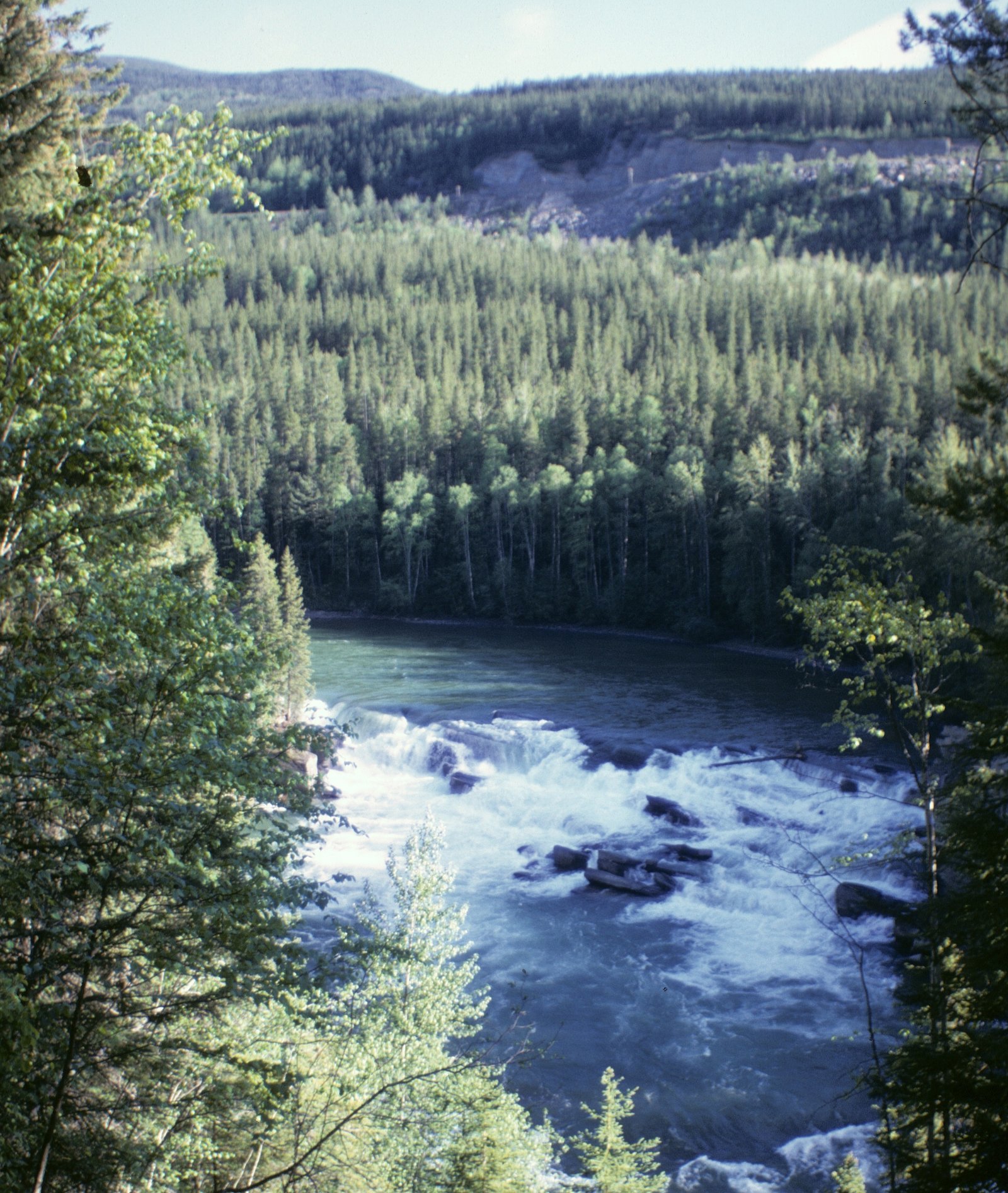
Overlander Falls
British Columbia • 9 m
By Armen Suny · Last verified Jun 2026
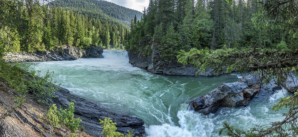
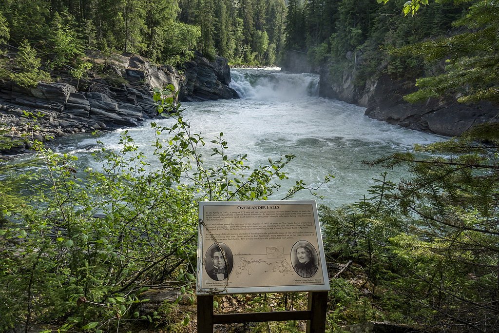
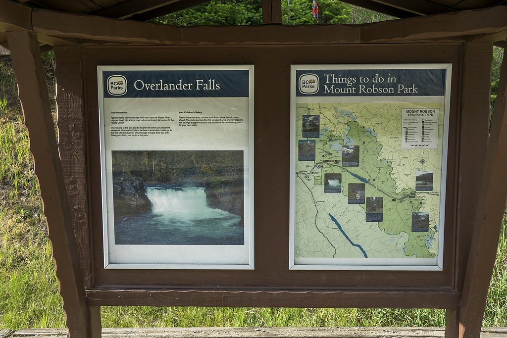
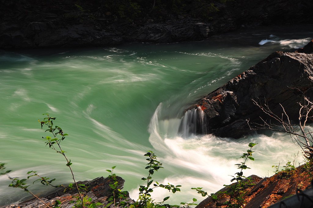

Photo Credits (5)
Difficulty
Easy
Trail Length
1.0 km
Trail Type
Out And Back
Elevation Gain
53 m
About Overlander Falls
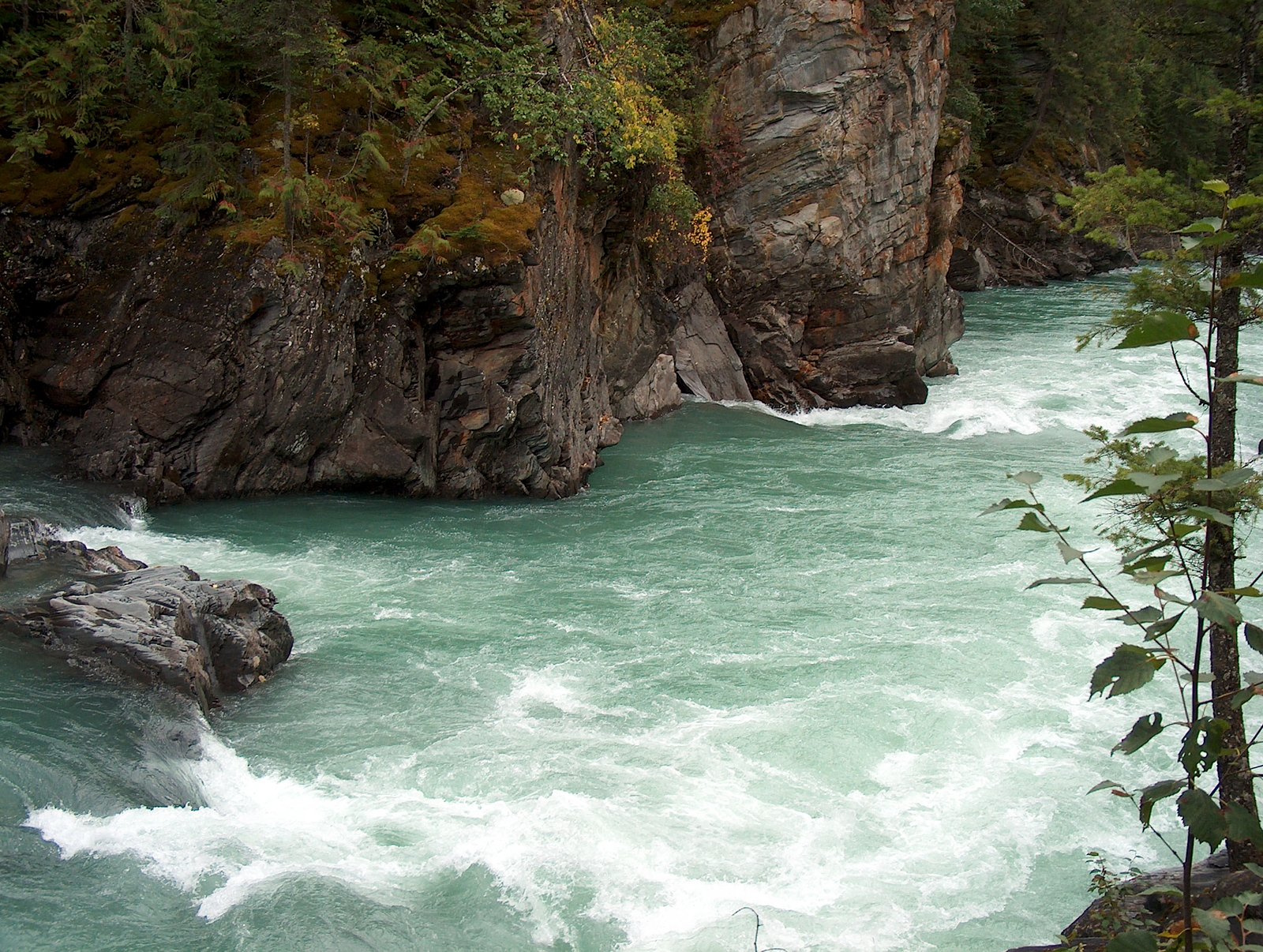
Overlander Falls is a waterfall on the Fraser River in Mount Robson Provincial Park, British Columbia, Canada. It is popular for kayakers. The falls are reached by a short walking trail which starts on the Yellowhead Highway 2 km (1.2 mi) east of the Mount Robson visitor centre. The waterfall is named for the Overlanders expedition of 1862. A group of 175 men and 1 woman from Ontario travelled across the prairies and through the Rocky Mountains, intending to reach the Barkerville or Cariboo goldfields. Just west of Overlander Falls, the group split. About half continued down the Fraser River, eventually reaching Barkerville in late fall of 1862, but over a year had elapsed since Billy Barker's gold strike and there were no claims left to stake. The other half abandoned their dreams of gold and rafted down the North Thompson River to Fort Kamloops.
The Setting
Overlander Falls sits at 864 metres within MOUNT ROBSON PARK, in the hills of British Columbia. The falls drop 9 metres.
Why This Waterfall Exists
Overlander Falls flows over Miette Formation, a layered sedimentary rock layer deposited about 539 million to 1.0 billion years ago. These soft rocks erode readily, allowing the stream to carve a 30-foot drop into the landscape.
Nearby Falls Worth Visiting
Rearguard Waterfalls (6 m) lies 12.4 kilometres to the west.
Trail & Hike Details
The Approach
The easy 1.0-km out-and-back trail gains 53 metres of elevation on the way to the falls.
What to Expect
The falls drop 9 metres over soft fine-grained rock.
Accessibility
The trail is short and relatively flat, but the surface may be uneven. Contact the managing agency for accessibility details.
Frequently Asked Questions
🐶 Are Dogs Allowed at Overlander Falls?
❌ Dogs are not allowed
Are There Any Fees or Permits Required?
🆖 No fees required
🏊 Is There Swimming at Overlander Falls?
❌ Swimming is not allowed
When to Visit
Current Water Conditions
124.0 m³/s
Current discharge — how much water is flowing
About average for this time of year
Based on 71 years of record
3.27 m
Water depth at gauge
7-Day Discharge Trend
What does this mean for your visit?
Flow is about average for this time of year.
About This Gauge
This gauge is on a nearby waterway and may not reflect exact conditions at the falls.
7-Day Flow Outlook
Based on the WSC gauge FRASER RIVER AT RED PASS (14 km away).
Today
Moderate
124 m³/s
9/10Tomorrow
Moderate
122 m³/s
9/10Thu
Moderate
120 m³/s
8/10Fri
Moderate
116 m³/s
9/10Sat
Moderate
126 m³/s
6/10Sun
Moderate
128 m³/s
6/10Mon
Moderate
119 m³/s
8/10Best window: Today — moderate flow, mainly sunny (trip score 9/10).
Best time of year: this gauge typically runs highest from late May to mid August, peaking in June.
How we calculate this
This is a transparent outlook, not a precise forecast. We take the waterfall's current flow strength (how it ranks against its historical normal for today, from the nearest WSC stream gauge), carry that ranking forward along the gauge's seasonal curve, and nudge it for forecast rain. Confidence is highest for the next day or two and falls further out. Always check official conditions and your own judgment before visiting — high flows can be dangerous.
Know when to go.
Get a free email alert when waterfalls near Jasper hit peak flow. We only send when conditions are worth the trip — no weekly newsletters, no spam.
Weather Forecast
Location & Access
Elevation
864 metres above sea level
Coordinates
53.030638° N, -119.204654° W
Land Management
Managed by Government of British Columbia
Visitor Tips & Gear
As an Amazon Associate, we earn from qualifying purchases.
For this easy 1.0 km trail, lightweight trail shoes and a water bottle are usually sufficient.

Columbia Watertight II Rain Jacket
Packs into its own pocket, seam-sealed, and keeps you dry from spray and surprise rain.

Earth Pak Waterproof Dry Bag
Keeps your phone and gear dry when waterfall mist soaks everything else.

Waterproof Phone Pouch (AiRunTech)
Cheap insurance — take photos right next to the falls without killing your phone.

JOBY GorillaPod Starter Kit
Wraps around railings and rocks for long-exposure waterfall shots — no flat surface needed.

Polarized Sunglasses (Knockaround)
Cuts glare off the water so you actually see the falls — and your photos turn out better too.

Osprey Daylite Daypack
Light, organized, and just the right size for a day hike — fits water, snacks, and layers.
Where to Stay
Browse vacation cabins and private rentals nearby
Unique outdoor stays — tents, yurts, and treehouses
Rent a campervan or RV for your waterfall road trip
Some links are affiliate links. We may earn a commission at no extra cost to you.
Nearby Campground
Robson Meadows Campground
2.1 km away
Additional Information
Cities near Overlander Falls
Nearby Waterfalls
Writing about Overlander Falls? Embed this waterfall on your site for free.