Photo Credits (5)
Difficulty
Easy
Trail Length
1.0 km
Trail Type
Out And Back
Elevation Gain
31 m
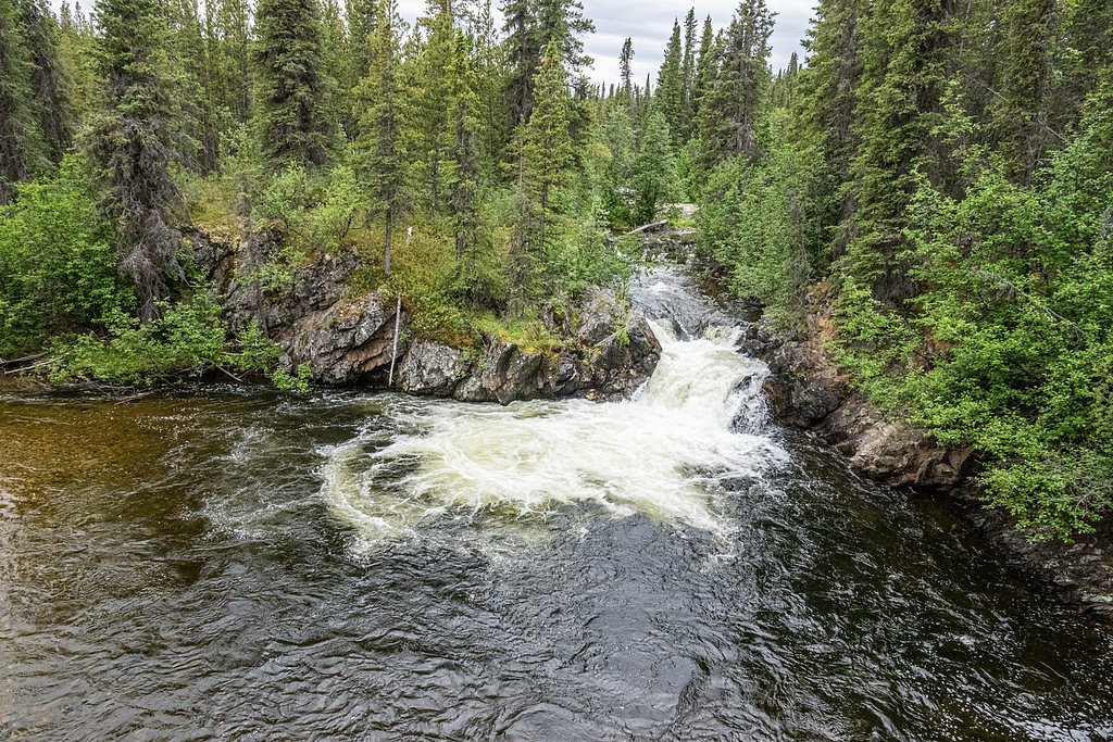
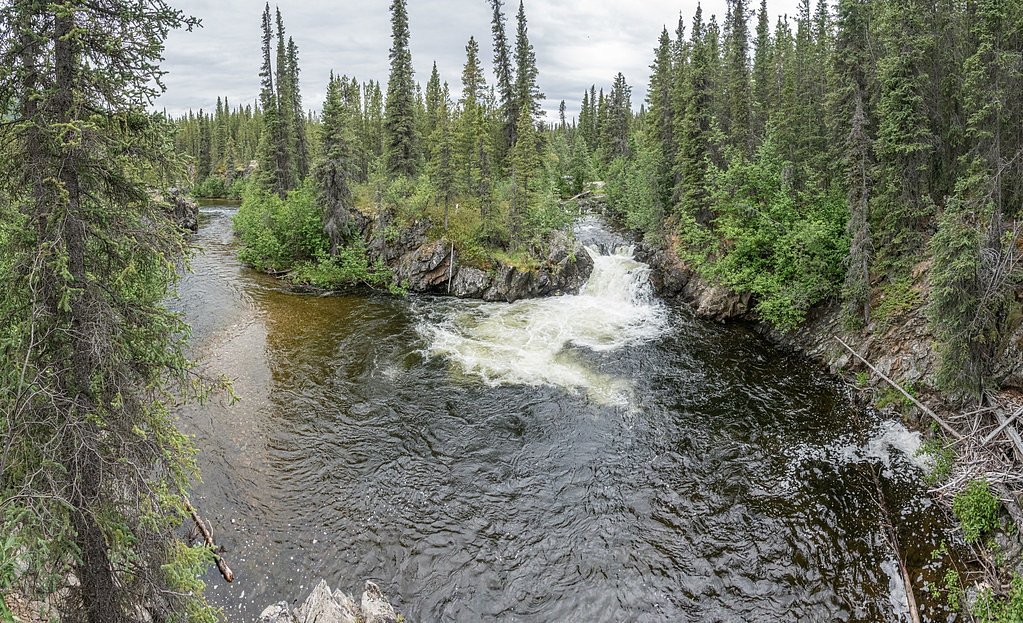
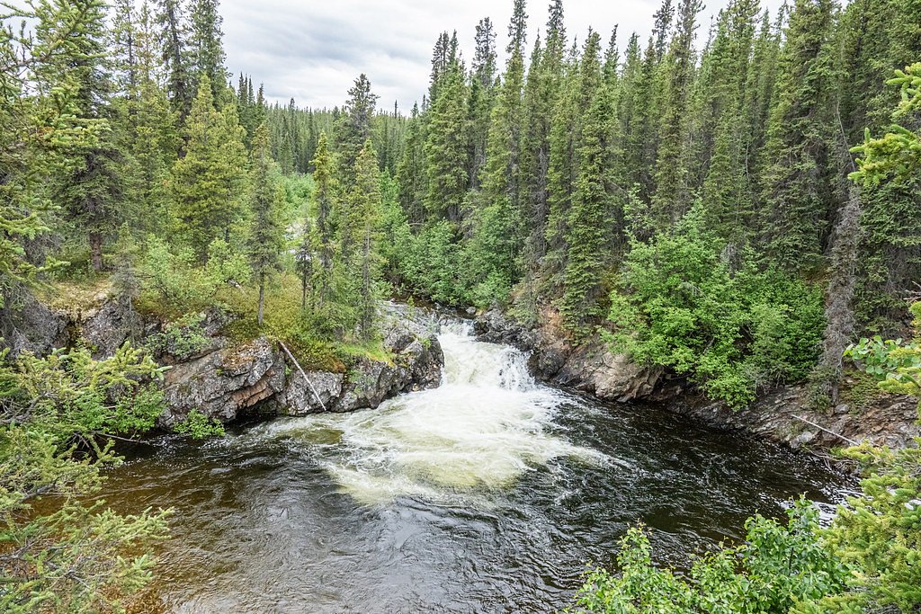
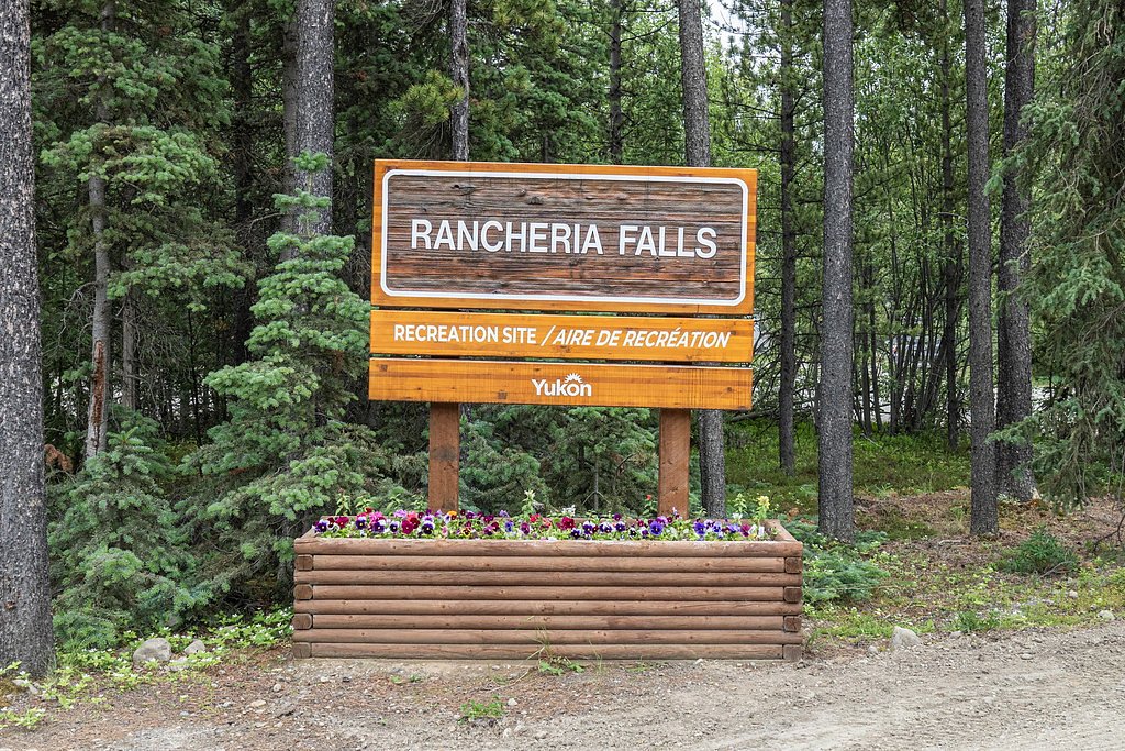
About Rancheria Falls
Rancheria Falls (coords: 60.0781, -130.8267) appears to be a remote waterfall in northern Yukon territory. Precise published information about the falls (official name, mapped trail, and measured height) is limited or not widely documented in mainstream hiking databases. Visitors should expect a wilderness setting with limited or no formal infrastructure and variable water flow depending on season and snowmelt. Where specific details are not confirmed they are stated as such below.
Why This Waterfall Exists
Rancheria Falls flows over hard intrusive rock, primarily granite, laid down about 66-145 million years ago. These resistant rocks form a durable ledge that water cannot easily wear away, creating the falls where softer material downstream has already eroded.
Trail & Hike Details
The Approach
The easy 1.0-km out-and-back trail gains 31 metres of elevation on the way to the falls.
Trail Description
There is no widely published maintained trail description for Rancheria Falls. If a route exists it may be an informal route requiring route-finding through brush, muskeg, and/or unnamed waterways. Expect uneven terrain, possible river or stream crossings, and sections of steep or slippery rock near the falls. Because official trail information is not confirmed, plan as if you will be undertaking a backcountry navigation route.
What to Expect
Remote, rugged wilderness. Depending on season you may encounter high spring runoff (higher flow and stronger currents), mosquito and blackfly activity in spring/early summer, and biting insects. Bank and cliff edges near falls may be unstable and slippery. Views may be partially obscured by trees or gorge walls. Expect limited or no cell coverage and no facilities (no toilets, no maintained viewpoints, no signage). Wildlife such as moose and bears may be present in the area.
Accessibility
The trail is short and relatively flat, but the surface may be uneven. Contact the managing agency for accessibility details.
Frequently Asked Questions
🐶 Are Dogs Allowed at Rancheria Falls?
❌ Dogs are not allowed
Are There Any Fees or Permits Required?
🆖 No fees required
🏊 Is There Swimming at Rancheria Falls?
❌ Swimming is not allowed
When to Visit
Late spring through early fall is the most practical window. Late spring/early summer often gives higher flows from snowmelt; mid to late summer may offer easier access on drier ground. Winter access is possible for experienced winter travelers (ski, snowmobile) but conditions are more hazardous and the falls may be frozen.
Seasonal Access
The best time to visit is Spring, Summer, and Fall. Winter access may be limited. Check with the managing park or local authority for current conditions.
Safety Information
Hazards include remoteness and limited cell coverage, rapid weather changes, river currents and cold water, slippery and unstable rock near edges, steep or brushy terrain, river/stream crossings, and wildlife encounters (bears and moose). Carry navigation and emergency communications, travel with a partner where possible, inform someone of your route and expected return, and be prepared to turn back if conditions are unsafe. Check with local authorities, outfitters, or First Nations for recent access reports and any seasonal advisories.
Weather Forecast
Location & Access
Getting There
The waterfall is in remote Yukon wilderness near the given coordinates. There does not appear to be a widely maintained or signed trail from a major highway. Access may require travel on resource/logging roads, cross-country hiking (bushwhack), river travel by canoe/raft, or floatplane depending on approach. Visitors should consult up-to-date topographic maps, satellite imagery, local forestry or park offices, and, if applicable, local First Nations or outfitters before attempting access.
Get Directions on Google MapsParking
No formal parking lot is confirmed. Parking may be limited to informal pullouts on nearby logging or access roads, or at a staging area used by outfitters. Expect primitive conditions and the possibility that parking is several kilometers from any access route.
Elevation
931 metres above sea level
Coordinates
60.078068° N, -130.826703° W
Visitor Tips & Gear
1) Confirm access and any land-ownership or First Nations permissions before traveling. 2) Carry topographic maps, GPS, and spare batteries; a satellite communicator is strongly recommended in remote Yukon areas. 3) Wear sturdy waterproof footwear and be prepared for wet, boggy ground. 4) Use bear-aware practices: carry bear spray, make noise while hiking, store food properly. 5) Do not approach cliff edges or attempt to climb near the falls, wet rocks are extremely slippery. 6) Practice Leave No Trace, pack out all garbage. 7) Check local weather and river conditions; snowmelt can make travel and crossings hazardous.
As an Amazon Associate, we earn from qualifying purchases.
For this easy 1.0 km trail, lightweight trail shoes and a water bottle are usually sufficient. Sun exposure on the trail makes good sun protection a must in summer.

Polarized Sunglasses (Knockaround)
Cuts glare off the water so you actually see the falls — and your photos turn out better too.

Columbia Watertight II Rain Jacket
Packs into its own pocket, seam-sealed, and keeps you dry from spray and surprise rain.

Earth Pak Waterproof Dry Bag
Keeps your phone and gear dry when waterfall mist soaks everything else.

Waterproof Phone Pouch (AiRunTech)
Cheap insurance — take photos right next to the falls without killing your phone.

JOBY GorillaPod Starter Kit
Wraps around railings and rocks for long-exposure waterfall shots — no flat surface needed.

Osprey Daylite Daypack
Light, organized, and just the right size for a day hike — fits water, snacks, and layers.
Where to Stay
Browse vacation cabins and private rentals nearby
Unique outdoor stays — tents, yurts, and treehouses
Rent a campervan or RV for your waterfall road trip
Some links are affiliate links. We may earn a commission at no extra cost to you.
Nearby Campground
Swift River Wild Camping
10 km away
Additional Information
Nearby Attractions
Specific nearby attractions are not well-documented for this exact coordinate. The site is within remote Yukon wilderness; visitors should consult regional maps to identify nearby lakes, rivers, or established parks. Nearest services and marked trails may be many kilometers away.
Wildlife
Typical Yukon wildlife may be present: moose, black bear, grizzly bear, wolves, foxes, migratory birds, and small mammals. Insect activity (mosquitoes, blackflies) is common in warmer months.
Other waterfalls named Rancheria Falls
1 other waterfall shares this name across Canada.
Writing about Rancheria Falls? Embed this waterfall on your site for free.