Difficulty
Moderate
Trail Length
7.6 km
Trail Type
Out And Back
Elevation Gain
126 m
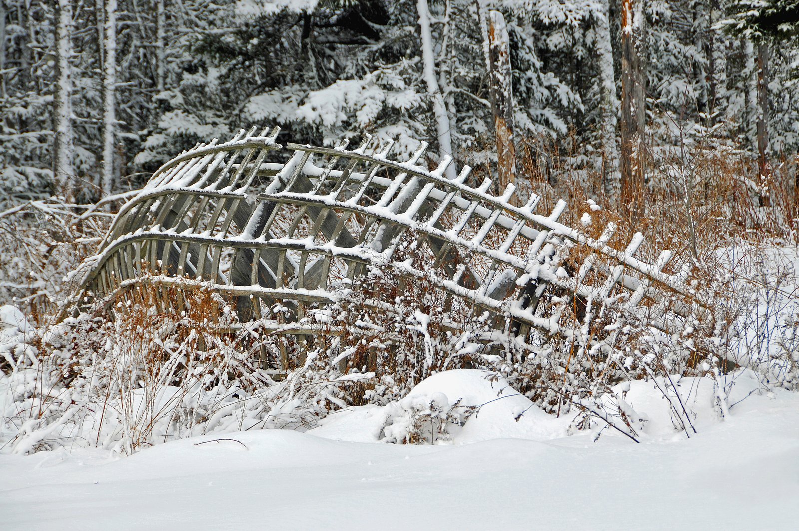
About Pockwock Falls
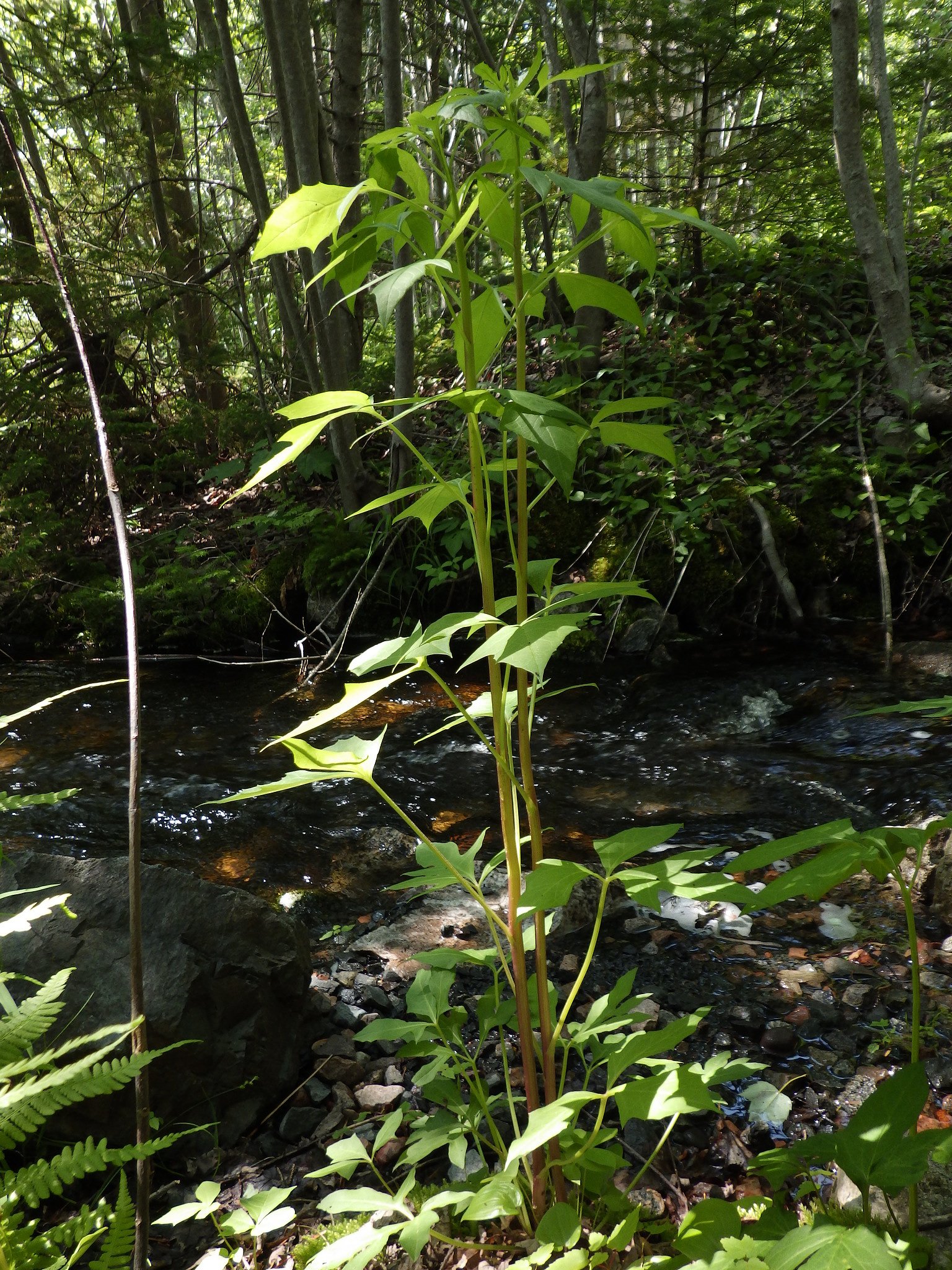
Pockwock Falls is a small cascade on the Pockwock Brook/Pockwock watershed area northwest of Halifax, Nova Scotia (coordinates ~44.7573, -63.8678). The falls are set in mixed Acadian forest and are most notable after spring snowmelt or heavy rain. Access appears informal and may require short walks or light bushwhacking from nearby roads or unofficial parking spots. Portions of the surrounding land are part of the Pockwock water supply watershed, so access and facilities may be limited or subject to restrictions.
Trail & Hike Details
The Approach
The moderate 7.6-km out-and-back trail gains 126 metres of elevation on the way to the falls.
Trail Description
There does not appear to be a widely maintained, officially signed trail to Pockwock Falls. Expect an informal path or short bushwhack from a nearby road or pullout. Terrain may include forest floor, roots, rocks, and possibly wet or muddy sections near the stream. Route-finding skills and stable footwear are recommended. Because access routes are not well documented, plan for a variable-length approach and return.
What to Expect
A modest waterfall or series of small drops and cascades set in forest. Water flow is highest in spring and after heavy rains; late summer flows may be reduced. Expect natural, undeveloped surroundings with limited or no trail infrastructure, minimal signage, and few (if any) other visitor amenities. Mosquitoes and black flies can be present in spring/early summer; ticks are present regionally. Cell service may be spotty in places.
Accessibility
The trail is not wheelchair accessible. Uneven terrain and elevation changes require steady footing.
Frequently Asked Questions
🐶 Are Dogs Allowed at Pockwock Falls?
❌ Dogs are not allowed
Are There Any Fees or Permits Required?
🆖 No fees required
🏊 Is There Swimming at Pockwock Falls?
❌ Swimming is not allowed
When to Visit
Late spring (high flows) and early fall (pleasant weather, foliage) are often the best times to see the falls with good water flow and scenery. Summer offers easier walking but possibly lower flow. Winter can produce icy, scenic conditions but also hazardous footing and limited access.
Seasonal Access
The best time to visit is Spring, Summer, and Fall. Winter access may be limited. Check with the managing park or local authority for current conditions.
Safety Information
Hazards include slippery and unstable rock near the water, steep or soft banks, cold water and strong currents near drops, limited or no trail maintenance, ticks and biting insects in season, and potentially limited cell coverage. If visiting in winter expect icy trails and the risk of thin ice near moving water. Always tell someone your plans and expected return time. Observe any posted watershed or private property restrictions.
Current Water Conditions
0.0 m³/s
Current discharge — how much water is flowing
98.51 m
Water depth at gauge
7-Day Discharge Trend
About This Gauge
7-Day Flow Outlook
Based on the WSC gauge TOMAHAWK LAKE OUTLET NEAR HAMMONDS PLAINS (7 km away).
Today
Moderate
0.0 m³/s
6/10Tomorrow
Moderate
0.0 m³/s
8/10Tue
Moderate
0.0 m³/s
8/10Wed
Moderate
0.0 m³/s
6/10Thu
Moderate
0.0 m³/s
6/10Fri
Moderate
0.0 m³/s
6/10Sat
Moderate
0.0 m³/s
6/10Best window: Tomorrow — moderate flow, partly cloudy (trip score 8/10).
How we calculate this
This is a transparent outlook, not a precise forecast. We take the waterfall's current flow strength (how it ranks against its historical normal for today, from the nearest WSC stream gauge), carry that ranking forward along the gauge's seasonal curve, and nudge it for forecast rain. Confidence is highest for the next day or two and falls further out. Always check official conditions and your own judgment before visiting — high flows can be dangerous.
Know when to go.
Get a free email alert when waterfalls near Halifax hit peak flow. We only send when conditions are worth the trip — no weekly newsletters, no spam.
Weather Forecast
Location & Access
Getting There
From Halifax (approx. 16–17 miles), drive northwest toward the Pockwock/Pockwock Lake area following local roads; use the provided coordinates (44.7573, -63.8678) in a GPS unit or mapping app. Expect rural roads and limited signage. There may be access points off minor roads or forestry tracks; route-finding on foot is often required.
Get Directions on Google MapsParking
Parking is likely informal (roadside or at small pullouts). There are no known official lots or visitor facilities specific to the falls. If visiting, park well off the traveled lane, avoid blocking gates, and be mindful of private property and watershed protection signs.
Elevation
101 metres above sea level
Coordinates
44.757269° N, -63.867839° W
Visitor Tips & Gear
• Check for any watershed or property signage before entering an area; some parts of the Pockwock watershed may have restricted access. • Wear sturdy, waterproof shoes with good traction. • Bring insect/tick repellent in spring and summer. • Park well off the road and avoid blocking gates or driveways. • Stay back from slippery banks and unstable rock edges; do not climb wet rock faces. • Pack out everything you bring in and follow Leave No Trace principles. • If unsure about legal access, contact the local municipality or Halifax Water for guidance.
As an Amazon Associate, we earn from qualifying purchases.
With 7.6 km and 126 m of elevation gain, sturdy boots and trekking poles will help on this moderate trail. Sun exposure on the trail makes good sun protection a must in summer.

Columbia Watertight II Rain Jacket
Packs into its own pocket, seam-sealed, and keeps you dry from spray and surprise rain.

Earth Pak Waterproof Dry Bag
Keeps your phone and gear dry when waterfall mist soaks everything else.

Waterproof Phone Pouch (AiRunTech)
Cheap insurance — take photos right next to the falls without killing your phone.

Timberland Euro Sprint Mid Waterproof
Trusted waterproof boot with premium leather and grippy rubber sole — reliable on rocky, wet trails.

TrailBuddy Trekking Poles
Lightweight aluminum, cork grips, and flip-locks that actually hold — a best-seller for good reason.

Sawyer Squeeze Water Filter
The backcountry standard — filters 99.9% of bacteria and weighs just 3 oz.
Where to Stay
Browse vacation cabins and private rentals nearby
Unique outdoor stays — tents, yurts, and treehouses
Rent a campervan or RV for your waterfall road trip
Some links are affiliate links. We may earn a commission at no extra cost to you.
Nearby Campground
Woodhaven Park Campground
8.4 km away
Additional Information
Nearby Attractions
Pockwock Lake / Pockwock Reservoir (watershed area), rural scenic drives toward the Halifax Regional Municipality interior. The falls are within driving distance of Halifax (approx. 16–17 miles), Windsor (approx. 21–22 miles), and Liverpool (approx. 70+ miles).
Wildlife
Birds (songbirds, raptors), white-tailed deer, beavers, foxes, and common small mammals. Insect season includes black flies, mosquitoes, and ticks. No special wildlife viewing infrastructure is expected.
Cities near Pockwock Falls
Nearby Waterfalls
Writing about Pockwock Falls? Embed this waterfall on your site for free.