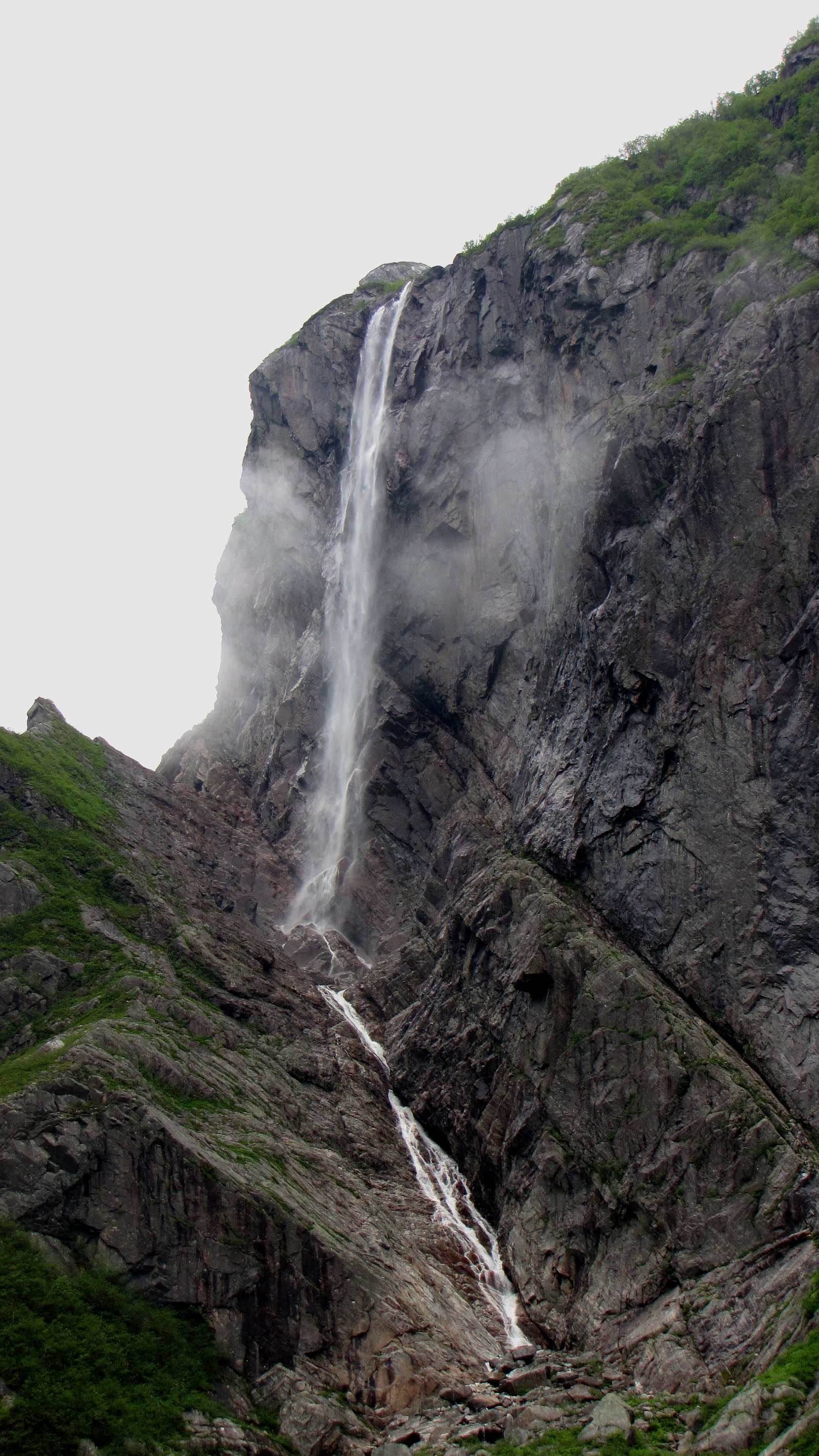
Pissing Mare Falls
Newfoundland and Labrador • Gros Morne National Park • 350 m
By Armen Suny · Last verified Jun 2026
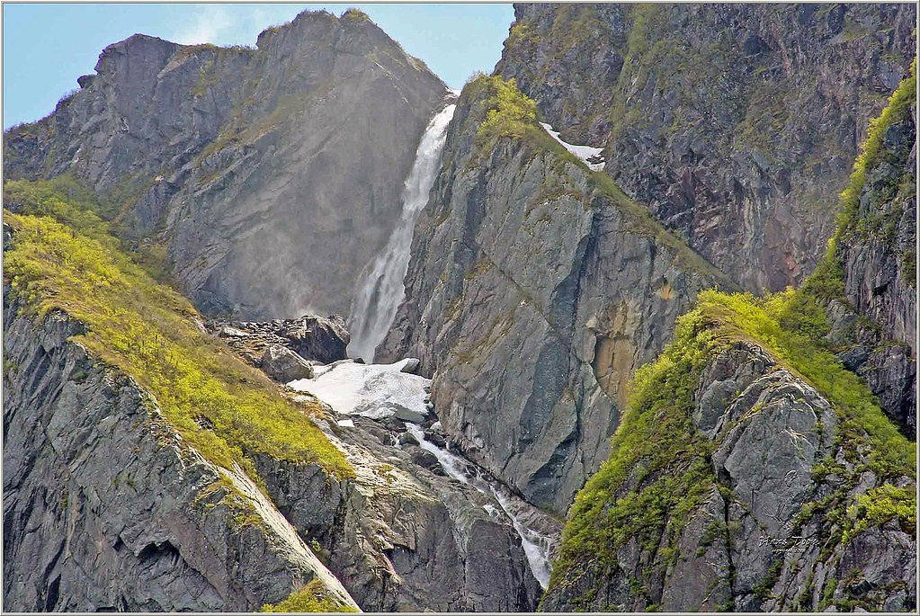
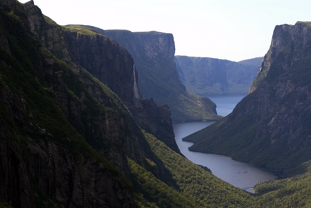
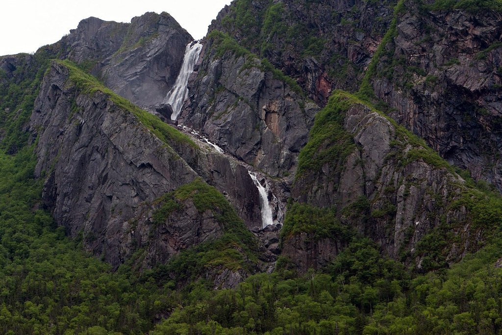
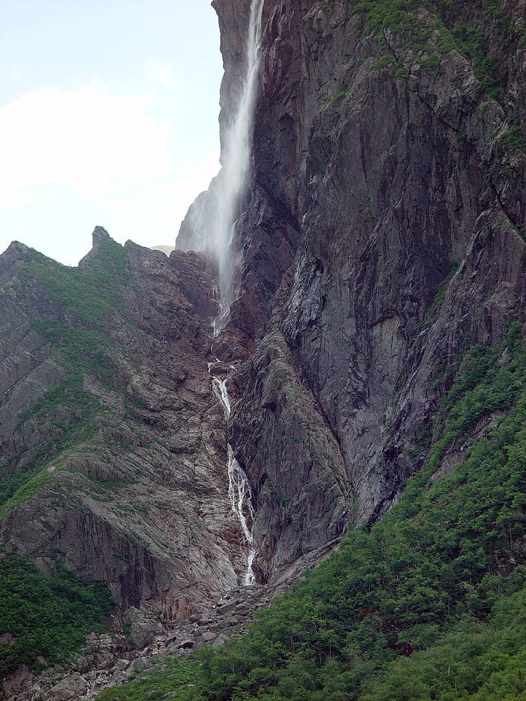

Photo Credits (5)
Difficulty
Easy
Trail Length
5.3 km
Trail Type
Out And Back
Elevation Gain
94 m
About Pissing Mare Falls
Pissing Mare Falls is a tiered waterfall in Gros Morne National Park, Newfoundland, Canada. It is formed from Burnt Woods Brook, which plunges over the edge of Big Level Plateau into Western Brook Pond. At 343 m (1,125 ft) high, with an unbroken drop of 250 m (820 ft), it is the highest in the province, and the 31st highest in Canada.
The Setting
Pissing Mare Falls sits at 22 metres within Gros Morne National Park, in the coastal lowlands of Newfoundland and Labrador. At 350 metres, it is among the taller waterfalls in Newfoundland and Labrador.
Why This Waterfall Exists
Pissing Mare Falls flows over hard crystalline rock laid down over 1.4-1.8 billion years ago. These resistant rocks form a durable ledge that water cannot easily wear away, creating a 1148-foot drop where softer material downstream has already eroded.
Trail & Hike Details
The Approach
The easy 5.3-km out-and-back trail gains 94 metres of elevation on the way to the falls.
Trail Description
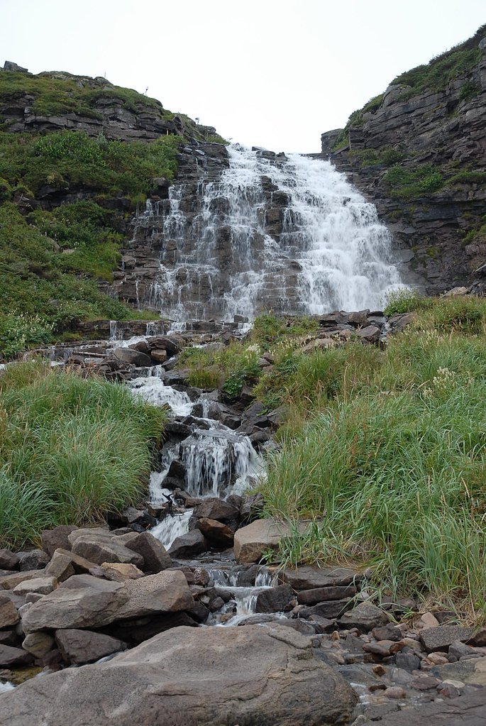
The trail is a coastal/forest path that leads to viewpoints overlooking the falls and the valley/inlet below. Expect uneven surfaces, roots, rocks, and some short steep sections. In many spots the viewpoint is exposed to wind and there may be limited or no railings; approach the cliff edge with caution. Trail markings may be minimal in places, carry a map or GPS and follow established footpaths to avoid disturbing sensitive vegetation.
What to Expect
The falls plunge a dramatic 350 metres over hard crystalline rock.
Accessibility
The trail is not wheelchair accessible. Uneven terrain and elevation changes require steady footing.
Frequently Asked Questions
🐶 Are Dogs Allowed at Pissing Mare Falls?
❌ Dogs are not allowed
Are There Any Fees or Permits Required?
🆖 No fees required
🏊 Is There Swimming at Pissing Mare Falls?
❌ Swimming is not allowed
When to Visit
Late spring through early summer for the fullest water flow. Summer offers the most reliable access and milder weather. Fall provides good colors but can be windy and wet. Winter offers dramatic ice features but access can be hazardous and trails/roads may be closed or impassable.
Seasonal Access
The best time to visit is Spring, Summer, Fall, and Winter. Check with Gros Morne National Park for current conditions.
Safety Information
Hazards include unstable or slippery cliff edges, strong coastal winds, sudden weather changes, limited cell service, and seasonal insects. Stay on marked trails, keep well back from cliff edges, supervise children and dogs closely, and wear appropriate footwear. In winter, expect snow/ice and potentially impassable roads, use caution and consult local park advisories. Always check current conditions with Parks Canada or local authorities before visiting.
Current Water Conditions
Based on a Water Survey of Canada gauge 28.7 km away
15.4 m³/s
Current discharge — how much water is flowing
Higher than usual for this time of year
Based on 37 years of record
0.84 m
Water depth at gauge
7-Day Discharge Trend
What does this mean for your visit?
The water is flowing higher than usual for this time of year.
About This Gauge
This gauge is on a regional waterway. Conditions at the falls may differ, especially after local rain.
7-Day Flow Outlook
Based on the WSC gauge UPPER HUMBER RIVER ABOVE BLACK BROOK (29 km away).
Today
Strong
17 m³/s
8/10Tomorrow
Strong
15 m³/s
8/10Tue
Strong
15 m³/s
8/10Wed
Strong
14 m³/s
8/10Thu
Strong
15 m³/s
8/10Fri
Strong
14 m³/s
8/10Sat
Strong
15 m³/s
8/10Best window: Today — strong flow, rain showers (trip score 8/10).
Best time of year: this gauge typically runs highest from mid April to late June, peaking in May.
How we calculate this
This is a transparent outlook, not a precise forecast. We take the waterfall's current flow strength (how it ranks against its historical normal for today, from the nearest WSC stream gauge), carry that ranking forward along the gauge's seasonal curve, and nudge it for forecast rain. Confidence is highest for the next day or two and falls further out. Always check official conditions and your own judgment before visiting — high flows can be dangerous.
Know when to go.
Get a free email alert when waterfalls near Trout River hit peak flow. We only send when conditions are worth the trip — no weekly newsletters, no spam.
Weather Forecast
Location & Access
Getting There
Coordinates: 49.7135, -57.6648. The falls are located on the west coast of Newfoundland, roughly 30 miles from Trout River and about 36 miles from Deer Lake (distances by road). Access is typically from local roads off the main Viking Trail (Route 430) in the Trout River area; final access may require a short unpaved/forestry road and a marked or informal trailhead. Visitors should follow Parks Canada signs and local directions, exact trailhead and parking locations may vary and are limited.
Get Directions on Google MapsParking
Small roadside pullout(s) or informal parking near the trailhead; parking is limited and may require roadside parking on a shoulder. No formal large parking lot or visitor center at the immediate falls access point; check local signage and park information.
Elevation
22 metres above sea level
Coordinates
49.713503° N, -57.664810° W
Land Management
Managed by Parks Canada Agency
Visitor Tips & Gear
Wear sturdy footwear and layered clothing; bring a rain shell. Keep a safe distance from cliff edges and do not create new paths. Check local park (Parks Canada) conditions and weather before leaving; inform someone of your plans. Carry water and snacks, there are no services at the site. Respect wildlife and follow Leave No Trace principles. If you plan to visit in winter, be prepared for snow/ice and potentially impassable roads/trails.
As an Amazon Associate, we earn from qualifying purchases.
This easy 5.3 km hike is straightforward — comfortable trail shoes and plenty of water should do. Icy conditions are common in winter — traction cleats are a smart addition.

Columbia Watertight II Rain Jacket
Packs into its own pocket, seam-sealed, and keeps you dry from spray and surprise rain.

Polarized Sunglasses (Knockaround)
Cuts glare off the water so you actually see the falls — and your photos turn out better too.

Earth Pak Waterproof Dry Bag
Keeps your phone and gear dry when waterfall mist soaks everything else.

Waterproof Phone Pouch (AiRunTech)
Cheap insurance — take photos right next to the falls without killing your phone.

Kahtoola MICROspikes
Cult-favorite traction cleats that grip ice and wet rock — essential for winter waterfall hikes.

Sawyer Squeeze Water Filter
The backcountry standard — filters 99.9% of bacteria and weighs just 3 oz.
Where to Stay
Browse vacation cabins and private rentals nearby
Unique outdoor stays — tents, yurts, and treehouses
Rent a campervan or RV for your waterfall road trip
Some links are affiliate links. We may earn a commission at no extra cost to you.
Nearby Campground
Western Brook Pond
0.3 km away
Additional Information
Nearby Attractions
Gros Morne National Park attractions (Tablelands, Western Brook Pond boat tours), Trout River and the coastal scenery of the Viking Trail, nearby lookouts and coastal viewpoints. Distances: Trout River ~30 miles by road, Deer Lake ~36 miles by road (approx.).
Wildlife
Common regional species include seabirds, bald eagles, foxes, and moose in the broader park area. Expect insects in warm months. Always observe wildlife from a distance.
Cities near Pissing Mare Falls
Nearby Waterfalls
Writing about Pissing Mare Falls? Embed this waterfall on your site for free.