Photo Credits (5)
Difficulty
Moderate
Trail Length
2.1 km
Trail Type
Out And Back
Elevation Gain
103 m
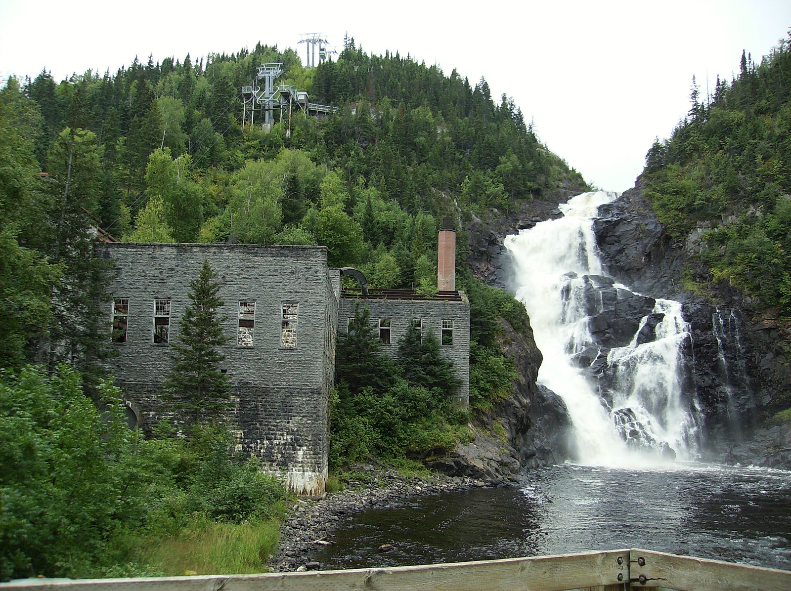
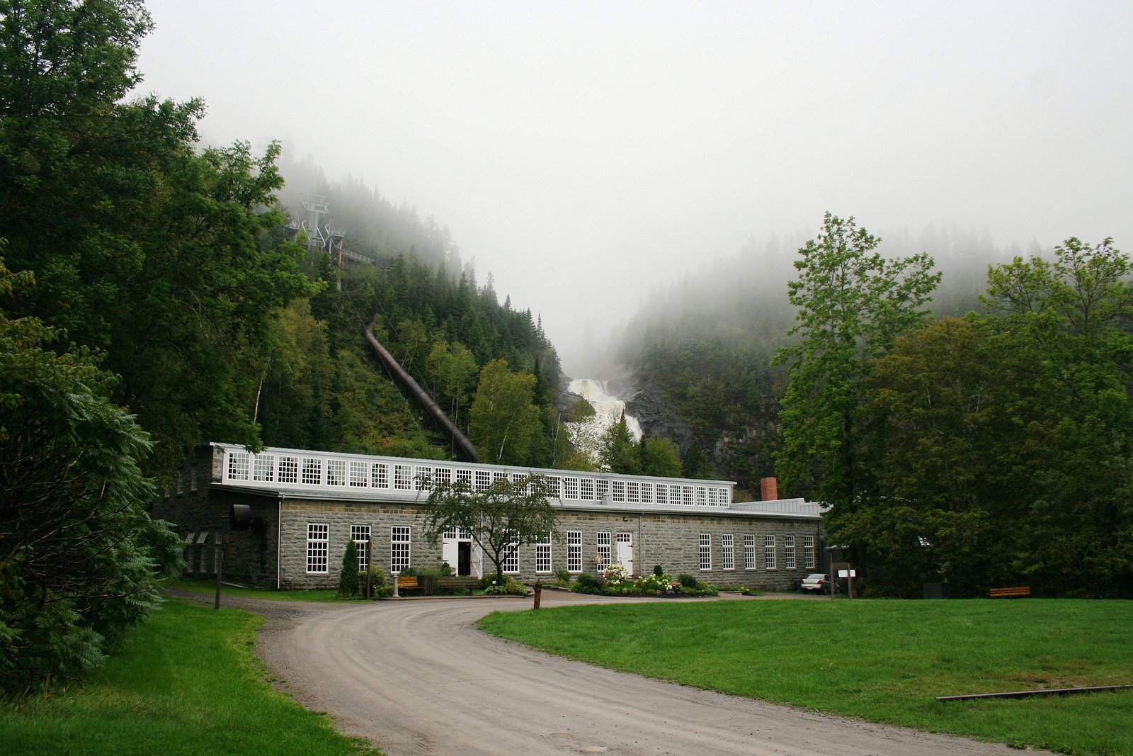
About Ouiatchouan-Bas
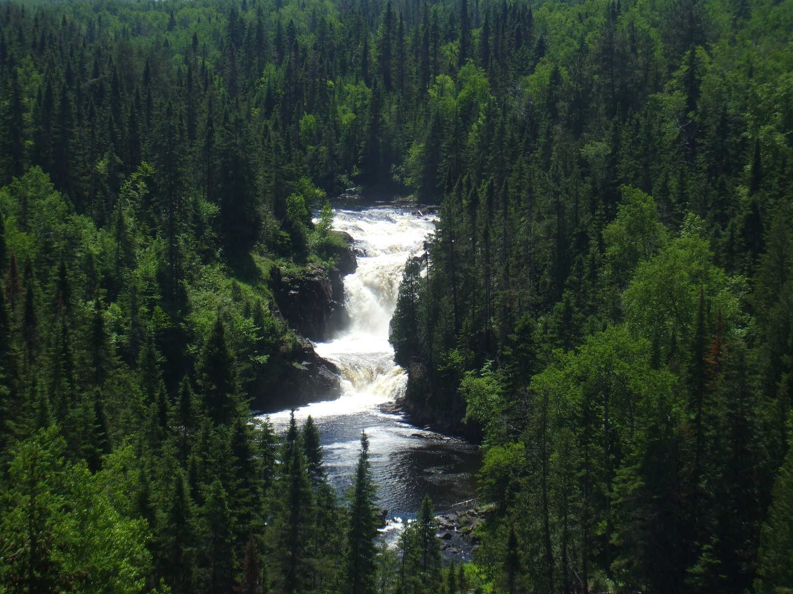
Ouiatchouan-Bas is a lower-section waterfall on the Ouiatchouan River in the Lac-Saint-Jean region of Quebec, located near Dolbeau (approximately 24 miles away). The falls are best known as a scenic riverside cascade and viewing spot rather than a large vertical drop. Flow is typically highest in spring during snowmelt and can be much reduced in late summer; in winter the falls commonly form significant ice features. Exact published height information is not consistently available and may vary by source.
Why This Waterfall Exists
Ouiatchouan-Bas flows over hard crystalline rock, primarily gneiss, laid down over 1.0-2.5 billion years ago. These resistant rocks form a durable ledge that water cannot easily wear away, creating the falls where softer material downstream has already eroded.
Nearby Falls Worth Visiting
Chute Ouiatchouan (72 m) lies 0.0 kilometres to the southwest.
Trail & Hike Details
The Approach
The moderate 2.1-km out-and-back trail gains 103 metres of elevation on the way to the falls.
Trail Description
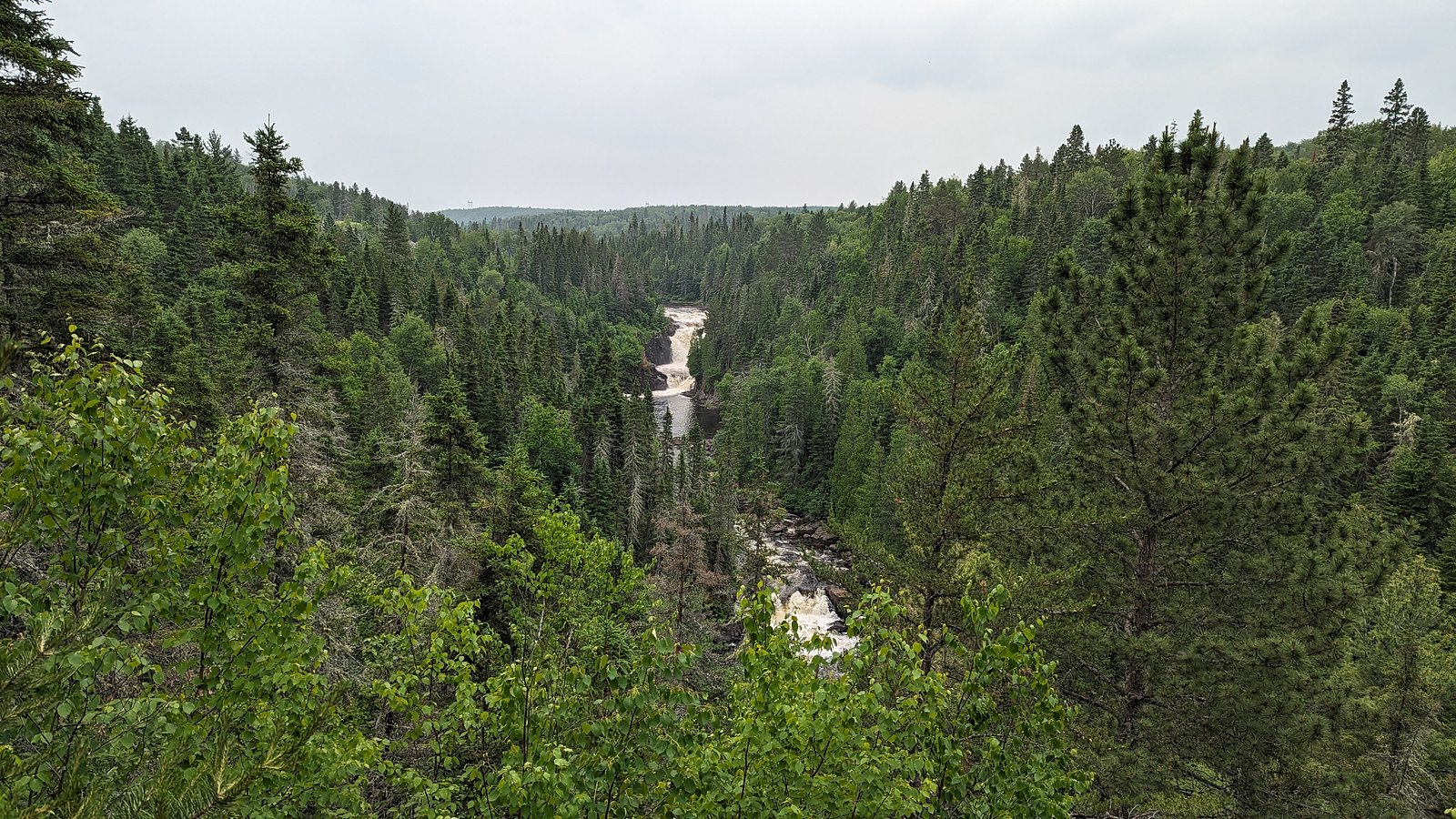
Approach typically involves a short, informal trail or path from parking to a riverside viewpoint. Expect uneven ground, roots, rocks, and possibly short stairs or a small boardwalk at some locations. Trails are generally short (often under a mile round-trip) but may be muddy or slippery after rain or thaw. Exact trail routing and infrastructure (viewpoints, railings) may vary by specific access point.
What to Expect
A scenic river cascade rather than a single high drop, rocky channel, rapids, and small vertical drops. Spring brings the strongest flows and dramatic water volume; summer offers calmer water and easier hiking; fall provides good foliage color. In winter, the falls can be partially or fully iced and look dramatic, but trails can be icy and dangerous. Limited facilities should be expected (few or no restrooms, no staffed visitor center). Cell service may be intermittent in remote sections.
Accessibility
The trail is not wheelchair accessible. Uneven terrain and elevation changes require steady footing.
Frequently Asked Questions
🐶 Are Dogs Allowed at Ouiatchouan-Bas?
❌ Dogs are not allowed
Are There Any Fees or Permits Required?
🆖 No fees required
🏊 Is There Swimming at Ouiatchouan-Bas?
❌ Swimming is not allowed
When to Visit
Late spring (snowmelt) for highest flows and dramatic water; early fall for fall colors with generally stable trail conditions. Summer is convenient for access but water levels may be lower. Winter is visually striking but access and trail safety can be significantly affected by ice and snow, travel with appropriate equipment and caution.
Seasonal Access
The best time to visit is Spring, Summer, Fall, and Winter. Check with the managing park or local authority for current conditions.
Safety Information
Hazards include slippery or unstable rock near the water, strong currents, cold water temperatures, and falling from unprotected edges. In winter, ice can be deceptively unstable and trails can be icy, use traction devices and exercise caution. Cell service may be limited; tell someone your plan and expected return. Do not park where you block emergency access or private driveways.
7-Day Flow Outlook
Based on the WSC gauge METABETCHOUANE (RIVIERE) EN AMONT DE LA CENTRALE S.R.P.C. (14 km away).
Best time of year: this gauge typically runs highest from mid April to late June, peaking in May.
How we calculate this
This is a transparent outlook, not a precise forecast. We take the waterfall's current flow strength (how it ranks against its historical normal for today, from the nearest WSC stream gauge), carry that ranking forward along the gauge's seasonal curve, and nudge it for forecast rain. Confidence is highest for the next day or two and falls further out. Always check official conditions and your own judgment before visiting — high flows can be dangerous.
Know when to go.
Get a free email alert when waterfalls near Dolbeau hit peak flow. We only send when conditions are worth the trip — no weekly newsletters, no spam.
Weather Forecast
Location & Access
Getting There
The site is located in the Lac‑Saint‑Jean region (coordinates 48.4331, -72.1679). From Dolbeau-Mistassini (≈24 miles), reach the area via regional roads; local signage or a GPS device with the provided coordinates is recommended. Roads to the immediate vicinity may be paved or gravel depending on the exact access point. Expect a short walk from informal parking or a small pullout to reach viewpoints.
Get Directions on Google MapsParking
Parking is likely limited to a small lot or roadside pullout near the river. There may not be large paved visitor lots or formal services; park legally and avoid blocking private driveways. Seasonal restrictions or closures of access roads are possible.
Elevation
165 metres above sea level
Coordinates
48.433050° N, -72.167929° W
Visitor Tips & Gear
• Wear sturdy shoes with good traction; rocks and boardwalks can be slippery. • Expect mosquitoes in late spring and summer; bring insect repellent. • Respect private property and posted signs; access routes can cross municipal or private land. • Do not attempt to climb on wet rocks near the edge; currents are strong and underwater hazards exist. • Check local municipal or regional park websites or contact local tourism offices for up-to-date access and parking info before you go.
As an Amazon Associate, we earn from qualifying purchases.
With 2.1 km and 103 m of elevation gain, sturdy boots and trekking poles will help on this moderate trail. Icy conditions are common in winter — traction cleats are a smart addition.

Columbia Watertight II Rain Jacket
Packs into its own pocket, seam-sealed, and keeps you dry from spray and surprise rain.

Polarized Sunglasses (Knockaround)
Cuts glare off the water so you actually see the falls — and your photos turn out better too.

Earth Pak Waterproof Dry Bag
Keeps your phone and gear dry when waterfall mist soaks everything else.

Waterproof Phone Pouch (AiRunTech)
Cheap insurance — take photos right next to the falls without killing your phone.

Timberland Euro Sprint Mid Waterproof
Trusted waterproof boot with premium leather and grippy rubber sole — reliable on rocky, wet trails.

TrailBuddy Trekking Poles
Lightweight aluminum, cork grips, and flip-locks that actually hold — a best-seller for good reason.
Where to Stay
Browse vacation cabins and private rentals nearby
Unique outdoor stays — tents, yurts, and treehouses
Rent a campervan or RV for your waterfall road trip
Some links are affiliate links. We may earn a commission at no extra cost to you.
Nearby Campground
Camping de Val-Jalbert
1.1 km away
Additional Information
Nearby Attractions
Lac Saint‑Jean shoreline and towns (Dolbeau‑Mistassini and surrounding communities), other regional rivers and small waterfalls, local parks and lookout points. Check regional tourism resources for organized parks and trails nearby.
Wildlife
Typical boreal/riverine wildlife for the region: waterfowl and songbirds, white‑tailed deer, small mammals, and insects (including mosquitoes). Moose are present in parts of the Lac‑Saint‑Jean region, use caution at dawn/dusk and avoid feeding wildlife.
Cities near Ouiatchouan-Bas
Nearby Waterfalls
Writing about Ouiatchouan-Bas? Embed this waterfall on your site for free.