
Photo Credits (5)
Difficulty
Moderate
Trail Length
2.1 km
Trail Type
Out And Back
Elevation Gain
103 m
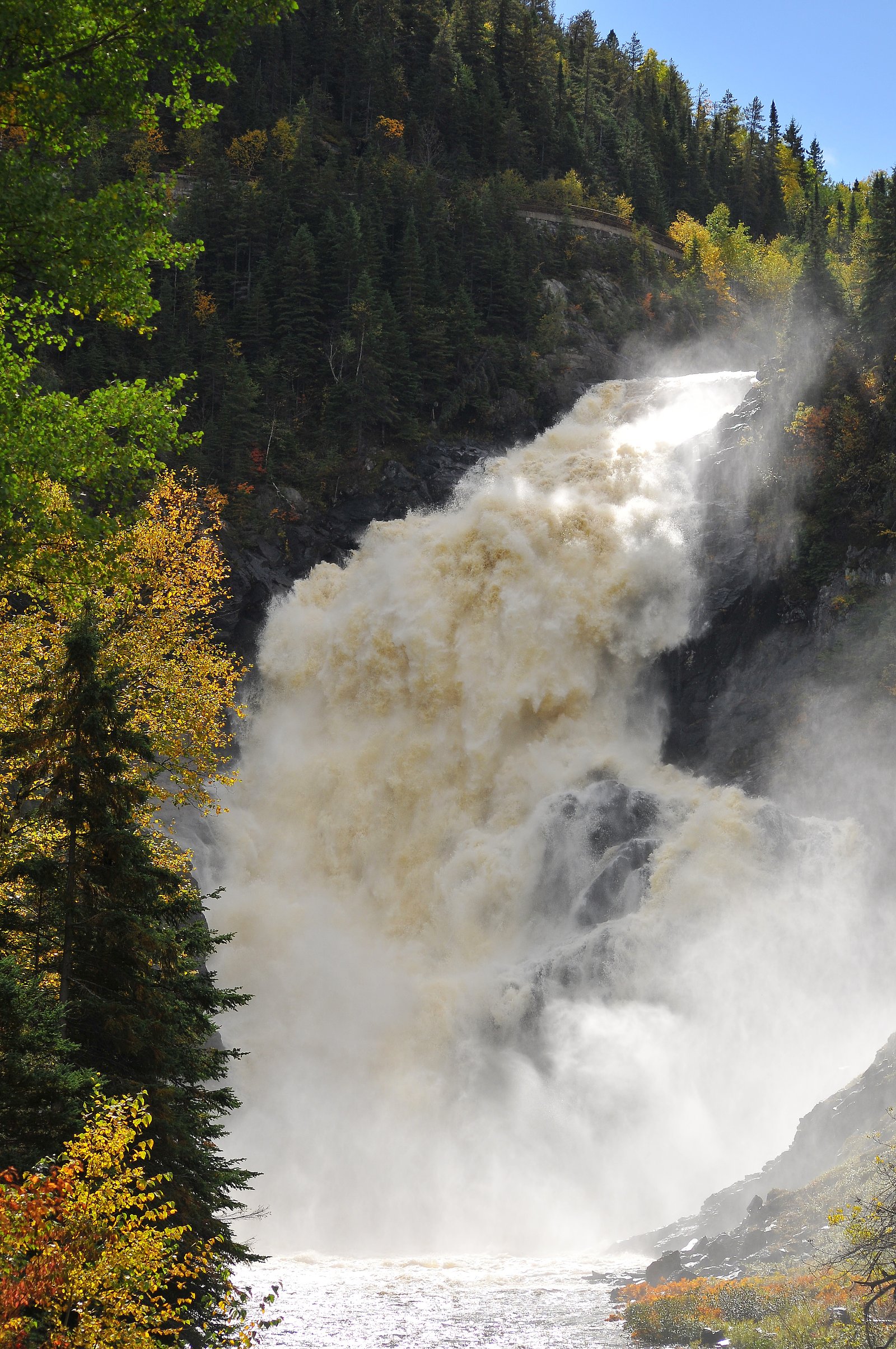
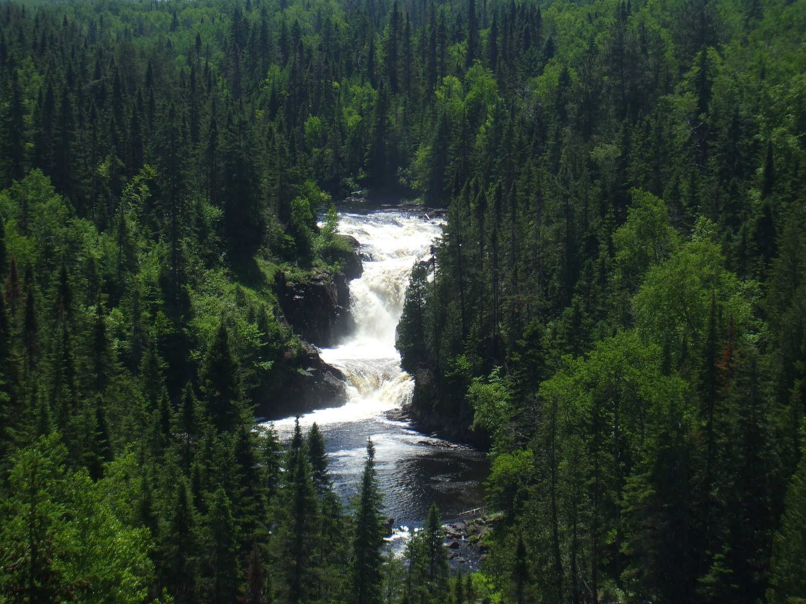
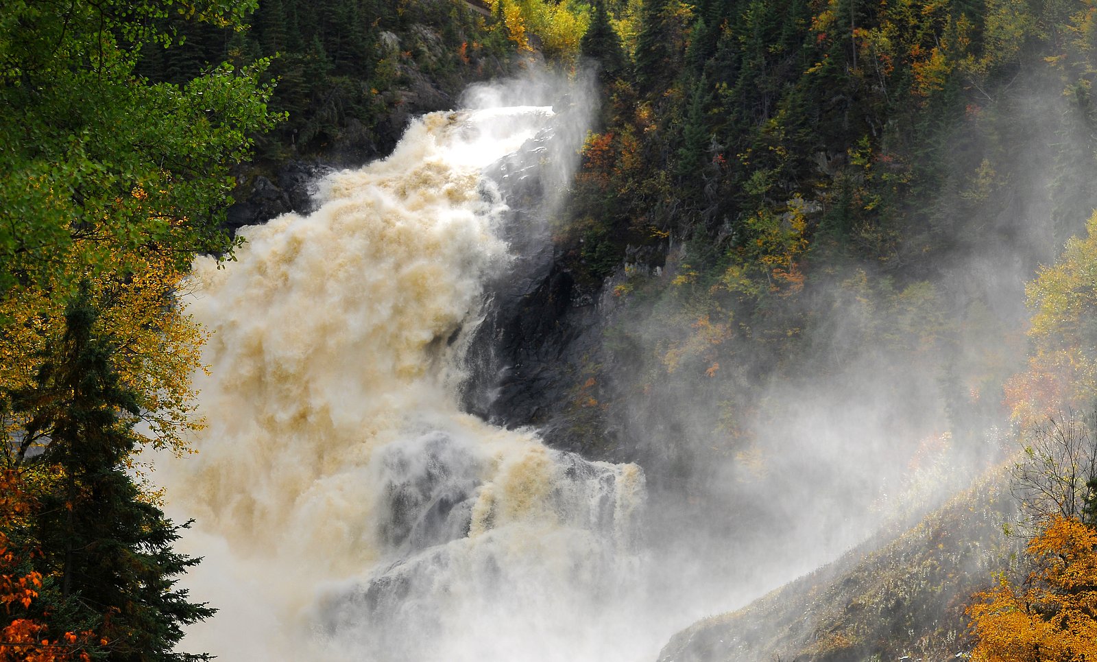
About Chute Ouiatchouan
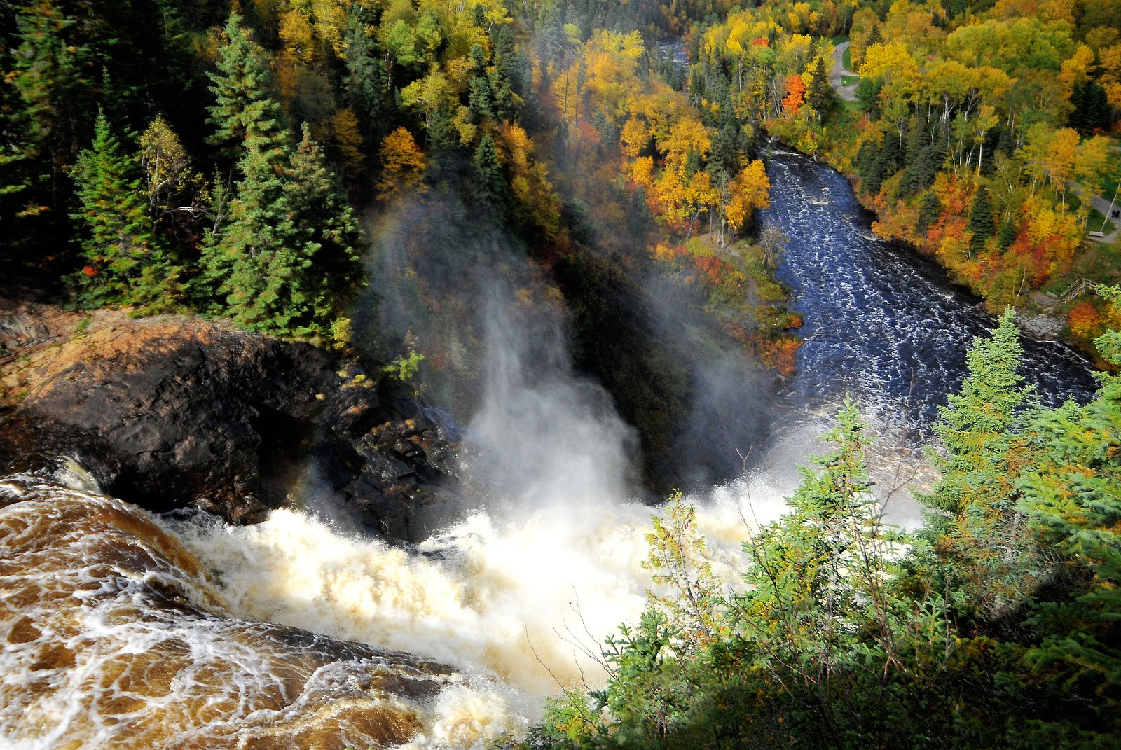
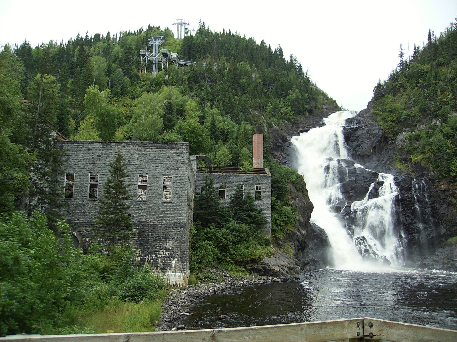
Chute Ouiatchouan is a waterfall on the Ouiatchouan watercourse in the Saguenay–Lac-Saint-Jean region of Quebec, located near the town of Dolbeau-Mistassini (about 24 miles from the coordinates provided). The falls sit in a largely forested, rural area and are best known locally as a scenic spot rather than a developed tourist site. Flow and appearance vary seasonally (high flow in spring, lower in late summer, often partially or fully frozen in winter). Exact official height and formal infrastructure information are not confirmed.
The Setting
Chute Ouiatchouan sits at 165 metres in the foothills of Quebec. At 72 metres, it is among the taller waterfalls in Quebec.
Why This Waterfall Exists
Chute Ouiatchouan flows over hard crystalline rock, primarily gneiss, laid down over 1.0-2.5 billion years ago. These resistant rocks form a durable ledge that water cannot easily wear away, creating a 236-foot drop where softer material downstream has already eroded.
Trail & Hike Details
The Approach
The moderate 2.1-km out-and-back trail gains 103 metres of elevation on the way to the falls.
Trail Description
There is no widely published, developed trail description for Chute Ouiatchouan. Expect a short, informal approach from a roadside or small parking area to a riverbank viewpoint. Surfaces are likely to be uneven, natural forest floor, and may include steep or muddy sections near the water. Facilities (boardwalks, railings, signage) are not guaranteed.
What to Expect
The falls plunge 72 metres over hard crystalline rock.
Accessibility
The trail is not wheelchair accessible. Uneven terrain and elevation changes require steady footing.
Frequently Asked Questions
🐶 Are Dogs Allowed at Chute Ouiatchouan?
❌ Dogs are not allowed
Are There Any Fees or Permits Required?
🆖 No fees required
🏊 Is There Swimming at Chute Ouiatchouan?
❌ Swimming is not allowed
When to Visit
Late spring (after snowmelt) for highest flows and dramatic water volume; early fall for foliage color and good weather. Summer is pleasant but flow may be reduced. Winter provides ice/frozen formation views for experienced visitors prepared for icy conditions.
Seasonal Access
The best time to visit is Spring, Summer, Fall, and Winter. Check with the managing park or local authority for current conditions.
Safety Information
Hazards: slippery rocks and riverbanks, steep and unstable edges, strong currents near the falls, cold water temperatures, and seasonal ice. Cell service may be unreliable in rural areas. Use caution during spring high-water events and after heavy rain, water levels and currents can change rapidly. In winter, ice can be unstable; do not walk onto frozen sections of river unless local authorities confirm it is safe. Leave no trace and avoid risky vantage points. If visiting alone, tell someone your plans and expected return time.
7-Day Flow Outlook
Based on the WSC gauge METABETCHOUANE (RIVIERE) EN AMONT DE LA CENTRALE S.R.P.C. (14 km away).
Best time of year: this gauge typically runs highest from mid April to late June, peaking in May.
How we calculate this
This is a transparent outlook, not a precise forecast. We take the waterfall's current flow strength (how it ranks against its historical normal for today, from the nearest WSC stream gauge), carry that ranking forward along the gauge's seasonal curve, and nudge it for forecast rain. Confidence is highest for the next day or two and falls further out. Always check official conditions and your own judgment before visiting — high flows can be dangerous.
Know when to go.
Get a free email alert when waterfalls near Dolbeau hit peak flow. We only send when conditions are worth the trip — no weekly newsletters, no spam.
Weather Forecast
Location & Access
Getting There
From Dolbeau-Mistassini or the surrounding highways, travel on local secondary roads toward the Ouiatchouan watercourse using the provided coordinates (48.4326, -72.1682) or a reliable map/GPS. Roads in the area are rural; expect two-lane paved or gravel local roads. Signage may be minimal, use GPS and recent local maps or contact local tourism offices for the latest access details.
Get Directions on Google MapsParking
Parking information is not formally published. Visitors should expect limited or informal parking: small roadside pullouts or an unpaved lot may be present. Park well off the travel lane and avoid blocking private driveways. If uncertain, plan to stop in the nearest town (Dolbeau-Mistassini) for directions and local advice.
Elevation
165 metres above sea level
Coordinates
48.432611° N, -72.168237° W
Visitor Tips & Gear
• Wear sturdy footwear with good traction, rocks and streambanks can be slippery. • Check recent local reports or contact the nearest tourism office (Dolbeau-Mistassini) for current access conditions. • Respect private property and posted signs; do not cross barriers. • Be cautious near edges, banks can be unstable. • Bring insect repellent in spring/summer. • In winter, bring appropriate traction devices (microspikes) and dress in layers. • Pack out what you pack in; carry a small first-aid kit.
As an Amazon Associate, we earn from qualifying purchases.
With 2.1 km and 103 m of elevation gain, sturdy boots and trekking poles will help on this moderate trail. Icy conditions are common in winter — traction cleats are a smart addition.

Columbia Watertight II Rain Jacket
Packs into its own pocket, seam-sealed, and keeps you dry from spray and surprise rain.

Polarized Sunglasses (Knockaround)
Cuts glare off the water so you actually see the falls — and your photos turn out better too.

Earth Pak Waterproof Dry Bag
Keeps your phone and gear dry when waterfall mist soaks everything else.

Waterproof Phone Pouch (AiRunTech)
Cheap insurance — take photos right next to the falls without killing your phone.

Timberland Euro Sprint Mid Waterproof
Trusted waterproof boot with premium leather and grippy rubber sole — reliable on rocky, wet trails.

TrailBuddy Trekking Poles
Lightweight aluminum, cork grips, and flip-locks that actually hold — a best-seller for good reason.
Where to Stay
Browse vacation cabins and private rentals nearby
Unique outdoor stays — tents, yurts, and treehouses
Rent a campervan or RV for your waterfall road trip
Some links are affiliate links. We may earn a commission at no extra cost to you.
Nearby Campground
Camping de Val-Jalbert
1.2 km away
Additional Information
Nearby Attractions
Dolbeau-Mistassini (town amenities), Lac Saint-Jean (regional lake with beaches and activities), regional parks in Saguenay–Lac-Saint-Jean. Local tourism offices in Dolbeau-Mistassini or Saguenay–Lac-Saint-Jean can provide up-to-date nearby points of interest.
Wildlife
Typical boreal fauna may be encountered in the area: songbirds, waterfowl, beaver, small mammals, and possibly moose or black bear. Take normal precautions with wildlife: store food securely, keep distance, and do not feed animals.
Cities near Chute Ouiatchouan
Nearby Waterfalls
Writing about Chute Ouiatchouan? Embed this waterfall on your site for free.