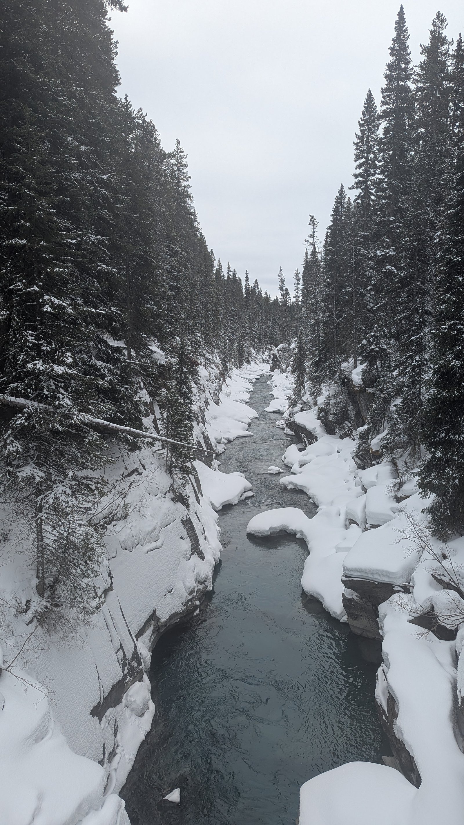
Numa Falls
British Columbia • Kootenay National Park
By Armen Suny · Last verified Jun 2026

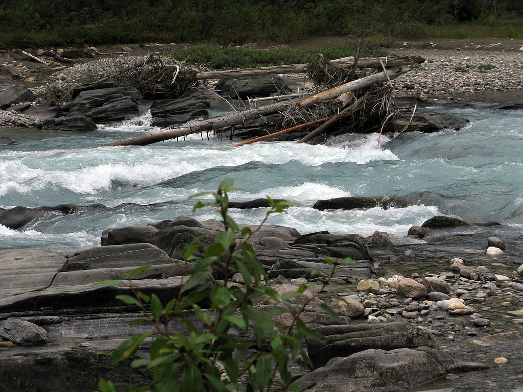
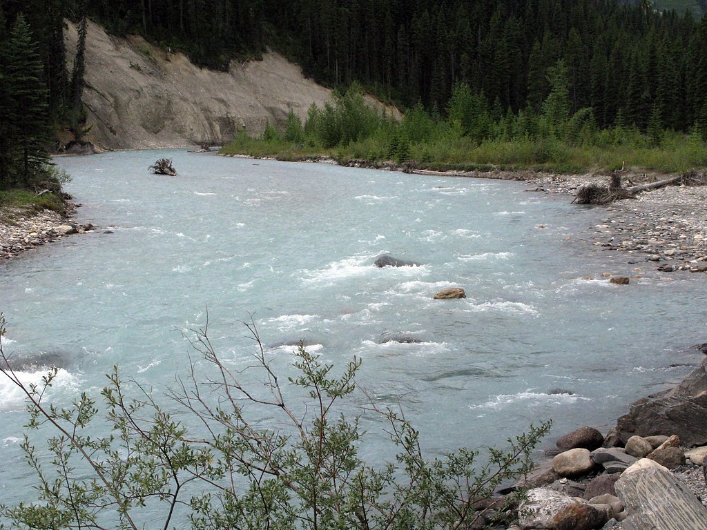
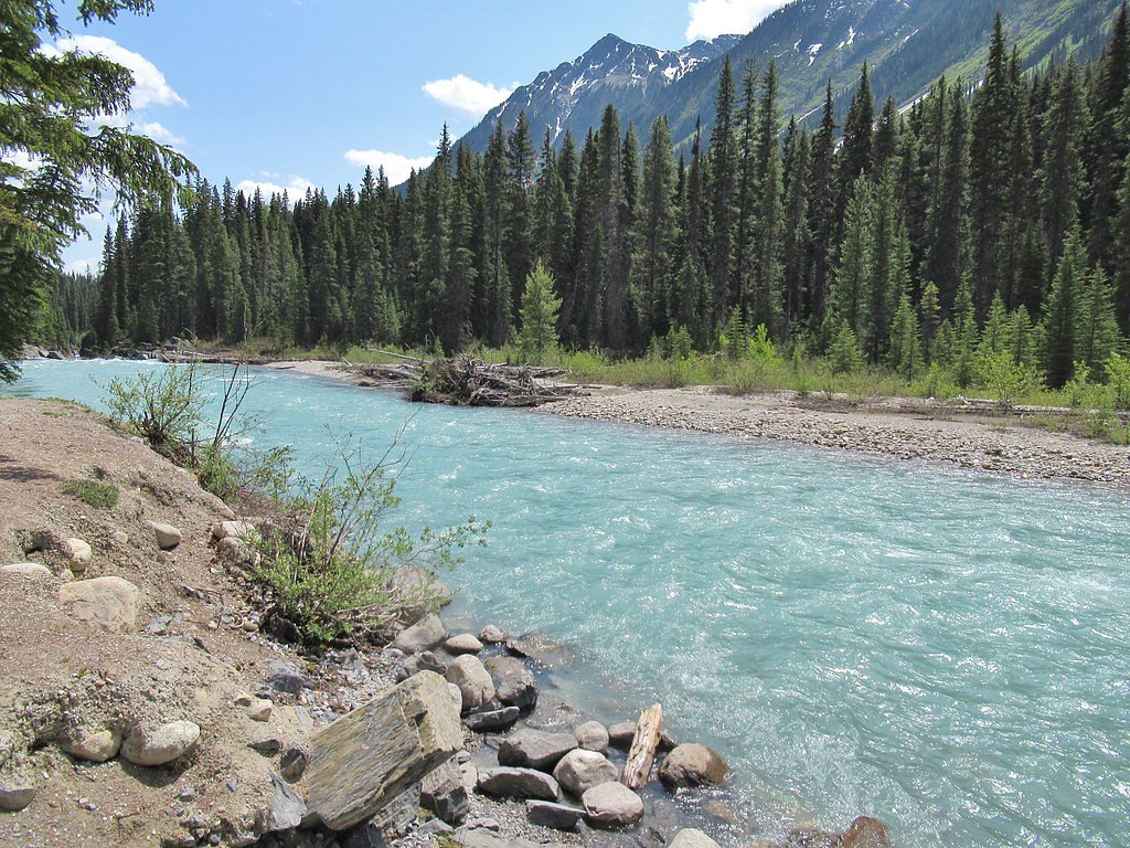
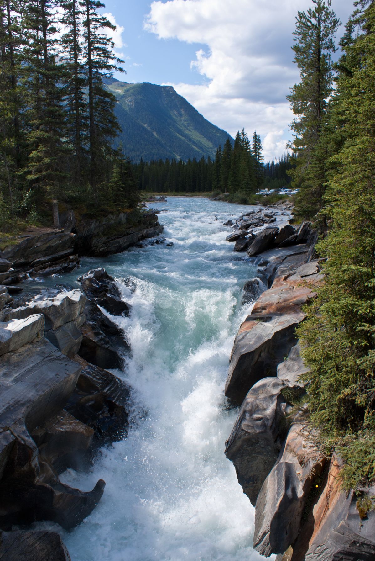
Photo Credits (5)
Difficulty
Easy
Trail Length
0.6 km
Trail Type
Out And Back
Elevation Gain
9 m
About Numa Falls
Numa Falls is a waterfall of the Vermilion River located in Kootenay National Park, British Columbia, Canada.
The Setting
Numa Falls sits at 1,387 metres within Kootenay National Park, in the mountains of British Columbia.
Why This Waterfall Exists
Numa Falls flows over Chancellor Formation, a layered carbonate rock layer deposited about 497-509 million years ago. These soft rocks erode readily, allowing the stream to carve a vertical drop into the landscape.
Nearby Falls Worth Visiting
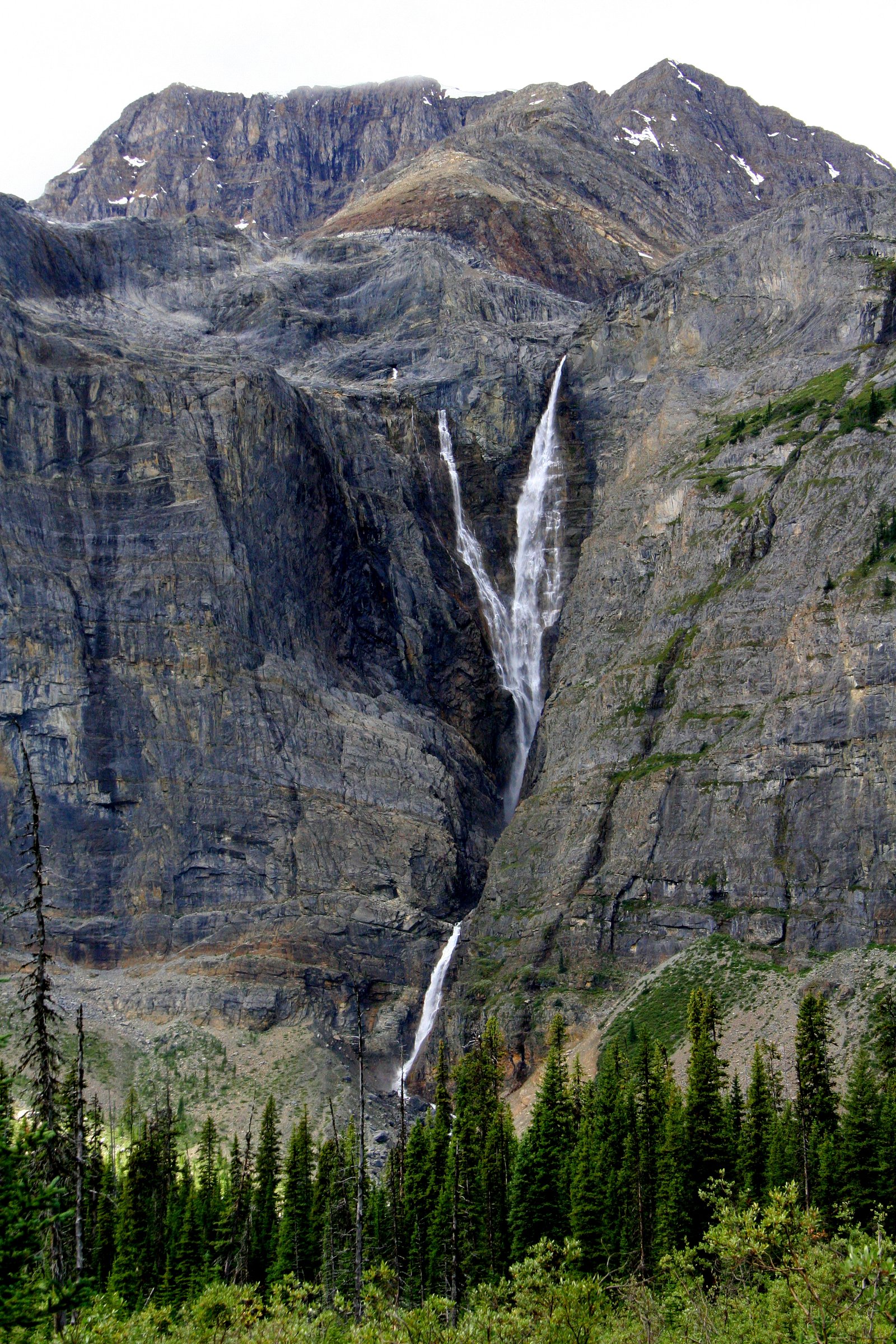
Helmet Falls (352 m) lies 14.6 kilometres to the west. Also nearby: Water Falls (50 m, 22.0 km).
Trail & Hike Details
The Approach
The easy 0.6-km out-and-back trail gains 9 metres of elevation on the way to the falls.
Trail Description
A very short, mostly level walk from the parking pullout leads to viewing areas alongside the Vermilion River and the falls. The path is short and well-trodden; sections may have boardwalks or compacted gravel. Expect minimal elevation change and a quick round-trip suitable for most visitors.
What to Expect
Easy roadside access with a short walk to one or more viewpoints. The falls are best viewed from the designated viewing area; rocks near the river can be slippery. Spring runoff increases flow and spray. There are generally no staffed facilities, potable water, or restrooms at the immediate site, plan accordingly. Wildlife (including bears and elk) may be present in the area.
Accessibility
The trail is short and relatively flat, but the surface may be uneven. Contact the managing agency for accessibility details.
Frequently Asked Questions
🐶 Are Dogs Allowed at Numa Falls?
❌ Dogs are not allowed
Are There Any Fees or Permits Required?
🆖 No fees required
🏊 Is There Swimming at Numa Falls?
❌ Swimming is not allowed
When to Visit
Late spring to early summer for highest water flow; summer for easiest access and comfortable weather; fall for color and fewer crowds. Winter offers ice formations but can present icy trails, deep snow, and limited roadside parking; check road conditions and avalanche warnings.
Seasonal Access
The best time to visit is Spring, Summer, Fall, and Winter. Check with Kootenay National Park for current conditions.
Safety Information
Hazards include slippery rocks and trails, high or fast-moving water during spring runoff, extreme cold and ice in winter, and wildlife encounters. Stay on marked trails and viewing areas, keep a safe distance from the river edge, supervise children, and carry appropriate safety gear (including traction devices in winter and bear spray if venturing beyond the immediate area). Be aware of potential road hazards and limited parking on busy days.
Current Water Conditions
Based on a Water Survey of Canada gauge 27.9 km away
9.7 m³/s
Current discharge — how much water is flowing
About average for this time of year
Based on 83 years of record
0.89 m
Water depth at gauge
7-Day Discharge Trend
What does this mean for your visit?
Flow is about average for this time of year.
About This Gauge
This gauge is on a regional waterway. Conditions at the falls may differ, especially after local rain.
7-Day Flow Outlook
Based on the WSC gauge KOOTENAY RIVER AT KOOTENAY CROSSING (28 km away).
Today
Moderate
9.7 m³/s
9/10Tomorrow
Moderate
9.5 m³/s
8/10Tue
Moderate
9.0 m³/s
8/10Wed
Moderate
8.9 m³/s
8/10Thu
Moderate
9.3 m³/s
6/10Fri
Moderate
9.4 m³/s
6/10Sat
Moderate
9.0 m³/s
6/10Best window: Today — moderate flow, mainly sunny (trip score 9/10).
Best time of year: this gauge typically runs highest from early May to early August, peaking in June.
How we calculate this
This is a transparent outlook, not a precise forecast. We take the waterfall's current flow strength (how it ranks against its historical normal for today, from the nearest WSC stream gauge), carry that ranking forward along the gauge's seasonal curve, and nudge it for forecast rain. Confidence is highest for the next day or two and falls further out. Always check official conditions and your own judgment before visiting — high flows can be dangerous.
Know when to go.
Get a free email alert when waterfalls near Lake Louise hit peak flow. We only send when conditions are worth the trip — no weekly newsletters, no spam.
Weather Forecast
Location & Access
Getting There
Numa Falls is located in Kootenay National Park along Highway 93 (the Banff–Windermere/ Icefields Parkway corridor). From Lake Louise it is about 16.9 miles (27 km) and from Banff about 25.6 miles (41 km). There is a signed roadside pullout and short trail to the falls. Coordinates: 51.1323, -116.1322.
Get Directions on Google MapsParking
Small paved pullout and parking area adjacent to the highway. Parking can fill on busy summer days; larger vehicles should use the designated turnout only. No large developed parking lot or formal facilities are guaranteed.
Elevation
1,387 metres above sea level
Coordinates
51.132314° N, -116.132208° W
Land Management
Managed by Parks Canada Agency
Visitor Tips & Gear
• Stay on the trail and viewing areas, riverbanks and wet rocks are slippery and unstable. • Check Parks Canada or provincial highway reports for road conditions before travel, especially in winter. • There are limited facilities at the pullout, bring water, sun protection, and layers. • Keep a safe distance from wildlife and store food in your vehicle. • If you plan to hike beyond the immediate viewpoint, carry bear spray and know how to use it. • Respect posted signs and barriers; do not attempt to climb the falls or enter fenced-off areas.
As an Amazon Associate, we earn from qualifying purchases.
For this easy 0.6 km trail, lightweight trail shoes and a water bottle are usually sufficient. Icy conditions are common in winter — traction cleats are a smart addition.

Columbia Watertight II Rain Jacket
Packs into its own pocket, seam-sealed, and keeps you dry from spray and surprise rain.

Polarized Sunglasses (Knockaround)
Cuts glare off the water so you actually see the falls — and your photos turn out better too.

Earth Pak Waterproof Dry Bag
Keeps your phone and gear dry when waterfall mist soaks everything else.

Waterproof Phone Pouch (AiRunTech)
Cheap insurance — take photos right next to the falls without killing your phone.

Kahtoola MICROspikes
Cult-favorite traction cleats that grip ice and wet rock — essential for winter waterfall hikes.

JOBY GorillaPod Starter Kit
Wraps around railings and rocks for long-exposure waterfall shots — no flat surface needed.
Where to Stay
Browse vacation cabins and private rentals nearby
Unique outdoor stays — tents, yurts, and treehouses
Rent a campervan or RV for your waterfall road trip
Some links are affiliate links. We may earn a commission at no extra cost to you.
Nearby Campground
Numa Creek
4.4 km away
Additional Information
Nearby Attractions
Lake Louise (~16.9 miles), Banff (~25.6 miles), Bow Valley Parkway, other stops in Kootenay National Park (scenic viewpoints and short hikes along Highway 93).
Wildlife
Bears (black and occasionally grizzly), elk, deer, small mammals, and various bird species. Maintain distance, store food securely, and follow Parks Canada wildlife safety guidance.
Cities near Numa Falls
Nearby Waterfalls
Writing about Numa Falls? Embed this waterfall on your site for free.